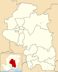
Itchen Valley

Last updated

Itchen Valley
Avington Park - geograph.org.uk - 899263.jpg
Avington Park
Hampshire UK location map.svg
Red pog.svg
Itchen Valley
Location within Hampshire
OS grid reference SU530319
Civil parish
  • Itchen Valley
District
Shire county
Region
Country England
Sovereign state United Kingdom
Post town Winchester
Postcode district SO21
Dialling code 01962
Police Hampshire and Isle of Wight
Fire Hampshire and Isle of Wight
Ambulance South Central
UK Parliament
List of places
UK
England
Hampshire
51°05′24″N1°15′07″W / 51.090°N 1.252°W / 51.090; -1.252

Itchen Valley is a civil parish in the English county of Hampshire. Forming part of the City of Winchester district, it comprises the villages of Avington, Easton, Itchen Abbas and Martyr Worthy, with a population of 1,267 at the time of the 2001 Census. [1] increasing at the 2011 Census to a population of 1,459. [2]

Contents

It is to the northeast of Winchester and takes its name from the River Itchen. The parish is crossed by the M3 motorway, and contains Winchester services. The main West–east route through the parish is the B3047. East bound from Winchester the B3047 enters the parish at Worthy Park and exits it at a point approx. 300m East of Rectory Lane, Itchen Abbas. [3] It is located near to the civil parishes of Itchen Stoke and Ovington and New and Old Alresford.

Largely rural in character, much of the parish is in both the South Downs National Park and the East Hampshire Area of Outstanding Natural Beauty, and is crossed by several designated walking paths and riding routes including the Itchen Way, King's Way, Pilgrims' Way, St. Swithun's Way, South Downs Way, Three Castles Path and Oxdrove Way.

Governance

Itchen Valley Parish Council has eleven councillors who hold various portfolios concerning the local area. Itchen Valley is part of the Hampshire County Council Ward of the same name, which has larger borders and also includes settlements such as Alresford. The ward has been represented by Jackie Porter since 2005, who was most recently reelected in 2017. [4] As part of Winchester City Council is forms part of Alresford and Itchen Valley ward, which since 2016 has had three councillors. As of the 2019 election, these are:

ElectionMember [5] [6] Ward
2016 Lisa GriffithsAlresford & Itchen Valley
2018 Margot PowerAlresford & Itchen Valley
2019 Russell Gordon-SmithAlresford & Itchen Valley

Related Research Articles

<span class="mw-page-title-main">City of Winchester</span> Place in England

Winchester, or the City of Winchester, is a local government district with city status in Hampshire, England.

<span class="mw-page-title-main">River Itchen, Hampshire</span> River in Hampshire, England

The River Itchen in Hampshire, England, rises to the south of New Alresford and flows 26 miles (42 km) to meet Southampton Water below the Itchen Bridge. The Itchen Navigation was constructed in the late 17th and early 18th centuries to enable barges to reach Winchester from Southampton Docks, but ceased to operate in the mid-19th century and is largely abandoned today.

<span class="mw-page-title-main">New Alresford</span> Market town in England

New Alresford or simply Alresford is a market town and civil parish in the City of Winchester district of Hampshire, England. It is 8.0 miles (12.9 km) northeast of Winchester and 12 miles (20 km) southwest of the town of Alton.

<span class="mw-page-title-main">Kings Worthy</span> Human settlement in England

Kings Worthy is a village and civil parish in Hampshire, England, approximately two miles north-east of Winchester. Kings Worthy was a tithing of Barton Stacey when the Domesday Book was written.

<span class="mw-page-title-main">Itchen Way</span> Long-distance footpath in Hampshire, England

<span class="mw-page-title-main">St Swithun's Way</span> Long-distance footpath in England

St Swithun's Way is a 34-mile (55 km) long-distance footpath in England from Winchester Cathedral, Hampshire to Farnham, Surrey. It is named after Swithun, a 9th-century Bishop of Winchester, and roughly follows the Winchester to Farnham stretch of the Pilgrims' Way. The route was opened in 2002 to mark the Golden Jubilee of Elizabeth II.

Itchen may refer to:

<span class="mw-page-title-main">Abbotstone</span> Hamlet in England

Abbotstone is a hamlet in the United Kingdom in English county of Hampshire. It is located 2 miles from the nearest town, New Alresford, 6 miles from Winchester and 54 miles from London. It lies at an elevation of 67 metres within the district of the City of Winchester, and the closest town is New Alresford. It is now in the parish of Itchen Stoke, but was formerly its own parish. Abbotstone lies along the Ellisfield to Itchen Abbas portion of the Three Castles Path, a hiking path. Abbotstone contains an abandoned medieval village, and evidence of fortifications, as well as several abandoned quarries.

<span class="mw-page-title-main">Twyford, Hampshire</span> Human settlement in England

Twyford is a village and civil parish in Hampshire, England, approximately three miles south of Winchester and near the M3 motorway and Twyford Down. In 2001, the population of the parish was 1,456. The village and parish are on the left bank of the Itchen, which passes through nearby watermeadows, and has been important economically for its residents.

<span class="mw-page-title-main">Colden Common</span> Human settlement in England

Colden Common is a civil parish in the Winchester District of Hampshire, England, approximately 5 miles south of the city of Winchester, covering an area of 690.74 hectares (2.6670 sq mi) with a resident population of approximately 4,000 people. It includes the village of Colden Common and the hamlets of Hensting, Fisher's Pond, Nob's Crook, Highbridge and Brambridge. Part of the parish lies within the South Downs National Park.

<span class="mw-page-title-main">Micheldever</span> Village and civil parish in Hampshire, England

Micheldever is a village and civil parish in Hampshire, England, situated 6 miles (10 km) north of Winchester. It lies upon the River Dever.

<span class="mw-page-title-main">Compton and Shawford</span> Human settlement in England

Compton and Shawford is a civil parish in the City of Winchester district, immediately southwest of the city, in Hampshire, England. Its main settlements are the villages of Compton and Shawford.

<span class="mw-page-title-main">Martyr Worthy</span> Human settlement in England

Martyr Worthy is a small village and former civil parish, now in the parish of Itchen Valley, in the Winchester non-metropolitan district of Hampshire, England. It is part of the Worthys cluster of small villages. In 1931 the parish had a population of 350. On 1 April 1932 the parish was abolished to form Itchen Valley.

The following are lists of recreational walks in Hampshire, England:

<span class="mw-page-title-main">Itchen Abbas</span> Human settlement in England

Itchen Abbas is a village and former civil parish, now in the parish of Itchen Valley, in the Winchester district, in the county of Hampshire, England. The village is on the River Itchen about 4 miles (6.4 km) north-east of Winchester.

<span class="mw-page-title-main">Chilcomb</span> Human settlement in England

Chilcomb is a small village and civil parish in the English county of Hampshire 3 miles (4.8 km) east of Winchester and includes the South Downs Way long-distance footpath.

Wonston is a village and civil parish in the City of Winchester district of Hampshire, England. The village had 1446 usual residents as of Census day 2011. The civil parish includes the settlements of Sutton Scotney, Stoke Charity, Norton and Hunton.

<span class="mw-page-title-main">Medstead</span> Human settlement in England

Medstead is a village and civil parish in the East Hampshire district of Hampshire, England. Its nearest town is Alton, which lies 4.3 miles (6.9 km) northeast of the village. According to the 2011 census, the village had a population of 2,036 people. The parish covers an area of 1,536 acres (622 ha) and has an average elevation of approximately 600 feet (180 m) above sea level. One of the county's high points at 716 feet (218 m), King's Hill, runs through Medstead and Bentworth.

<span class="mw-page-title-main">Itchen Stoke and Ovington</span> Human settlement in England

Itchen Stoke and Ovington is an English civil parish consisting of two adjoining villages in Hampshire, England, 2 miles (3.2 km) west of Alresford town centre in the valley of the River Itchen, 5 miles (8.0 km) north-east of Winchester, and 2 miles (3.2 km) south-east of Itchen Abbas.

The Worthys is a cluster of villages in the City of Winchester district of Hampshire, located north and north-east of the city itself.

References

  1. "Parish Headcounts, Area: Itchen Valley CP". Neighbourhood Statistics. Office for National Statistics. 2001. Archived from the original on 12 June 2011. Retrieved 6 October 2008.
  2. "Civil Parish population 2011". Neighbourhood Statistics. Office for National Statistics. Archived from the original on 22 December 2016. Retrieved 8 December 2016.
  3. "Location Map".
  4. "Councillor details - Councillor Jackie Porter". www.hants.gov.uk. 12 April 2020. Retrieved 12 April 2020.
  5. "Your Councillors". January 2022.
  6. phone; email. "Ward Map". Winchester City Council. Retrieved 10 April 2020.