West Meon

Last updated

West Meon
High Street, West Meon - geograph.org.uk - 619938.jpg
Hampshire UK location map.svg
Red pog.svg
West Meon
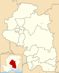
Location within Hampshire
Population724 (2011 Census) [1]
OS grid reference SU640240
Civil parish
  • West Meon
District
Shire county
Region
Country England
Sovereign state United Kingdom
Post town PETERSFIELD
Postcode district GU32
Dialling code 01730
Police Hampshire and Isle of Wight
Fire Hampshire and Isle of Wight
Ambulance South Central
UK Parliament
List of places
UK
England
Hampshire
51°00′43″N1°05′16″W / 51.01192°N 1.08773°W / 51.01192; -1.08773

West Meon is a village and civil parish in Hampshire, England, with a population of 749 people at the 2011 census.

Contents

Geography

It is 2+34 miles (4.4 km) north-west of East Meon, on the headwaters of the River Meon. Its closest town is Petersfield which is 6+12 miles (10.5 km) to the east. [2]

There are a number of walks around the village and surrounding hills along the South Downs Way and the bridleway provided by the, now defunct Meon Valley Railway Line, which leads 11 miles (17.7 km) south from West Meon to Wickham. [2]

History

A charter of 932 in which King Æthelstan granted West Meon to the thegn Æthelweard includes a detailed account of the boundary of the estate which almost coincides with the boundary of the modern parish of West Meon. [3] [4] The Manor of West Meon was listed in the Domesday Book as owned by the Bishop of Winchester. [5] A charter of 1205 confirmed the grant of land to the Prior and Convent of St. Swithun, Winchester, in whose hands it remained until the Dissolution of the Monasteries. In 1541 the manor was granted to the Dean and Chapter of Winchester by Henry VIII, and the maintenance of six theology students at each of the universities of Oxford and Cambridge was ordered. In 1544 the king changed this regulation, and the manor was granted to Thomas Wriothesley, Earl of Southampton, in whose family the manor remained until 1677. [6]

Other lands in West Meon Parish held by the Wriothesley family were the manors of Hall Park, Coombe and Woodlands. Another manor, called Punsholt, was first mentioned in 1341 when it was held by Walter de Ticheborne. Later the manor was combined with that of West Tisted and followed the same descent. Punsholt Farm in the North of the Parish indicates the site of the manor. [6]

The manor of Woodlands is now occupied by the Woodlands Estate, situated in the north of the parish. Woodlands is notable for its collection of model farm buildings, built by the Nicholson family of Basing Park, Privett. The Woodlands Estate was formed in 1945, when the property was purchased by Lord Northbrook. Prior to this, Woodlands had formed a section of the 8,446 acre Basing Park Estate, during which time many of the cottages and farm buildings were erected. Woodlands once boasted a coaching inn, shop, school, and a chapel, all of which are now private residences.

During the Civil War West Meon was the scene of several skirmishes prior to the Battle of Cheriton, which was fought on 29 March 1644.

The remains of a Roman villa have been uncovered in Lippen Wood, a mile from the village. The outer walls of the villa, some hypocaust pillars and a patterned mosaic floor were found during a 1905 excavation. [7]

Thomas Lord of cricket ground fame retired to the village in 1830. The eponymous pub is in the high street. British spy Guy Burgess lived in the village and his ashes were interred in the family plot in the churchyard. [8] Between West Meon and East Meon is Westbury House which was built in 1904, after the previous Palladian mansion on the estate was destroyed by fire. [9]

Related Research Articles

<span class="mw-page-title-main">Wickham, Hampshire</span> Village in Hampshire, England

Wickham is a large village in the civil parish of Wickham and Knowle, in the Winchester district, in the county of Hampshire, England. It is about 3 miles north of Fareham. In 2021 it had a population of 2173. At the 2001 census, it the parish a population of 4,816, falling to 4,299 at the 2011 Census.

<span class="mw-page-title-main">East Meon</span> Human settlement in England

East Meon is a village and civil parish in the East Hampshire district of Hampshire, England. It is 4.4 miles (7.1 km) west of Petersfield.

<span class="mw-page-title-main">Crondall</span> Human settlement in England

Crondall is a village and large civil parish in the north east of Hampshire in England, in the Crondall Hundred surveyed in the Domesday Book of 1086. The village is on the gentle slopes of the low western end of the North Downs range, and has the remains of a Roman villa. Despite the English Reformation, Winchester Cathedral held the chief manors representing much of its land from 975 until 1861. A large collection of Anglo-Saxon and Merovingian coins found in the parish has become known as the Crondall Hoard.

<span class="mw-page-title-main">Ashmansworth</span> Human settlement in England

Ashmansworth is a village and civil parish in the Basingstoke and Deane district of the English county of Hampshire.

<span class="mw-page-title-main">Barton Stacey</span> Human settlement in England

Barton Stacey is a village and undulating civil parish, which includes the hamlets of Bransbury, Newton Stacey, Drayton and Cocum, in the Test Valley district of Hampshire, England, centred about 7 miles (11 km) south-east of Andover. It is bounded to the north by the estate of Drayton Lodge, and, to the south, by the minor A30 road; both being east–west routes, and connected by The Street/Cocum Road, the main road that bisects the village. The distance between the A303 and A30 at this point is 2 miles (3.2 km), which is twice the width of the parish.

<span class="mw-page-title-main">Bentworth</span> Village in Hampshire, England

Bentworth is a village and civil parish in the East Hampshire district of Hampshire, England. The nearest town is Alton, which lies about 3 miles (5 km) east of the village. It sits within the East Hampshire Hangers, an area of rolling valleys and high downland. The parish covers an area of 3,763 acres (15.23 km2) and at its highest point is the prominent King's Hill, 716 feet (218 m) above sea level. According to the 2011 census, Bentworth had a population of 553.

<span class="mw-page-title-main">Croxton, Cambridgeshire</span> Human settlement in England

Croxton is a village and civil parish about 13 miles (21 km) west of Cambridge in South Cambridgeshire, England. In 2001, the resident population was 163 people, falling slightly to 160 at the 2011 Census. Croxton Park is to the south of the current village and contains a large house and parkland.

<span class="mw-page-title-main">Droxford</span> Human settlement in Hampshire, United Kingdom

Droxford is a village in Hampshire, England.

Southwick Priory or Our Lady at Southwick was a priory of Augustinian canons founded in Portchester Castle on Portsmouth Harbour and later transferred 2 miles (3.2 km) north to Southwick, Hampshire, England. It ceased at the Dissolution of the Monasteries in 1538.

<span class="mw-page-title-main">Sparsholt, Hampshire</span> Human settlement in England

Sparsholt (/ˈspɑːʃəʊlt/) is a village and civil parish in Hampshire, England, 2+12 miles (4 km) west of Winchester. In 1908 its area was 3,672 acres (1,486 ha). The 2011 Census recorded its population as 982.

<span class="mw-page-title-main">East Tisted</span> Human settlement in England

East Tisted is a village and civil parish in the East Hampshire district of Hampshire, England. It is 4.8 miles (7.7 km) south of Alton on the A32 road.

<span class="mw-page-title-main">Warnford</span> Human settlement in England

Warnford is a village and civil parish in the City of Winchester district of Hampshire, England. The parish covers 1283 hectares. The village lies on the A32 in the upper valley of the River Meon between West Meon and Exton. The population in 2019 was estimated at 220. The village is rural in character, with most of the buildings along River Lane, Lippen Lane and Hayden Lane.

<span class="mw-page-title-main">East Stratton</span> Human settlement in England

East Stratton is an estate village and former civil parish, now in the parish of Micheldever, in the Winchester district, in the county of Hampshire, England. It is at the entrance to the landscaped grounds of Stratton Park, some 8 miles northeast of Winchester Both park and village demonstrate the evolution of a landscape directed by three eminent families - Wriothesley, Russell and Baring - during the 17th, 18th and 19th centuries. In 1931 the parish had a population of 230.

<span class="mw-page-title-main">North Stoneham</span> Human settlement in England

North Stoneham is a settlement between Eastleigh and Southampton in south Hampshire, England. Formerly an ancient estate, manor, and civil parish, it is currently part of the Borough of Eastleigh. Until the nineteenth century, it was a rural community comprising a number of scattered hamlets, including Middle Stoneham, North End, and Bassett Green, and characterised by large areas of woodland.

<span class="mw-page-title-main">Privett</span> Human settlement in England

Privett is a small village and former civil parish, now in the parish of Froxfield and Privett, in the East Hampshire district of Hampshire, England. It is 5 miles (8.0 km) northwest of Petersfield, just off the A272 road. Its principal feature is Holy Trinity Church, designed by Arthur Blomfield and built at the expense of local landowner, businessman and M.P. William Nicholson. Nicholson was also responsible for building in the village a number of dwellings for workers on his Basing Park estate. In 1931 the parish had a population of 172.

<span class="mw-page-title-main">Shalden</span> Human settlement in England

Shalden is a village and civil parish in the East Hampshire district of Hampshire, England. It is 2.3 miles (3.7 km) northwest of Alton and 1.9 miles (3.1 km) northeast of Bentworth, just off the A339 road. The parish covers an area of 1,536 acres (622 ha) and has an average elevation of 600 feet (180 m) above sea level. The nearest railway station is Alton, 2.5 miles (4.0 km) southeast of the village. According to the 2011 census, it had a population of 435.

<span class="mw-page-title-main">West Worldham</span> Human settlement in England

West Worldham is a small village and former civil parish, now in the parish of Worldham, in the East Hampshire district of Hampshire, England. It is 2.1 miles (3.4 km) southeast of the town of Alton. The village of East Worldham is to the East and Hartley Mauditt is to the South, which along with West Worldham form the current Parish of Worldham.

<span class="mw-page-title-main">Bradley, Hampshire</span> Human settlement in England

Bradley is a small village and civil parish in the Basingstoke and Deane district of Hampshire, England. Its nearest town is Alton, which lies 5.4 miles (8.7 km) southeast from the village, although Basingstoke lies 6.6 miles (10.6 km) to the north. According to the 2011 census, the village had a population of 202 people. The parish covers an area of 975 acres (395 ha), of which 149 acres (60 ha) is woodland and its highest point is 170 metres (560 ft) above sea level. It contains no hamlets.

<span class="mw-page-title-main">Knowle, Hampshire</span> Human settlement in England

Knowle is a village with mainly 21st century shops and businesses in the civil parish of Wickham and Knowle, in the Winchester district of Hampshire, England that sits high on the left bank of the Meon between the Southampton and Portsmouth conurbations. It is in the south of the parish of Wickham and Knowle in which it ranks in population about 25% behind Wickham. Its nearest town is Fareham, adjoining an inlet of Portsmouth Harbour approximately 3 miles (4.8 km) south-east.

<span class="mw-page-title-main">Woolstone, Oxfordshire</span> Human settlement in England

Woolstone is a village and civil parish about 4+12 miles (7 km) south of Faringdon in the Vale of White Horse. Woolstone was part of Berkshire until the 1974 boundary changes transferred it to Oxfordshire. The 2011 Census recorded the parish population as 210.

References

  1. "Civil Parish population 2011". Neighbourhood Statistics. Office for National Statistics. Retrieved 23 January 2017.
  2. 1 2 Google. "West Meon" (Map). Google Maps . Google.
  3. Naismith, Rory (2021). Early Medieval Britain, c. 500-1000. Cambridge, UK: Cambridge University Press. pp. 362–369. ISBN   978-1-108-44025-7.
  4. Charter S 417
  5. "West Meon village design statement". Winchester City Council. 2002.
  6. 1 2 'Parishes: West Meon. Manors', in W. Page (ed.), A History of the County of Hampshire Vol. 3 (VCH, London 1908), pp. 342-45 (British History Online accessed 26 February 2023).
  7. A. Moray Williams (1905). "Report of preliminary excavations, May - August 1905" (PDF).{{cite journal}}: Cite journal requires |journal= (help)
  8. "The Thomas Lord, restaurant review: This cheerleader for Hampshire". Independent.co.uk . 27 January 2015.
  9. "Westbury House". www.eastmeonhistory.net. Retrieved 4 April 2019.