Upham, Hampshire

Last updated

Upham
Southeastern corner of Upham triangle - geograph.org.uk - 56394.jpg
Southeastern corner of Upham triangle
Hampshire UK location map.svg
Red pog.svg
Upham
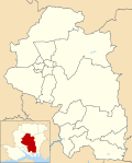
Location within Hampshire
Population616  [1]
663 (2011 Census) [2]
OS grid reference SU531202
Civil parish
  • Upham
District
Shire county
Region
Country England
Sovereign state United Kingdom
Post town Southampton
Postcode district SO32
Dialling code 01489
Police Hampshire and Isle of Wight
Fire Hampshire and Isle of Wight
Ambulance South Central
UK Parliament
Website Upham Parish Council
List of places
UK
England
Hampshire
50°58′43″N1°14′34″W / 50.97866°N 1.24282°W / 50.97866; -1.24282

Upham is a small village and civil parish in the south of England located in Hampshire approximately 7 miles south-east of Winchester .

Contents

The village

There is a small post office and a local primary school. The village is divided into two parts: Upham, centred on the church to the north, and Lower Upham, centred on the post office and main road. There are two pubs, the Brushmakers Arms and the Alma Inn. Other features include a village pond.

The country house The Holt, a Grade II-listed building, was the longtime seat of the Shendley-Leavett family, and the home of John Alfred Leavett-Shendley, DL, High Sheriff of Hampshire in 19851986 who married Alison Yvonne Cecil, daughter of Hon. Yvonne Cornwallis and Royal Navy Commander Henry Mitford Amherst Cecil, O.B.E., who served as a Navy Commander in both World Wars. It was also the home of Sir Robert Calder, a naval officer in the Napoleonic Wars, who died there in 1815. Calder is buried in the local churchyard.

There are marginal remains of a Late Roman period Villa in nearby Little Woodcotte, found in 1849.

Transport

Lower Upham is crossed by the B2177 road, formerly the A333 Winchester to Portsmouth road; there are no other main roads in the parish. There is a regular bus service to Winchester, Twyford, Colden Common, Bishop's Waltham and Fareham.

The parish is crossed by many trackways and paths including the Monarch's Way, Pilgrims' Trail and King's Way. In the south of the parish King's Way and the Pilgrims' Trail partly use the course of the former Roman road from Winchester to Portchester, which passes between Upham and Lower Upham. [3] [4]

Geology

Upham lies on the northern margin of the Paleogene deposits of the Hampshire Basin. The north of the parish is on chalk with the Lambeth Group and London Clay to the south. [5]

Related Research Articles

<span class="mw-page-title-main">Hampshire</span> County of England

Hampshire is a ceremonial county in South East England. It is bordered by Berkshire to the north, Surrey and West Sussex to the east, the Isle of Wight across the Solent to the south, Dorset to the west, and Wiltshire to the north-west. The cities of Southampton and Portsmouth are the largest settlements, and the county town is the city of Winchester.

<span class="mw-page-title-main">Wickham, Hampshire</span> Village and parish in Hampshire, England

Wickham is a village in the civil parish of Wickham and Knowle, in the Winchester district, in the county of Hampshire, England. It is about 3 miles north of Fareham. In 2021 it had a population of 2173. At the 2001 census, it the parish a population of 4,816, falling to 4,299 at the 2011 Census.

<span class="mw-page-title-main">Nursling</span> Village in Hampshire, England

Nursling is a village in the civil parish of Nursling and Rownhams, in the Test Valley district, in Hampshire, England, about 6 kilometres north-west of the city of Southampton. Formerly called Nhutscelle, then Nutsall, Nutshalling or Nutshullyng until the mid-19th century, it has now been absorbed into the suburbs of Southampton, although it is not part of the district of Southampton.

<span class="mw-page-title-main">Portchester</span> Village and parish in Hampshire, England

Portchester is a village in the borough of Fareham in Hampshire, England. It is 4 miles (6.4 km) northwest of Portsmouth and around 18 miles east of Southampton on the A27 road. Its population according to the 2011 United Kingdom census was 17,789.

<span class="mw-page-title-main">City of Winchester</span> Place in England

Winchester, or the City of Winchester, is a local government district with city status in Hampshire, England.

<span class="mw-page-title-main">River Itchen, Hampshire</span> River in Hampshire, England

The River Itchen in Hampshire, England, rises to the south of New Alresford and flows 26 miles (42 km) to meet Southampton Water below the Itchen Bridge. The Itchen Navigation was constructed in the late 17th and early 18th centuries to enable barges to reach Winchester from Southampton Docks, but ceased to operate in the mid-19th century and is largely abandoned today.

Whiteley is a planned community of 6,500 homes in the county of Hampshire, England, United Kingdom near Fareham. The development straddles the boundary between two council districts: the Borough of Fareham to the south and east, and the city of Winchester to the north and west.

<span class="mw-page-title-main">Pilgrims' Way</span> Historic walking route in England

The Pilgrims' Way is the historical route supposedly taken by pilgrims from Winchester in Hampshire, England, to the shrine of Thomas Becket at Canterbury in Kent. This name, of comparatively recent coinage, is applied to a pre-existing ancient trackway dated by archaeological finds to 600–450 BC, but probably in existence since the Stone Age. The prehistoric route followed the "natural causeway" east to west on the southern slopes of the North Downs.

The geology of Hampshire in southern England broadly comprises a gently folded succession of sedimentary rocks dating from the Cretaceous and Palaeogene periods. The lower (early) Cretaceous rocks are sandstones and mudstones whilst those of the upper (late) Cretaceous are the various formations which comprise the Chalk Group and give rise to the county's downlands. Overlying these rocks are the less consolidated Palaeogene clays, sands, gravels and silts of the Lambeth, Thames and Bracklesham Groups which characterise the Hampshire Basin.

<span class="mw-page-title-main">South Hampshire</span> Conurbation in Hampshire, southern England

South Hampshire is a term used mainly to refer to the conurbation formed by the city of Portsmouth, city of Southampton and the non-metropolitan boroughs of Gosport, Fareham, Havant and Eastleigh in southern Hampshire, South East England. The area was estimated to have a population of over 1.5 million in 2013. It is the most populated part of South East England excluding London. The area is sometimes referred to as Solent City particularly in relation to local devolution, but the term is controversial.

<span class="mw-page-title-main">Twyford, Hampshire</span> Village and parish in Hampshire, England

Twyford is a village and civil parish in Hampshire, England, approximately three miles south of Winchester and near the M3 motorway and Twyford Down. In 2001, the population of the parish was 1,456. The village and parish are on the left bank of the Itchen, which passes through nearby watermeadows, and has been important economically for its residents.

<span class="mw-page-title-main">Colden Common</span> Village and parish in Hampshire, England

Colden Common is a civil parish in the Winchester District of Hampshire, England, approximately 5 miles south of the city of Winchester, covering an area of 690.74 hectares (2.6670 sq mi) with a resident population of approximately 4,000 people. It includes the village of Colden Common and the hamlets of Hensting, Fisher's Pond, Nob's Crook, Highbridge and Brambridge. Part of the parish lies within the South Downs National Park.

<span class="mw-page-title-main">Micheldever</span> Village and civil parish in Hampshire, England

Micheldever is a village and civil parish in Hampshire, England, situated 6 miles (10 km) north of Winchester. It lies upon the River Dever.

<span class="mw-page-title-main">Owslebury</span> Village and parish in Hampshire, England

Owslebury is a village and civil parish in the county of Hampshire, in the south of England approximately 5 miles (8.0 km) southeast of Winchester. It lies within the administrative district of the City of Winchester.

Upper Clatford is a village and civil parish in Hampshire, England. The village is in the valley of the River Anton, 3.5 miles (5.6 km) upstream from the point where it joins the River Test at the south.

<span class="mw-page-title-main">Bassett, Southampton</span> Suburb of Southampton, England

Bassett is a suburb and electoral ward of the City of Southampton, England. The suburb lies to the north of the city centre and is largely residential, including the University of Southampton's Glen Eyre Halls of residence complex, which houses around 2,100 students. Bassett gives its name to part of the A33 arterial road which links the city centre to the M3, described by Pevsner & Lloyd as "part of the splendid tree-lined route into Southampton from Winchester, London and the north". The highest point in the City of Southampton lies on Bassett Avenue at a height of 82 metres (269 ft) above sea level.

<span class="mw-page-title-main">Crawley, Hampshire</span> Village in Hampshire, England

Crawley is a small village in Hampshire, England. It is a few miles from the county town of Winchester. It is a civil parish within the City of Winchester local government district. The village is the location of Crawley Court, currently the headquarters of broadcast infrastructure company Arqiva.

<span class="mw-page-title-main">Chilcomb</span> Village and parish in Hampshire, England

Chilcomb is a small village and civil parish in the English county of Hampshire 3 miles (4.8 km) east of Winchester and includes the South Downs Way long-distance footpath.

<span class="mw-page-title-main">Curdridge</span> Village and parish in Hampshire, England

Curdridge is a village and civil parish within the City of Winchester district of Hampshire, England. The parish also contains the similarly named village of Curbridge. The village has a small school. The parish is located eight miles to the east of Southampton and had a population of 1,292 people in 473 households in the 2001 census, the population increasing to 1,398 in 520 households at the 2011 Census. Curdridge is also known for its annual Curdridge Country Show that takes place in a field off Reading Room Lane

<span class="mw-page-title-main">Warnford</span> Village and parish in Hampshire, England

Warnford is a village and civil parish in the City of Winchester district of Hampshire, England. The parish covers 1283 hectares. The village lies on the A32 in the upper valley of the River Meon between West Meon and Exton. The population in 2019 was estimated at 220. The village is rural in character, with most of the buildings along River Lane, Lippen Lane and Hayden Lane.

References

  1. "Parish Headcounts, Area: Upham CP". Neighbourhood Statistics. Office for National Statistics. 2001. Retrieved 11 March 2008.
  2. "Civil Parish population 2011". Neighbourhood Statistics. Office for National Statistics. Retrieved 22 January 2017.
  3. Ordnance Survey (2007), Meon Valley, Portsmouth, Gosport & Fareham, Explorer 119, 1:25,000 scale map, Southampton: Ordnance Survey, ISBN   0-319-23596-3
  4. Ordnance Survey (2001), Roman Britain south sheet, 5th Ed, 1:625,000 map, Southampton: Ordnance Survey, ISBN   0-319-29029-8
  5. Andrews I.J. & Balson P.S. (1995), Wight: Sheet 50N 02W Solid Geology, 1:250,000 geological map series, Keyworth: British Geological Survey, ISBN   978-0-7518-3088-0 (flat).

Commons-logo.svg Media related to Upham, Hampshire at Wikimedia Commons