Cheriton, Hampshire

Last updated

Cheriton
River Itchen at Cheriton. - geograph.org.uk - 182842.jpg
View of the village centre and Itchen
Hampshire UK location map.svg
Red pog.svg
Cheriton
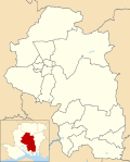
Location within Hampshire
Population1,000  [1] [2]
OS grid reference SU582284
Civil parish
  • Cheriton
District
Shire county
Region
Country England
Sovereign state United Kingdom
Post town ALRESFORD
Postcode district SO24
Dialling code 01962
Police Hampshire and Isle of Wight
Fire Hampshire and Isle of Wight
Ambulance South Central
UK Parliament
List of places
UK
England
Hampshire
51°03′07″N1°10′08″W / 51.051903°N 1.168855°W / 51.051903; -1.168855
The church of St. Michael and all Angels at Cheriton in Hampshire, England. September 2024. The Church Of St Michael And All Angels Cheriton Hampshire.jpg
The church of St. Michael and all Angels at Cheriton in Hampshire, England. September 2024.

Cheriton is a village and civil parish near Alresford in Hampshire, England.

Contents

The settlement is close to the site of the 1644 Battle of Cheriton, fought during the First English Civil War.

Facilities and Services

Cheriton has two pubs, and a local shop that contains a sub-post office. The Flower Pots Inn has its own microbrewery, [3] and has won numerous awards for brewing over the past twenty years as attested to by the certificates adorning its walls. The community also enjoys the village hall, tennis courts and cricket pitches which offer a quintessentially English country scene. [4]

The Church of England parish church dates from the 13th century and is dedicated to St Michael and All Angels. The chancel was extended in the 15th century and the tower, porch and aisle walls were rebuilt following a fire in 1744. It is a Grade I listed building. [5]

About 1 mile (1.6 km) to the east of the village is a monument to the Battle of Cheriton which was fought on 29 March 1644 and resulted in the defeat of the Royalist army. [6]

Related Research Articles

<span class="mw-page-title-main">Abbotsbury</span> Village in Dorset, England

Abbotsbury is a village and civil parish in the English county of Dorset. The village is located around 7+12 miles (12.1 km) west southwest of Dorchester and 1 mile (1.6 km) inland from the English Channel coast. In the 2021 census the civil parish had a population of 451.

<span class="mw-page-title-main">Rockhampton, Gloucestershire</span> Human settlement in England

Rockhampton is a village and civil parish in the English county of Gloucestershire, situated in the unitary district of South Gloucestershire. It is located 2.8 miles (4.5 km) northeast of Thornbury, 18.6 miles (29.9 km) north of Bristol and is approximately 4 miles (6.4 km) east of the River Severn. It had a population of 166 people according to the 2011 census.

<span class="mw-page-title-main">Silchester</span> Human settlement in England

Silchester is a village and civil parish about 5 miles (8 km) north of Basingstoke in Hampshire. It is adjacent to the county boundary with Berkshire and about 9 miles (14 km) south-west of Reading.

<span class="mw-page-title-main">Hursley</span> Human settlement in England

Hursley is a village and civil parish in Hampshire, England with a population of around 900 in 2011. It is located roughly midway between Romsey and Winchester on the A3090. Besides the village the parish includes the hamlets of Standon and Pitt and the outlying settlement at Farley Chamberlayne.

<span class="mw-page-title-main">Exton, Hampshire</span> Human settlement in England

Exton is a small village and civil parish in the City of Winchester district of Hampshire, England. The village lies in the South Downs National Park, on the west bank of the River Meon, immediately to the north of Corhampton. It is located two miles north of Droxford and five miles north-east of Bishop's Waltham. Its name first appears in 940 as East Seaxnatune, meaning "farmstead of the East Saxons".

<span class="mw-page-title-main">East Meon</span> Human settlement in England

East Meon is a village and civil parish in the East Hampshire district of Hampshire, England. It is 4.4 miles (7.1 km) west of Petersfield.

<span class="mw-page-title-main">Hambledon, Hampshire</span> Human settlement in England

Hambledon is a small village and civil parish in the county of Hampshire in England, situated about 10 miles (16 km) north of Portsmouth within the South Downs National Park.

<span class="mw-page-title-main">Tichborne</span> Human settlement in England

Tichborne is a village and civil parish 4 miles (6.4 km) east of Winchester in Hampshire, England.

<span class="mw-page-title-main">Horsington, Somerset</span> Human settlement in England

Horsington is a village and civil parish in Somerset, England, situated 4 miles (6.4 km) south of Wincanton and 1 mile (1.6 km) north of Templecombe in the South Somerset district. The village lies on the edge of Horsington Marsh, part of the Blackmore Vale. In 2011 the population of the Parish, which includes the adjoining hamlets of Peckholdsash and Wilkin Throop and the village of South Cheriton was 571.

<span class="mw-page-title-main">Radway</span> Human settlement in England

Radway is a village and civil parish in Warwickshire, England, about 7 miles (11 km) north-west of Banbury in neighbouring Oxfordshire. The population taken at the 2011 census had reduced to 238. The village is at the foot of Edge Hill and is notable for the Battle of Edgehill, one of the early major engagements of the English Civil War, which was fought in fields around the village.

<span class="mw-page-title-main">Ashmansworth</span> Village and parish in Hampshire, England

Ashmansworth is a village and civil parish in the Basingstoke and Deane district of the English county of Hampshire.

<span class="mw-page-title-main">Bishops Sutton</span> Village and parish in Hampshire, England

Bishop's Sutton or Bishop's Sutton is a village and civil parish one mile (1.6 km) east of the market town of Alresford in the City of Winchester district of Hampshire, England. According to the 2001 census it had a population of 419, increasing to 463 at the 2011 Census.

<span class="mw-page-title-main">West Meon</span> Human settlement in England

West Meon is a village and civil parish in Hampshire, England, with a population of 749 people at the 2011 census.

<span class="mw-page-title-main">Hartford, Cheshire</span> Human settlement in England

Hartford is a village and civil parish in the unitary authority of Cheshire West and Chester and the ceremonial county of Cheshire, England. It lies at the intersection of the A559 road and the West Coast Main Line and is less than 2 miles (3.2 km) south west of the town of Northwich. It forms part of the Mid Cheshire parliamentary constituency. According to the 2011 Census, the population of the parish was 5,558.

<span class="mw-page-title-main">Longparish</span> Human settlement in England

Longparish is a village and civil parish in Hampshire, England. It is composed of the five hamlets of Middleton, East Aston, West Aston ,Forton and Longparish Station that over time have expanded and effectively joined up to become one village. Longparish is situated on the northwest bank of the River Test. In 2011 the population was 716.

<span class="mw-page-title-main">West Tisted</span> Human settlement in England

West Tisted is a small village in the East Hampshire district of Hampshire, England. It is 6.7 miles (10.8 km) northwest of Petersfield, just off the A32 road.

<span class="mw-page-title-main">Wardington</span> Human settlement in England

Wardington is a village and civil parish in Oxfordshire, about 4 miles (6.4 km) northeast of Banbury. The village consists of two parts: Wardington and Upper Wardington. The village is on a stream that rises in Upper Wardington and flows north to join the River Cherwell.

<span class="mw-page-title-main">Goltho</span> Hamlet in the West Lindsey district of Lincolnshire, England

Goltho is a hamlet in the West Lindsey district of Lincolnshire, England. The population was 157 at the 2011 census. It is situated 1 mile (1.6 km) south-west from Wragby, and 0.5 miles (0.8 km) south from the A158 road.

Ellisfield is a village in the Basingstoke and Deane district of Hampshire, England. It lies approximately 4 miles (6.4 km) south of Basingstoke on the other side of the M3 motorway from the town. As a parish it is grouped together with Cliddesden, Dummer and Farleigh Wallop.

<span class="mw-page-title-main">Langrish</span> Human settlement in England

Langrish is a village and civil parish in the East Hampshire district of Hampshire, England. It is next to the civil parish of Stroud and is 2.7 miles (4.3 km) west of Petersfield, on the A272 road.

References

  1. "Parish Headcounts, Area: Cheriton CP". Neighbourhood Statistics. Office for National Statistics. 2001. Archived from the original on 12 June 2011. Retrieved 6 October 2008. The population was similar in 1871 at 642 (William White (1878) History, Gazetter and Directory of the County of Hampshire).
  2. "Civil Parish population 2011". Neighbourhood Statistics. Office for National Statistics. Retrieved 8 December 2016.
  3. Good Beer Guide 2019. CAMRA Books. 2018. p. 562. ISBN   978-1852493547.
  4. The Rough Guide to Dorset, Hampshire & the Isle of Wight. Rough Guides. 2017. p. 284. ISBN   978-0241253939.
  5. Historic England. "CHURCH OF ST MICHAEL (1303010)". National Heritage List for England . Retrieved 1 May 2020.
  6. Foard, G; Partida, T (May 2005). "Battle of Cheriton". www.battlefieldstrust.com. The Battlefields Trust. Retrieved 1 May 2020.

Commons-logo.svg Media related to Cheriton, Hampshire at Wikimedia Commons