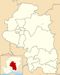
Exton, Hampshire

Last updated

Exton
St peter and paul church exton hampshire.JPG
St Peter and Paul Church
Hampshire UK location map.svg
Red pog.svg
Exton
Location within Hampshire
Population230  [1]
203 (2011 Census) [2]
OS grid reference SU611209
Civil parish
  • Exton
District
Shire county
Region
Country England
Sovereign state United Kingdom
Post town SOUTHAMPTON
Postcode district SO32
Dialling code 01489
Police Hampshire and Isle of Wight
Fire Hampshire and Isle of Wight
Ambulance South Central
UK Parliament
Website Exton Parish Council
List of places
UK
England
Hampshire
50°59′03″N1°07′43″W / 50.98416°N 1.128746°W / 50.98416; -1.128746

Exton is a small village and civil parish in the City of Winchester district of Hampshire, England. The village lies in the South Downs National Park, on the west bank of the River Meon, immediately to the north of Corhampton. It is located two miles north of Droxford and five miles north-east of Bishop's Waltham. Its name first appears in 940 as East Seaxnatune, [3] meaning "farmstead of the East Saxons". [4]

The parish straddles the Meon Valley, including higher ground of the South Downs to either side, with Old Winchester Hill to the east and the southern part of Beacon Hill (shared with Warnford parish) to the west. It is crossed from east to west by the South Downs Way long-distance footpath. The A32 and the Meon Valley Railway footpath cross from north to south.

The parish contains numerous archaeological sites including a Mesolithic flint working site, Bronze Age bowl barrows and the Iron Age fort at Old Winchester Hill. There are also Roman and Dark Age sites and the site of the mediaeval village of Lomer. The 13th-century church of St Peter and St Paul was heavily restored in the 19th century. [5] The 1892 restoration (the second of the 19th century) added stained glass windows by Charles Spooner in the style of the Arts and Crafts movement. [6]

Exton has remained a small community for more than two centuries. In 1801 Exton's total population was 224, by 1901 it had grown slightly to 299 yet by 2001 the population had shrunk to 230 and again to 203 at the 2011 Census. [2] Photographs from the 1950s show a village shop and post office in Exton but this closed in the 1960s. The only community buildings in the village are the church and the Shoe Inn public house.

In 1870–72, John Goring's Imperial Gazetteer of England and Wales described Exton like this:

"EXTON, a village and a parish in Droxford district, Hants. The village stands 2 miles N by E of Droxford, and 5 NE of Bishops-Waltham r. station; and has a post office under Southampton. The parish comprises 2,464 acres (10 km²). Real property, £2,640. Pop., 257. Houses, 41. Exton Lodge is a principal residence. The living is a rectory in the diocese of Winchester. Value, 331.* Patron, the Bishop of Winchester. The church was rebuilt in 1847, and is in the early English style. "
Cottages in Exton ExtonHampshire1.jpg
Cottages in Exton
Shoe Public House in Exton Shoe public house exton hampshire.JPG
Shoe Public House in Exton

Related Research Articles

<span class="mw-page-title-main">Wickham, Hampshire</span> Village in Hampshire, England

Wickham is a village in the civil parish of Wickham and Knowle, in the Winchester district, in the county of Hampshire, England. It is about 3 miles north of Fareham. In 2021 it had a population of 2173. At the 2001 census, it the parish a population of 4,816, falling to 4,299 at the 2011 Census.

<span class="mw-page-title-main">City of Winchester</span> Place in England

Winchester, or the City of Winchester, is a local government district with city status in Hampshire, England.

<span class="mw-page-title-main">River Meon</span> River in Hampshire, England

The River Meon is a chalk stream in Hampshire in the south of England. It rises at East Meon then flows 34 km (21 mi) in a generally southerly direction to empty into the Solent at Hill Head near Stubbington. Above Wickham, the river runs through the South Downs National Park.

<span class="mw-page-title-main">East Meon</span> Village and parish in Hampshire, England

East Meon is a village and civil parish in the East Hampshire district of Hampshire, England. It is 4.4 miles (7.1 km) west of Petersfield.

<span class="mw-page-title-main">Twyford, Hampshire</span> Human settlement in England

Twyford is a village and civil parish in Hampshire, England, approximately three miles south of Winchester and near the M3 motorway and Twyford Down. In 2001, the population of the parish was 1,456. The village and parish are on the left bank of the Itchen, which passes through nearby watermeadows, and has been important economically for its residents.

<span class="mw-page-title-main">Meon Valley (UK Parliament constituency)</span> Parliamentary constituency in the United Kingdom, 2010-2024

Meon Valley was a parliamentary constituency in Hampshire represented in the House of Commons of the UK Parliament. It was represented from its 2010 creation by George Hollingbery and from 2019 to 2024 by Flick Drummond.

<span class="mw-page-title-main">West Meon</span> Human settlement in England

West Meon is a village and civil parish in Hampshire, England, with a population of 749 people at the 2011 census.

<span class="mw-page-title-main">Droxford</span> Village and parish in Hampshire, England

Droxford is a village in Hampshire, England.

<span class="mw-page-title-main">Beacon Hill, Warnford</span>

Beacon Hill, Warnford is a 46.4-hectare (115-acre) biological Site of Special Scientific Interest west of Warnford in Hampshire. It is a Nature Conservation Review site, and an area of 40.1 hectares is a national nature reserve. There is a round barrow cemetery dating to the Late Neolithic or Bronze Age on the hill, and this is a scheduled monument.

<span class="mw-page-title-main">Meonstoke</span> Village in Hampshire, England

Meonstoke is a village and former civil parish, now in the parish of Corhampton and Meonstoke, in the Winchester district, in the county of Hampshire, England. It is in the Meon Valley where it cuts through the Middle Chalk of the South Downs, Old Winchester Hill is at the edge of the parish to the east. In 1931 the parish had a population of 439.

Swanmore is a rural village and civil parish situated in the Meon Valley, Hampshire, England. It is very near to Bishop's Waltham.

<span class="mw-page-title-main">Soberton</span> Human settlement in England

Soberton is a village in the Meon Valley, Hampshire, England, east of the A32 and a few miles south of the village of Droxford. It appears in the Domesday Book as "Sudbertone" or "Sudbertune". For administration, it is in the Hampshire County Council area, headquartered in Winchester.

<span class="mw-page-title-main">Chilcomb</span> Village and parish in Hampshire, England

Chilcomb is a small village and civil parish in the English county of Hampshire 3 miles (4.8 km) east of Winchester and includes the South Downs Way long-distance footpath.

<span class="mw-page-title-main">Curdridge</span> Village and parish in Hampshire, England

Curdridge is a village and civil parish within the City of Winchester district of Hampshire, England. The parish also contains the similarly named village of Curbridge. The village has a small school. The parish is located eight miles to the east of Southampton and had a population of 1,292 people in 473 households in the 2001 census, the population increasing to 1,398 in 520 households at the 2011 Census. Curdridge is also known for its annual Curdridge Country Show that takes place in a field off Reading Room Lane

Shedfield is a village and civil parish in the City of Winchester district of Hampshire, England. In the 2001 UK Census, Shedfield had a population of 3,914, falling to 3,842 at the 2011 Census. Shedfield parish includes the neighbouring villages of Waltham Chase and Shirrell Heath.

<span class="mw-page-title-main">Upham, Hampshire</span> Human settlement in England

Upham is a small village and civil parish in the south of England located in Hampshire approximately 7 miles south-east of Winchester.

<span class="mw-page-title-main">Warnford</span> Human settlement in England

Warnford is a village and civil parish in the City of Winchester district of Hampshire, England. The parish covers 1283 hectares. The village lies on the A32 in the upper valley of the River Meon between West Meon and Exton. The population in 2019 was estimated at 220. The village is rural in character, with most of the buildings along River Lane, Lippen Lane and Hayden Lane.

<span class="mw-page-title-main">Steep, Hampshire</span> Human settlement in England

Steep is a village and civil parish in the East Hampshire district of Hampshire, England. Its nearest town is Petersfield, which lies 1.4 miles (2.3 km) south of the village, just off the A3 road. The nearest railway station is Petersfield, at 1.6 miles (2.6 km) south of the village. It has two public houses, The Harrow and the Cricketers Inn, with the former being an 18th-century Grade II listed building. According to the 2011 census, it had a population of 1,391.

<span class="mw-page-title-main">All Saints Church, East Meon</span> Church in Hampshire, England

All Saints' Church is an Anglican parish church in the village of East Meon, Hampshire, England. It is a Grade I listed building and the oldest building in the village, lying so tight to a hill to the north of the village – part of the South Downs – that there was no room for a north aisle to be built. Most of the church dates from the Norman period, with the south chapel and south aisle being added in the 13th century.

References

  1. "Parish Headcounts, Area: Exton CP". Neighbourhood Statistics. Office for National Statistics. 2001. Retrieved 31 March 2008.
  2. 1 2 "Civil Parish population 2011". Neighbourhood Statistics. Office for National Statistics. Retrieved 16 December 2016.
  3. William Page, ed. (1908). "Parishes: Exton". A History of the County of Hampshire: Volume 3 pp 319-321. Victoria County History. Retrieved 1 April 2008.
  4. Mills, A.D. and Room,A. Dictionary of British Place-Names Oxford University Press
  5. "Exton". Hampshire Treasures Volume 1 Winchester City District p 105-112. Hampshire County Council. Archived from the original on 9 March 2005.
  6. O’Brien, Charles; Bailey, Bruce; Pevsner, Nikolaus; Lloyd, David W. (2018). The Buildings of England Hampshire: South. Yale University Press. p. 264. ISBN   9780300225037.