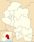
Shedfield

Last updated

Shedfield
Hampshire UK location map.svg
Red pog.svg
Shedfield
Location within Hampshire
Population3,914  [1]
3,842 (2011 Census including Waltham Chase) [2]
OS grid reference SU5569413135
District
Shire county
Region
Country England
Sovereign state United Kingdom
Post town Southampton
Postcode district SO32
Dialling code 01329
Police Hampshire
Fire Hampshire and Isle of Wight
Ambulance South Central
UK Parliament
List of places
UK
England
Hampshire
50°54′54″N1°12′33″W / 50.915000°N 1.2091345°W / 50.915000; -1.2091345 Coordinates: 50°54′54″N1°12′33″W / 50.915000°N 1.2091345°W / 50.915000; -1.2091345

Shedfield is a village and civil parish in the City of Winchester district of Hampshire, England. In the 2001 UK Census, Shedfield had a population of 3,914, [3] falling to 3,842 at the 2011 Census. [2] Shedfield parish includes the neighbouring villages of Waltham Chase and Shirrell Heath. [4]

Contents

History

Manorial records and casual archaeological finds, along with five more detailed archaeological studies, suggest that the land around Shedfield has been occupied continually since the Mesolithic period. [5]

The manor of Shedfield was owned by the Bishops of Winchester. [5] Shedfield was recorded in a 1337 court roll, adding the Tithing of Shedfield to the parish of Droxford. [6] Shedfield's parish registers date from 1829, but the civil parish was established in 1894 as part of a national reorganisation following significant population growth. [6] At that time, the parish was within the Bishop's Waltham Hundred. [6]

Ownership of the manor house and its estate passed to the Phillimore family in 1868, when it was purchased by Admiral Sir Augustus Phillimore and remains with the Phillimore family today. [5] Most of the buildings and structures in Shedfield today date from the nineteenth century, including the Parish Church of St. John the Baptist which was built in 1875. [6] However, this building replaced an earlier structure, and the buttressed tower of the earlier church is still standing. [6] Shedfield Cricket Club was founded in 1886, playing at various grounds, until folding at the end of the 2012 season.

Much of the estate's land is now a golf course, and many of the estate buildings are used for business purposes. Also located on the estate is a Marriott hotel and country club.

Geography

The village is located in a valley, and is located close to several freshwater springs. [5] The soil in the area is mainly sandy, therefore having good drainage, and is regarded as good pasture for keeping sheep and cattle. [5]

Demography

Demographics at a glance
2001 census Shedfield City of Winchester England
Total population3,914107,22249,138,831
Households1,48243,13220,451,427
Christian79.9%76.2%71.7%
No religion12.1%15.9%14.6%
Health: good74.0%74.6%68.8%
Health: fairly good20.0%19.5%22.2%
Health: not good6.1%5.9%9.0%

The gender split in Shedfield is roughly even, with 1,931 males and 1,983 females in the parish. [3] Most of the population claim to be Christians, with just over 12 per cent having no religion and eight percent having other religions. [3] The number of people professing to have good health is slightly above the rates for South East England and England as a whole, but slightly below the average for the Winchester district. [3]

Related Research Articles

Bishops Waltham Town in the Winchester district of Hampshire, England

Bishop's Waltham is a medieval market town situated at the source of the River Hamble in Hampshire, England. It has a foot in the South Downs National Park and is located at the midpoint of a long-established route between Winchester and Portsmouth. It is home to the ruins of Bishop's Waltham Palace, a Scheduled Ancient Monument under English Heritage management, and a well-preserved high street with many listed buildings which now house independent shops.

Hursley Human settlement in England

Hursley is a village and civil parish in Hampshire, England with a population of around 900 in 2011. It is located roughly midway between Romsey and Winchester on the A3090. Besides the village the parish includes the hamlets of Standon and Pitt and the outlying settlement at Farley Chamberlayne.

Exton, Hampshire Human settlement in England

Exton is a small village and civil parish in the City of Winchester district of Hampshire, England. The village lies in the South Downs National Park, on the west bank of the River Meon, immediately to the north of Corhampton. It is located two miles north of Droxford and five miles north-east of Bishop's Waltham. Its name first appears in 940 as East Seaxnatune, meaning "farmstead of the East Saxons".

Dummer, Hampshire Human settlement in England

Dummer is a parish and village in Hampshire, England. It is 6 miles south-west of Basingstoke and half a mile south of Junction 7 on the M3 motorway.

Waltham St Lawrence Village in England

Waltham St Lawrence is a small village and civil parish in the English county of Berkshire.

Colden Common Human settlement in England

Colden Common is a civil parish in the Winchester District of Hampshire, England, approximately 5 miles south of the city of Winchester, covering an area of 690.74 hectares (2.6670 sq mi) with a resident population of approximately 4,000 people. It includes the village of Colden Common and the hamlets of Hensting, Fisher's Pond, Nob's Crook, Highbridge and Brambridge. Part of the parish lies within the South Downs National Park.

Ashmansworth Human settlement in England

Ashmansworth is a village and civil parish in the Basingstoke and Deane district of the English county of Hampshire.

Bentworth Village in Hampshire, England

Bentworth is a village and civil parish in the East Hampshire district of Hampshire, England. The nearest town is Alton, which lies about 3 miles (5 km) east of the village. The parish covers an area of 3,763 acres (15.23 km2) and at its highest point is King's Hill, 716 feet (218 m) above sea level. According to the 2011 census, Bentworth had a population of 553. It lies on the edge of the East Hampshire Hangers.

Bishops Sutton Human settlement in England

Bishops Sutton or Bishop's Sutton is a village and civil parish one mile (1.6 km) east of the market town of Alresford in the City of Winchester district of Hampshire, England. According to the 2001 census it had a population of 419, increasing to 463 at the 2011 Census.

Damerham Human settlement in England

Damerham is a rural village and civil parish in Hampshire, England, located near Fordingbridge, on the River Allen. Damerham has notable Neolithic and Bronze Age barrows. It was the site of an Anglo-Saxon religious community, mentioned in the will of Alfred the Great. By the time of Domesday Book (1086), Damerham was a major settlement in the possession of Glastonbury Abbey.

West Meon Human settlement in England

West Meon is a village and civil parish in Hampshire, England, with a population of 749 people as of the 2011 census.

Droxford Human settlement in England

Droxford is a village in Hampshire, England.

Waltham Chase is a village in Hampshire, England, neighbouring the town of Bishop's Waltham. It is in the civil parish of Shedfield. The village comprises about 2 sq. kilometres of land to the south-east of Bishop's Waltham.

Curdridge Human settlement in England

Curdridge is a village and civil parish within the City of Winchester district of Hampshire, England. The parish also contains the similarly-named village of Curbridge. The village has a small school. The parish is located eight miles to the east of Southampton and had a population of 1,292 people in 473 households in the 2001 census, the population increasing to 1,398 in 520 households at the 2011 Census. Curdridge is also known for its annual Curdridge Country Show that takes place in a field off Reading Room Lane

Upham, Hampshire Human settlement in England

Upham is a small village and civil parish in the south of England located in Hampshire approximately 7 miles south-east of Winchester.

Warnford Human settlement in England

Warnford is a village and civil parish in the City of Winchester district of Hampshire, England. The parish covers 1283 hectares. The population in 2019 was estimated at 220.

Compton, Waverley Human settlement in England

Compton is a former village and today a semi-rural suburb centred 1 mile (1.6 km) ESE of Farnham in the Waverley district of Surrey, England and connected to Farnham by two direct urban single carriageways and green space footpaths along the Wey which in part marks the northern boundary of the area together with the A31. The area relies on Farnham for most of its modern amenities and its eastern part is rural whereas its western part is urban, with a divide where the Wey flows between the two south-eastwards.

Medstead Human settlement in England

Medstead is a village and civil parish in the East Hampshire district of Hampshire, England. Its nearest town is Alton, which lies 4.3 miles (6.9 km) northeast of the village. According to the 2011 census, the village had a population of 2,036 people. The parish covers an area of 1,536 acres (622 ha) and has an average elevation of approximately 600 feet (180 m) above sea level. One of the county's high points at 716 feet (218 m), King's Hill, runs through Medstead and Bentworth.

Bradley, Hampshire Human settlement in England

Bradley is a small village and civil parish in the Basingstoke and Deane district of Hampshire, England. Its nearest town is Alton, which lies 5.4 miles (8.7 km) southeast from the village, although Basingstoke lies 6.6 miles (10.6 km) to the north. According to the 2011 census, the village had a population of 202 people. The parish covers an area of 975 acres (395 ha), of which 149 acres (60 ha) is woodland and its highest point is 170 metres (560 ft) above sea level. It contains no hamlets.

Itchen Stoke and Ovington Human settlement in England

Itchen Stoke and Ovington is an English civil parish consisting of two adjoining villages in Hampshire, England, 2 miles (3.2 km) west of Alresford town centre in the valley of the River Itchen, 5 miles (8.0 km) north-east of Winchester, and 2 miles (3.2 km) south-east of Itchen Abbas.

References

  1. Census data
  2. 1 2 "Civil Parish population 2011". Neighbourhood Statistics. Office for National Statistics. Retrieved 9 January 2017.
  3. 1 2 3 4 "Key Figures for 2001 Census: Census Area Statistics". 2001 UK Census . Office for National Statistics . Retrieved 26 November 2007.
  4. Shedfield Parish boundary Retrieved 2013-02-21
  5. 1 2 3 4 5 "Shedfield House History". Shedfield House Estate. Retrieved 21 February 2013.
  6. 1 2 3 4 5 "Shedfield". Bishop's Waltham Local Pages. Hampshire County Council. Retrieved 26 November 2007.