Curdridge | |
---|---|
Curdridge Church | |
Location within Hampshire | |
Population | 1,398 (2011) [1] |
OS grid reference | SU5277113792 |
Civil parish |
|
District | |
Shire county | |
Region | |
Country | England |
Sovereign state | United Kingdom |
Post town | SOUTHAMPTON |
Postcode district | SO32 |
Dialling code | 01489 |
Police | Hampshire and Isle of Wight |
Fire | Hampshire and Isle of Wight |
Ambulance | South Central |
UK Parliament | |
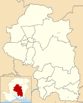
Curdridge is a village and civil parish within the City of Winchester district of Hampshire, England. The parish also contains the similarly named village of Curbridge. The village has a small school. [2] The parish is located eight miles to the east of Southampton [2] and had a population of 1,292 people in 473 households in the 2001 census, [3] the population increasing to 1,398 in 520 households at the 2011 Census. [1] Curdridge is also known for its annual Curdridge Country Show that takes place in a field off Reading Room Lane [4]
Although named after the nearby village of Botley, Botley railway station is actually located in the civil parish of Curdridge. [5]
On 11 February 2024, a large fire destroyed a historic mansion in the village. [6] No injuries were reported. [7]
The village of Curdridge itself is 2.0 km (1.25 mi) northeast of Botley, and is on the B3051 road. The A334 passes through the southern portion of the parish. Travelling from west to east the A334 enters the parish as it crosses the River Hamble near Botley. It exits the parish, 1.75 km (1.09 mi) later as it crosses Kitnocks Gully immediately east of Lake Road. The B3051 forks off the A334 100m northeast of Botley railway station. The B3051 carries on in a generally northeast direction for approximately 2.9 km (1.8 mi) exiting the parish 100m northeast of Harfield Bungalow. Within the parish the B3051 is named Botley Road. Curdridge Lane is a road, generally wider than 4m, which crosses the parish west to east. Curdridge Lane begins at the B3051 junction with Calcot Lane. Curdridge Lane passes The Cricketers Public House, crosses the course of an old Roman road and marks the boundary of the parish for approximately 190 m (620 ft), before it makes a complete change of direction and leaves the parish at Yew Tree Farm. [8]
The village is part of the civil parish of Curdridge [9] and is part of the Owslebury and Curdridge ward of the City of Winchester non-metropolitan district, and the Meon Valley division [10] of Hampshire County Council. [11]
The village Church is the church of St Peter. [12] It was largely built in 1887 and 1888 to a design by Thomas Graham Jackson. [12] A tower was added in 1895. [12]
The local legends of two women with tragic lives are often mixed and confused in the village's folklore. [13]
According to local legend, Kitnocks Hill, on the Wickham road, takes its name from a young girl called Kitty Nocks, or some variation thereof, who drowned, either by suicide or accident while eloping with a lover of whom her father did not approve. Her ghost, reportedly seen by locals returning from Southampton on the bus, is now said to haunt the top of the hill. [13]
According to local legend, Mill Hill on the Botley road was, in the 17th century, home to an elderly witch called Kate Hunt, who moved felled trees with magic, rode to Bishops Waltham on a farm gate and changed into a white hare. The elderly woman was found dead after locals from Pink Mead Farm shot the hare with a silver coin. [13]
The River Hamble in south Hampshire, England, rises near Bishop's Waltham and flows for 10.1 km (6.3 mi) through Botley, Bursledon, and Lower Swanwick before entering Southampton Water between Hamble Common and Warsash.
Wickham is a village in the civil parish of Wickham and Knowle, in the Winchester district, in the county of Hampshire, England. It is about 3 miles north of Fareham. In 2021 it had a population of 2173. At the 2001 census, it the parish a population of 4,816, falling to 4,299 at the 2011 Census.
Winchester, or the City of Winchester, is a local government district with city status in Hampshire, England.
Whiteley is a planned community of 6,500 homes in the county of Hampshire, England, United Kingdom near Fareham. The development straddles the boundary between two council districts: the Borough of Fareham to the south and east, and the city of Winchester to the north and west.
Botley is a historic village in Hampshire, England, approximately 3 miles (4.8 km) east of Southampton. It was developed as a natural crossing point for the River Hamble, and received its first market charter from Henry III in 1267. The village grew on the success of its mills, its coaching inns, and more recently strawberries, and was described as "the most delightful village in the world" by 18th century journalist and radical politician William Cobbett.
Hedge End is a town and civil parish in Hampshire, England. Situated to the east of the City of Southampton, it adjoins the districts of West End and Botley. Hedge End lies within the Borough of Eastleigh and is part of the Southampton Urban Area. The original hamlet developed on Botley Common after 1250 when it was granted to the men of Botley as common pasture. In 1267, royal charters allowed Botley to hold an annual fair and a weekly market on the common which eventually became a market town.
Barkston is an English village and civil parish in the South Kesteven district of Lincolnshire. The parish population was 497 at the 2001 census and 493 at the 2011 census. The village lies about 4 miles (6 km) north of the market town of Grantham, on the A607, just south of the junction with the A153 to Ancaster.
Chandler's Ford is a largely residential area and civil parish in the Borough of Eastleigh in Hampshire, England. It had a population of 21,436 in the 2011 Census.
Botley railway station serves Botley and the surrounding areas in the English county of Hampshire. The station is on the railway line between Eastleigh and Fareham, 78 miles 72 chains (127.0 km) from London Waterloo.
North Baddesley is a large village and civil parish in Hampshire, England. It is situated 3 mi (5 km) east of the town of Romsey and 6 mi (10 km) north of Southampton. It occupies an area of approximately 9.15 km2 (3.53 sq mi), and is home to a population of just over 10,000 people, reducing to 7,000 at the 2011 Census. It is located in the Test Valley; a river famous for trout fishing.
Itchen Valley is a civil parish in the English county of Hampshire. Forming part of the City of Winchester district, it comprises the villages of Avington, Easton, Itchen Abbas and Martyr Worthy, with a population of 1,267 at the time of the 2001 Census, increasing at the 2011 Census to a population of 1,459.
Bassett is a suburb and electoral ward of the City of Southampton, England. The suburb lies to the north of the city centre and is largely residential, including the University of Southampton's Glen Eyre Halls of residence complex, which houses around 2,100 students. Bassett gives its name to part of the A33 arterial road which links the city centre to the M3, described by Pevsner & Lloyd as "part of the splendid tree-lined route into Southampton from Winchester, London and the north". The highest point in the City of Southampton lies on Bassett Avenue at a height of 82 metres (269 ft) above sea level.
Crawley is a small village in Hampshire, England. It is a few miles from the county town of Winchester. It is a civil parish within the City of Winchester local government district. The village is the location of Crawley Court, currently the headquarters of broadcast infrastructure company Arqiva.
Durley is a village and civil parish in the City of Winchester district of Hampshire, England. It is located approximately 7½ miles (12.1 km) northeast of Southampton and has a population of around 992. The village is home to two pubs, The Robin Hood Inn and the Farmers Home. Both of the pubs have a rich history dating back till the nineteenth century. Durley is home to one school, Durley CE Primary. Which is home to approximately 130 pupils ranging from four to eleven years of age. The village also has one pre-school called Durley Ladybirds. The village is also home to a local church called the Church of the Holy Cross where services are regularly held.
Upham is a small village and civil parish in the south of England located in Hampshire approximately 7 miles south-east of Winchester.
Warnford is a village and civil parish in the City of Winchester district of Hampshire, England. The parish covers 1283 hectares. The village lies on the A32 in the upper valley of the River Meon between West Meon and Exton. The population in 2019 was estimated at 220. The village is rural in character, with most of the buildings along River Lane, Lippen Lane and Hayden Lane.
East Stratton is an estate village and former civil parish, now in the parish of Micheldever, in the Winchester district, in the county of Hampshire, England. It is at the entrance to the landscaped grounds of Stratton Park, some 8 miles northeast of Winchester Both park and village demonstrate the evolution of a landscape directed by three eminent families – Wriothesley, Russell and Baring – during the 17th, 18th and 19th centuries. In 1931 the parish had a population of 230.
Curbridge is a village and former civil parish, now in the parish of Curdridge, in the Winchester district, in the county of Hampshire, England. In 1951 the parish had a population of 444.
Durley Street is a village in the City of Winchester district of Hampshire, England. It is located approximately 7 miles (11 km) northeast of Southampton.
Hilldale is a civil parish in the West Lancashire district of Lancashire, England, containing the village of Hill Dale and the neighbouring hamlet of Andertons Mill. Formerly part of Wrightington, Hilldale became a separate civil parish in 1999. As of 2011, Hilldale has a population of 581.