List of United Kingdom locations: Kip-Kz

Last updated

The United Kingdom Uk-map.svg
The United Kingdom

This is part of the list of United Kingdom locations: a gazetteer of place names in the United Kingdom showing each place's locality and geographical coordinates.

Contents

Ki (continued)

Kip–Kiz

LocationLocality Coordinates
(links to map & photo sources)
OS grid
reference
Kip Hill Durham 54°52′N1°41′W / 54.87°N 01.68°W / 54.87; -01.68 NZ2053
Kiplin North Yorkshire 54°22′N1°35′W / 54.36°N 01.58°W / 54.36; -01.58 SE2797
Kiplingcotes East Riding of Yorkshire 53°54′N0°36′W / 53.90°N 00.60°W / 53.90; -00.60 SE9245
Kippax Leeds 53°46′N1°22′W / 53.76°N 01.37°W / 53.76; -01.37 SE4130
Kippen Stirling 56°07′N4°10′W / 56.12°N 04.17°W / 56.12; -04.17 NS6594
Kippford Dumfries and Galloway 54°52′N3°49′W / 54.86°N 03.82°W / 54.86; -03.82 NX8354
Kippilaw Scottish Borders 55°32′N2°44′W / 55.54°N 02.73°W / 55.54; -02.73 NT5428
Kippilaw Mains Scottish Borders 55°33′N2°44′W / 55.55°N 02.73°W / 55.55; -02.73 NT5429
Kipping's Cross Kent 51°07′N0°20′E / 51.12°N 00.34°E / 51.12; 00.34 TQ6439
Kippington Kent 51°16′N0°10′E / 51.26°N 00.17°E / 51.26; 00.17 TQ5254
Kirbister (near Kirkwall)Orkney Islands 58°56′N3°07′W / 58.94°N 03.11°W / 58.94; -03.11 HY3607
Kirbister (near Stromness)Orkney Islands 59°00′N3°19′W / 59.00°N 03.32°W / 59.00; -03.32 HY2414
Kirbuster Orkney Islands 59°06′N3°15′W / 59.10°N 03.25°W / 59.10; -03.25 HY2825
Kirby Isle of Man 54°09′N4°31′W / 54.15°N 04.51°W / 54.15; -04.51 SC3676
Kirby Bedon Norfolk 52°35′N1°22′E / 52.59°N 01.36°E / 52.59; 01.36 TG2805
Kirby Bellars Leicestershire 52°44′N0°56′W / 52.74°N 00.94°W / 52.74; -00.94 SK7117
Kirby Cane Norfolk 52°29′N1°29′E / 52.48°N 01.48°E / 52.48; 01.48 TM3793
Kirby Corner Warwickshire 52°23′N1°34′W / 52.38°N 01.57°W / 52.38; -01.57 SP2976
Kirby Cross Essex 51°50′N1°13′E / 51.83°N 01.22°E / 51.83; 01.22 TM2220
Kirby Fields Leicestershire 52°37′N1°14′W / 52.62°N 01.23°W / 52.62; -01.23 SK5203
Kirby Green Norfolk 52°29′N1°29′E / 52.49°N 01.49°E / 52.49; 01.49 TM3794
Kirby Grindalythe North Yorkshire 54°05′N0°37′W / 54.09°N 00.62°W / 54.09; -00.62 SE9067
Kirby Hill (Richmondshire)North Yorkshire 54°26′N1°48′W / 54.44°N 01.80°W / 54.44; -01.80 NZ1306
Kirby Hill (Harrogate)North Yorkshire 54°04′N1°24′W / 54.06°N 01.40°W / 54.06; -01.40 SE3886
Kirby Knowle North Yorkshire 54°16′N1°17′W / 54.27°N 01.29°W / 54.27; -01.29 SE4687
Kirby-le-Soken Essex 51°50′N1°13′E / 51.84°N 01.22°E / 51.84; 01.22 TM2221
Kirby Misperton North Yorkshire 54°12′N0°49′W / 54.20°N 00.82°W / 54.20; -00.82 SE7779
Kirby Muxloe Leicestershire 52°38′N1°14′W / 52.63°N 01.24°W / 52.63; -01.24 SK5104
Kirby Row Norfolk 52°28′N1°29′E / 52.47°N 01.48°E / 52.47; 01.48 TM3792
Kirby Sigston North Yorkshire 54°20′N1°22′W / 54.34°N 01.37°W / 54.34; -01.37 SE4194
Kirby Underdale East Riding of Yorkshire 54°01′N0°47′W / 54.01°N 00.78°W / 54.01; -00.78 SE8058
Kirby Wiske North Yorkshire 54°15′N1°26′W / 54.25°N 01.43°W / 54.25; -01.43 SE3784
Kirdford West Sussex 51°01′N0°34′W / 51.02°N 00.56°W / 51.02; -00.56 TQ0126
Kirkabister (Bressay)Shetland Islands 60°07′30″N1°07′01″W / 60.125°N 01.117°W / 60.125; -01.117 HU4938
Kirkabister (near Neap)Shetland Islands 60°18′N1°07′W / 60.30°N 01.11°W / 60.30; -01.11 HU4958
Kirkabister (near Vidlin Voe)Shetland Islands 60°22′N1°08′W / 60.37°N 01.13°W / 60.37; -01.13 HU4866
Kirkandrews Dumfries and Galloway 54°48′N4°11′W / 54.80°N 04.19°W / 54.80; -04.19 NX5948
Kirkandrews-on-Eden Cumbria 54°55′N3°01′W / 54.91°N 03.01°W / 54.91; -03.01 NY3558
Kirkapol Argyll and Bute 56°31′N6°49′W / 56.52°N 06.81°W / 56.52; -06.81 NM0447
Kirkaton Shetland Islands 60°48′N0°48′W / 60.80°N 00.80°W / 60.80; -00.80 HP6514
Kirkbampton Cumbria 54°53′N3°05′W / 54.89°N 03.09°W / 54.89; -03.09 NY3056
Kirkbean Dumfries and Galloway 54°55′N3°36′W / 54.91°N 03.60°W / 54.91; -03.60 NX9759
Kirkborough Cumbria 54°43′N3°28′W / 54.71°N 03.47°W / 54.71; -03.47 NY0536
Kirk Bramwith Doncaster 53°35′N1°04′W / 53.59°N 01.07°W / 53.59; -01.07 SE6111
Kirkbride Cumbria 54°53′N3°13′W / 54.89°N 03.21°W / 54.89; -03.21 NY2256
Kirkbridge North Yorkshire 54°18′N1°37′W / 54.30°N 01.61°W / 54.30; -01.61 SE2590
Kirkburn East Riding of Yorkshire 53°59′N0°30′W / 53.98°N 00.50°W / 53.98; -00.50 SE9855
Kirkburn Scottish Borders 55°38′N3°07′W / 55.63°N 03.12°W / 55.63; -03.12 NT2938
Kirkburton Kirklees 53°36′N1°43′W / 53.60°N 01.71°W / 53.60; -01.71 SE1912
Kirkby North Yorkshire 54°26′N1°11′W / 54.44°N 01.18°W / 54.44; -01.18 NZ5306
Kirkby Knowsley 53°28′N2°53′W / 53.47°N 02.89°W / 53.47; -02.89 SJ4198
Kirkby Lincolnshire 53°25′N0°24′W / 53.41°N 00.40°W / 53.41; -00.40 TF0692
Kirkby Fenside Lincolnshire 53°08′N0°01′W / 53.13°N 00.02°W / 53.13; -00.02 TF3261
Kirkby Fleetham North Yorkshire 54°20′N1°34′W / 54.34°N 01.57°W / 54.34; -01.57 SE2894
Kirkby Green Lincolnshire 53°05′N0°23′W / 53.09°N 00.38°W / 53.09; -00.38 TF0857
Kirkby Hill North Yorkshire 54°06′N1°25′W / 54.10°N 01.42°W / 54.10; -01.42 SE3868
Kirkby-in-Ashfield Nottinghamshire 53°05′N1°15′W / 53.09°N 01.25°W / 53.09; -01.25 SK5056
Kirkby-in-Furness Cumbria 54°13′N3°11′W / 54.22°N 03.19°W / 54.22; -03.19 SD2282
Kirkby la Thorpe Lincolnshire 52°59′N0°22′W / 52.99°N 00.37°W / 52.99; -00.37 TF0945
Kirkby Lonsdale Cumbria 54°11′N2°35′W / 54.19°N 02.59°W / 54.19; -02.59 SD6178
Kirkby Malham North Yorkshire 54°02′N2°10′W / 54.04°N 02.16°W / 54.04; -02.16 SD8961
Kirkby Mallory Leicestershire 52°35′N1°20′W / 52.59°N 01.33°W / 52.59; -01.33 SK4500
Kirkby Malzeard North Yorkshire 54°10′N1°38′W / 54.16°N 01.64°W / 54.16; -01.64 SE2374
Kirkby Mills North Yorkshire 54°15′N0°55′W / 54.25°N 00.92°W / 54.25; -00.92 SE7085
Kirkbymoorside North Yorkshire 54°16′N0°56′W / 54.26°N 00.94°W / 54.26; -00.94 SE6986
Kirkby on Bain Lincolnshire 53°08′N0°08′W / 53.14°N 00.14°W / 53.14; -00.14 TF2462
Kirkby Overblow North Yorkshire 53°56′N1°31′W / 53.93°N 01.51°W / 53.93; -01.51 SE3249
Kirkby Stephen Cumbria 54°28′N2°21′W / 54.46°N 02.35°W / 54.46; -02.35 NY7708
Kirkby Thore Cumbria 54°37′N2°34′W / 54.61°N 02.57°W / 54.61; -02.57 NY6325
Kirkby Underwood Lincolnshire 52°50′N0°25′W / 52.83°N 00.41°W / 52.83; -00.41 TF0727
Kirkby Wharfe North Yorkshire 53°51′N1°14′W / 53.85°N 01.24°W / 53.85; -01.24 SE5040
Kirkby Woodhouse Nottinghamshire 53°05′N1°16′W / 53.08°N 01.26°W / 53.08; -01.26 SK4954
Kirkcaldy Fife 56°06′N3°10′W / 56.10°N 03.17°W / 56.10; -03.17 NT2791
Kirkcambeck Cumbria 55°00′N2°44′W / 55.00°N 02.73°W / 55.00; -02.73 NY5368
Kirkcolm Dumfries and Galloway 54°58′N5°05′W / 54.96°N 05.09°W / 54.96; -05.09 NX0268
Kirkconnel Dumfries and Galloway 55°23′N4°00′W / 55.38°N 04.00°W / 55.38; -04.00 NS7312
Kirkcowan Dumfries and Galloway 54°55′N4°37′W / 54.91°N 04.62°W / 54.91; -04.62 NX3261
Kirkcudbright Dumfries and Galloway 54°49′N4°03′W / 54.82°N 04.05°W / 54.82; -04.05 NX6850
Kirkdale Liverpool 53°26′N2°59′W / 53.43°N 02.99°W / 53.43; -02.99 SJ3493
Kirk Deighton North Yorkshire 53°56′N1°24′W / 53.94°N 01.40°W / 53.94; -01.40 SE3950
Kirk Ella East Riding of Yorkshire 53°44′N0°27′W / 53.74°N 00.45°W / 53.74; -00.45 TA0229
Kirkfieldbank South Lanarkshire 55°40′N3°49′W / 55.66°N 03.81°W / 55.66; -03.81 NS8643
Kirkforthar Feus Fife 56°13′N3°10′W / 56.22°N 03.16°W / 56.22; -03.16 NO2804
Kirkgunzeon Dumfries and Galloway 54°58′N3°47′W / 54.97°N 03.78°W / 54.97; -03.78 NX8666
Kirk Hallam Derbyshire 52°57′N1°20′W / 52.95°N 01.33°W / 52.95; -01.33 SK4540
Kirkham North Yorkshire 54°04′N0°53′W / 54.07°N 00.88°W / 54.07; -00.88 SE7365
Kirkham Lancashire 53°47′N2°53′W / 53.78°N 02.88°W / 53.78; -02.88 SD4232
Kirkhamgate Wakefield 53°41′N1°34′W / 53.69°N 01.56°W / 53.69; -01.56 SE2922
Kirk Hammerton North Yorkshire 53°59′N1°17′W / 53.98°N 01.29°W / 53.98; -01.29 SE4655
Kirkhams Bury 53°32′N2°17′W / 53.54°N 02.28°W / 53.54; -02.28 SD8105
Kirkharle Northumberland 55°08′N1°59′W / 55.13°N 01.98°W / 55.13; -01.98 NZ0182
Kirkheaton Northumberland 55°05′N1°59′W / 55.08°N 01.98°W / 55.08; -01.98 NZ0177
Kirkheaton Kirklees 53°39′N1°43′W / 53.65°N 01.72°W / 53.65; -01.72 SE1818
Kirkhill Highland 57°28′N4°25′W / 57.47°N 04.41°W / 57.47; -04.41 NH5545
Kirkhill Angus 56°44′N2°31′W / 56.73°N 02.52°W / 56.73; -02.52 NO6860
Kirkhill (Penicuik)Midlothian 55°49′N3°14′W / 55.82°N 03.23°W / 55.82; -03.23 NT2360
Kirkhill (Broxburn)West Lothian 55°56′N3°29′W / 55.93°N 03.49°W / 55.93; -03.49 NT0772
Kirkhill (Newton Mearns)East Renfrewshire 55°46′N4°19′W / 55.76°N 04.31°W / 55.76; -04.31 NS5555
Kirkholt Rochdale 53°35′N2°10′W / 53.59°N 02.16°W / 53.59; -02.16 SD8911
Kirkhope Scottish Borders 55°29′N2°59′W / 55.49°N 02.98°W / 55.49; -02.98 NT3823
Kirkhouse Cumbria 54°55′N2°41′W / 54.92°N 02.68°W / 54.92; -02.68 NY5659
Kirkibost Highland 57°10′N6°04′W / 57.17°N 06.07°W / 57.17; -06.07 NG5417
Kirkibost Island Western Isles 57°33′N7°25′W / 57.55°N 07.42°W / 57.55; -07.42 NF757647
Kirkinner Dumfries and Galloway 54°49′N4°28′W / 54.82°N 04.46°W / 54.82; -04.46 NX4251
Kirkintilloch East Dunbartonshire 55°56′N4°10′W / 55.93°N 04.16°W / 55.93; -04.16 NS6573
Kirk Ireton Derbyshire 53°02′N1°37′W / 53.04°N 01.61°W / 53.04; -01.61 SK2650
Kirkland (Copeland)Cumbria 54°32′N3°26′W / 54.54°N 03.43°W / 54.54; -03.43 NY0717
Kirkland (Eden)Cumbria 54°41′N2°33′W / 54.68°N 02.55°W / 54.68; -02.55 NY6432
Kirkland (Allerdale)Cumbria 54°49′N3°09′W / 54.82°N 03.15°W / 54.82; -03.15 NY2648
Kirkland Dumfries and Galloway 55°11′N3°53′W / 55.19°N 03.88°W / 55.19; -03.88 NX8090
Kirkland Fife 56°11′N3°02′W / 56.18°N 03.03°W / 56.18; -03.03 NO3600
Kirkland Dam Fife 56°11′N3°02′W / 56.18°N 03.04°W / 56.18; -03.04 NO3500
Kirkland Guards Cumbria 54°44′N3°16′W / 54.74°N 03.27°W / 54.74; -03.27 NY1840
Kirk Langley Derbyshire 52°56′N1°35′W / 52.93°N 01.58°W / 52.93; -01.58 SK2838
Kirkleatham Redcar and Cleveland 54°35′N1°05′W / 54.58°N 01.08°W / 54.58; -01.08 NZ5921
Kirklees Bury 53°36′N2°20′W / 53.60°N 02.33°W / 53.60; -02.33 SD7812
Kirklevington Stockton-on-Tees 54°28′N1°21′W / 54.47°N 01.35°W / 54.47; -01.35 NZ4209
Kirkley Suffolk 52°27′N1°43′E / 52.45°N 01.72°E / 52.45; 01.72 TM5391
Kirklington North Yorkshire 54°13′N1°31′W / 54.22°N 01.52°W / 54.22; -01.52 SE3181
Kirklington Nottinghamshire 53°06′N1°00′W / 53.10°N 01.00°W / 53.10; -01.00 SK6757
Kirklinton Cumbria 54°59′N2°53′W / 54.99°N 02.89°W / 54.99; -02.89 NY4367
Kirkliston City of Edinburgh 55°57′N3°25′W / 55.95°N 03.41°W / 55.95; -03.41 NT1274
Kirkmaiden Dumfries and Galloway 54°41′N4°55′W / 54.68°N 04.91°W / 54.68; -04.91 NX1236
Kirk Merrington Durham 54°40′N1°35′W / 54.67°N 01.59°W / 54.67; -01.59 NZ2631
Kirkmichael Perth and Kinross 56°43′N3°30′W / 56.72°N 03.50°W / 56.72; -03.50 NO0860
Kirkmichael South Ayrshire 55°20′N4°37′W / 55.33°N 04.61°W / 55.33; -04.61 NS3408
Kirk Michael Isle of Man 54°16′N4°35′W / 54.27°N 04.59°W / 54.27; -04.59 SC3190
Kirkmichael Mains Dumfries and Galloway 55°10′N3°33′W / 55.16°N 03.55°W / 55.16; -03.55 NY0187
Kirkmuirhill South Lanarkshire 55°40′N3°55′W / 55.66°N 03.92°W / 55.66; -03.92 NS7943
Kirknewton Northumberland 55°34′N2°08′W / 55.56°N 02.14°W / 55.56; -02.14 NT9130
Kirknewton West Lothian 55°53′N3°25′W / 55.88°N 03.42°W / 55.88; -03.42 NT1167
Kirkney Aberdeenshire 57°22′N2°49′W / 57.37°N 02.81°W / 57.37; -02.81 NJ5132
Kirk of Shotts North Lanarkshire 55°50′N3°51′W / 55.83°N 03.85°W / 55.83; -03.85 NS8462
Kirkoswald South Ayrshire 55°19′N4°46′W / 55.32°N 04.77°W / 55.32; -04.77 NS2407
Kirkoswald Cumbria 54°46′N2°42′W / 54.76°N 02.70°W / 54.76; -02.70 NY5541
Kirkpatrick Dumfries and Galloway 55°11′N3°43′W / 55.19°N 03.72°W / 55.19; -03.72 NX9090
Kirkpatrick Durham Dumfries and Galloway 55°01′N3°54′W / 55.01°N 03.90°W / 55.01; -03.90 NX7870
Kirkpatrick-Fleming Dumfries and Galloway 55°01′N3°08′W / 55.01°N 03.14°W / 55.01; -03.14 NY2770
Kirk Sandall Doncaster 53°33′N1°05′W / 53.55°N 01.08°W / 53.55; -01.08 SE6107
Kirksanton Cumbria 54°12′N3°20′W / 54.20°N 03.33°W / 54.20; -03.33 SD1380
Kirkshaw North Lanarkshire 55°50′N4°02′W / 55.84°N 04.04°W / 55.84; -04.04 NS7263
Kirk Smeaton North Yorkshire 53°38′N1°14′W / 53.63°N 01.23°W / 53.63; -01.23 SE5116
Kirkstall Leeds 53°49′N1°36′W / 53.81°N 01.60°W / 53.81; -01.60 SE2635
Kirkstead Scottish Borders 55°30′N3°10′W / 55.50°N 03.17°W / 55.50; -03.17 NT2624
Kirkstyle Highland 58°38′N3°08′W / 58.63°N 03.13°W / 58.63; -03.13 ND3472
Kirkthorpe Wakefield 53°40′N1°27′W / 53.67°N 01.45°W / 53.67; -01.45 SE3620
Kirkton Aberdeenshire 57°19′N2°35′W / 57.31°N 02.59°W / 57.31; -02.59 NJ6425
Kirkton (Tealing, near Dundee)Angus 56°31′N2°58′W / 56.52°N 02.97°W / 56.52; -02.97 NO4037
Kirkton (Arbroath)Angus 56°34′N2°36′W / 56.56°N 02.60°W / 56.56; -02.60 NO6342
Kirkton (Forfar)Angus 56°36′N2°56′W / 56.60°N 02.94°W / 56.60; -02.94 NO4246
Kirkton Dumfries and Galloway 55°07′N3°37′W / 55.11°N 03.61°W / 55.11; -03.61 NX9781
Kirkton (Newport-on-Tay)Fife 56°25′N3°02′W / 56.41°N 03.03°W / 56.41; -03.03 NO3625
Kirkton (Burntisland)Fife 56°04′N3°14′W / 56.06°N 03.23°W / 56.06; -03.23 NT2386
Kirkton (Golspie)Highland 57°57′N4°02′W / 57.95°N 04.04°W / 57.95; -04.04 NH7998
Kirkton (Strathcarron)Highland 57°25′N5°29′W / 57.41°N 05.48°W / 57.41; -05.48 NG9141
Kirkton (Kyle)Highland 57°17′N5°36′W / 57.28°N 05.60°W / 57.28; -05.60 NG8327
Kirkton Scottish Borders 55°24′N2°43′W / 55.40°N 02.72°W / 55.40; -02.72 NT5413
Kirkton Stirling 56°10′N4°24′W / 56.16°N 04.40°W / 56.16; -04.40 NN5100
Kirkton West Lothian 55°52′N3°33′W / 55.87°N 03.55°W / 55.87; -03.55 NT0366
Kirktonhill Renfrewshire 55°56′N4°35′W / 55.93°N 04.59°W / 55.93; -04.59 NS3874
Kirkton of Auchterhouse Angus 56°32′N3°04′W / 56.53°N 03.07°W / 56.53; -03.07 NO3438
Kirkton of Auchterless Aberdeenshire 57°27′N2°29′W / 57.45°N 02.48°W / 57.45; -02.48 NJ7141
Kirkton of Craig Angus 56°41′N2°29′W / 56.68°N 02.49°W / 56.68; -02.49 NO7055
Kirkton of Culsalmond Aberdeenshire 57°22′N2°36′W / 57.37°N 02.60°W / 57.37; -02.60 NJ6432
Kirkton of Cults Fife 56°16′N3°04′W / 56.26°N 03.06°W / 56.26; -03.06 NO3409
Kirkton of Durris Aberdeenshire 57°03′N2°23′W / 57.05°N 02.38°W / 57.05; -02.38 NO7796
Kirkton of Glenbuchat Aberdeenshire 57°13′N3°02′W / 57.22°N 03.04°W / 57.22; -03.04 NJ3715
Kirkton of Glenisla Angus 56°43′N3°17′W / 56.72°N 03.29°W / 56.72; -03.29 NO2160
Kirkton of Kingoldrum Angus 56°40′N3°05′W / 56.67°N 03.09°W / 56.67; -03.09 NO3354
Kirkton of Largo (or Upper Largo)Fife 56°13′N2°56′W / 56.21°N 02.93°W / 56.21; -02.93 NO4203
Kirkton of Lethendy Perth and Kinross 56°34′N3°25′W / 56.56°N 03.41°W / 56.56; -03.41 NO1342
Kirkton of Lude Perth and Kinross 56°47′N3°48′W / 56.79°N 03.80°W / 56.79; -03.80 NN9068
Kirkton of Maryculter Aberdeenshire 57°05′N2°14′W / 57.08°N 02.24°W / 57.08; -02.24 NO8599
Kirkton of Menmuir Angus 56°46′N2°46′W / 56.76°N 02.77°W / 56.76; -02.77 NO5364
Kirkton of Monikie Angus 56°32′N2°47′W / 56.53°N 02.79°W / 56.53; -02.79 NO5138
Kirkton of Oyne Aberdeenshire 57°19′N2°32′W / 57.31°N 02.53°W / 57.31; -02.53 NJ6825
Kirkton of Rayne Aberdeenshire 57°22′N2°31′W / 57.36°N 02.51°W / 57.36; -02.51 NJ6930
Kirkton of Skene Aberdeenshire 57°09′N2°20′W / 57.15°N 02.33°W / 57.15; -02.33 NJ8007
Kirkton of Tough Aberdeenshire 57°12′N2°38′W / 57.20°N 02.64°W / 57.20; -02.64 NJ6113
Kirktoun East Ayrshire 55°37′N4°31′W / 55.62°N 04.52°W / 55.62; -04.52 NS4140
Kirktown (Peterhead)Aberdeenshire 57°30′N1°48′W / 57.50°N 01.80°W / 57.50; -01.80 NK1246
Kirktown of St Fergus (or Kirktown)Aberdeenshire 57°32′N1°51′W / 57.54°N 01.85°W / 57.54; -01.85 NK0951
Kirktown of Alvah Aberdeenshire 57°37′N2°33′W / 57.62°N 02.55°W / 57.62; -02.55 NJ6760
Kirktown of Deskford Moray 57°38′N2°50′W / 57.63°N 02.83°W / 57.63; -02.83 NJ5061
Kirktown of Fetteresso Aberdeenshire 56°57′N2°14′W / 56.95°N 02.24°W / 56.95; -02.24 NO8585
Kirktown of Mortlach Moray 57°26′N3°08′W / 57.43°N 03.13°W / 57.43; -03.13 NJ3239
Kirkurd Scottish Borders 55°41′N3°24′W / 55.68°N 03.40°W / 55.68; -03.40 NT1244
Kirkwall Orkney Islands 58°58′N2°57′W / 58.97°N 02.95°W / 58.97; -02.95 HY4510
Kirkwhelpington Northumberland 55°09′N2°01′W / 55.15°N 02.01°W / 55.15; -02.01 NY9984
Kirkwood Dumfries and Galloway 55°04′N3°22′W / 55.06°N 03.37°W / 55.06; -03.37 NY1275
Kirkwood North Lanarkshire 55°50′N4°04′W / 55.84°N 04.06°W / 55.84; -04.06 NS7163
Kirk Yetholm Scottish Borders 55°32′N2°17′W / 55.54°N 02.28°W / 55.54; -02.28 NT8228
Kirmington North Lincolnshire 53°35′N0°20′W / 53.58°N 00.33°W / 53.58; -00.33 TA1011
Kirmond le Mire Lincolnshire 53°25′N0°13′W / 53.41°N 00.22°W / 53.41; -00.22 TF1892
Kirn Argyll and Bute 55°57′N4°55′W / 55.95°N 04.91°W / 55.95; -04.91 NS1877
Kirriemuir Angus 56°40′N3°01′W / 56.66°N 03.01°W / 56.66; -03.01 NO3853
Kirstead Green Norfolk 52°31′N1°22′E / 52.52°N 01.37°E / 52.52; 01.37 TM2997
Kirtlebridge Dumfries and Galloway 55°02′N3°12′W / 55.03°N 03.20°W / 55.03; -03.20 NY2372
Kirtleton Dumfries and Galloway 55°06′N3°10′W / 55.10°N 03.16°W / 55.10; -03.16 NY2680
Kirtling Cambridgeshire 52°10′N0°27′E / 52.17°N 00.45°E / 52.17; 00.45 TL6856
Kirtling Green Cambridgeshire 52°10′N0°27′E / 52.16°N 00.45°E / 52.16; 00.45 TL6855
Kirtlington Oxfordshire 51°52′N1°17′W / 51.86°N 01.28°W / 51.86; -01.28 SP4919
Kirtomy Highland 58°32′N4°10′W / 58.53°N 04.16°W / 58.53; -04.16 NC7463
Kirton Suffolk 52°00′N1°18′E / 52.00°N 01.30°E / 52.00; 01.30 TM2739
Kirton Lincolnshire 52°55′N0°04′W / 52.92°N 00.06°W / 52.92; -00.06 TF3038
Kirton Nottinghamshire 53°13′N0°58′W / 53.21°N 00.96°W / 53.21; -00.96 SK6969
Kirton Campus West Lothian 55°52′N3°33′W / 55.87°N 03.55°W / 55.87; -03.55 NT0366
Kirton End Lincolnshire 52°56′N0°05′W / 52.94°N 00.09°W / 52.94; -00.09 TF2840
Kirton Holme Lincolnshire 52°57′N0°07′W / 52.95°N 00.12°W / 52.95; -00.12 TF2641
Kirton in Lindsey North Lincolnshire 53°28′N0°36′W / 53.47°N 00.60°W / 53.47; -00.60 SK9398
Kiskin Cumbria 54°16′N3°23′W / 54.26°N 03.39°W / 54.26; -03.39 SD0986
Kislingbury Northamptonshire 52°13′N0°59′W / 52.22°N 00.99°W / 52.22; -00.99 SP6959
Kitbridge Devon 50°49′N2°59′W / 50.82°N 02.99°W / 50.82; -02.99 ST3003
Kitchenroyd Kirklees 53°34′N1°39′W / 53.57°N 01.65°W / 53.57; -01.65 SE2309
Kitebrook Oxfordshire 51°58′N1°39′W / 51.97°N 01.65°W / 51.97; -01.65 SP2431
Kite Green Warwickshire 52°17′N1°46′W / 52.29°N 01.76°W / 52.29; -01.76 SP1666
Kite Hill Isle of Wight 50°43′N1°13′W / 50.72°N 01.22°W / 50.72; -01.22 SZ5592
Kites Hardwick Warwickshire 52°18′N1°19′W / 52.30°N 01.31°W / 52.30; -01.31 SP4768
Kit Hill Dorset 50°58′N2°13′W / 50.97°N 02.22°W / 50.97; -02.22 ST8419
Kitlye Gloucestershire 51°44′N2°10′W / 51.73°N 02.16°W / 51.73; -02.16 SO8904
Kit's Coty Kent 51°19′N0°29′E / 51.32°N 00.49°E / 51.32; 00.49 TQ7461
Kitt Green Wigan 53°32′N2°41′W / 53.54°N 02.68°W / 53.54; -02.68 SD5505
Kittisford Somerset 50°59′N3°19′W / 50.99°N 03.32°W / 50.99; -03.32 ST0722
Kittle Swansea 51°35′N4°04′W / 51.58°N 04.06°W / 51.58; -04.06 SS5789
Kitts End Hertfordshire 51°40′N0°12′W / 51.66°N 00.20°W / 51.66; -00.20 TQ2498
Kitt's Green Birmingham 52°29′N1°47′W / 52.48°N 01.78°W / 52.48; -01.78 SP1587
Kitt's Moss Stockport 53°21′N2°11′W / 53.35°N 02.18°W / 53.35; -02.18 SJ8884
Kittwhistle Dorset 50°49′N2°52′W / 50.82°N 02.86°W / 50.82; -02.86 ST3903
Kittybrewster City of Aberdeen 57°09′N2°08′W / 57.15°N 02.13°W / 57.15; -02.13 NJ9207
Kitwood Hampshire 51°05′N1°03′W / 51.09°N 01.05°W / 51.09; -01.05 SU6633
Kivernoll Herefordshire 51°59′N2°47′W / 51.98°N 02.78°W / 51.98; -02.78 SO4632
Kiveton Park Rotherham 53°20′N1°16′W / 53.34°N 01.26°W / 53.34; -01.26 SK4983

Kn

LocationLocality Coordinates
(links to map & photo sources)
OS grid
reference
Knaith Lincolnshire 53°20′N0°46′W / 53.34°N 00.76°W / 53.34; -00.76 SK8284
Knaith Park Lincolnshire 53°21′N0°44′W / 53.35°N 00.73°W / 53.35; -00.73 SK8485
Knaphill Surrey 51°19′N0°37′W / 51.31°N 00.62°W / 51.31; -00.62 SU9658
Knapp Hampshire 51°00′N1°26′W / 51.00°N 01.43°W / 51.00; -01.43 SU4023
Knapp Perth and Kinross 56°28′N3°10′W / 56.46°N 03.17°W / 56.46; -03.17 NO2831
Knapp Somerset 51°01′N2°59′W / 51.02°N 02.99°W / 51.02; -02.99 ST3025
Knapp Wiltshire 51°01′N1°58′W / 51.02°N 01.97°W / 51.02; -01.97 SU0225
Knapp Hill Dorset 51°02′N2°13′W / 51.04°N 02.21°W / 51.04; -02.21 ST8527
Knapthorpe Nottinghamshire 53°07′N0°53′W / 53.11°N 00.89°W / 53.11; -00.89 SK7458
Knaptoft Leicestershire 52°29′N1°05′W / 52.49°N 01.08°W / 52.49; -01.08 SP6289
Knapton York 53°58′N1°08′W / 53.96°N 01.14°W / 53.96; -01.14 SE5652
Knapton Norfolk 52°51′N1°25′E / 52.85°N 01.41°E / 52.85; 01.41 TG3034
Knapton Green Herefordshire 52°10′N2°49′W / 52.16°N 02.82°W / 52.16; -02.82 SO4452
Knapwell Cambridgeshire 52°14′N0°03′W / 52.24°N 00.05°W / 52.24; -00.05 TL3362
Knaresborough North Yorkshire 54°00′N1°28′W / 54.00°N 01.46°W / 54.00; -01.46 SE3557
Knarsdale Northumberland 54°52′N2°31′W / 54.87°N 02.51°W / 54.87; -02.51 NY6753
Knarston Orkney Islands 59°04′N3°13′W / 59.06°N 03.22°W / 59.06; -03.22 HY3020
Knatts Valley Kent 51°19′N0°14′E / 51.32°N 00.23°E / 51.32; 00.23 TQ5661
Knaven Aberdeenshire 57°28′N2°11′W / 57.47°N 02.18°W / 57.47; -02.18 NJ8943
Knave's Ash Kent 51°20′N1°08′E / 51.33°N 01.14°E / 51.33; 01.14 TR1964
Knaves Green Suffolk 52°14′N1°06′E / 52.24°N 01.10°E / 52.24; 01.10 TM1265
Knavesmire York 53°56′N1°07′W / 53.93°N 01.11°W / 53.93; -01.11 SE5849
Knayton North Yorkshire 54°16′N1°20′W / 54.27°N 01.34°W / 54.27; -01.34 SE4387
Knebworth Hertfordshire 51°52′N0°11′W / 51.86°N 00.18°W / 51.86; -00.18 TL2520
Knedlington East Riding of Yorkshire 53°44′N0°53′W / 53.74°N 00.89°W / 53.74; -00.89 SE7328
Kneep Western Isles 58°13′N6°57′W / 58.21°N 06.95°W / 58.21; -06.95 NB0936
Kneesall Nottinghamshire 53°10′N0°57′W / 53.16°N 00.95°W / 53.16; -00.95 SK7064
Kneesworth Cambridgeshire 52°04′N0°02′W / 52.07°N 00.04°W / 52.07; -00.04 TL3444
Kneeton Nottinghamshire 53°00′N0°56′W / 53.00°N 00.94°W / 53.00; -00.94 SK7146
Knelston Swansea 51°34′N4°13′W / 51.57°N 04.22°W / 51.57; -04.22 SS4688
Knenhall Staffordshire 52°56′N2°07′W / 52.93°N 02.12°W / 52.93; -02.12 SJ9237
Knettishall Suffolk 52°23′N0°53′E / 52.38°N 00.89°E / 52.38; 00.89 TL9780
Knightacott Devon 51°08′N3°56′W / 51.13°N 03.94°W / 51.13; -03.94 SS6439
Knightcote Warwickshire 52°11′N1°26′W / 52.18°N 01.43°W / 52.18; -01.43 SP3954
Knightcott North Somerset 51°19′N2°53′W / 51.32°N 02.89°W / 51.32; -02.89 ST3859
Knightley Staffordshire 52°49′N2°17′W / 52.82°N 02.28°W / 52.82; -02.28 SJ8125
Knightley Dale Staffordshire 52°48′N2°17′W / 52.80°N 02.28°W / 52.80; -02.28 SJ8123
Knighton Devon 50°19′N4°05′W / 50.32°N 04.08°W / 50.32; -04.08 SX5249
Knighton Dorset 50°53′N2°33′W / 50.89°N 02.55°W / 50.89; -02.55 ST6111
Knighton Poole, Dorset 50°46′N1°56′W / 50.77°N 01.94°W / 50.77; -01.94 SZ0497
Knighton City of Leicester 52°36′N1°08′W / 52.60°N 01.13°W / 52.60; -01.13 SK5901
Knighton Oxfordshire 51°35′N1°35′W / 51.58°N 01.59°W / 51.58; -01.59 SU2887
Knighton Powys 52°20′N3°03′W / 52.34°N 03.05°W / 52.34; -03.05 SO2872
Knighton Shropshire 52°57′N2°25′W / 52.95°N 02.41°W / 52.95; -02.41 SJ7240
Knighton Somerset 51°11′N3°10′W / 51.18°N 03.16°W / 51.18; -03.16 ST1944
Knighton Wiltshire 51°26′N1°35′W / 51.43°N 01.58°W / 51.43; -01.58 SU2971
Knighton Worcestershire 52°12′N1°57′W / 52.20°N 01.95°W / 52.20; -01.95 SP0356
Knighton Fields City of Leicester 52°36′N1°08′W / 52.60°N 01.13°W / 52.60; -01.13 SK5901
Knighton on Teme Worcestershire 52°19′N2°32′W / 52.32°N 02.54°W / 52.32; -02.54 SO6370
Knightor Cornwall 50°22′N4°46′W / 50.37°N 04.77°W / 50.37; -04.77 SX0356
Knightsbridge Gloucestershire 51°56′N2°10′W / 51.93°N 02.16°W / 51.93; -02.16 SO8926
Knightsbridge Royal Borough of Kensington and Chelsea 51°29′N0°10′W / 51.49°N 00.17°W / 51.49; -00.17 TQ2779
Knight's End Cambridgeshire 52°31′N0°04′E / 52.52°N 00.06°E / 52.52; 00.06 TL4094
Knight's Enham Hampshire 51°14′N1°29′W / 51.23°N 01.48°W / 51.23; -01.48 SU3648
Knight's Hill Lambeth 51°26′N0°06′W / 51.44°N 00.10°W / 51.44; -00.10 TQ3273
Knightsmill Cornwall 50°35′N4°43′W / 50.58°N 04.72°W / 50.58; -04.72 SX0780
Knightsridge West Lothian 55°54′N3°32′W / 55.90°N 03.53°W / 55.90; -03.53 NT0469
Knightswood City of Glasgow 55°53′N4°22′W / 55.89°N 04.36°W / 55.89; -04.36 NS5269
Knightwick Worcestershire 52°11′N2°25′W / 52.19°N 02.41°W / 52.19; -02.41 SO7255
Knill Herefordshire 52°14′N3°02′W / 52.23°N 03.04°W / 52.23; -03.04 SO2960
Knipe Fold Cumbria 54°23′N3°01′W / 54.38°N 03.01°W / 54.38; -03.01 SD3499
Knipoch Argyll and Bute 56°21′N5°29′W / 56.35°N 05.48°W / 56.35; -05.48 NM8523
Knipton Leicestershire 52°52′N0°47′W / 52.87°N 00.78°W / 52.87; -00.78 SK8231
Knitsley Durham 54°49′N1°50′W / 54.82°N 01.83°W / 54.82; -01.83 NZ1148
Kniveton Derbyshire 53°02′N1°42′W / 53.04°N 01.70°W / 53.04; -01.70 SK2050
Knock Moray 57°33′N2°46′W / 57.55°N 02.77°W / 57.55; -02.77 NJ5452
Knock Cumbria 54°38′N2°31′W / 54.63°N 02.51°W / 54.63; -02.51 NY6727
Knockan (Sutherland)Highland 58°02′N5°02′W / 58.04°N 05.03°W / 58.04; -05.03 NC2110
Knockan (Mull)Argyll and Bute 56°19′N6°12′W / 56.32°N 06.20°W / 56.32; -06.20 NM4023
Knockandhu Moray 57°17′N3°19′W / 57.29°N 03.31°W / 57.29; -03.31 NJ2123
Knockando Moray 57°27′N3°21′W / 57.45°N 03.35°W / 57.45; -03.35 NJ1941
Knockarthur Highland 58°01′N4°07′W / 58.02°N 04.11°W / 58.02; -04.11 NC7506
Knockbog Moray 57°34′N2°47′W / 57.57°N 02.78°W / 57.57; -02.78 NJ5354
Knockbreck Highland 57°32′N6°35′W / 57.54°N 06.58°W / 57.54; -06.58 NG2660
Knockbrex Dumfries and Galloway 54°49′N4°13′W / 54.81°N 04.21°W / 54.81; -04.21 NX5849
Knockdown Gloucestershire 51°35′N2°14′W / 51.59°N 02.24°W / 51.59; -02.24 ST8388
Knockenbaird Aberdeenshire 57°21′N2°37′W / 57.35°N 02.61°W / 57.35; -02.61 NJ6329
Knockenkelly North Ayrshire 55°29′N5°06′W / 55.49°N 05.10°W / 55.49; -05.10 NS0427
Knockentiber East Ayrshire 55°37′N4°33′W / 55.61°N 04.55°W / 55.61; -04.55 NS3939
Knockerdown Derbyshire 53°03′N1°39′W / 53.05°N 01.65°W / 53.05; -01.65 SK2351
Knockfarrel Highland 57°35′N4°31′W / 57.58°N 04.51°W / 57.58; -04.51 NH5058
Knockglass Highland 58°32′N3°38′W / 58.54°N 03.63°W / 58.54; -03.63 ND0563
Knockglass Dumfries and Galloway 54°52′N5°03′W / 54.87°N 05.05°W / 54.87; -05.05 NX0458
Knockhall Kent 51°26′N0°17′E / 51.44°N 00.28°E / 51.44; 00.28 TQ5974
Knockholt Kent 51°19′N0°07′E / 51.31°N 00.12°E / 51.31; 00.12 TQ4859
Knockin Shropshire 52°47′N2°59′W / 52.79°N 02.99°W / 52.79; -02.99 SJ3322
Knockin Heath Shropshire 52°47′N2°58′W / 52.78°N 02.96°W / 52.78; -02.96 SJ3521
Knockinlaw East Ayrshire 55°37′N4°31′W / 55.61°N 04.51°W / 55.61; -04.51 NS4239
Knockintorran Western Isles 57°34′N7°28′W / 57.57°N 07.47°W / 57.57; -07.47 NF7367
Knocklaw Northumberland 55°18′N1°54′W / 55.30°N 01.90°W / 55.30; -01.90 NU0601
Knockline Western Isles 57°34′N7°27′W / 57.57°N 07.45°W / 57.57; -07.45 NF7467
Knockmill Kent 51°19′N0°15′E / 51.32°N 00.25°E / 51.32; 00.25 TQ5761
Knockrome Argyll and Bute 55°52′N5°55′W / 55.87°N 05.91°W / 55.87; -05.91 NR5571
Knocksharry Isle of Man 54°14′N4°39′W / 54.23°N 04.65°W / 54.23; -04.65 SC2785
Knodishall Suffolk 52°11′N1°32′E / 52.19°N 01.53°E / 52.19; 01.53 TM4261
Knole Somerset 51°01′N2°44′W / 51.02°N 02.74°W / 51.02; -02.74 ST4825
Knollbury Monmouthshire 51°35′N2°49′W / 51.58°N 02.82°W / 51.58; -02.82 ST4388
Knoll Green Somerset 51°08′N3°06′W / 51.14°N 03.10°W / 51.14; -03.10 ST2339
Knolls Green Cheshire 53°18′N2°18′W / 53.30°N 02.30°W / 53.30; -02.30 SJ8079
Knoll Top North Yorkshire 54°05′N1°43′W / 54.08°N 01.71°W / 54.08; -01.71 SE1965
Knolton Shropshire 52°56′N2°56′W / 52.93°N 02.93°W / 52.93; -02.93 SJ3738
Knolton Bryn Wrexham 52°56′N2°56′W / 52.94°N 02.93°W / 52.94; -02.93 SJ3739
Knook Wiltshire 51°10′N2°06′W / 51.16°N 02.10°W / 51.16; -02.10 ST9341
Knossington Leicestershire 52°40′N0°49′W / 52.66°N 00.81°W / 52.66; -00.81 SK8008
Knotbury Staffordshire 53°12′N1°59′W / 53.20°N 01.98°W / 53.20; -01.98 SK0168
Knott Highland 57°29′N6°22′W / 57.49°N 06.37°W / 57.49; -06.37 NG3853
Knott End-on-Sea Lancashire 53°55′N2°59′W / 53.92°N 02.99°W / 53.92; -02.99 SD3548
Knotting Bedfordshire 52°15′N0°32′W / 52.25°N 00.53°W / 52.25; -00.53 TL0063
Knotting Green Bedfordshire 52°14′N0°32′W / 52.24°N 00.53°W / 52.24; -00.53 TL0062
Knottingley Wakefield 53°42′N1°15′W / 53.70°N 01.25°W / 53.70; -01.25 SE4923
Knott Lanes Oldham 53°30′N2°07′W / 53.50°N 02.12°W / 53.50; -02.12 SD9201
Knott Oak Somerset 50°55′N2°53′W / 50.92°N 02.89°W / 50.92; -02.89 ST3714
Knotts Lancashire 53°58′N2°22′W / 53.97°N 02.36°W / 53.97; -02.36 SD7653
Knotty Ash Liverpool 53°25′N2°54′W / 53.41°N 02.90°W / 53.41; -02.90 SJ4091
Knotty Corner Devon 51°00′N4°16′W / 51.00°N 04.26°W / 51.00; -04.26 SS4125
Knotty Green Buckinghamshire 51°37′N0°39′W / 51.61°N 00.65°W / 51.61; -00.65 SU9392
Knowbury Shropshire 52°22′N2°38′W / 52.36°N 02.63°W / 52.36; -02.63 SO5774
Knowe Dumfries and Galloway 55°00′N4°38′W / 55.00°N 04.64°W / 55.00; -04.64 NX3171
Knowefield Cumbria 54°54′N2°56′W / 54.90°N 02.93°W / 54.90; -02.93 NY4057
Knowes East Lothian 55°59′N2°37′W / 55.98°N 02.62°W / 55.98; -02.62 NT6177
Knowesgate Northumberland 55°09′N2°02′W / 55.15°N 02.03°W / 55.15; -02.03 NY9885
Knowes of Elrick Aberdeenshire 57°34′N2°40′W / 57.56°N 02.67°W / 57.56; -02.67 NJ6053
Knowetop North Lanarkshire 55°46′N3°59′W / 55.77°N 03.99°W / 55.77; -03.99 NS7555
Knowl Bank Staffordshire 53°02′N2°20′W / 53.03°N 02.34°W / 53.03; -02.34 SJ7749
Knowle (Braunton)Devon 51°07′N4°09′W / 51.12°N 04.15°W / 51.12; -04.15 SS4938
Knowle (Copplestone)Devon 50°47′N3°44′W / 50.79°N 03.73°W / 50.79; -03.73 SS7801
Knowle (Cullompton)Devon 50°51′N3°25′W / 50.85°N 03.42°W / 50.85; -03.42 ST0007
Knowle (Budleigh Salterton)Devon 50°38′N3°20′W / 50.63°N 03.34°W / 50.63; -03.34 SY0582
Knowle Shropshire 52°21′N2°36′W / 52.35°N 02.60°W / 52.35; -02.60 SO5973
Knowle Solihull 52°23′N1°44′W / 52.38°N 01.73°W / 52.38; -01.73 SP1876
Knowle Somerset 51°08′N2°57′W / 51.14°N 02.95°W / 51.14; -02.95 ST3339
Knowle Wiltshire 51°20′N1°46′W / 51.33°N 01.77°W / 51.33; -01.77 SU1660
Knowle City of Bristol 51°25′N2°34′W / 51.42°N 02.57°W / 51.42; -02.57 ST6070
Knowle Fields Worcestershire 52°13′N1°56′W / 52.21°N 01.94°W / 52.21; -01.94 SP0457
Knowlegate Shropshire 52°21′N2°36′W / 52.35°N 02.60°W / 52.35; -02.60 SO5973
Knowle Green Surrey 51°25′N0°30′W / 51.41°N 00.50°W / 51.41; -00.50 TQ0470
Knowle Green Lancashire 53°50′N2°34′W / 53.83°N 02.56°W / 53.83; -02.56 SD6338
Knowle Grove Solihull 52°22′N1°45′W / 52.37°N 01.75°W / 52.37; -01.75 SP1775
Knowle Hill Surrey 51°23′N0°35′W / 51.38°N 00.59°W / 51.38; -00.59 SU9866
Knowle Park Bradford 53°51′N1°55′W / 53.85°N 01.92°W / 53.85; -01.92 SE0540
Knowlesands Shropshire 52°31′N2°25′W / 52.51°N 02.41°W / 52.51; -02.41 SO7291
Knowles Hill Devon 50°31′N3°37′W / 50.52°N 03.62°W / 50.52; -03.62 SX8571
Knowle St Giles Somerset 50°53′N2°56′W / 50.89°N 02.93°W / 50.89; -02.93 ST3411
Knowl Green Essex 52°02′N0°35′E / 52.03°N 00.59°E / 52.03; 00.59 TL7841
Knowl Hill Berkshire 51°30′N0°49′W / 51.50°N 00.81°W / 51.50; -00.81 SU8279
Knowlton Dorset 50°53′N1°58′W / 50.88°N 01.97°W / 50.88; -01.97 SU0210
Knowlton Kent 51°14′N1°16′E / 51.23°N 01.26°E / 51.23; 01.26 TR2853
Knowl Wall Staffordshire 52°56′N2°13′W / 52.94°N 02.22°W / 52.94; -02.22 SJ8539
Knowl Wood Calderdale 53°41′N2°06′W / 53.69°N 02.10°W / 53.69; -02.10 SD9322
Knowsley Knowsley 53°26′N2°51′W / 53.44°N 02.85°W / 53.44; -02.85 SJ4395
Knowsthorpe Leeds 53°47′N1°32′W / 53.78°N 01.53°W / 53.78; -01.53 SE3132
Knowstone Devon 50°59′N3°41′W / 50.99°N 03.68°W / 50.99; -03.68 SS8223
Knox Bridge Kent 51°08′N0°32′E / 51.13°N 00.54°E / 51.13; 00.54 TQ7840
Knoxes Reef Northumberland 55°37′N1°39′W / 55.62°N 01.65°W / 55.62; -01.65 NU217367
Knoydart Highland 57°04′N5°34′W / 57.06°N 05.56°W / 57.06; -05.56 NG842027
Knucklas Powys 52°21′N3°06′W / 52.35°N 03.10°W / 52.35; -03.10 SO2574
Knuston Northamptonshire 52°17′N0°38′W / 52.28°N 00.63°W / 52.28; -00.63 SP9366
Knutsford Cheshire 53°17′N2°22′W / 53.29°N 02.37°W / 53.29; -02.37 SJ7578
Knutton Staffordshire 53°01′N2°15′W / 53.02°N 02.25°W / 53.02; -02.25 SJ8347
Knuzden Brook Lancashire 53°44′N2°26′W / 53.73°N 02.44°W / 53.73; -02.44 SD7127
Knypersley Staffordshire 53°06′N2°11′W / 53.10°N 02.18°W / 53.10; -02.18 SJ8856

Kr

LocationLocality Coordinates
(links to map & photo sources)
OS grid
reference
Krumlin Calderdale 53°39′N1°55′W / 53.65°N 01.92°W / 53.65; -01.92 SE0518

Ku

LocationLocality Coordinates
(links to map & photo sources)
OS grid
reference
Kuggar Cornwall 50°00′N5°11′W / 50.00°N 05.18°W / 50.00; -05.18 SW7216

Ky

LocationLocality Coordinates
(links to map & photo sources)
OS grid
reference
Kyleakin Highland 57°16′N5°44′W / 57.26°N 05.73°W / 57.26; -05.73 NG7526
Kyle of Lochalsh Highland 57°16′N5°43′W / 57.27°N 05.71°W / 57.27; -05.71 NG7627
Kylepark South Lanarkshire 55°49′N4°05′W / 55.82°N 04.09°W / 55.82; -04.09 NS6961
Kylerhea Highland 57°13′N5°40′W / 57.21°N 05.67°W / 57.21; -05.67 NG7820
Kylesku Highland 58°15′N5°02′W / 58.25°N 05.03°W / 58.25; -05.03 NC2233
Kylestrome Highland 58°15′N5°03′W / 58.25°N 05.05°W / 58.25; -05.05 NC2134
Kymin Herefordshire 52°06′N2°37′W / 52.10°N 02.61°W / 52.10; -02.61 SO5845
Kymin Monmouthshire 51°48′N2°41′W / 51.80°N 02.69°W / 51.80; -02.69 SO5212
Kynaston Herefordshire 51°56′N2°40′W / 51.93°N 02.67°W / 51.93; -02.67 SO5427
Kynaston Shropshire 52°46′N2°58′W / 52.77°N 02.96°W / 52.77; -02.96 SJ3520
Kynnersley Shropshire 52°44′N2°29′W / 52.74°N 02.49°W / 52.74; -02.49 SJ6716
Kyre Worcestershire 52°16′N2°33′W / 52.26°N 02.55°W / 52.26; -02.55 SO6263
Kyre Green Worcestershire 52°15′N2°35′W / 52.25°N 02.58°W / 52.25; -02.58 SO6062
Kyre Park Worcestershire 52°16′N2°33′W / 52.26°N 02.55°W / 52.26; -02.55 SO6263
Kyrewood Worcestershire 52°17′N2°35′W / 52.29°N 02.58°W / 52.29; -02.58 SO6067

Related Research Articles

Britain most often refers to:

<span class="mw-page-title-main">Parliament of the United Kingdom</span> Legislative body in the United Kingdom

The Parliament of the United Kingdom of Great Britain and Northern Ireland is the supreme legislative body of the United Kingdom, and may also legislate for the Crown Dependencies and the British Overseas Territories. It meets at the Palace of Westminster in London. Parliament possesses legislative supremacy and thereby holds ultimate power over all other political bodies in the United Kingdom and the Overseas Territories. While Parliament is bicameral, it has three parts: the sovereign (King-in-Parliament), the House of Lords, and the House of Commons. In theory, power is officially vested in the King-in-Parliament. However, the Crown normally acts on the advice of the prime minister, and the powers of the House of Lords are limited to only delaying legislation; thus power is de facto vested in the House of Commons.

June is the sixth month of the year in the Julian and Gregorian calendars. Its length is 30 days. June contains the summer solstice in the Northern Hemisphere, the day with the most daylight hours, and the winter solstice in the Southern Hemisphere, the day with the fewest daylight hours. June in the Northern Hemisphere is the seasonal equivalent to December in the Southern Hemisphere and vice versa. In the Northern Hemisphere, the beginning of the traditional astronomical summer is 21 June. In the Southern Hemisphere, meteorological winter begins on 1 June.

<span class="mw-page-title-main">Prime Minister of the United Kingdom</span> Head of government in the United Kingdom

The prime minister of the United Kingdom is the head of government of the United Kingdom. The prime minister advises the sovereign on the exercise of much of the royal prerogative, chairs the Cabinet and selects its ministers. As modern prime ministers hold office by virtue of their ability to command the confidence of the House of Commons, they sit as members of Parliament.

<span class="mw-page-title-main">Primary school</span> School for children

A primary school, elementary school, or grade school is a school for primary education of children who are 4 to 10 years of age. Primary schooling follows preschool and precedes secondary schooling.
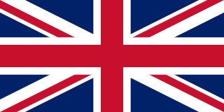
<span class="mw-page-title-main">United Kingdom</span> Country in Northwestern Europe

The United Kingdom of Great Britain and Northern Ireland, commonly known as the United Kingdom (UK) or Britain, is a country in Northwestern Europe, off the north-western coast of the continental mainland. It comprises England, Scotland, Wales, and Northern Ireland. It includes the island of Great Britain, the north-eastern part of the island of Ireland, and most of the smaller islands within the British Isles. Northern Ireland shares a land border with the Republic of Ireland; otherwise, the United Kingdom is surrounded by the Atlantic Ocean, the North Sea, the English Channel, the Celtic Sea and the Irish Sea. The total area of the United Kingdom is 94,060 square miles (243,610 km2), with an estimated 2022 population of nearly 67 million people.

The Peerage of Ireland consists of those titles of nobility created by the English monarchs in their capacity as Lord or King of Ireland, or later by monarchs of the United Kingdom of Great Britain and Ireland. It is one of the five divisions of Peerages in the United Kingdom. The creation of such titles came to an end in the 19th century. The ranks of the Irish peerage are duke, marquess, earl, viscount and baron. As of 2016, there were 135 titles in the Peerage of Ireland extant: two dukedoms, ten marquessates, 43 earldoms, 28 viscountcies, and 52 baronies. However, these titles have no official recognition in the Republic of Ireland, with Article 40.2 of the Constitution of Ireland forbidding the state conferring titles of nobility and stating that an Irish citizen may not accept titles of nobility or honour except with the prior approval of the Irish government.

<span class="mw-page-title-main">Kingdom of England</span> Sovereign state from 927 to 1707

The Kingdom of England was a sovereign state on the island of Great Britain from 12 July 927, when it emerged from various Anglo-Saxon kingdoms, until 1 May 1707, when it united with Scotland to form the Kingdom of Great Britain, which would later become the United Kingdom. The Kingdom of England was among the most powerful states in Europe during the medieval and early modern colonial periods.

<span class="mw-page-title-main">December 1910 United Kingdom general election</span>

The December 1910 United Kingdom general election was held from 3 to 19 December. It was the last general election to be held over several days and the last to be held before the First World War.

<span class="mw-page-title-main">Lists of places in Wales</span>

This is a list of lists of places in Wales.

<span class="mw-page-title-main">Kingdom of Israel (united monarchy)</span> Israelite kingdom of Israel and Judah (c. 1047–930 BCE)

According to the Deuteronomistic history of the Hebrew Bible, a United Monarchy or United Kingdom of Israel existed under the reigns of Saul, David, and Solomon, encompassing the territories of both the later kingdoms of Judah and Israel.

<span class="mw-page-title-main">United Kingdom of Portugal, Brazil and the Algarves</span> Pluricontinental monarchy

The United Kingdom of Portugal, Brazil and the Algarves was a pluricontinental monarchy formed by the elevation of the Portuguese colony named State of Brazil to the status of a kingdom and by the simultaneous union of that Kingdom of Brazil with the Kingdom of Portugal and the Kingdom of the Algarves, constituting a single state consisting of three kingdoms.

<span class="mw-page-title-main">Unitary authorities of England</span> Local government in some parts of England

The unitary authorities of England are a type of local authority responsible for all local government services in an area. They combine the functions of a non-metropolitan county council and a non-metropolitan district council, which elsewhere in England provide two tiers of local government.

<span class="mw-page-title-main">Kingdom of Portugal</span> Kingdom in Southwestern Europe (1139–1910)

The Kingdom of Portugal was a monarchy in the western Iberian Peninsula and the predecessor of the modern Portuguese Republic. Existing to various extents between 1139 and 1910, it was also known as the Kingdom of Portugal and the Algarves after 1415, and as the United Kingdom of Portugal, Brazil and the Algarves between 1815 and 1822. The name is also often applied to the Portuguese Empire, the realm's overseas colonies.

<span class="mw-page-title-main">United Kingdom in the Eurovision Song Contest</span>

The United Kingdom has participated in the Eurovision Song Contest 65 times. It first took part in the second contest in 1957 and has entered every year since 1959. Along with Sweden and the Netherlands, the UK is one of only three countries with Eurovision victories in four different decades. It is one of the "Big Five" countries, along with France, Germany, Italy and Spain, that are automatically prequalified for the final each year as they are the biggest financial contributors to the European Broadcasting Union (EBU). The British national broadcaster, the BBC, broadcasts the event and has, on multiple occasions, organised different national selection processes to choose the British entry. The United Kingdom has won the Eurovision Song Contest five times, and has finished as runner-up on a record sixteen occasions. The UK has hosted the contest a record nine times, four times in London and once each in Edinburgh (1972), Brighton (1974), Harrogate (1982), Birmingham (1998), and Liverpool (2023).

<span class="mw-page-title-main">Countries of the United Kingdom</span> Component parts of the UK since 1922

Since 1922, the United Kingdom has been made up of four countries: England, Scotland, Wales and Northern Ireland. The UK Prime Minister's website has used the phrase "countries within a country" to describe the United Kingdom. Some statistical summaries, such as those for the twelve NUTS 1 regions of the UK, refer to Northern Ireland, Scotland, and Wales as "regions". With regard to Northern Ireland, Scotland and Wales particularly, the descriptive name one uses "can be controversial, with the choice often revealing one's political preferences".