Kirkcowan

Last updated

Kirkcowan
Barlennan Hill and Kirkcowan Church from near Mindork - geograph.org.uk - 1309758.jpg
Barlennan Hill and Kirkcowan Church
Dumfries and Galloway UK location map.svg
Red pog.svg
Kirkcowan
Location within Dumfries and Galloway
Council area
Lieutenancy area
Country Scotland
Sovereign state United Kingdom
Police Scotland
Fire Scottish
Ambulance Scottish
UK Parliament
Scottish Parliament
List of places
UK
Scotland
54°54′50″N4°36′32″W / 54.914°N 4.609°W / 54.914; -4.609

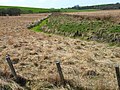
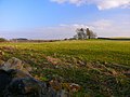
Kirkcowan is an area about 15 miles in length, and from nearly two to nearly seven miles in breadth, comprising 30,580 acres, of which 7000 are arable, 300 woodland and plantations, and the remainder meadow, pasture in Machars, in the historical county of Wigtownshire, in Dumfries and Galloway, Scotland, with the village of Kirkcowan, bounded on the east by the river Bladnoch, on the west by the river Tarff, and is 6 miles W. by S.W. from Newton Stewart.

Contents

Kirkcowan with its wide moorlands is one of the larger Wigtownshire areas, and a map of the area/parish can be seen at the National Library of Scotland, on the John Ainslie map AD1782. [1]

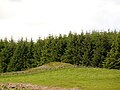
The principal industry has always been agriculture, although in the 19th century two woollen mills were erected on the River Tarff nearby.

The A75 road which goes through Kirkcowan is effectively the London - Belfast road. The road forms part of the international E-road, European route E18.

There is a Community Council at Kirkcowan. [2]

Kirkcowan is on the medieval pilgrim route to Whithorn Priory, seat of Christianity in Scotland.

Location

The village of Kirkcowan is on the road to Wigtown, and situated between the rivers Tarff and Bladnoch. [3]

Because the village is situated on the main Stranraer to Carlisle bus route, and between the two rivers, it attracts fishermen, hikers and also cyclists since it is on the Machars Yellow cycle route.

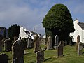
The church, erected in 1829, under the patronage of the Agnew family, is a substantial structure with a tower. A congregation of Seceders assembled for public worship in an old barn. [4]

Kirkcowan Village has a Post Office; Nursery and Primary School; a village hall, a service station, mechanical garage, pub/hotel (Craighlaw Arms) and a photography studio.

Places of interest

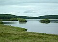
Glendarroch Loch, situated in the vicinity of the village of Kirkcowan and easily accessible from the A75 Euroroute, is one of the region's coarse fishing gems. The loch is a small, gin clear estate loch which holds a large head of roach, rudd and perch. Carp have been stocked in recent years and are regularly caught whilst tench and bream up to 3lb are also present. [5]

Loch Maberry Castle Crannog. A fortified island surrounded by the remains of a massive drystone wall, 1.8m to 2.1m thick and about 2.1m high, enclosing an area approx 34.1m by 25.9m which has been subdivided and contains buildings all except the largest being of dry-stone. Entrances on east and west and the island has been connected by causeway to both the loch shore and the island to the north, which shows evidence of having been surrounded at the water's edge by a low wall of large boulders occasionally set on end. A causeway from the south-western end of this island links with that between the southern island and the shore. [6] [7]

The River Bladnoch rises at Loch Maberry in the parish of Kirkcowan, through which it runs south to Polbae.

On its journey south it is joined by Reoch Burn as it passes through Carseriggan Moor.

Continuing its journey it passes Isle-na-Gower and becomes a border between the afforested land at Hopeless Howe and the Ring of Barfad.

Shortly after this it is met and joined by Black Burn. At this point the river is bordered on its east side by Barnley Plantation.

Crossing the River Bladnoch at the stepping stones is a single-track road which links Mark of Shennanton with Little Eldrig.

Shortly after this point the river widens briefly at Broad Wheel. Continuing on its journey southwards it is next forded by Shennanton Bridge where the A75 crosses it.

Next we come to Linn Wood and the waterfall at Linn of Barhoise. The word "linn" refers to the pool rather than the waterfall. (see photo)

The river then moves on past Barhoise Farm to Barhoise Mill.

In 1684, according to Symson, this area had a salmon fishery with nets on both the Bladnoch and the Tarff.

At the Mill of Barhoise, the Laird of Craichlaw had fishing rights. Barhoise Mill is a T-shaped two storey construction of granite, whinstone and slate, which is falling into a dilapidated state. The mill was driven by a wheel which was situated at the side of the building. Of this wheel only the wooden axle remains. The datestone above the door reads 1827, but this mill is most certainly a reconstruction of a much earlier one, perhaps connected with the Old Place of Glaisnick, a one-time nearby residence of the powerful Gordon family of Craichlaw. The main road from Kirkcowan to Wigtown and from Kirkcowan to Minnigaff via Glaisnick crossed the river just south of this mill. There are still stepping stones at the fording place east of Ring Farm.

Eldrig Fell, Wood Cairn. a large circular cairn 18m. in diameter and 2.2m. high. [8]

Near Shennanton there is a cairn marked on OS mapping, shown in the centre of the photo in front of the tall trees (see photo).

Boreland Mote or Motte is on OS mapping and sits at the side of the B733. It is about 20 feet high and 100-120feet around the base (see photo). [9]

Mindork or Mondork Castle, Wood Hill. Thomas M'Dowall was born c.1500 at Mondork Castle. map [10] c.1782 map [11] [12] [13]

Woodhill (Cairn opposite side of road to Mindork Castle ?) archaeological site. [14]

History

William Gordon, had charters of parts of the barony of Craichlaw, in the parish of Kirkcowan and county of Wigtown, 17 September 1500 and 28 January 1506–7; one of the lands of Larglegastell and Markleif, 10 January 1515–16; and another of the lands of Auchingilbert, 4 August 1515. He married Janet Baillie, and was ancestor of the Gordons of Craighlaw.

The railway station of the Portpatrick and Wigtownshire Joint Railway closed in 1965.

A mill was erected in 1822 for the manufacture of woollen cloths, blankets, plaidings, flannels, and plain and pilot cloths, for the dyeing and dressing of which the soft water of the Tarff was well adapted.

Notable people

Listed Buildings

List of listed buildings in Kirkcowan, Dumfries and Galloway

Related Research Articles

<span class="mw-page-title-main">Dumfries and Galloway</span> Council area of Scotland

Dumfries and Galloway is one of the 32 unitary council areas of Scotland, located in the western part of the Southern Uplands. It is bordered by East Ayrshire, South Ayrshire, and South Lanarkshire to the north; Scottish Borders to the north-east; the English ceremonial county of Cumbria, the Solway Firth, and the Irish Sea to the south, and the North Channel to the west. The administrative centre and largest settlement is the town of Dumfries. The second largest town is Stranraer, located 76 miles (122 km) to the west of Dumfries on the North Channel coast.

<span class="mw-page-title-main">Wigtown</span> Human settlement in Scotland

Wigtown is a town and former royal burgh in Wigtownshire, of which it is the county town, within the Dumfries and Galloway region in Scotland. It lies east of Stranraer and south of Newton Stewart. It is known as "Scotland's National Book Town" with a high concentration of second-hand book shops and an annual book festival.

<span class="mw-page-title-main">Isle of Whithorn</span> Human settlement in Scotland

Isle of Whithorn is one of the most southerly villages and seaports in Scotland, lying on the coast north east of Burrow Head, about three miles from Whithorn and about thirteen miles south of Wigtown in Dumfries and Galloway. Whithorn,, is a former royal burgh in Wigtownshire, Dumfries and Galloway, with which Isle of Whithorn is frequently incorrectly amalgamated or confused. It is referred to locally as 'The Isle' - never 'the Isle of Whithorn'.

<span class="mw-page-title-main">Wigtownshire</span> Historic county in Scotland

Wigtownshire or the County of Wigtown is one of the historic counties of Scotland, covering an area in the south-west of the country. Until 1975, Wigtownshire was an administrative county used for local government. Since 1975 the area has formed part of Dumfries and Galloway for local government purposes. Wigtownshire continues to be used as a territory for land registration, being a registration county. The historic county is all within the slightly larger Wigtown Area, which is one of the lieutenancy areas of Scotland and was used in local government as the Wigtown District from 1975 to 1996.

<span class="mw-page-title-main">Machars</span>

The Machars is a peninsula in the historical county of Wigtownshire in Galloway in the south-west of Scotland. Its name is derived from the Gaelic word Machair meaning low-lying or level land, known as "links" on the east coast of Scotland. Although there are no high peaks in The Machars, it is not flat and would best be described as undulating or rolling. The North Atlantic Drift or Gulf Stream creates a mild climate, and dolphins and basking sharks are frequently seen in the seas.

<span class="mw-page-title-main">River Bladnoch</span>

The Bladnoch is a river in Wigtownshire in the Machars of Galloway in southwest Scotland. One of the earliest descriptions of it is given by Sir Andrew Agnew of Lochnaw and Sir David Dunbar in an appendix to Andrew Symson's work "A Large Description of Galloway" written in the 17th century. In this they state that:

Blaidzenoch which floweth from the mountnous parts of Penninghame, and runs from the north to the south. It runneth through Lochmabary, and by the way it receaveth into several waters; the most considerable is the water of Tarfe, which hath its rise from Airtfeeld, in the Muirs of Luce, and falleth into Blaidzenoch, under the house of Craighlaw. The Blaidzenoch turns to the east, and after it heth fra its source run twenty miles (32 km), it falleth into the Bay of Wigtown, near above the place of Baldone.

<span class="mw-page-title-main">New Luce</span> Civil parish in south-west Scotland

New Luce is a civil parish in Dumfries and Galloway, south-west Scotland. It lies in the traditional county of Wigtownshire, and is about 10 miles (16 km) in length and 5 miles (8.0 km) in breath, being the upper part of the original Glenluce Parish. New Luce is shown as a civil parish on John Ainslie's county map of 1782.

Sorbie is a small village in Wigtownshire, Machars, within the Administration area of Dumfries and Galloway Council, Scotland.

Mochrum is a coastal civil and Church of Scotland parish situated to the east of Luce Bay on the Machars peninsula and 8 miles (13 km) southwest of Wigtown and in the historical county of Wigtownshire in Galloway, Scotland. It covers 22,000 acres (8,900 ha) and is approximately 10 miles (16 km) in length and 5 miles (8.0 km) in breadth. The parish contains the eponymous village of Mochrum, as well as Port William and the clachan of Elrig.

Glasserton is a civil parish in Dumfries and Galloway, south-west Scotland. It is on the Machars peninsula, in the traditional county of Wigtownshire. The parish is about 8 miles (13 km) in length, varying in breadth from 1 to 3 miles, and contains 13,477 acres (54.54 km2).

<span class="mw-page-title-main">River Cree</span>

The River Cree is a river in Dumfries and Galloway, Scotland which runs through Newton Stewart and into the Solway Firth. It forms part of the boundary between the counties of Wigtownshire and Kirkcudbrightshire. The tributaries of the Cree are the Minnoch, Trool, Penkiln and Palnure which drain from the Range of the Awful Hand, the labyrinthine range of mountains and lochs, bogs, burns and crags, rising at its highest to The Merrick, Galloway, 12 miles north and visible from Newton Stewart.

<span class="mw-page-title-main">Castle Kennedy</span> Human settlement in Scotland

Castle Kennedy is a small village 3 miles (4.8 km) east of Stranraer in Dumfries and Galloway, south-west Scotland. It is on the A75 road, and is within the civil parish of Inch. The village is to the south of the Lochinch Castle estate, which includes the ruins of the 17th-century Castle Kennedy, as well as Castle Kennedy Gardens which are open to the public.

Leswalt is a village and civil parish in Dumfries and Galloway, south-west Scotland. It lies between Portpatrick and Stranraer in the Rhins of Galloway, part of the traditional county of Wigtownshire. The parish covers around 8 square miles (21 km2).

Kirkinner is a village in the Machars, in the historical county of Wigtownshire in Dumfries and Galloway, Scotland. About 3 miles (4.8 km) southwest of Wigtown, it is bounded on the east by the bay of Wigtown, along which it extends for about three miles, and on the north by the river Bladnoch.

<span class="mw-page-title-main">Inch, Dumfries and Galloway</span> Human settlement in Scotland

Inch is a civil parish in Dumfries and Galloway, southwest Scotland. It lies on the shore of Loch Ryan, in the traditional county of Wigtownshire.

Penninghame in Wigtownshire, Dumfries and Galloway, Scotland, is a civil parish area, 8 miles from Wigtown. The area is approx 16 miles in length, and from 5 to 6 miles' width, bounded on the north and east by the River Cree, and on the west by the Bladnoch; comprising nearly 38,000 acres, of which 12,000 were arable, 600 woodland and plantations, 1600 meadow, and the remainder hill pasture, moorland, moss, etc.

Old Luce is a civil parish in Dumfries and Galloway, Scotland. It lies in the Machars peninsula, in the traditional county of Wigtownshire. The parish is around 10 miles (16 km) long and 8 miles (13 km) broad, and contains 40,350 acres (16,330 ha).

<span class="mw-page-title-main">Bladnoch, Wigtownshire</span>

Bladnoch is a small village on the River Bladnoch in Wigtownshire, Scotland, located just outside the county town of Wigtown.

<span class="mw-page-title-main">Wigtown Harbour</span>

Wigtown Harbour or Wigtown Quay was relocated in 1818 to serve the town of Wigtown and its hinterland in Wigtownshire, Dumfries and Galloway, following the silting up of the original natural harbour that was originally located near to St Machute's church. This relocation occurred following centuries of silting and then the alteration of the course of the River Bladnoch that runs into Wigtown Bay where it joins the River Cree.

References

  1. "View map: A map of the county of Wigton. - Counties of Scotland, 1580-1928".
  2. "Contact Info for Kirkcowan Community Council Members".
  3. "Kirkcowan Feature Page on Undiscovered Scotland".
  4. A Topographical Dictionary of Scotland, Samuel Lewis, 1846.
  5. "Glendarroch Loch Coarse Fishing | Coarse Fishing Venues | Gofishing UK". Archived from the original on 18 August 2009.
  6. "Loch Maberry Castle | Canmore".
  7. "Loch Maberry Castle | Castle in Kirkcowan parish, Wigtownshire | Stravaiging around Scotland".
  8. "Wood Cairn, Eldrig Fell | Canmore".
  9. "Boreland Mote | Canmore".
  10. "Welcome to Canmore | Canmore".
  11. "View map: A map of the county of Wigton. - Counties of Scotland, 1580-1928".
  12. "BBC - Domesday Reloaded: ROUND KIRKCOWAN DISTRICT". Archived from the original on 14 March 2012. Retrieved 22 December 2019.
  13. "Mindork Castle | Castle in Kirkcowan parish, Wigtownshire | Stravaiging around Scotland".
  14. "Woodhill (Site of) | Castle in Kirkcowan parish, Wigtownshire | Stravaiging around Scotland".