Holywood, Dumfries and Galloway

Last updated
Holywood
Twelve Apostles Stone Circle - geograph.org.uk - 385556.jpg
Twelve Apostles stone circle
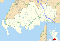
Dumfries and Galloway UK location map.svg
Red pog.svg
Holywood
Location within Dumfries and Galloway
OS grid reference NX950797
Council area
Lieutenancy area
Country Scotland
Sovereign state United Kingdom
Post town DUMFRIES
Postcode district DG2
Police Scotland
Fire Scottish
Ambulance Scottish
UK Parliament
Scottish Parliament
List of places
UK
Scotland
55°06′36″N3°39′29″W / 55.110°N 3.658°W / 55.110; -3.658 Coordinates: 55°06′36″N3°39′29″W / 55.110°N 3.658°W / 55.110; -3.658

Holywood is a village and civil parish in the historical county of Dumfriesshire in Dumfries and Galloway, Scotland. The village of Holywood was developed in the mid twentieth century. [1] In 1949 eighteen houses were built by the county council and followed shortly after by another 38. [2]

Holywood was the site of a Premonstratensian abbey which was established in 1225 and dissolved in 1609. [3] [4] The abbey was dismantled and used to build the parish church in 1778. [3] No remains are now visible. [3]

The site of Holywood Abbey was previously called Dercongal , 'Congal's oak-copse'. [5] The name Holywood refers to this oak-copse. [5] The saint commemorated in this name may be Convallus, disciple of Saint Mungo. [5] However, there are a number of other saints to whom the dedication could apply. [6] The surrounding landscape has several prehistoric monuments, including two cursuses and the Twelve Apostles stone circle, [7] which suggests a continuity of sacred or administrative tradition in the area. [8]

The parish previously had three schools: Speddoch, Steilston and Holywood, near the village. [9] The current school building was built in 1967. [1] Its catchment includes the Woodlands area of Dumfries and part of the catchment of Auldgirth Primary School, which closed in 2000. [10]

Holywood railway station opened as Killylung in 1849 but was renamed Holywood within a year and closed in 1949.
Related Research Articles

Dumfries and Galloway Council area of Scotland

Dumfries and Galloway is one of 32 unitary council areas of Scotland and is located in the western Southern Uplands. It comprises the historic counties of Dumfriesshire, Stewartry of Kirkcudbright and Wigtownshire, the latter two of which are collectively known as Galloway. The administrative centre is the town of Dumfries.

Kirkcudbrightshire Historic county in Scotland

Kirkcudbrightshire, or the County of Kirkcudbright or the Stewartry of Kirkcudbright, is a historic county, registration county and lieutenancy area in the informal Galloway area of south-western Scotland. For local government purposes, it forms part of the wider Dumfries and Galloway council area of which it forms a committee area under the name of the Stewartry.

Dumfriesshire Historic county in Scotland

Dumfriesshire or the County of Dumfries is a historic county, registration county and lieutenancy area of Scotland.

Dumfries and Galloway (UK Parliament constituency) Parliamentary constituency in the United Kingdom, 2005 onwards

Dumfries and Galloway is a county constituency in the House of Commons of the Parliament of the United Kingdom. It was first used in the 2005 general election, and replaced Galloway and Upper Nithsdale and part of Dumfries. It elects one Member of Parliament (MP) by the first past the post system of election.

Dumfriesshire, Clydesdale and Tweeddale (UK Parliament constituency) Parliamentary constituency in the United Kingdom, 2005 onwards

Dumfriesshire, Clydesdale and Tweeddale is a constituency of the House of Commons, located in the South of Scotland, within the Dumfries and Galloway, South Lanarkshire and Scottish Borders council areas. It elects one Member of Parliament (MP) at least once every five years using the First-past-the-post system of voting. It is currently represented in Westminster by the former Secretary of State for Scotland, David Mundell, a Conservative, who has been the MP since 2005.

Penpont Human settlement in Scotland

Penpont is a village about 2 miles (3 km) west of Thornhill in Dumfriesshire, in the Dumfries and Galloway region of Scotland. It is near the confluence of the Shinnel Water and Scaur Water rivers in the foothills of the Southern Uplands. It has a population of about 400 people.

Beeswing, Dumfries and Galloway Small village in the historical county of Kirkcudbrightshire in Scotland

Beeswing is a small village in the historical county of Kirkcudbrightshire in Scotland. It was formerly known as Lochend in reference to its position near Loch Arthur, which lies to the east of the village and has been claimed as the setting for the Arthurian story of the Lady of the Lake. The village was renamed to honour the famous racing mare, Beeswing. The village formerly had a church, which has now been converted to a house. Killywhan railway station nearby was open from 1859 to 1959 on the Castle Douglas and Dumfries Railway.

Dercongal Abbey

Dercongal Abbey was a Premonstratensian monastic community located in Dumfriesshire, Scotland. The date of its foundation is not known, but it was certainly in existence as a Premonstratensian monastic community by 1225. The founder was presumably Alan, Lord of Galloway. Dercongal seems to come from Doire Congaill, Congall's oak-copse, Congall being a saint venerated by the natives of the area. For this reason the abbot of Dercongal also became known as the abbot "de Sacro Nemore", becoming "Holywood" in English.

Cummertrees Human settlement in Scotland

Cummertrees is a coastal village and civil parish of Annandale in the historical county of Dumfriesshire in Dumfries and Galloway. It lies about 1 mile (1.6 km) inland, on the Pow Water, 12 miles (19 km) from Dumfries and 3 miles (5 km) from Annan.

Mochrum Human settlement in Scotland

Mochrum is a coastal civil and Church of Scotland parish situated to the east of Luce Bay on the Machars peninsula and 8 miles (13 km) southwest of Wigtown and in the historical county of Wigtownshire in Galloway, Scotland. It covers 22,000 acres (8,900 ha) and is approximately 10 miles (16 km) in length and 5 miles (8.0 km) in breadth. The parish contains the eponymous village of Mochrum, as well as Port William and the clachan of Elrig.

Durisdeer Human settlement in Scotland

Durisdeer is a small village in Dumfries and Galloway, south-west Scotland. It lies 6 miles (9.7 km) north of Thornhill, above the Carron Water, a tributary of the Nith.

Tynron

Tynron is a village and civil parish in Dumfries and Galloway, south-west Scotland, lying in a hollow of the Shinnel Water, 2 miles (3.2 km) from Moniaive.

Twelve Apostles Stone Circle Stone circle in Dumfries and Galloway, Scotland

The Twelve Apostles is a large stone circle located between the villages of Holywood and Newbridge, near Dumfries, Scotland. It is the seventh largest stone circle in Britain and the largest on the mainland of Scotland. It is similar in design to the stone circles of Cumbria, and is considered to be an outlier of this group. Its south-westerly arrangement aligns it with the midwinder sunset.

Hoddom Village in Dumfries and Galloway, Scotland

Hoddom is a small settlement and civil parish in Dumfries and Galloway, Scotland. The earliest reference to Hoddom is in a copy of an eighth-century letter sent from Alcuin to Wulfhard, 'abbot of Hodda Helm'.

Troqueer Human settlement in Scotland

Troqueer is a former village and a parish in the historic county of Kirkcudbrightshire in Dumfries and Galloway on the west side of the River Nith. The eastern-side was merged with Dumfries to the east in 1929, and today eastern Troqueer is a suburb of Dumfries.

Kirkmahoe is a civil parish in Dumfries and Galloway. The parish contains the settlements Kirkton, where the parish church is located, Dalswinton and Duncow. It is bounded by the parishes of Dumfries to the south, Holywood and Dunscore to the west, and Kirkmichael and Tinwald to the east.

Duncow Human settlement in Scotland

Duncow is a small settlement in the civil parish of Kirkmahoe, Dumfries and Galloway, Scotland. Located in the geographical centre of the parish, Duncow was a village in the eighteenth and nineteenth centuries and was formerly its most populous settlement. At the time the First Statistical Account of Scotland was written the village had between 150 and 200 residents. By the time of the Third Statistical Account there were only five houses in the village. It has had a school since at least the time of the New Statistical Account. The current school was opened in 1878 and has a roll of 24. The village post office closed in 1952.

Kirkgunzeon Human settlement in Scotland

Kirkgunzeon is a village and civil parish in Dumfries and Galloway, south west Scotland. The village is 10.4 miles (16.7 km) south west of Dumfries and 4.1 miles (6.6 km) north east of Dalbeattie. The civil parish is in the former county of Kirkcudbrightshire, and is bounded by the parishes Lochrutton to the north, Urr to the west, Colvend and Southwick to the south and New Abbey to the east.

Picts Knowe prehistoric monument in Scotland

Pict's Knowe is a henge monument in the parish of Troqueer, Dumfries and Galloway. It is one of a small group of henge monuments around Dumfries which includes Broadlea henge near Annan. Pict's Knowe is located 4km SW of Dumfries on a small sandy bank in the peat covered valley of the Crooks Pow stream.

Ingram de Balliol 13th century English noble

Ingram de Balliol, Lord of Redcastle and Urr in Scotland, Dalton in England and Tours-en-Vimeu in France was an Anglo Scoto-French noble.

References

  1. 1 2 Gifford, John (2002) [1996]. Dumfries and Galloway. Pevsner Architectural Guides: The Buildings of Scotland. New Haven and London: Yale University Press. p. 348. ISBN   9780300096712.
  2. Duncan, Walter (1962). "Chapter 13: The Parish of Holywood". In Reid, W. Arnold (ed.). The County of Dumfries. The Third Statistical Account of Scotland. 12. Glasgow: Collins. p. 151.
  3. 1 2 3 "Canmore: Holywood Abbey". RCAHMS - Royal Commission on the Ancient and Historical Monuments of Scotland. Archived from the original on 2015-05-17. Retrieved 2015-05-17.
  4. Crowe, Chris (2002). "Holywood, an Early Mediaeval Monastery: Problems and Possibilities" (PDF). Transactions of the Dumfriesshire and Galloway Natural History and Antiquarian Society. Third Series. LXXVI: 113. ISSN   0141-1292. Archived from the original (PDF) on 2015-04-02.
  5. 1 2 3 Watson, W. J. (1926). The Celtic Place-Names of Scotland. Edinburgh and London. p. 169. Archived from the original on 2014-08-21.
  6. "HOLYWOOD ABBEY, AKA DERCONGAL, HOLYWOOD". Saints in Scottish Place-Names. Archived from the original on 2015-04-12. Retrieved 2015-05-17.
  7. Burl, Aubrey (2005). A Guide to the Stone Circles of Britain, Ireland and Brittany. New Haven; London: Yale University Press. p. 124.
  8. Crowe, Chris (2002). "Holywood, an Early Mediaeval Monastery: Problems and Possibilities" (PDF). Transactions of the Dumfriesshire and Galloway Natural History and Antiquarian Society. Third Series. LXXVI: 114. ISSN   0141-1292. Archived from the original (PDF) on 2015-04-02.
  9. Duncan, Walter (1962). "Chapter 13: The Parish of Holywood". In Reid, W. Arnold (ed.). The County of Dumfries. The Third Statistical Account of Scotland. 12. Glasgow: Collins. p. 152.
  10. "Holywood Primary School". Dumfries and Galloway Council. Archived from the original on 2015-05-17. Retrieved 2015-05-17.