Auldgirth

Last updated

Auldgirth
The Auldgirth Inn - an old coaching Inn on the A76.jpg
The Auldgirth Inn, an old coaching Inn on the A76 road.
Dumfries and Galloway UK location map.svg
Red pog.svg
Auldgirth
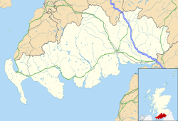
Location within Dumfries and Galloway
OS grid reference NX9186
Council area
Country Scotland
Sovereign state United Kingdom
Post town Dumfries
Dialling code 01387
Police Scotland
Fire Scottish
Ambulance Scottish
List of places
UK
Scotland
55°09′N3°43′W / 55.15°N 03.71°W / 55.15; -03.71

Auldgirth is a village on the A76 road in Dumfries and Galloway, Scotland. Auldgirth village features 'The Auldgirth Inn' and the former Auldgirth Primary School, which closed in 2000. [1] Originally inhabitants of Auldgirth located to the scheme, situated next to the A76, but in recent years this has expanded to the outlying areas due to rejuvenation programmes. The name Auldgirth is from Early Scots ald(e) girth, meaning 'old enclosure'. [2] At one time it had a staffed railway station, situated one mile south of the village, just before the hamlet of Dalswinton. Carse Loch and the Friar's Carse country house hotel are located nearby.

A link of Auldgirth to Thomas Carlyle is revealed in the book Obiter Dicta, by Augustine Birrell, Carlyle he wrote, "beheld with pride and no ignoble envy the bridge at Auldgarth his mason-father had helped to build half a century before, and then exclaimed, 'A noble craft, that of a mason; a good building will last longer than most books—than one book in a million' [3] , [4]

See also

Related Research Articles

<span class="mw-page-title-main">Dumfries</span> Town in Dumfries and Galloway, Scotland

Dumfries is a market town and former royal burgh in Dumfries and Galloway, Scotland, near the mouth of the River Nith on the Solway Firth, 25 miles (40 km) from the Anglo-Scottish border. Dumfries is the county town of the historic county of Dumfriesshire.

<span class="mw-page-title-main">Dumfries and Galloway</span> Council area of Scotland

Dumfries and Galloway is one of the 32 unitary council areas of Scotland, located in the western part of the Southern Uplands. It is bordered by East Ayrshire, South Ayrshire, and South Lanarkshire to the north; Scottish Borders to the north-east; the English ceremonial county of Cumbria, the Solway Firth, and the Irish Sea to the south, and the North Channel to the west. The administrative centre and largest settlement is the town of Dumfries. The second largest town is Stranraer, located 76 miles (122 km) to the west of Dumfries on the North Channel coast.

<span class="mw-page-title-main">Thornhill, Dumfries and Galloway</span> Village in rural lowland Scotland

Thornhill is a village in the Mid Nithsdale area of Dumfries and Galloway, Scotland, south of Sanquhar and north of Dumfries on the main A76 road. Thornhill sits in the Nithsdale valley with the Carsphairn and Scaur range to the west and the Lowther hills to the east. It was initially a small village, planned and built in 1717 on the Queensberry Estate on the road linking Dumfries to Glasgow. The Earl of Queensberry initially named the village 'New Dalgarnock' however the name did not achieve popular approval.

<span class="mw-page-title-main">Augustine Birrell</span> British politician (1850–1933)

Augustine Birrell KC was a British Liberal Party politician, who was Chief Secretary for Ireland from 1907 to 1916. In this post, he was praised for enabling tenant farmers to own their property, and for extending university education for Catholics. But he was criticised for failing to take action against the rebels before the Easter Rising, and resigned. A barrister by training, he was also an author, noted for humorous essays.

<span class="mw-page-title-main">Kirkconnel</span> Human settlement in Scotland

Kirkconnel is a small parish in Dumfries and Galloway, southwestern Scotland. It is located on the A76 near the head of Nithsdale. Principally it has been a sporting community. The name comes from The Church of Saint Conal. In 1850 the village had only a single street. Next to Kirkconnel is a separate village called Kelloholm.

<span class="mw-page-title-main">Wanlockhead</span> Human settlement in Scotland

Wanlockhead is a village in Dumfries and Galloway, Scotland, nestling in the Lowther Hills and 1 mile south of Leadhills at the head of the Mennock Pass, which forms part of the Southern Uplands. It is Scotland's highest village, the village centre being at an elevation of around 405 m (1,329 ft) above sea level. Some sources, including VisitScotland, cite an altitude of 467 metres (1,532 ft) but the highest house in the village has been measured at 444 metres (1,457 ft).

<span class="mw-page-title-main">Ellisland Farm</span>

Ellisland Farm lies about 6.5 mi/10.4 km northwest of Dumfries near the village of Auldgirth, located in the Parish of Dunscore, Dumfries and Galloway, Scotland. The complex is a museum in the farm Robert Burns built, lived in and farmed from 1788 until 1791. One of the earliest references to the site is in 1465. Cardinal Antonius confirming a Charter by the Monastery of Melrose of the adjoining property of Ellisland to John Kirkpatrick.

<span class="mw-page-title-main">Closeburn, Dumfries and Galloway</span> Village in rural lowland Scotland

Closeburn is a village and civil parish in Dumfries and Galloway, Scotland. The village is on the A76 road 2+12 miles (4 km) south of Thornhill. In the 2001 census, Closeburn had a population of 1,119. Closeburn is recorded as Killosbern in 1185. The first element of the name is Gaelic cill 'cell or church'. The second element is a saint's name, but none has definitely been identified.

<span class="mw-page-title-main">Friars Carse</span> Historic site in Auldgirth, Dumfries

Friars' Carse is a mansion house and estate situated 2 kilometres (1.2 mi) southeast of Auldgirth on the main road (A76) to Dumfries, Parish of Dunscore, Scotland. The property is located on the west bank of the River Nith and is known for its strong associations with Robert Burns who lived for a while at the nearby Ellisland farm. The mansion house is unlisted, however the stables and hermitage are Category B listed buildings.

<span class="mw-page-title-main">Lowther Hills</span> Geographical object in Dumfries and Galloway, Scotland, UK

The Lowther Hills, also sometimes known as the Lowthers, are an extensive area of hill country in the Southern Uplands of Scotland, though some sub-ranges of hills in this area also go under their own local names - see "Hillwalking" below. They form a roughly rhomboidal or lozenge shape on the map with the acute angles being to north and south. It has river valleys along its boundaries to north east (Clydesdale) and south west (Nithsdale) which carry the two largest arterial routes northwards into the west side of the Central Belt of Scotland. A string of small towns have long since developed along these routes. Most of the Lowther Hills lie in the Administrative County of Dumfries and Galloway, though part in the administrative county of South Lanarkshire moves into them around the village of Leadhills and the Daer Reservoir.

Carse Loch is situated in a low-lying area, surrounded by woodland, close to the A76 at Friar's Carse, in Dumfries and Galloway, Parish of Dunscore. It was once used as a monastic fish pond and the friars are said to have hidden their treasures on the crannog in times of danger. The loch is located about 7 miles from Dumfries and 2 miles from Auldgirth.

<span class="mw-page-title-main">Dunscore Old Kirk</span> Church in Merkland, Dumfries and Galloway

Dunscore Old Kirk was a pre-reformation kirk (church) situated on rising ground off a minor road to Merkland, Parish of Dunscore, Dumfriesshire, Dumfries and Galloway, Scotland; about 3 km from Auldgirth. The church was known locally as the Kirk of Dunscore; it lies close to Fardingwell Farm and was between Isle Tower and Ellisland of Robert Burns, in the eastern part of the Civil Parish of Dunscore.

<span class="mw-page-title-main">Duncow</span> Human settlement in Scotland

Duncow is a small settlement in the civil parish of Kirkmahoe, Dumfries and Galloway, Scotland. Located in the geographical centre of the parish, Duncow was a village in the eighteenth and nineteenth centuries and was formerly its most populous settlement. At the time the First Statistical Account of Scotland was written the village had between 150 and 200 residents. By the time of the Third Statistical Account there were only five houses in the village. It has had a school since at least the time of the New Statistical Account. The current school was opened in 1878 and has a roll of 24. The village post office closed in 1952.

<span class="mw-page-title-main">Holywood, Dumfries and Galloway</span> Human settlement in Scotland

Holywood is a village and civil parish in the historical county of Dumfriesshire in Dumfries and Galloway, Scotland. The village of Holywood was developed in the mid twentieth century. In 1949 eighteen houses were built by the county council and followed shortly after by another 38.

<span class="mw-page-title-main">Kirkgunzeon</span> Human settlement in Scotland

Kirkgunȝeon is a village and civil parish in Dumfries and Galloway, south west Scotland. The village is 10.4 miles (16.7 km) south west of Dumfries and 4.1 miles (6.6 km) north east of Dalbeattie. The civil parish is in the former county of Kirkcudbrightshire, and is bounded by the parishes Lochrutton to the north, Urr to the west, Colvend and Southwick to the south and New Abbey to the east.

<span class="mw-page-title-main">Brownhill Inn</span>

Brownhill Inn, now just called Brownhill, was an inn approximately 1 mile (1.6 km) mile south of Closeburn, on the A76, which itself is about 2 miles (3.2 km) south of Thornhill, in Dumfries and Galloway, Scotland. Built in approximately 1790, this old coaching inn has undergone extensive changes, and the south side of the original property appears little changed whilst part of the inn has been demolished. The inns facilities used to include the once-extensive 12 stall livery stables on the west side of the road, but these have been sold and converted to farm buildings after the inn closed. The inn was the first changing place for horses hauling coaches from Dumfries and closed in 1850. In 1789 an Act of Parliament had been passed that enabled the building of a Turnpike from Auldgirth Bridge to Sanquhar through Closeburn Parish and the inn was built to serve the patrons of this new road. The toll road supplanted the original post road that ran via Stepends, Gateside and Shaw that may have been of Roman origins.

Mennock is a small village or hamlet which lies 2 miles (3.2 km) south-east of Sanquhar on the A76, in Dumfriesshire, in the District Council Region of Dumfries and Galloway, southwest Scotland. Its original nucleus are the old smithy and corn mill with associated buildings. The site is dominated by the A76 that runs through the centre of Mennock. The village has expanded in recent years with housing on the River Nith side of the A76.

<span class="mw-page-title-main">Enterkinfoot</span> Human settlement in Scotland

Enterkinfoot is a small village or hamlet which lies 6 miles (9.7 km) north of Thornhill on the A76 on the route to Sanquhar, in Dumfriesshire, Durisdeer Parish, in Dumfries and Galloway, south-west Scotland. Its original nucleus was the old mill with associated buildings, the school and the famous Enterkin Pass and path that followed the course of the Enterkin Glen to Wanlockhead and from there to Edinburgh. The site features the A76 that runs through the centre of Enterkinfoot, the River Nith and the Enterkin Burn that once powered the mill before joining the Nith. The area is famous for its association with the Covenanters.

Barburgh Mill is a hamlet composed of an old lint mill, later extended as a woollen mill and associated buildings which lies north of Auldgirth on the A76 on the route to Closeburn, in Dumfriesshire, Closeburn Parish, in Dumfries and Galloway, south-west Scotland. Its original nucleus was the old mill with associated buildings, the smithy, toll house and the miller's and workers dwellings. The site features the A76 that runs nearby, the River Nith and the Lake Burn that once powered the mill via a lade before joining the Nith. The area is famous for its association with the Covenanters. A Roman fortlet stood opposite the mill and a Roman road is thought to have run through Nithsdale at this point.

<span class="mw-page-title-main">Auldgirth Bridge</span> 18th-century stone bridge in Dumfries and Galloway, Scotland

Auldgirth Bridge is a bridge over the River Nith just outside Auldgirth in Dumfries and Galloway, Scotland. Designed by David Henderson of Edinburgh in 1781, it was built by William Stewart, and completed in 1782; Thomas Carlyle's father worked on its construction. The bridge is made of red sandstone ashlar, with three segmental arched spans, and carried road traffic and pedestrians; refuges are built into the parapets, supported by pilasters on the piers, allowing pedestrians using the bridge to move out of the path of heavier traffic. Its total length is 200 feet (61 m). Each of its three spans is 56 feet (17 m) wide, and its roadway, which is level, measures 25.7 feet (7.8 m) from one parapet to the other.

References

  1. "Holywood Primary School". Dumfries and Galloway Council. Archived from the original on 17 May 2015. Retrieved 17 May 2015.
  2. Williamson, May G. (1942). The Non-Celtic Place-names of the Scottish Border Counties (PDF). University of Edinburgh (Unpublished PhD Thesis). p. 115. Archived from the original (PDF) on 21 August 2014.
  3. "Obiter Dicta, by Augustine Birrell".
  4. "Google Maps".