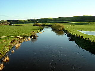
The Lugar Water, or River Lugar, is created by the confluence of the Bellow Water and the Glenmuir Water, just north of Lugar, both of which flow from the hills of the Southern Uplands in East Ayrshire, Scotland.

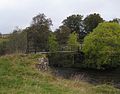
Cambuskenneth is a village in the city of Stirling, Scotland. It has a population of 250 and is the site of the historic Cambuskenneth Abbey. It is situated by the River Forth and the only road access to the village is along Ladysneuk Road from Alloa Road in Causewayhead. In 1935 a footbridge was constructed across the river to the neighbouring district of Riverside. Prior to then, the access to Stirling was by ferry.
The River Isla is a tributary of the River Tay in Angus and Perthshire, Scotland. It runs for 46 miles (74 km) through the Kirkton of Glenisla and Strathmore.
Willerby is a village and civil parish located on the western outskirts of the city of Kingston upon Hull in the East Riding of Yorkshire, England.
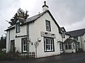
Gatelawbridge is a hamlet in the region of Dumfries and Galloway, Scotland. It is situated two and a half miles east of Thornhill and near the gorge Crichope Linn. The origin of the name is unknown though in the past the locals called it Gateley Bridge, so perhaps it takes its name from a type of bridge over the Cample River in the centre of the settlement. The river divides the parishes, with all those east of the river being in Closeburn Parish, and those west of the river being in Morton Parish.
Muir of Ord is a village in the council area of Highland of Scotland. It is situated near the western boundary of the Black Isle, about 9 miles (14 km) west of the city of Inverness and 5+1⁄2 miles (9 km) south of Dingwall. The village has a population of 2,690 and sits 35 metres (115 ft) above sea level. The Scottish geologist, Sir Roderick Murchison was born in the village in 1792.
The Douglas Water is a river in South Lanarkshire of south-central Scotland. It is a tributary of the River Clyde.

Glen Shee is a glen in eastern Perthshire, Scotland. Shee Water flows through the glen. The head of the glen, where Gleann Taitneach and Glen Lochsie meet, is approximately 2 km north-west of the Spittal of Glenshee; it then runs south-east to Bridge of Cally where it merges with Strathardle to form Glen Ericht. Once known as the glen of the fairies it takes its name from the Gaelic "sith" meaning fairy and the old meeting place at the standing stone behind the present day church is called Dun Shith or Hill of the Fairies.

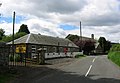
Kirkmichael is a village located in Strathardle, Perth and Kinross, Scotland. It is 13 miles north-northwest of Blairgowrie and 12 miles east-northeast of Pitlochry on the A924 Bridge of Cally to Pitlochry road, and is linked to the A93 Perth to Aberdeen road by the B950. The village is centred around Kirkmichael Bridge over the River Ardle.

Garthorpe is a village in North Lincolnshire, England. It is situated approximately 8 miles (13 km) south-east from Goole, 1 mile (1.6 km) west from the River Trent, and in the Isle of Axholme. Together with Fockerby, which is contiguous with the village, Garthorpe forms a civil parish of about 500 inhabitants, measured as 418 in the 2011 census.

Hollyhock Island is an inhabited island in the River Thames in England on the reach between Bell Weir Lock and Penton Hook Lock.

The Cateran Trail is a 103-kilometre (64 mi) circular long-distance walking route in central Scotland. The trail has no official beginning or end and can be joined at any stage. The route was established, way-marked and is now maintained by, the Perth & Kinross Countryside Trust. A variety of terrain is covered by the trail including farmland, mountains and forest. The path itself follows old drovers' roads, minor paved roads and farm tracks and can be walked in 4 or 5 days. It is now designated as one of Scotland's Great Trails by NatureScot. As of 2018 it was estimated that around 8,000 people were using the trail each year.

Cavers is a parish in the Scottish Borders area of Scotland, in the former county of Roxburghshire, south and east of Hawick. The largest village in the parish is Denholm.

Brewlands Bridge is a hamlet in Glen Isla, Angus, Scotland. It is lies situated on the River Isla, eleven miles north-west of Kirriemuir and ten miles north of Blairgowrie, on the B951 road.
Folda is a hamlet in Glen Isla, Angus, Scotland. It is situated on the River Isla, twelve miles north-west of Kirriemuir and eleven miles north of Blairgowrie, on the B951 road.
Little Forter is a hamlet in Glen Isla, Angus, Scotland. It is on the River Isla, 13 miles north-west of Kirriemuir and 11 miles north of Blairgowrie, on the B951 road.

Cults is a small parish and hamlet close to the centre of the Kingdom of Fife, Scotland. It lies mainly in the Howe of Fife, and about 4+1⁄2 miles (7.2 km) south-west of the nearest town - Cupar. The parish is about 2+1⁄3 miles (3.8 km) long and 1+1⁄3 miles (2.1 km) wide.

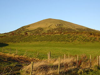
Kirkton of Bourtie stone circle is a recumbent stone circle located in Aberdeenshire, Scotland. It is situated about 2+3⁄4 miles (4.4 km) to the northeast of Inverurie at the end of a south-facing hillside just outside the hamlet of Kirkton of Bourtie. It stands on arable land near a minor road at an altitude of 515 ft (157 m) above sea level, with the Hill of Barra prominently visible to the north.
Largo is a parish in Fife, Scotland containing the villages of Upper Largo or Kirkton of Largo, Lower Largo and Lundin Links. It is bounded on the west by the parish of Scoonie, on the north by Ceres and on the east by the parishes of Newburn and Kilconquhar. It has a coastline of 2¾ miles along Largo bay. Inland it extends 3-4 ½ miles north from the south coast of Fife. Area 7,378 acres.
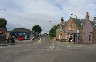
Drumclog is a small village in South Lanarkshire, Parish of Avendale and Drumclog, Scotland. The habitation is situated on the A71, between Caldermill and Priestland in East Ayrshire at a height of 196.7m and about 5 miles west of Strathaven.