
The Battle of Culloden was the final confrontation of the Jacobite rising of 1745. On 16 April 1746, the Jacobite army of Charles Edward Stuart was decisively defeated by a British government force under Prince William Augustus, Duke of Cumberland, on Drummossie Moor near Inverness in the Scottish Highlands. It was the last pitched battle fought on British soil.
The Board of Ordnance was a British government body. Established in the Tudor period, it had its headquarters in the Tower of London. Its primary responsibilities were 'to act as custodian of the lands, depots and forts required for the defence of the realm and its overseas possessions, and as the supplier of munitions and equipment to both the Army and the Navy'. The Board also maintained and directed the Artillery and Engineer corps, which it founded in the 18th century. By the 19th century, the Board of Ordnance was second in size only to HM Treasury among government departments. The Board lasted until 1855, at which point it was disbanded.

Earl of Airlie is a title of the peerage in Scotland created on 2 April 1639 for James Ogilvy, 7th Lord Ogilvy of Airlie, along with the title “Lord Ogilvy of Alith and Lintrathen.” The title “Lord Ogilvy of Airlie” was then created on 28 April 1491.
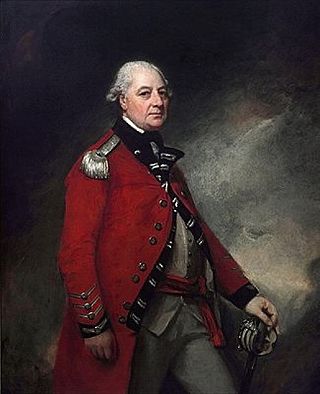
Field Marshal George Townshend, 1st Marquess Townshend, PC, known as The Viscount Townshend from 1764 to 1787, was a British soldier and politician. After serving at the Battle of Dettingen during the War of the Austrian Succession and the Battle of Culloden during the Jacobite Rising, Townshend took command of the British forces for the closing stages of the Battle of the Plains of Abraham during the Seven Years' War. He went on to be Lord Lieutenant of Ireland or Viceroy where he introduced measures aimed at increasing the size of Irish regiments, reducing corruption in Ireland and improving the Irish economy. In cooperation with Prime Minister North in London, he solidified governmental control over Ireland. He also served as Master-General of the Ordnance, first in the North Ministry and then in the Fox–North Coalition.

The Battle of Prestonpans, also known as the Battle of Gladsmuir, was fought on 21 September 1745, near Prestonpans, in East Lothian, the first significant engagement of the Jacobite rising of 1745.
Major-General William Roy was a Scottish military engineer, surveyor, and antiquarian. He was an innovator who applied new scientific discoveries and newly emerging technologies to the accurate geodetic mapping of Great Britain. His masterpiece is usually referred to as Roy's Map of Scotland.

The Battle of Falkirk Muir, also known as the Battle of Falkirk, took place on 17 January 1746 during the Jacobite rising of 1745. Although it resulted in a Jacobite victory, their inability to take advantage meant it ultimately had little impact on the campaign.

The Battle of Glen Shiel took place on 10 June 1719 in the West Scottish Highlands, during the 1719 Jacobite Rising. A Jacobite army composed of Highland levies and Spanish marines, was defeated by British troops, reinforced by a Highland Independent Company.

Bawsey is a village and civil parish in the English county of Norfolk. The village is about 4 miles (6.4 km) east of the town of King's Lynn and 40 miles (64 km) west of the city of Norwich. The village sits astride of the B1145 Kings Lynn to Mundesley road that dissects North Norfolk west to east.

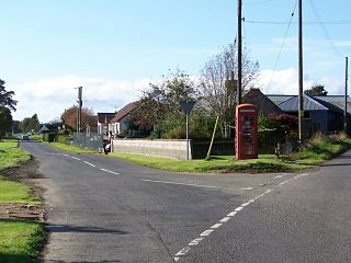
Cortachy is a village in Angus, Scotland. It lies in at the mouth of Glen Clova, on the River South Esk, four miles north of Kirriemuir. Nearby lies Cortachy Castle, seat of the Earls of Airlie.

Clan Ogilvy/Ogilvie is a Scottish Highland clan from Angus, Scotland. Gillebride, Earl of Angus, received a barony from King William the Lion in 1163 and bestowed the lands of Ogilvy upon his son Gilbert. In 1491, King James IV elevated Sir James Ogilvy as Lord Ogilvy of Airlie.
Dunalastair is an estate in the southern part of the Highlands, in Perthshire, Scotland. It is 18 miles west of the town of Pitlochry, lying along the River Tummel between Tummel Bridge to the east and Kinloch Rannoch to the west, and incorporates part of Dunalastair Loch/Reservoir.
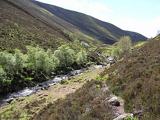
The Water of Aven is a tributary of the Water of Feugh, itself the largest tributary of the River Dee, Aberdeenshire, Scotland. The Water of Aven rises at Loch Tennet, where the historic counties of Aberdeenshire, Angus and Kincardineshire meet and flows for approximately 15 km to its confluence with the Feugh near Whitestone. The Water of Aven forms the historic boundary between Aberdeenshire and Kincardineshire for its entire length and the lower 4.5 km are designated as part of the River Dee Special Area of Conservation, due to its importance for Atlantic salmon and Eurasian otter.

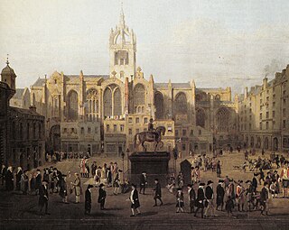
Ordnance Survey (OS) is the national mapping agency for Great Britain. The agency's name indicates its original military purpose, which was to map Scotland in the wake of the Jacobite rising of 1745. There was also a more general and nationwide need in light of the potential threat of invasion during the Napoleonic Wars. Since 1 April 2015 Ordnance Survey has operated as Ordnance Survey Ltd, a government-owned company, 100% in public ownership. The Ordnance Survey Board remains accountable to the Secretary of State for Business, Energy and Industrial Strategy. It was also a member of the Public Data Group.
James Johnstone, also known as Chevalier de Johnstone or Johnstone de Moffatt, was the son of an Edinburgh merchant. He escaped to France after participating in the 1745 Rising; in 1750, he was commissioned in the colonial army and served in French North America.
Little Brechin is a village in Angus, Scotland. It lies approximately two miles north of Brechin on the north side of the A90 road.
Kirkton of Glenisla consists of a church and graveyard, a hotel, hall and several homes forming the largest concentration of habitation in Glenisla, Angus, Scotland. It is situated on the River Isla, eleven miles north-west of Kirriemuir and ten miles north of Blairgowrie, on the B951 road. The kirkton is situated adjacent to the 64 mile waymarked Cateran Trail. There is a suspension footbridge that was built in 1824 over the River Isla.
Colonel the Honorable Donald Ogilvy of Clova in Forfarshire was a Scottish politician.
The Jacobite Army, sometimes referred to as the Highland Army, was the military force assembled by Charles Edward Stuart and his Jacobite supporters during the 1745 Rising that attempted to restore the House of Stuart to the British throne.

Major-general David Watson (1704–1761) of the Royal Engineers was a Scottish officer and military engineer in the British Army.


