Stracathro

Last updated

Stracathro
Stracathro School.jpg
Stracathro School
Angus UK location map.svg
Red pog.svg
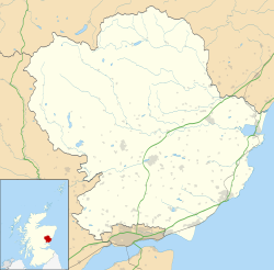
Stracathro
Location within Angus
Council area
Lieutenancy area
Country Scotland
Sovereign state United Kingdom
Post town BRECHIN
Postcode district DD9
Dialling code 01356
Police Scotland
Fire Scottish
Ambulance Scottish
UK Parliament
Scottish Parliament
List of places
UK
Scotland
56°46′43″N2°37′18″W / 56.7785°N 2.6216°W / 56.7785; -2.6216 Coordinates: 56°46′43″N2°37′18″W / 56.7785°N 2.6216°W / 56.7785; -2.6216

Stracathro (Scottish Gaelic : Srath Catharach) is a small place in Angus, Scotland. It was the site of a Roman marching camp as their forces invaded to the north.

Contents

Location

Stracathro is located 2+12 miles (4.0 km) southeast of Edzell in north-east Angus. It lies to the north-east of Brechin on the A90. [1]

History

A Roman marching camp has been discovered at Stracathro. This camp is one day's march from the next camp, at Raedykes to the north. [2] The gate design of the Stracathro Roman Camp is a distinctive bell-shaped indentation of the rampart perimeter. [3]

Stracathro was the site of the Battle of Stracathro in 1130. This was the culmination of an invasion into southern Scotland led by Angus, ruler of the partially independent "kingdom" of Moray. He wanted to expand his territory and obtain recognition as a ruler independent of the Scottish kings. Angus was met by the royal army, led by the Constable of Scotland in the absence of King David, who had pressing business in England. The result was a decisive victory for the king's men. Four thousand Moravians were killed, including Angus, and Moray became wholly part of the kingdom of Scotland. [4]

At Stracathro on 7 July 1296, John Balliol publicly admitted the errors of his ways and confirmed his reconciliation with Edward I, King of England. John Balliol abdicated on 10 July, [5] the arms of Scotland were formally torn from his surcoat, and he was held for three years in the Tower of London. After that he was allowed to flee to France, where he died in 1314. His abdication and surrender of the Royal Crown and Seal of the Kingdom of Scotland to Edward I of England led to the First War of Scottish Independence.

Late 19th century to present

Construction of a railway to this area connected it to other villages. The station here was opened as Inchbare and then briefly renamed Dunlappie before finally being named Stracathro. From 1896 to 1964, Stracathro railway station served the sparsely populated rural area around the villages of Stracathro and Inchbare, as well as Dunlappie and other estates on the Brechin and Edzell District Railway.

Stracathro House

Stracathro House Stracathro House.jpg
Stracathro House

Stracathro House is an A-listed Palladian-style mansion, overlooking the Cruick Water. In 1775, the Stracathro Estate, which extended to almost 800 hectares (2,000 acres), was bought by Patrick Cruickshank. He had made his fortune in Jamaica in sugar plantations, where labor was comprised of enslaved Africans. [6] His brother, Alexander, inherited the property and employed the Aberdeen-based architect Archibald Simpson (1790–1847) to build the house between 1824 and 1827, together with a deer-park and gardens. In 1874, the house and estate was purchased by Sir James Campbell (1790–1876), Lord Provost of Glasgow and father of Prime Minister Sir Henry Campbell-Bannerman (1836–1908). [6]

Stracathro House was requisitioned by the government in 1938 but reverted to private ownership following its sale by Tayside Health Board in 2003. [6] It is being refurbished as a family home. [6] Cottages in the grounds are let as self-catering holiday accommodation. [7]

Stracathro Hospital

A temporary Emergency Medical Services Hospital was established in the grounds of Stracathro House to cope with military and civilian casualties during the Second World War. [6] Stracathro Hospital became an NHS hospital and is now managed by NHS Tayside. [8]

Footnotes

  1. "Stonehaven and Banchory", Ordnance Survey Landranger Map (C1 ed.), 2009, ISBN   0-319-23168-2
  2. C. Michael Hogan (3 October 2007). Andy Burnham (ed.). "Raedykes Roman Camp". The Megalithic Portal. Retrieved 29 August 2009.
  3. "Stracathro Roman Camp". Roman Britain. 2005. Archived from the original on 24 July 2009. Retrieved 29 August 2009.
  4. Paul, Sir James (1909). The Scots Peerage. Edinburgh: David Douglas.
  5. Dunbar, Sir Archibald H.,Bt., Scottish Kings – A Revised Chronology of Scottish History 1005–1625, Edinburgh, 1899: p. 116
  6. 1 2 3 4 5 "Stracathro House". Gazetteer for Scotland . Retrieved 29 August 2009.
  7. "Stracathro Holiday Cottages". franclyn ltd. Archived from the original on 20 November 2008. Retrieved 31 January 2010.
  8. "Stracathro Hospital". NHS Tayside. Retrieved 19 January 2019.

Related Research Articles

<span class="mw-page-title-main">Angus, Scotland</span> Council area of Scotland

Angus is one of the 32 local government council areas of Scotland, a registration county and a lieutenancy area. The council area borders Aberdeenshire, Dundee City and Perth and Kinross. Main industries include agriculture and fishing. Global pharmaceuticals company GSK has a significant presence in Montrose in the north of the county.

<span class="mw-page-title-main">John Balliol</span> King of Scotland from 1292 to 1296

John Balliol, known derisively as Toom Tabard, was King of Scots from 1292 to 1296. Little is known of his early life. After the death of Margaret, Maid of Norway, Scotland entered an interregnum during which several competitors for the Crown of Scotland put forward claims. Balliol was chosen from among them as the new King of Scotland by a group of selected noblemen headed by King Edward I of England.

Forfar Human settlement in Scotland

Forfar is the county town of Angus, Scotland and the administrative centre for Angus Council, with a new multi-million pound office complex located on the outskirts of the town. As of 2021, the town has a population of 16,280.

Brechin Human settlement in Scotland

Brechin is a town and former Royal burgh in Angus, Scotland. Traditionally Brechin was described as a city because of its cathedral and its status as the seat of a pre-Reformation Roman Catholic diocese, but that status has not been officially recognised in the modern era. Nevertheless, the designation is often used, with examples being the City of Brechin and District Community Council, City of Brechin and Area Partnership, City of Brechin Civic Trust and Brechin City Football Club. Kinnaird Castle is nearby. Brechin is located slightly closer to Dundee than Aberdeen and is located on the A90 between the cities. It is the fourth largest settlement of Angus.

Gask Ridge Roman fortifications in Scotland

The Gask Ridge is the modern name given to an early series of fortifications, built by the Romans in Scotland, close to the Highland Line. Modern excavation and interpretation has been pioneered by the Roman Gask Project, with Birgitta Hoffmann and David Woolliscroft. The ridge fortifications: forts, fortlets and watchtowers were only in operation for a short number of years, probably a single digit number.

Edzell Village in Angus, Scotland

Edzell is a village in Angus, Scotland. It is 5 miles (8 km) north of Brechin, by the River North Esk. Edzell is a Georgian-era planned town, with a broad main street and a grid system of side streets. Originally called Slateford, Edzell was renamed in 1818 after an earlier hamlet 1.5 miles (2.5 km) to the west, which by then had been abandoned. Edzell's population in 2004 was 780.

Inverkeilor is a village and parish in Angus, Scotland. It lies near the North Sea coast, midway between Arbroath and Montrose. The A92 road now bypasses the village.

Raedykes

Raedykes is the site of a Roman marching camp located just over three miles northwest of Stonehaven, Aberdeenshire, Scotland. National Grid Reference NO 842902. It is designated as a scheduled monument. A marching camp was a temporary camp used mainly for overnight stops on a long route between more permanent forts, or as a temporary base while on campaign in hostile territory.

Sunnyside Royal Hospital Hospital in Angus, Scotland

Sunnyside Royal Hospital was a psychiatric hospital located in Hillside, north of Montrose, Scotland. It closed in 2011 and is now used for housing.

NHS Tayside

NHS Tayside is an NHS board which forms one of the fourteen regions of NHS Scotland. It provides healthcare services in Angus, the City of Dundee and Perth and Kinross. NHS Tayside is headquartered at Ninewells Hospital in Dundee. It currently has one of the largest hospitals in the world and also one of the largest teaching hospitals in the world within its boundaries.

Brechin High School Comprehensive school in Brechin, Angus, Scotland

Brechin High School is a non-denominational secondary school in Brechin, Angus, Scotland

<span class="mw-page-title-main">Stracathro Hospital</span> Hospital in Angus, Scotland

Stracathro Hospital is a community hospital in Angus, Scotland. Established as a wartime Emergency Hospital Service facility during the Second World War, it was afterward developed as a District General Hospital. Since 2005 it has been the site of the Scottish Regional Treatment Centre.

Angus North and Mearns (Scottish Parliament constituency) Constituency of the Scottish Parliament

Angus North and Mearns is a constituency of the Scottish Parliament (Holyrood) covering parts of the council areas of Angus and Aberdeenshire. It elects one Member of the Scottish Parliament (MSP) by the first past the post method of election. It is one of ten constituencies in the North East Scotland electoral region, which elects seven additional members, in addition to the ten constituency MSPs, to produce a form of proportional representation for the region as a whole.

Muiryfold

Muiryfold was one of the Roman fortifications built by Septimius Severus in northern Caledonia. The site is located 6 kilometres (3.7 mi) east of Keith in Moray.

The Brechin and Edzell District Railway was a local line in Scotland connecting Edzell, then a developing tourist centre, to the nearby main population centre of Brechin, where there was a branch of the Caledonian Railway. The short line opened in 1896, and it was worked by the Caledonian Railway.

Edzell railway station Disused railway station in Edzell, Angus

Edzell railway station served the village of Edzell, Angus, Scotland from 1896 to 1964 on the Brechin and Edzell District Railway.

Stracathro railway station served the sparsely populated rural area around the villages of Stracathro and Inchbare as well as Dunlappie and other estates in Angus, Scotland from 1896 to 1964 on the Brechin and Edzell District Railway. The station was opened as Inchbare and then renamed Dunlappie before finally being named Stracathro.