Bridge of Dun

Last updated

Bridge of Dun
The Bridge of Dun - geograph.org.uk - 4602992.jpg
The Bridge of Dun
Angus UK location map.svg
Red pog.svg
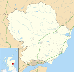
Bridge of Dun
Location within Angus
OS grid reference NO521558
Council area
Lieutenancy area
Country Scotland
Sovereign state United Kingdom
Post town FORFAR
Postcode district DD8
Dialling code 01307
Police Scotland
Fire Scottish
Ambulance Scottish
UK Parliament
Scottish Parliament
List of places
UK
Scotland
56°43′04″N2°33′04″W / 56.717778°N 2.551111°W / 56.717778; -2.551111

Bridge of Dun is a village in Angus, Scotland, located north of the River South Esk and south of the A935 road from Brechin to Montrose.

Contents

History

The village's 19th-century railway footbridge was restored in 2014. [1] In October 2023, Storm Babet caused destructive flooding to hit the area. [2] A sinkhole appeared on the eponymous Bridge of Dun, which was built between 1785 and 1787. [3] [4]

Transportation

References

  1. Strachan, Graeme (19 December 2022). "When Angus railway heritage site took delivery of 19th Century footbridge". The Courier. Retrieved 22 October 2023.
  2. Scale of Storm Babet flooding in Scottish countryside captured in aerial footage, 21 October 2023, retrieved 22 October 2023
  3. "Storm Babet: Sinkhole appears on Bridge of Dun after heavy rain and flooding". Sky News. Retrieved 22 October 2023.
  4. "Bridge Of Dun". Canmore. Retrieved 1 November 2023.