
Perthshire, officially the County of Perth, is a historic county and registration county in central Scotland. Geographically it extends from Strathmore in the east, to the Pass of Drumochter in the north, Rannoch Moor and Ben Lui in the west, and Aberfoyle in the south; it borders the counties of Inverness-shire and Aberdeenshire to the north, Angus to the east, Fife, Kinross-shire, Clackmannanshire, Stirlingshire and Dunbartonshire to the south and Argyllshire to the west.

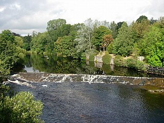
The River Tay is the longest river in Scotland and the seventh-longest in Great Britain. The Tay originates in western Scotland on the slopes of Ben Lui, then flows easterly across the Highlands, through Loch Dochart, Loch Iubhair and Loch Tay, then continues east through Strathtay, in the centre of Scotland, then southeasterly through Perth, where it becomes tidal, to its mouth at the Firth of Tay, south of Dundee. It is the largest river in the United Kingdom by measured discharge. Its catchment is approximately 2,000 square miles, the Tweed's is 1,500 sq mi (3,900 km2) and the Spey's is 1,097 sq mi (2,840 km2).

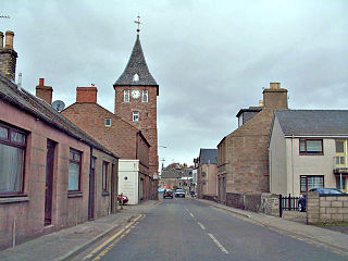
Blairgowrie and Rattray is a twin burgh in Perth and Kinross, Scotland. Locals refer to the town as "Blair". Blairgowrie is the larger of the two former burghs which were united by an Act of Parliament in 1928 and lies on the southwest side of the River Ericht while Rattray is on the northeast side. Rattray claims to be the older and certainly Old Rattray, the area round Rattray Kirk, dates back to the 12th century. New Rattray, the area along the Boat Brae and Balmoral Road dates from 1777 when the River was spanned by the Brig o' Blair. The town lies on the north side of Strathmore at the foot of the Grampian Mountains. The west boundary is formed by the Knockie, a round grassy hill, and Craighall Gorge on the Ericht. Blairgowrie and Rattray developed over the centuries at the crossroads of several historic routes with links from the town to Perth, Coupar Angus, Alyth and Braemar. The roads to Coupar Angus and Braemar form part of General Wade's military road from Perth to Ayrshire then over the tiny bridge to the hill Fort George. The town's centrepiece is the Wellmeadow, a grassy triangle in the middle of town which hosts regular markets and outdoor entertainment.

The Mounth is the broad upland in northeast Scotland between the Highland Boundary and the River Dee, at the eastern end of the Grampians.
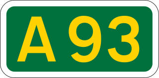
The A93 is a major road in Scotland and the highest public road in the United Kingdom. It runs north from Perth through Blairgowrie and Rattray, then through the Grampian Mountains by way of Glenshee, the Cairnwell Pass and Glen Clunie to Braemar in Aberdeenshire. At Braemar, the road then switches east down the strath of the River Dee before crossing the A90 and terminating in Aberdeen.

Alyth is a town in Perth and Kinross, Scotland, five miles northeast of Blairgowrie and about 17 miles northwest of Dundee. In 2016 the town had an estimated population of 2,400.
Coupar Angus is a town in Perth and Kinross, Scotland. It lies on the River Isla in the broad and fertile Valley of Strathmore, 4 miles south of Blairgowrie. The A94 road from Perth to Forfar runs through the town, and it had a station on the Midland Junction line until 1967.
The River Isla is a tributary of the River Tay in Angus and Perthshire, Scotland. It rises in the Grampians before flowing down through Glen Isla into the Valley of Strathmore. After a course of 46 miles (74 km), it falls into the Tay near Meikleour. Its tributaries include the Ericht.
The River Ericht is a river in Perthshire, Scotland formed from the confluence of the rivers Blackwater and Ardle at Bridge of Cally.

Bridge of Craigisla is a hamlet in Angus, Scotland. The bridge crosses the River Isla. This settlement lies along the B954 road.

Meikleour is a village in Perth and Kinross, Scotland. It lies near the confluence of the Tay and the Isla in the valley of Strathmore, 12 miles (19 km) north of Perth and 4 miles (6.4 km) south of Blairgowrie. It is in the parish of Caputh.

Dalguise is a settlement in Perth and Kinross, Scotland. It is situated on the western side of the River Tay on the B898 road, 5 miles north of Dunkeld. Located there is Dalguise House, a place where, from the age of four, Beatrix Potter stayed annually with her family throughout the summer, from May till the end of the salmon season.

Kirkmichael is a village located in Strathardle, Perth and Kinross, Scotland. It is 13 miles north-northwest of Blairgowrie and 12 miles east-northeast of Pitlochry on the A924 Bridge of Cally to Pitlochry road, and is linked to the A93 Perth to Aberdeen road by the B950. The village is centred around Kirkmichael Bridge over the River Ardle.
The Scottish Midland Junction Railway was authorised in 1845 to build a line from Perth to Forfar. Other companies obtained authorisation in the same year, and together they formed a route from central Scotland to Aberdeen. The SMJR opened its main line on 4 August 1848. Proposals to merge with other railways were rejected by Parliament at first, but in 1856 the SMJR merged with the Aberdeen Railway to form the Scottish North Eastern Railway. The SNER was itself absorbed into the larger Caledonian Railway in 1866. The original SMJR main line was now a small section of a main line from Carlisle and central Scotland to Aberdeen.
Kirkton of Glenisla consists of a church and graveyard, a hotel, hall and several homes forming the largest concentration of habitation in Glenisla, Angus, Scotland. It is situated on the River Isla, eleven miles north-west of Kirriemuir and ten miles north of Blairgowrie, on the B951 road. The kirkton is situated adjacent to the 64 mile waymarked Cateran Trail. There is a suspension footbridge that was built in 1824 over the River Isla.
Folda is a hamlet in Glen Isla, Angus, Scotland. It is situated on the River Isla, twelve miles north-west of Kirriemuir and eleven miles north of Blairgowrie, on the B951 road.

Little Forter is a hamlet in Glen Isla, Angus, Scotland. It is on the River Isla, 13 miles north-west of Kirriemuir and 11 miles north of Blairgowrie, on the B951 road.

Loch of Craiglush is a freshwater loch, located around 1+1⁄2 miles (2.4 km) north-east of Dunkeld in Perth and Kinross, Scotland. The loch is a designated Site of Special Scientific Interest (SSSI), as well as forming part of a Special Area of Conservation.

Bridge of Cally is a small village in Kirkmichael parish, Perth and Kinross, Scotland. It sits at the junction of three glens, Glenshee, Strathardle and Glenericht and is centred round the bridge over the River Ardle 200 m (220 yd) before it joins the Black Water to form the River Ericht. The A93 road from Perth to Aberdeen crosses the bridge where it forms a junction with the A924 road to Kirkmichael and Pitlochry. The village is on the Cateran Trail long-distance path, and is popular in winter as it is near the Glen Shee skiing area.

