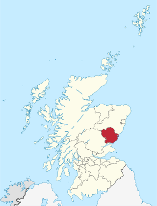
Angus is one of the 32 local government council areas of Scotland, a registration county and a lieutenancy area. The council area borders Aberdeenshire, Dundee City and Perth and Kinross. Main industries include agriculture and fishing. Global pharmaceuticals company GSK has a significant presence in Montrose in the east of the county.
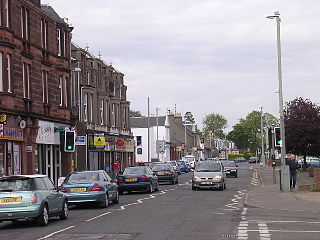
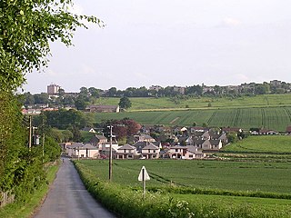
Monifieth is a town and former police burgh in the council area of Angus, Scotland. It is situated on the north bank of the Firth of Tay on the east coast. In 2016, the population of Monifieth was estimated at 8,110, making it the fifth largest town in Angus.

East Haven is a fishing village in the council area of Angus, Scotland. It is situated 1.5 miles (2 km) east of Carnoustie and 5 miles (8 km) south west of Arbroath. The closest city, Dundee, is 13 miles (21 km) to the west.

Angus Glen(Census Tract No. 5350403.05) is a community in the city of Markham, just north of the community and former municipality of Unionville, Ontario, Canada. The area was originally farmland, but as Unionville's housing development in the late 1990s matured in 1997 the original Angus Glen East Village, comprising approximately 500 single family homes and townhouses, was developed. Angus Glen incorporated the residential concept of "New Urbanism", to allow for the homes to be designed with the appearance of old downtown Toronto houses, with lane-ways on which the homes' separate garages were built. In the mid-2000s the land west of the small creek on the west border of the East Village commenced development, and is still under construction, known as the West Village. Throughout this period the East Village had a tract of land which had originally been sold to the school board for a possible school. However, the demographic studies could not support a school and after many years of negotiations the developer re-purchased the land in early 2014 and the East Village has had approximately 50 homes under construction, just east of the baseball park and along the north border of York Downs Golf Club. These homes will increase the East Village's homes to close to 600 and the entire community to approximately 1,100.

Guthrie is a village in Angus, Scotland, roughly at the centre point of the towns of Arbroath, Brechin and Forfar. The principal building in the village is Guthrie Castle. The village of Guthrie is centered on the Guthrie parish church, containing the Guthrie Aisle, built in 1450. The parish was united with Carbuddo in the sixteenth century.
Letham is a village in Angus, Scotland.
Newbigging is a village in Angus, Scotland, two miles northeast of Dundee. The name "Newbigging" originally referred to a "new bigging" or "new cottar town" (hamlet). The village is roughly two miles north of Monifieth.
Clan Wedderburn is a Lowland Scottish clan.

Tannadice is a village in Angus, Scotland that lies on the River South Esk and is 4 miles north of Forfar. The estate of Tannadice was formerly owned by William Neish of Tannadice and Clepington. Jock Neish Scout Centre at Tannadice was built on the family's lands and named for William Neish's grandson.

Inverarity is a village in Angus, Scotland, UK, on the A90, 6 miles from Forfar, and 7 miles from Dundee. The nearest villages are Gateside, Invereighty, Kincaldrum and Gallowfauld. Inverarity used to be in the old county of Forfarshire. Its name means "creek of Arity".

The Monifieth Sculptured Stones are a series of five class II and III standing Pictish stones from the early Medieval period found in or around St Regulus' church in Monifieth, Angus, Scotland. Uncovered during the demolition of a pre-Reformation church and its kirkyard wall in the 19th and 20th centuries, the stones are now housed in the collection of the Museum of Scotland.
Bridgefoot, previously called Kirkton of Strathmartine, is a village in Angus, Scotland. It lies approximately one mile north of Dundee, to the west of Strathmartine Hospital.

Ruthven is a village in Angus, Scotland. It is two miles (3.2 km) north of Meigle, where the A926 road crosses the River Isla.
Campmuir is a small village in the Perth and Kinross area of Scotland.
Angus Folk Museum was a centre for agricultural history and rural life located near Forfar, Angus. It was located in the village of Glamis off the A94. The museum was founded by Jean, Lady Maitland who gave her collections to the nation in the 1950s. Since 1976 it has been administered by the National Trust for Scotland. The museum has been described as containing "one of Scotland's finest folk collections".
Craigo is a village in Angus, Scotland. It lies about 5 miles (8.0 km) northwest of Montrose, and 1 mile (1.6 km) south of Marykirk, which is across the River North Esk in Aberdeenshire. Craigo developed in the 19th century as a textile village.
The Dundee and Forfar direct line was a railway line opened by the Caledonian Railway in 1870, connecting the important county town of Forfar with the harbour and manufacturing town of Dundee.

George Wishart of Drymme was a Scottish landowner, lawyer, and a financial administrator for Mary, Queen of Scots.
Kingennie railway station served the village of Kingennie, Angus, Scotland, from 1870 to 1955 on the Dundee and Forfar direct line.


