York North was a federal riding in Ontario, Canada, that was in the House of Commons of Canada from Confederation in 1867 until 2004.
Renfrew North was a federal electoral district represented in the House of Commons of Canada from 1867 to 1979. It was located in the province of Ontario. It was created by the British North America Act of 1867. The riding existed until 1972, when the name was changed to "Renfrew North—Nipissing East".
Renfrew South was a federal riding represented in the House of Commons of Canada from 1867 to 1968. It was located in the province of Ontario. The federal riding was created by the British North America Act of 1867 and was abolished in 1966, with the riding being apportioned into Frontenac—Lennox and Addington, Lanark and Renfrew, and Renfrew North.
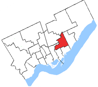
York East was a federal electoral district represented in the House of Commons of Canada at different times. It was located in the province of Ontario.
Essex South was a federal and provincial electoral district represented in the House of Commons of Canada from 1882 to 1968. It was located in the province of Ontario. This riding was created in 1882 from parts of Essex riding.

Ardgroom is a village on the Beara peninsula in County Cork, Ireland. Its name refers to two gravelly hills deposited by a glacier, Dromárd and Drombeg. It lies to the north north west of Glenbeg Lough, overlooking the Kenmare River estuary. It sits between the coast and the Slieve Miskish Mountains. The village contains a shop, post office, a petrol station and "The Village Inn" pub.

Stormyrbassenget, also known as Stormyraven or Avan, is a lake in the municipality of Hemnes in Nordland county, Norway. It lies about 12 kilometres (7.5 mi) south of the municipal center of Korgen and about 4 kilometres (2.5 mi) north of the village of Bleikvasslia. The lake lies along the river Røssåga as it flows north to the Ranfjord.
Strindvatnet (Norwegian) or Tjoalmejávrre (Lule Sami) is a lake in the municipality of Hamarøy in Nordland county, Norway. The lake lies about 5 kilometres (3.1 mi) south of the village of Tømmerneset. The European route E06 highway runs along the eastern shore of the lake. The lake Sandnesvatnet lies to the southeast and the lake Rotvatnet lies to the north of Strindvatnet.

Hostovatnet is a lake in Trøndelag county, Norway. The 3.14-square-kilometre (1.21 sq mi) lake lies in Orkland Municipality. The village of Hoston is located on the northeastern shore of the lake.
Vostervatnet is a lake in the municipality of Strand in Rogaland county, Norway. The 2.62-square-kilometre (1.01 sq mi) lake lies in the northwestern part of Strand, just south of the Fognafjorden. The village of Tau lies about 3.5 kilometres (2.2 mi) southwest of the lake. The main outflow of the lake is the river Fiskåna, which flows north from the northeastern corner of the lake, down the hill to the village of Fiskå on the shore of the fjord.

Botsvatn or Bossvatn is a lake in the municipality of Bykle in Aust-Agder county, Norway. The 14.6-kilometre (9.1 mi) long, narrow reservoir is located just to the southeast of the large lake Blåsjø and northeast of the lake Ytre Storevatnet. The lake holds water for the Brokke Hydroelectric Power Station, located in nearby Valle municipality. The water from the lake can flow out into the nearby river Otra, but only when water is released from the dam.
Gilten is a lake in the municipality of Steinkjer in Trøndelag county, Norway. The 31.62-square-kilometre (12.21 sq mi) lake lies in the northern part of Steinkjer, about 8 kilometres (5.0 mi) northeast of the village of Kvam, about 1.5 kilometres (0.93 mi) north of the village of Følling, and about 14 kilometres (8.7 mi) east of the village of Namdalseid. The lake is only accessible by road from Namdalseid, even though most of the 31.62-square-kilometre (12.21 sq mi) lake lies in Steinkjer. The lake Bangsjøan lies to the northeast and the lake Snåsavatnet lies to the south.

Vuolit Spielgajávri is a lake in the municipality of Kautokeino-Guovdageaidnu in Troms og Finnmark county, Norway. The lake lies on the Finnmarksvidda plateau, about 25 kilometres (16 mi) southwest of the village of Masi and about 30 kilometres (19 mi) north of the village of Kautokeino. The lake Bajit Spielgajávri lies just 400 metres (1,300 ft) to the west of this lake.

King's Walden is a civil parish in the English county of Hertfordshire. The name includes an apostrophe, but this is often omitted.

East Tisted is a village and civil parish in the East Hampshire district of Hampshire, England. It is 4.8 miles (7.7 km) south of Alton on the A32 road.

Rewe is a village and civil parish in the county of Devon in England. It lies on the river Culm, 5 miles (8 km) north of the city of Exeter and 9 miles (14 km) south of the town of Tiverton. Rewe is a linear village, with most of its buildings lying along the A396 road about 1 mile (1.6 km) north of the larger village of Stoke Canon. The Reading to Plymouth railway line also passes through the village, but there has never been a station here; the nearest operating station is Exeter St Davids. Before its closure, Stoke Canon station was the nearest.

Lembach is a commune in the Bas-Rhin department and Grand Est region of north-eastern France.

Martinvelle is a commune in the Vosges department in Grand Est in northeastern France.

Abay is a village in Almaty Region of south-eastern Kazakhstan. During the Soviet era it was called Oktyabrskoye Desyatoye.
Nitinat Lake is a large lake and inlet on the southwestern coast of Vancouver Island, British Columbia, Canada. The lake is about 150 kilometres (93 mi) northwest by road from Victoria, BC's capital on the southern tip of Vancouver Island, and about 60 kilometres (37 mi) southwest by road from the town of Lake Cowichan. The town of Port Alberni is about 80 kilometres (50 mi) by road to the north.

