
Angus is one of the 32 local government council areas of Scotland, and a lieutenancy area. The council area borders Aberdeenshire, Dundee City and Perth and Kinross. Main industries include agriculture and fishing. Global pharmaceuticals company GSK has a significant presence in Montrose in the east of the county.
Clan Ross is a Highland Scottish clan. The original chiefs of the clan were the original Earls of Ross.
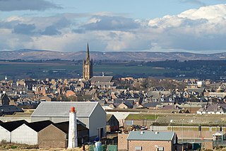
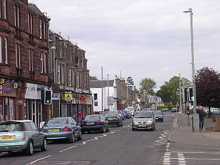
Montrose is a town and former royal burgh in Angus, Scotland. Situated 28 miles north of Dundee and 37 miles south of Aberdeen, Montrose lies between the mouths of the North and South Esk rivers. It is the northernmost coastal town in Angus and developed as a natural harbour that traded in skins, hides, and cured salmon in medieval times.
Balintore Football Club was a senior football club in Scotland. They played at Seaboard Park in Balintore, representing the Seaboard Villages in the Scottish Highlands.
Coupar Angus is a town in Perth and Kinross, Scotland. It lies on the River Isla in the broad and fertile Valley of Strathmore, 4 miles south of Blairgowrie. The A94 road from Perth to Forfar runs through the town, and it had a station on the Midland Junction line until 1967.

Hill of Fearn is a small village near Tain in Easter Ross, in the Scottish council area of Highland.
William Burn was a Scottish architect. He received major commissions from the age of 20 until his death at 81. He built in many styles and was a pioneer of the Scottish Baronial Revival, often referred to as the golden age of Scottish architecture.

Easter Ross is a loosely defined area in the east of Ross, Highland, Scotland.
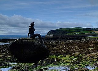
Balintore is a village near Tain in Easter Ross, Scotland. It is one of three villages on this northern stretch of the Moray Firth coastline: Hilton, Balintore, and Shandwick are known collectively as the Seaboard Villages.

Shandwick, a village near Tain in Easter Ross, and is in the Scottish council area of Highland, Scotland.
Hilton of Cadboll, or simply Hilton, is a village about 15 km (9 mi) southeast of Tain in Easter Ross, in the Scottish council area of Highland. It is famous for the Hilton of Cadboll Stone.
Monifieth is a town and former police burgh in the council area of Angus, Scotland. It is situated on the north bank of the Firth of Tay on the east coast. In 2016, the population of Monifieth was estimated at 8,110, making it the fifth largest town in Angus.

Fearn railway station is a railway station serving the village of Hill of Fearn in the Highland council area of Scotland, located around 1.3 miles (2.1 km) from the village. It is situated on the Far North Line, 40 miles 60 chains (65.6 km) form Inverness, between Tain and Invergordon, and is also the nearest station to Balintore, Hilton and Shandwick, Portmahomack and the Nigg Bay area of Easter Ross. ScotRail, who manage the station, operate all services.
Rockfield is a hamlet in the parish of Tarbat, on the Tarbat Peninsula, near the village of Portmahomack, Easter Ross, Highland, Scotland. There is a small stone jetty and the traditional way of life included fishing and agriculture. Rockfield is generally east-facing, below the level of a raised beach.
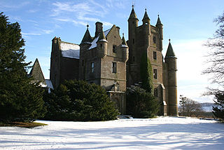
Balintore Castle is a Victorian Category A listed building in Scotland.
Fearn is a hamlet, situated 1 mile (1.6 km) south of Loch Eye and 2 miles (3.2 km) northwest of Balintore, in eastern Ross-shire, Scottish Highlands and is in the Scottish council area of Highland. The buildings in the hamlet are mostly cottages with walls constructed of boulders and clay.
Balintore can refer to several places in Scotland:

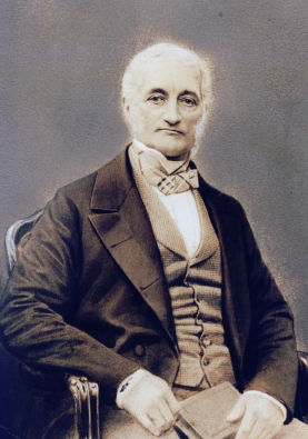
David Lyon Junior (1794–1872) was a West Indies merchant, Member of parliament, and landowner. His portrait was painted by Sir Thomas Lawrence c. 1825, and is now in the Museum Thyssen-Bornemisza in Madrid.

Cat Law is a hill in the southern Mounth of Scotland, north of Kirriemuir in Angus.

