Airlie, Angus

Last updated

Airlie
Angus UK location map.svg
Red pog.svg
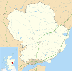
Airlie
Location within Angus
OS grid reference NO312514
Council area
Lieutenancy area
Country Scotland
Sovereign state United Kingdom
Post town KIRRIEMUIR
Postcode district DD8
Dialling code 01575
Police Scotland
Fire Scottish
Ambulance Scottish
UK Parliament
Scottish Parliament
List of places
UK
Scotland
56°38′58″N3°07′25″W / 56.649328°N 3.123623°W / 56.649328; -3.123623
Standing Stone by Baitland of Airlie Standing stone at Airlie.jpg
Standing Stone by Baitland of Airlie

Airlie (Scottish Gaelic : Iarlaidh) is a civil parish in the Scottish council area of Angus. [1] [2] It is the seat of the Earl of Airlie, and the location of Airlie Castle. It comprises Craigton of Airlie, Baitland of Airlie and Kirkton of Airlie. There is a standing stone in a field just east of the Baitland; various Pictish and Roman relics (stone coffins etc.) have been uncovered and the primary school is reputed to have been built on the site of an old graveyard. Airlie also contains one of the finest examples of a Pictish souterrain in Scotland, with the carving of a snake clearly visible in the ceiling.

Drawing of "The Bonnie Hoose o' Airlie" Bonnie.house.o.Airlie.jpg
Drawing of "The Bonnie Hoose o' Airlie"

Airlie Castle is not currently open to the public, however it is remembered in the song The Bonnie Hoose o' Airlie which is mentioned in Robert Louis Stevenson's novel Kidnapped . The song commemorates the burning of the castle (some of the stonework is still black) by the Earl of Argyll, claiming to act on behalf of the anti-royalists, while the earl was away fighting for the Jacobite cause. However, it is also claimed that Forter Castle in Glen Isla was the "bonnie hoose" destroyed in 1640. It is also mentioned in the song Wha'll be King but Charlie?, as performed by The Corries, presumably because it is a good rhyme for "Chairlie".

Related Research Articles

<span class="mw-page-title-main">Angus, Scotland</span> Council area of Scotland

Angus is one of the 32 local government council areas of Scotland, a registration county and a lieutenancy area. The council area borders Aberdeenshire, Dundee City and Perth and Kinross. Main industries include agriculture and fishing. Global pharmaceuticals company GSK has a significant presence in Montrose in the east of the county.

<span class="mw-page-title-main">Earl of Airlie</span> Title in the Peerage of Scotland

Earl of Airlie is a title of the peerage in Scotland created on 2 April 1639 for James Ogilvy, 7th Lord Ogilvy of Airlie, along with the title "Lord Ogilvy of Alith and Lintrathen". The title "Lord Ogilvy of Airlie" was created on 28 April 1491.

<span class="mw-page-title-main">Cortachy</span> Village in Angus, Scotland

Cortachy is a village in Angus, Scotland. It lies in at the mouth of Glen Clova, on the River South Esk, four miles north of Kirriemuir. Nearby lies Cortachy Castle, seat of the Earls of Airlie.

<span class="mw-page-title-main">Letham, Angus</span> Human settlement in Scotland

Letham is a village in Angus, Scotland.

<span class="mw-page-title-main">Clan Ogilvy</span> Highland Scottish clan

Clan Ogilvy, also known as Clan Ogilvie, is a Highland Scottish clan. Originating from Angus, Scotland, the progenitor of the Clan received a barony from King William the Lion in 1163. In 1491, King James IV elevated Sir James Ogilvy as Lord Ogilvy of Airlie.

<span class="mw-page-title-main">Arbirlot</span> Human settlement in Scotland

Arbirlot is a village in a rural parish of the same name in Angus, Scotland. The current name is usually presumed to be a contraction of Aberelliot or Aber-Eliot - both meaning the mouth of the Elliot. It is situated west of Arbroath. The main village settlement is on the Elliot Water, 2+12 miles (4 km) from Arbroath. There is a Church of Scotland church and a primary school. The school lies 1 mile (1.6 km) further west, in the approximate geographic centre of the parish.

The Bonnie House of Airlie is a traditional Scottish folk song of the seventeenth century, telling the tale of the raid by Archibald Campbell, Earl of Argyll, on Airlie Castle, the home of James Ogilvy, Earl of Airlie, in the summer of 1640. A broadsheet version first appeared in 1790 and it received formal publication as number 199 in Francis Child's collection The English and Scottish Popular Ballads of 1882.

<span class="mw-page-title-main">Eassie Stone</span>

The Eassie Stone is a Class II Pictish stone of about the mid 8th century AD in the village of Eassie, Angus, Scotland. The stone was found in Eassie burn in the late 18th century and now resides in a purpose-built perspex building in the ruined Eassie church.

<span class="mw-page-title-main">Eassie</span> Human settlement in Scotland

Eassie is a village located along the A94 road in Angus, Scotland. The church in Eassie is dedicated to Saint Fergus, a monk who worked at nearby Glamis. Eassie is noted for the presence of the Eassie Stone, a carved Pictish stone, which resides in the ruins of Eassie Old Church.

Castleton, officially Castleton Of Eassie, is a village in Angus, Scotland. This settlement is situated along the A94 road between Glamis and Meigle. One mile to the south is the village of Eassie and Eassie Old Church, noted for the presence of the Eassie Stone; this carved Pictish stone is dated prior to the Early Middle Ages. Slightly further to the south lies Ark Hill within the Sidlaw Hills.

<span class="mw-page-title-main">Wester Denoon</span> Human settlement in Scotland

Wester Denoon is a small settlement in Angus, Scotland. Approximately one mile to the north of Wester Denoon is the village of Eassie, where the Eassie Stone is displayed in a ruined church; this carved Pictish stone is dated prior to the Early Middle Ages. Other nearby settlements are Charleston, Balkeerie and Kirkinch. Two fragments of small Pictish cross-slabs have also been found at Wester Denoon itself. One shows the stylised figure of a woman wearing a long dress or mantle fastened on the breast by a large brooch.

Milton is a hamlet in Angus, Scotland situated near Glamis. Considerable early history is in the general area including Glamis Castle and the Eassie Stone, a carved Pictish stone dating prior to the Early Middle Ages.

<span class="mw-page-title-main">Antonine Wall</span> Defensive fortification in Roman Britain

The Antonine Wall was a turf fortification on stone foundations, built by the Romans across what is now the Central Belt of Scotland, between the Firth of Clyde and the Firth of Forth. Built some twenty years after Hadrian's Wall to the south, and intended to supersede it, while it was garrisoned it was the northernmost frontier barrier of the Roman Empire. It spanned approximately 63 kilometres and was about 3 metres high and 5 metres wide. Lidar scans have been carried out to establish the length of the wall and the Roman distance units used. Security was bolstered by a deep ditch on the northern side. It is thought that there was a wooden palisade on top of the turf. The barrier was the second of two "great walls" created by the Romans in Great Britain in the second century AD. Its ruins are less evident than those of the better-known and longer Hadrian's Wall to the south, primarily because the turf and wood wall has largely weathered away, unlike its stone-built southern predecessor.

<span class="mw-page-title-main">Battle of Barry</span> Legendary battle in 1010 AD

The Battle of Barry is a legendary battle in which the Scots, purportedly led by Malcolm II, defeated a Danish invasion force in 1010 AD. Its supposed site in Carnoustie, Angus can be seen in early Ordnance Survey maps. The history of the event relies heavily on tradition and it is considered to be apocryphal. The battle was named for the Parish of Barry, rather than the village, and was formerly thought to have taken place at the mouth of the Lochty burn, in the vicinity of the area that is now occupied by Carnoustie High Street. While the battle is not historically authentic, its romantic appeal continues to capture the popular imagination.

<span class="mw-page-title-main">Airlie Castle</span>

Airlie Castle is a mansion house in the parish of Airlie, Angus, near the junction of the Isla and Melgund rivers, 9 kilometres west of Kirriemuir, Angus, Scotland. A castle was built on the site in c. 1432 and was burnt out in 1640, with a mansion house built incorporating and on top of some of the ruins in c. 1792–93, and occupied today. The house and the stables are Category B listed buildings and the grounds are included in the Inventory of Gardens and Designed Landscapes in Scotland.

<span class="mw-page-title-main">Camus Cross</span> Sculpture in Angus, Scotland, UK

The Camus Cross, otherwise known as the Camuston or Camustane Cross, is an Early Medieval Scottish standing stone on the Panmure Estate near Carnoustie in Angus, Scotland. First recorded in the 15th century in a legal document describing the boundaries between Camuston and the barony of Downie, and described in the 17th century by Robert Maule, it is a freestanding cross, rare in Eastern Scotland.

<span class="mw-page-title-main">Woodwrae Stone</span>

The Woodwrae Stone is a Class II Pictish Stone that was found in 1819 when the foundations of the old castle at Woodwrae, Angus, Scotland were cleared. It had been reused as a floor slab in the kitchen of the castle. Following its removal from the castle, it was donated to the collection of Sir Walter Scott at Abbotsford House. It is now on display at the Museum of Scotland in Edinburgh.

<span class="mw-page-title-main">St Orland's Stone</span> Cross slab in Angus, Scotland, UK

St Orland's Stone is a Class II Pictish Cross-Slab at Cossans, near Kirriemuir and Forfar, Angus, Scotland

<span class="mw-page-title-main">Abergeldie Castle</span> Tower house in Aberdeenshire, Scotland

Abergeldie Castle is a four-floor tower house in Crathie and Braemar parish, SW Aberdeenshire, Scotland. It stands at an altitude of 840 feet (260 m), on the south bank of the River Dee, five miles (8 km) west of Ballater, and about two miles (3 km) east of the royal residence of Balmoral Castle. Behind it rises Creag nam Ban, a rounded granite hill about 527 metres (1,729 ft) high, and across the river to its front is the cairn-crowned Geallaig Hill, rising to 743 metres (2,438 ft).

<span class="mw-page-title-main">Forter Castle</span> Castle in Angus, Scotland, UK

Forter Castle is located in Glenisla, Perthshire, Scotland. It was built in 1560 by James Ogilvy, the 5th Lord of Airlie. In 1640, it was burned by Archibald Campbell, the 8th Earl of Argyll, but it was rebuilt in the early 1990s.

References

  1. Ordnance Survey: Landranger map sheet 53 Blairgowrie & Forest of Alyth (Map). Ordnance Survey. 2012. ISBN   9780319231210.
  2. "Ordnance Survey: 1:50,000 Scale Gazetteer" (csv (download)). www.ordnancesurvey.co.uk. Ordnance Survey. 1 January 2016. Retrieved 30 January 2016.