Newtyle

Last updated

Newtyle
Sidlaw Hills - Kinpurnie, Hatton and Newtyle Hills.jpg
Looking south towards the Sidlaw Hills. Left to right: Kinpurnie, Hatton, and Newtyle Hills.
Angus UK location map.svg
Red pog.svg
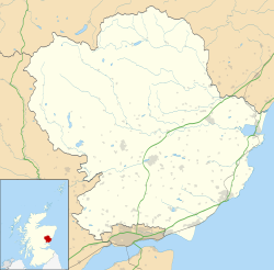
Newtyle
Location within Angus
Population680 (mid-2020 est.) [1]
OS grid reference NO297413
Council area
Lieutenancy area
Country Scotland
Sovereign state United Kingdom
Post town Blairgowrie
Postcode district PH12
Dialling code 01828 650
Police Scotland
Fire Scottish
Ambulance Scottish
UK Parliament
Scottish Parliament
List of places
UK
Scotland
56°33′29″N3°08′38″W / 56.558°N 3.144°W / 56.558; -3.144 Coordinates: 56°33′29″N3°08′38″W / 56.558°N 3.144°W / 56.558; -3.144

Newtyle is a village in the west of Angus, Scotland. It lies eleven miles (eighteen kilometres) north of Dundee in the southwest of Strathmore, between Hatton Hill and Newtyle (Heather Hill) in the Sidlaws. The village sits on gently sloping ground with a northwest aspect. The main communication link is the B954 road. The population was about 800 as of 2004. [2]

Contents

History

The original village of Newtyle was centred on the church and what are now Kirkton Road and Smiddy road. Hatton Castle to the south and Newbigging to the north lie within the parish boundary.

The Railway

Newtyle was the northern terminus for the first commercial railway in Scotland, the Dundee and Newtyle Railway which opened in 1831. The grid street plan of the central part of the village was laid out shortly after the railway opened and was intended to form the basis for a manufacturing centre which could take advantage of the communications link to Dundee. [3] Rail services to and from Newtyle were in decline for a number of years before the line was closed in the 1960s under the Beeching Axe. [4] Most of the railway buildings have since been demolished but the embankments and cuttings remain a prominent feature of the countryside surrounding the village.

Education

Newtyle school provides education at primary level up to year 7 after which pupils travel elsewhere for secondary education. The school provided two years of secondary education until 1998. Local government boundary changes have seen different generations of Newtyle pupils receive their secondary education at Forfar Academy, Harris Academy in Dundee, Monifieth High School and latterly at Webster's High School in Kirriemuir. A new school was constructed in 2009 to replace the old building which had been in use since 1963.

Economy

There are no major employers in Newtyle, but a number of small local businesses also provide employment within the village. A large part of the working population commutes to Dundee.

See also

Notes

  1. "Mid-2020 Population Estimates for Settlements and Localities in Scotland". National Records of Scotland. 31 March 2022. Retrieved 31 March 2022.
  2. Year 2004 population of selected Scottish settlements Archived 2012-01-25 at the Wayback Machine
  3. William Murdoch Duncan, (1979) Newtyle. A Planned Manufacturing Village, Forfar Historical Society
  4. N. Ferguson [October 1995] Dundee and Newtyle Railway Including the Alyth and Blairgowrie Branches (Oakwood Library of Railway History) (hardcover), The Oakwood Press. ISBN   0-85361-476-8.

Related Research Articles

Angus, Scotland Council area of Scotland

Angus is one of the 32 local government council areas of Scotland, a registration county and a lieutenancy area. The council area borders Aberdeenshire, Dundee City and Perth and Kinross. Main industries include agriculture and fishing. Global pharmaceuticals company GSK has a significant presence in Montrose in the north of the county.

Dundee City and council area in Scotland

Dundee is Scotland's fourth-largest city and the 51st-most-populous built-up area in the United Kingdom. The mid-year population estimate for 2016 was 148,210, giving Dundee a population density of 2,478/km2 or 6,420/sq mi, the second-highest in Scotland. It lies within the eastern central Lowlands on the north bank of the Firth of Tay, which feeds into the North Sea. Under the name of Dundee City, it forms one of the 32 council areas used for local government in Scotland.

Forfar Human settlement in Scotland

Forfar is the county town of Angus, Scotland and the administrative centre for Angus Council, with a new multi-million pound office complex located on the outskirts of the town. As of 2021, the town has a population of 16,280.

Methil Human settlement in Scotland

Methil is an eastern coastal town in Scotland. It was first recorded as "Methkil" in 1207, and belonged to the Bishop of St Andrews. Two Bronze Age cemeteries have been discovered which date the settlement as over 8,000 years old. Famous for its High Street having the most pubs per mile in Scotland, it was part of its own barony in 1614 and also part of the former burgh of Buckhaven and Methil. This burgh existed between 1891 and 1975. It is situated within a continuous urban area described as Levenmouth.

Friockheim Human settlement in Scotland

Friockheim is a village in Angus, Scotland dating from 1814. It lies between the towns of Arbroath, Brechin, Forfar and Montrose.

Uddingston is a small town in South Lanarkshire, Scotland. It is on the north side of the River Clyde, south-east of Glasgow city centre, and acts as a dormitory suburb for the city.

Patna, East Ayrshire Human settlement in Scotland

Patna is a village in East Ayrshire, Scotland, straddling the traditional districts of Carrick and Kyle.

Monifieth Town in Angus, Scotland

Monifieth is a town and former police burgh in the council area of Angus, Scotland. It is situated on the north bank of the Firth of Tay on the east coast. In 2016, the population of Monifieth was estimated at 8,110, making it the fifth largest town in Angus.

Liff, Angus Human settlement in Scotland

Liff is a village in Angus, Scotland, situated 4.5 miles west-north-west of Dundee on a south-facing slope two miles north of the River Tay. It had a population of 568 in 2011. Surrounded by farmland, it has been described as 'haunted by wood pigeons and the scent of wild garlic' and having a 'wonderful view over the firth [of Tay]'. Half a mile to the east lies the site of the former Royal Dundee Liff Hospital, now given over to private housing. Further east lie Camperdown House and Park. Half a mile to the south is House of Gray, a large eighteenth-century mansion house in the neoclassical style, currently standing empty. The village contains twelve listed buildings, with others nearby.

Gifford, East Lothian Human settlement in Scotland

Gifford is a village in the parish of Yester in East Lothian, Scotland. It lies approximately 4 miles (6.4 km) south of Haddington and 25 miles (40 km) east of Edinburgh.

Banknock Human settlement in Scotland

Banknock is a village within the Falkirk council area in Central Scotland. The village is 6.7 miles (10.8 km) west-southwest of Falkirk, 3.9 miles (6.3 km) east-northeast of Kilsyth and 3.0 miles (4.8 km) north-northeast of Cumbernauld.

Dundee and Newtyle Railway

The Dundee and Newtyle Railway opened in 1831 and was the first railway in the north of Scotland. It was built to carry goods between Dundee and the fertile area known as Strathmore; this involved crossing the Sidlaw Hills, and was accomplished with three rope-worked inclined planes. Newtyle was simply a remote railhead, and the anticipated traffic volumes were not achieved, the inclines incurred heavy operating costs, and the railway never made money.

Birkhill, Angus Human settlement in Scotland

Birkhill and neighbouring Muirhead are two small villages in Angus, just to the west of Dundee, Scotland.

Auchterhouse Human settlement in Scotland

Auchterhouse is a village, community, and civil parish in the Scottish council area of Angus, located 7.3 miles (11.7 km) north west of Dundee, 9.5 miles (15.3 km) south east of Alyth and 14.9 miles (24.0 km) south west of Forfar. It lies on the southern edge of the Sidlaw Hills, below Auchterhouse Hill, 1,398 feet (426 m) high. The parish, which is coterminous with the community, had a population of 520 in 2001. The village, formerly known as Milltown of Auchterhouse, straddles the B954 Muirhead to Newtyle road. About 1.0 mile (1.6 km) east lies the larger village of Kirkton of Auchterhouse, where the church and school are located.

The Scottish Midland Junction Railway was authorised in 1845 to build a line from Perth to Forfar. Other companies obtained authorisation in the same year, and together they formed a route from central Scotland to Aberdeen. The SMJR opened its main line on 4 August 1848. Proposals to merge with other railways were rejected by Parliament at first, but in 1856 the SMJR merged with the Aberdeen Railway to form the Scottish North Eastern Railway. The SNER was itself absorbed into the larger Caledonian Railway in 1866. The original SMJR main line was now a small section of a main line from Carlisle and central Scotland to Aberdeen.

The Scottish North Eastern Railway was a railway company in Scotland operating a main line from Perth to Aberdeen, with branches to Kirriemuir, Brechin and Montrose. It was created when the Aberdeen Railway amalgamated with the Scottish Midland Junction Railway on 29 July 1856. It did not remain independent for long, for it was itself absorbed by the Caledonian Railway on 10 August 1866.

Lawside Academy was a Roman Catholic secondary school in Dundee, Scotland. It was the northernmost state Catholic school in Europe. Lawside closed in June 2008, 101 years after it opened. The school's successor is St Paul's Academy.

Hatton Castle, Angus

Hatton Castle stands on the lower part of Hatton Hill, the most easterly of the Sidlaw Hills, to the south of Newtyle in Angus, Scotland. The castle overlooks the wooded Den of Newtyle, and its views extend across Strathmore and include Ben Lawers and Schiehallion as well as the Angus and Glenshee hills. The 16th-century castle was originally built in a typical Scottish "Z plan" tower house design, as a fortified country house or château. There was an earlier castle called Balcraig Castle which stood less than half a mile from the present building, also on Hatton Hill.

The Dundee and Forfar direct line was a railway line opened by the Caledonian Railway in 1870, connecting the important county town of Forfar with the harbour and manufacturing town of Dundee.