Related Research Articles

Penn is an area which is divided between the City of Wolverhampton and South Staffordshire district. The population of the Wolverhampton Ward taken at the 2011 census was 12,718. Originally, it was a village in the historic county of Staffordshire. There is considerable confusion about exactly which areas fall within Penn. In 19th century censuses, Merry Hill, Bradmore are understood to form part of Penn, although these areas are generally understood to be separate today. However, there has never been any doubt that the two historic settlements of Upper and Lower Penn form the core of the area.

Seisdon is a rural village in the parish of Trysull and Seisdon, Staffordshire approximately six miles west of Wolverhampton and the name of one of the five hundreds of Staffordshire. The population recorded at the 2011 census does not distinguish this hamlet from the rest of the parish, which had a population of 1,150.

Wombourne is a large village and civil parish located in the district of South Staffordshire, in the county of Staffordshire, England. It is 4 miles (6 km) south-west of Wolverhampton and just outside the county and conurbation of the West Midlands.

The A449 is a major road in the United Kingdom. It runs north from junction 24 of the M4 motorway at Newport in South Wales to Stafford in Staffordshire.
A liberty was an English unit originating in the Middle Ages, traditionally defined as an area in which regalian right was revoked and where the land was held by a mesne lord. It later became a unit of local government administration.
Gilson is a hamlet in the civil parish of Coleshill, in the North Warwickshire district of Warwickshire, England. It lies between the M42 and the A446, on the B4117 road between the village of Water Orton and the small market town of Coleshill.
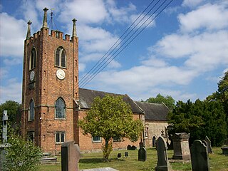
Seighford is a village and civil parish about 3 miles (5 km) west of Stafford in Staffordshire, England. The population of this civil parish at the 2011 census was 1,793. The ford across a small stream is the origin of the village's toponym. The village has a red brick Church of England parish church, St Chad's, and a 16th-century Tudor mansion.
The South Staffordshire Railway Walk is located in Staffordshire, England. It runs for five and a half miles from Castlecroft to Wall Heath. It is a local nature reserve.
Swindon is a village and civil parish located in the West Midlands. The nearest major town is Dudley, approximately five miles eastwards. It stands today that Swindon is in fact actually in Wombourne and used to be where less wealthy people would live.
Himley is a small village and civil parish in the English ceremonial county of Staffordshire, situated 4 miles west of Dudley and 5 miles southwest of Wolverhampton. At the time of the 2011 Census, Himley had a population of 802.It is most notable for being the location of Himley Hall, the former home of the Lords of Dudley.

Trysull is a rural village in the county of Staffordshire, England approximately five miles south-west of Wolverhampton. With the adjacent village of Seisdon, it forms the civil parish of Trysull and Seisdon, within the South Staffordshire non-metropolitan district. Until 1974 it formed part of Seisdon Rural District. The 2011 census recorded a usually resident population for the parish of Trysull & Seisdon of 1,150 persons in 455 households.
The Smestow Brook, sometimes called the River Smestow, is a small river that plays an important part in the drainage of Wolverhampton, South Staffordshire, and parts of Dudley in the United Kingdom, and has contributed to the industrial development of the Black Country. It is the most important tributary of the River Stour, Worcestershire and part of the River Severn catchment.
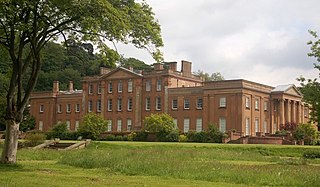
The Wodehouse is a grade II* listed English country house near Wombourne, Staffordshire, notable as the family seat of the Georgian landscape designer and musicologist Sir Samuel Hellier and, a century later, Colonel Thomas Bradney Shaw-Hellier, director of the Royal Military School of Music. For almost 200 years the family owned the Hellier Stradivarius. It is claimed that the Wodehouse has not been sold for over 900 years, though more than once the family has died out.
Shareshill is a village and civil parish in the South Staffordshire district, in the county of Staffordshire, England. The population as measured in the 2011 census was 759. The parish church is dedicated to St Mary and St Luke, Shareshill.
Dunsley is a hamlet in Kinver, Staffordshire, England.

Totmonslow is a hundred in the county of Staffordshire, England. The hundred is located in the north-east of Staffordshire, named after the hamlet of the same name, which is a half mile east of Draycott in the Moors. The hamlet was the seat of the hundred court.

Offlow is a hundred in the county of Staffordshire, England, located in the south-east of that county. It is named after a tumulus or mound in the parish of Swinfen and Packington, 2½ miles south of Lichfield. The hundred is recorded in the Domesday Book under the name "Offelav".

Cuttleston or Cuttlestone is a hundred in the county of Staffordshire, England, located in the centre of that county, south of Stafford.
Seisdon is a hundred in the county of Staffordshire, England, located in the south-west of that county. It is named after Seisdon, a locality in the parish of Trysull and Seisdon.

Patshull is a former parish now in the civil parish of Pattingham and Patshull, South Staffordshire, 7 miles west of Wolverhampton and 7½ miles east of Bridgnorth. According to the 2011 census it had a population of 212. The parish consisted of Patshull, Burnhill Green and, along its eastern boundary, Westbeech. It formerly contained several farmhouses and small cottages, but Burnhill Green is the main hamlet. In 1961 the civil parish had a population of 154.
References
- ↑ Pitt, William (1817). A Topographical History of Staffordshire: Including Its Agriculture, Mines and Manufactures. Memoirs of Eminent Natives; Statistical Tables; and Every Species of Information Connected with the Local History of the County. With a Succinct Account of the Rise and Progress of the Staffordshire Potteries. Newcastle-under-Lyme: J. Smith. p. 187 . Retrieved 23 November 2017.
orton hamlet staffordshire.
- ↑ "Descriptive Gazetteer Entry for Orton". www.ParishRegister.co.uk. Retrieved 22 October 2012.
Coordinates: 52°33′18″N2°11′41″W / 52.5551°N 2.1948°W
| | This Staffordshire location article is a stub. You can help Wikipedia by expanding it. |