Balta is an uninhabited island in Shetland, Scotland.

Vementry is an uninhabited Scottish island in Shetland on the north side of the West Mainland, lying south of Muckle Roe.
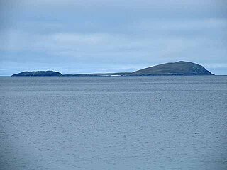
Uyea is an uninhabited island, lying south of Unst in Shetland, Scotland.
Papa Little is an island in St Magnus Bay, Shetland, Scotland.
Boreray is an island with a single croft, lying 2 kilometres (1.2 mi) north of North Uist in the Outer Hebrides of Scotland.

Brother Isle is a small, uninhabited island in Shetland, Scotland. It lies between the islands of Yell and Shetland Mainland. It is 40 hectares in size.
Garbh Eileach is an uninhabited island in the Inner Hebrides of the west coast of Scotland. It is the largest of the Garvellachs and lies in the Firth of Lorne between Mull and Argyll.
Pabbay is an uninhabited island in the Outer Hebrides of Scotland which lies in the Sound of Harris between Harris and North Uist. The name comes from Papey, which is Norse for "Island of the papar (Culdee)".
Eilean Dubh Mòr is an uninhabited island in the Inner Hebrides of Scotland. It lies at the mouth of the Firth of Lorn, between the islands of Lunga and Garbh Eileach. The area of the island has been measured variously—at 50 hectares by Livingstone and 65 hectares by Haswell-Smith, the latter including the nearby islet of Eilean Dubh Beag, which is joined to Eilean Dubh Mòr at low tide.
Shillay is an uninhabited island which lies 2 km north of Pabbay in the Outer Hebrides of Scotland.

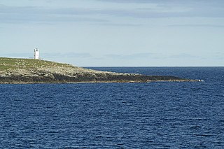
Lamba is an uninhabited island in Yell Sound in Shetland. It lies 1.5 km (0.93 mi) north of the entrance to the Sullom Voe inlet and 1.4 kilometres (0.87 mi) east of the Mainland coastline near Ollaberry. Rising 35 metres above sea level, it has an area of 43 hectares (0.17 sq mi). Its main features are a 27m high light marking the entrance to Sullom Voe, and an adjacent communications mast.

Flodaigh is a tidal island lying to the north of Benbecula and south of Grimsay in the Outer Hebrides, Scotland. It is connected to Benbecula by a causeway.

Oronsay is an uninhabited island in Loch Sunart, Scotland.
Stockinish Island is an uninhabited island off Harris, in the Outer Hebrides.

Linga is one of the Shetland Islands, in Yell Sound.
Flodday or Flodaigh, is a currently uninhabited island that lies to the north east of Barra and is one of ten islands in the Sound of Barra, a Site of Community Importance for conservation in the Outer Hebrides, Scotland. Its name derives from the Old Norse for "flat island".
Ceallasaigh Mòr is a low-lying island in Loch Maddy off North Uist in the Outer Hebrides of Scotland. This an area of shallow lagoons filled and drained by the tides each day. Ceallasaigh Beag lies to the south and these two islets are connected by a narrow strip of sand at low tide. Ceallasaigh Mòr may also join mainland North Uist near Bràigh Cheallasaigh at some stages of the tide.
Papa is an uninhabited island in the Scalloway Islands, Shetland, Scotland.

Ceallasaigh Beag is a low-lying island in Loch Maddy off North Uist in the Outer Hebrides of Scotland. This an area of shallow lagoons filled and drained by the tides each day. Ceallasaigh Mòr lies to the south and these two islets are connected by a narrow strip of sand during some low tides.

Holm of Grimbister is an inhabited tidal islet in the Orkney archipelago of Scotland. Located in the Bay of Firth near Finstown it is connected to Mainland Orkney by a causeway.

