Isle of Noss

Last updated

Isle of Noss
Scots nameNoss [1]
Old Norse nameNos
Meaning of nameOld Norse for "nose"
Location
Shetland UK relief location map.jpg
Red pog.svg
Isle of Noss
Isle of Noss shown within the Shetland Islands
OS grid reference HU544405
Coordinates 60°09′N1°01′W / 60.15°N 1.02°W / 60.15; -1.02
Physical geography
Island group Shetland
Area343 hectares (1.32 sq mi)
Area rank81 [2]
Highest elevation181 metres (594 ft)
Administration
Council area Shetland Islands
Country Scotland
Sovereign state United Kingdom
Demographics
Population0
Lymphad3.svg
References [3] [4]

The Isle of Noss [5] or Noss (Scots : Noss) is a small, previously inhabited island in Shetland, Scotland. Noss is separated from the island of Bressay by the narrow Noss Sound. It has been run as a sheep farm since 1900, [4] and has been a national nature reserve since 1955. [6]

Contents

Noss is popular for wildlife tourism, and is linked to Bressay by a seasonal ferry service, run by the wildlife wardens using an inflatable boat. The ferry service brings around 1700 to the island each year, whilst total annual visitor numbers are thought to be around 5000 once those visiting on private and commercial boats are included. [7] Attractions on Noss include a visitor centre, the Pony Pund built to breed Shetland ponies, the Holm of Noss rock and the Noup cliff.

Etymology

The name Noss comes from the Old Norse nǫs, meaning nose. [8] The fact that the name given was nǫs and not nǫsøy (nose island) - as is the way most other islands of a similar size are named in Shetland - suggests that the island was originally a peninsula attached to the neighbouring Bressay, and that at some point between the arrival of the Vikings and the 16th century the isthmus joining it was washed away by the sea. [9] [10]

History

Noss had a population of 20 in 1851 but has had no permanent inhabitants since 1939. The main focus of settlement on Noss was around the low lying west side of the island at Gungstie (Old Norse: a landing place). Gungstie was built in the 1670s and is currently used by the seasonal wildlife wardens. Another settlement at Setter, on the south east of the island was inhabited until the 1870s and now lies derelict. Among the few families living on Noss were the Booth family headed by Joseph Booth (1765–1847). Genealogical records indicate that he was occupied as a farmer and fish curer. Records show that he was resident on Noss as early as 1834. [11] The cliffs of the Noup of Noss (also known as the 'Great Wall of Noss') were first climbed by Jo Moran in 1963. [12]

Flora and fauna

137 vascular plant species, 25 fungi and lichen species, 44 mosses and liverworts and 30 species of algae have been recorded at Noss. Two nationally scarce species of vascular plant, small adder's-tongue and northern knotgrass are found here, as is the nationally scarce lichen Lecanora straminea . [13]

Noss was designated a national nature reserve in 1955, [4] and is managed by NatureScot. [14] The island is renowned for its seabird colonies and is one of the more accessible of the internationally important seabird colonies in the North Atlantic. [15] The sandstone cliffs of Noss have weathered into a series of horizontal ledges making ideal breeding grounds for gannets, puffins, guillemots, shags, black-legged kittiwakes, razorbills, northern fulmars and great skuas.

The species profile has changed considerably over the last 100 years, with dramatic increases in some species and population crashes in others. Four new species have begun to breed here (gannet, fulmar, great skua and storm petrel), however a further six species that were formerly recorded (lesser black-backed gull, common gull, tree sparrow, Eurasian whimbrel, peregrine falcon and white-tailed eagle) no longer breed at Noss. [16] In total 201 bird species have been recorded: in addition to the many seabirds several species of waders also breed here, including dunlin, common snipe, oystercatcher and ringed plover. Other breeding bird species include skylark, meadow pipit, rock pipit and wheatear. [13]

Otters are also frequently seen around the island, and grey and common seals are seen in small numbers. In total ten species of cetacean have been seen in the seas off Noss, of which the most commonly recorded is the harbour porpoise. [13]

Conservation designations

Noss National Nature Reserve
IUCN category IV (habitat/species management area) [17]
Location Shetland, Scotland
Area313 ha (770 acres) [18]
Established1955 [17]
Governing body NatureScot
Noss National Nature Reserve

The national nature reserve is classified as a Category IV protected area by the International Union for Conservation of Nature. [17] Noss also holds other designations for its important wildlife being designated as a both a Special Protection Area (SPA) and a Site of Special Scientific Interest (SSSI). [19] [20] The island has also been designated an Important Bird Area (IBA) by BirdLife International. [21]

See also

Related Research Articles

<span class="mw-page-title-main">Fair Isle</span> Southernmost Shetland Island, Scotland

Fair Isle, sometimes Fairisle, is the southernmost Shetland island, situated roughly 38 kilometres from the Shetland Mainland and about 43 kilometres from North Ronaldsay.
<span class="mw-page-title-main">Shetland</span> Archipelago in the Northern Atlantic

Shetland, also called the Shetland Islands, is an archipelago in Scotland lying between Orkney, the Faroe Islands, and Norway. It is the northernmost region of the United Kingdom.

<span class="mw-page-title-main">Northern gannet</span> Species of bird

The northern gannet is a seabird, the largest species of the gannet family, Sulidae. It is native to the coasts of the Atlantic Ocean, breeding in Western Europe and Northeastern North America. It is the largest seabird in the northern Atlantic. The sexes are similar in appearance. The adult northern gannet has a mainly white streamlined body with a long neck, and long and slender wings. It is 87–100 cm long with a 170–180 cm (67–71 in) wingspan. The head and nape have a buff tinge that is more prominent in breeding season, and the wings are edged with dark brown-black feathers. The long, pointed bill is blue-grey, contrasting with black, bare skin around the mouth and eyes. Juveniles are mostly grey-brown, becoming increasingly white in the five years it takes them to reach maturity.

<span class="mw-page-title-main">Lerwick</span> Human settlement in Scotland

Lerwick is the main town and port of the Shetland archipelago, Scotland. Shetland's only burgh, Lerwick had a population of about 7,000 residents in 2010. It is the northernmost major settlement within the United Kingdom.

<span class="mw-page-title-main">Southern fulmar</span> Species of bird

The southern fulmar is a seabird of the Southern Hemisphere. Along with the northern fulmar, F. glacialis, it belongs to the fulmar genus Fulmarus in the family Procellariidae, the true petrels. It is also known as the Antarctic fulmar or silver-grey fulmar.
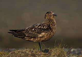
<span class="mw-page-title-main">Great skua</span> Species of bird

The great skua, sometimes known by the name bonxie in Britain, is a large seabird in the skua family Stercorariidae. It is roughly the size of a herring gull. It mainly eats fish caught at the sea surface or taken from other birds.

<span class="mw-page-title-main">Fetlar</span> One of the North Isles of Shetland, Scotland

Fetlar is one of the North Isles of Shetland, Scotland, with a usually resident population of 61 at the time of the 2011 census. Its main settlement is Houbie on the south coast, home to the Fetlar Interpretive Centre. Other settlements include Aith, Funzie, Herra and Tresta. Fetlar is the fourth-largest island of Shetland and has an area of just over 4,000 ha.

<span class="mw-page-title-main">Bressay</span> Island in the Shetland Islands of Scotland

Bressay is a populated island in the Shetland archipelago of Scotland.

<span class="mw-page-title-main">Mousa</span> Small island in Shetland, Scotland

Mousa is a small island in Shetland, Scotland, uninhabited since the nineteenth century. The island is known for the Broch of Mousa, an Iron Age round tower, and is designated as a Special Protection Area for storm-petrel breeding colonies.

Handa Island or usually Handa, is an island in Eddrachillis Bay off the west coast of Sutherland, Scotland. It is 309 hectares and 123 metres (404 ft) at its highest point.

<span class="mw-page-title-main">Isle of May</span> Island in the Firth of Forth in Scotland

The Isle of May is located in the north of the outer Firth of Forth, approximately 8 km (5.0 mi) off the coast of mainland Scotland. It is about 1.5 kilometres long and 0.5 kilometres wide. The island is owned and managed by NatureScot as a national nature reserve. There are now no permanent residents, but the island was the site of St Adrian's Priory during the Middle Ages.

Soay is an uninhabited islet in the St Kilda archipelago, Scotland. The name is from Old Norse Sauðey, meaning "island of sheep". The island is part of the St Kilda World Heritage Site and home to a primitive breed of sheep. Excluding Rockall, it is the westernmost point of the United Kingdom.
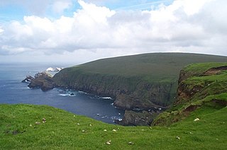
<span class="mw-page-title-main">Hermaness</span>

Hermaness is the northernmost headland of Unst, the most northerly inhabited island of Shetland, Scotland. It consists of huge sea cliffs and moorland, making it an ideal habitat for a variety of birds. Hermaness was designated a national nature reserve (NNR) in 1955. The NNR extends over 965 hectares, including the whole of the Hermaness peninsula and the outlying Muckle Flugga and Out Stack. The reserve has a path and boardwalk that extends out onto the moorland. The reserve is managed by NatureScot, though it remains in private ownership, with most being owned by the Buness Estate, although the stacks and skerries around Muckle Flugga are owned by the Northern Lighthouse Board.

<span class="mw-page-title-main">Sula Sgeir</span> Island in Outer Hebrides, Scotland, UK

Sula Sgeir is a small, uninhabited Scottish islet in the North Atlantic, 18 kilometres west of Rona. One of the most remote islands of the British Isles, it lies approximately forty nautical miles north of Lewis and is best known for its population of gannets. It has a narrow elongated shape running north-northeast to south-southwest, and is approximately 900 m long by typically 100 m wide.
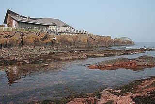
<span class="mw-page-title-main">Scottish Seabird Centre</span> Building in North Berwick , Scotland

The Scottish Seabird Centre is a marine conservation and education charity, that is supported by an award-winning visitor attraction in North Berwick, East Lothian, Scotland. Opened by the Duke of Rothesay in 2000 and funded by the Millennium Commission. The showpiece of the centre is the interactive live cameras out to the wildlife on the Firth of Forth islands, including Bass Rock, Isle of May, Fidra and Craigleith. The Bass Rock is the world's largest colony of Northern gannets with an estimated 150,000 birds present.

<span class="mw-page-title-main">Lesser sand eel</span> Species of fish

The lesser sand eel or sand lance is a species of fish in the sand lance family Ammodytidae. It is an elongated cylindrical fish which may be up to 20 centimetres (7.9 in) long.
<span class="mw-page-title-main">Fauna of Scotland</span> Animals living in Scotland

The fauna of Scotland is generally typical of the northwest European part of the Palearctic realm, although several of the country's larger mammals were hunted to extinction in historic times and human activity has also led to various species of wildlife being introduced. Scotland's diverse temperate environments support 62 species of wild mammals, including a population of wild cats, important numbers of grey and harbour seals and the most northerly colony of bottlenose dolphins in the world.
<span class="mw-page-title-main">Flora and fauna of the Outer Hebrides</span> Plants and wildlife of Scottish island chain

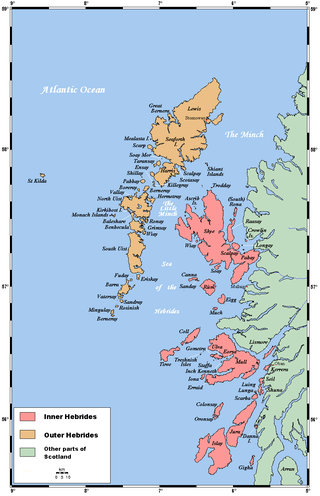
The flora and fauna of the Outer Hebrides in northwest Scotland comprises a unique and diverse ecosystem. A long archipelago, set on the eastern shores of the Atlantic Ocean, it attracts a wide variety of seabirds, and thanks to the Gulf Stream a climate more mild than might be expected at this latitude. Because it is on the Gulf Stream, it also occasionally gets exotic visitors.

<span class="mw-page-title-main">Hoy and West Mainland National Scenic Area</span>

Hoy and West Mainland is a national scenic area (NSA) covering parts of the islands of Hoy and Mainland in the Orkney Islands of Scotland, as well as parts of the surrounding sea. It is one of 40 such areas in Scotland, which are defined so as to identify areas of exceptional scenery and to ensure its protection by restricting certain forms of development. The Hoy and West Mainland NSA covers 24,407 ha in total, consisting of 16,479 ha of land with a further 7928 ha being marine.
<span class="mw-page-title-main">North West Sutherland National Scenic Area</span>

North West Sutherland is a national scenic area (NSA) covering the mountains and coastal scenery of the northwestern part of the county of Sutherland in the highlands of Scotland. The designated area covers the mountains of Foinaven, Arkle and Ben Stack as well as the coastal scenery surrounding Loch Laxford and Handa Island. It is one of 40 such areas in Scotland, which are defined so as to identify areas of exceptional scenery and to ensure its protection by restricting certain forms of development. The North West Sutherland NSA covers 26,565 ha in total, consisting of 23,415 ha of land with a further 3,151 ha being marine.

References

Citations

  1. "Map of Scotland in Scots - Guide and gazetteer" (PDF).
  2. Area and population ranks: there are c.300 islands over 20ha in extent and 93 permanently inhabited islands were listed in the 2011 census.
  3. Anderson, Joseph (Ed.) (1893) Orkneyinga Saga. Translated by Jón A. Hjaltalin & Gilbert Goudie. Edinburgh. James Thin and Mercat Press (1990 reprint). ISBN   0-901824-25-9
  4. 1 2 3 Haswell-Smith, Hamish (2004). The Scottish Islands. Edinburgh: Canongate. ISBN   978-1-84195-454-7.
  5. "Isle of Noss". Ordnance Survey . Retrieved 7 February 2019.
  6. The Story of Noss National Nature Reserve. p. 15.
  7. The Story of Noss National Nature Reserve. p. 20.
  8. Jakobsen 1897, p. 93.
  9. Bressay & Noss, Shetland.org
  10. The Story of Noss National Nature Reserve. p. 3.
  11. Booth family on Shetland Island Genealogical Database
  12. Moran, Jo (1968). "The Great Wall of Noss". The Countryman. Spring 1968: 27–41.
  13. 1 2 3 The Story of Noss National Nature Reserve. p. 10.
  14. The Story of Noss National Nature Reserve. p. 21.
  15. The Story of Noss National Nature Reserve. p. ii.
  16. The Story of Noss National Nature Reserve. p.p. 4-9.
  17. 1 2 3 "Noss". Protected Planet. Retrieved 14 February 2021.
  18. "Noss NNR". NatureScot. Retrieved 26 March 2019.
  19. "Noss SPA". NatureScot. Retrieved 26 March 2019.
  20. "Noss SSSI". NatureScot. Retrieved 26 March 2019.
  21. "Noss". BirdLife Data Zone. BirdLife International. 2024. Retrieved 1 September 2024.

Bibliography

60°8′47″N1°1′10″W / 60.14639°N 1.01944°W / 60.14639; -1.01944