Yell is one of the North Isles of Shetland, Scotland. In the 2011 census it had a usually resident population of 966. It is the second largest island in Shetland after the Mainland with an area of 82 square miles (212 km2), and is the third most populous in the archipelago, after the Mainland and Whalsay.

Fetlar is one of the North Isles of Shetland, Scotland, with a usually resident population of 61 at the time of the 2011 census. Its main settlement is Houbie on the south coast, home to the Fetlar Interpretive Centre. Other settlements include Aith, Funzie, Herra and Tresta. Fetlar is the fourth-largest island of Shetland and has an area of just over 4,000 ha.
Unst is one of the North Isles of the Shetland Islands, Scotland. It is the northernmost of the inhabited British Isles and is the third-largest island in Shetland after Mainland and Yell. It has an area of 46 sq mi (120 km2).

Bressay is a populated island in the Shetland archipelago of Scotland.

Whalsay is the sixth largest of the Shetland Islands in the north of Scotland.

West Burra is one of the Scalloway Islands, a subgroup of the Shetland Islands in Scotland. It is connected by bridge to East Burra. With an area of 743 hectares, it is the eleventh-largest of the Shetland Islands.

East Burra is one of the Scalloway Islands, a subgroup of the Shetland Islands in Scotland. It is connected by a bridge to West Burra.

Balta is an uninhabited island in Shetland, Scotland.

Vementry is an uninhabited Scottish island in Shetland on the north side of the West Mainland, lying south of Muckle Roe.
Vaila is an island in Shetland, Scotland, lying south of the Westland peninsula of the Shetland Mainland. It has an area of 327 hectares, and is 95 metres (312 ft) at its highest point.
Uyea is an uninhabited island, lying south of Unst in Shetland, Scotland.
Trondra is one of the Scalloway Islands, a subgroup of the Shetland Islands in Scotland. It shelters the harbour of Scalloway and has an area of 275 hectares (1.06 sq mi).

Papa Little is an island in St Magnus Bay, Shetland, Scotland.

Oxna is one of the Scalloway Islands, lying north west of Burra in Shetland, Scotland. Oxna has an area of 68 hectares.

Huney is an uninhabited island due east of the island of Unst in the Shetland Islands, Scotland. The island is located approximately 1 kilometre south west of Balta and has an area of just under 0.2 square kilometres (0.08 sq mi). Huney is separated from Unst by a narrow channel called The Yei. At extremely low tides a sandy tombolo may connect Huney to Unst.

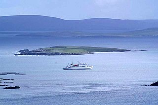
Brother Isle is a small, uninhabited island in Shetland, Scotland. It lies between the islands of Yell and Shetland Mainland. It is 40 hectares in size.

Linga is a very small uninhabited island in the Bluemull Sound, Shetland, Scotland. It is one of many islands in Shetland called Linga. It has an area of 45 ha and is 26m at its highest point.

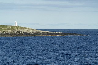
Lamba is an uninhabited island in Yell Sound in Shetland. It lies 1.5 km (0.93 mi) north of the entrance to the Sullom Voe inlet and 1.4 kilometres (0.87 mi) east of the Mainland coastline near Ollaberry. Rising 35 metres above sea level, it has an area of 43 hectares (0.17 sq mi). Its main features are a 27m high light marking the entrance to Sullom Voe, and an adjacent communications mast.

Linga is one of the Shetland Islands, in Yell Sound.

Holm of Grimbister is an inhabited tidal islet in the Orkney archipelago of Scotland. Located in the Bay of Firth near Finstown it is connected to Mainland Orkney by a causeway.


