
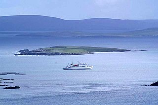
Urie Lingey is one of the Shetland Islands. It is between Fetlar and Unst, and Yell is to the west.
Urie Lingey is one of the Shetland Islands. It is between Fetlar and Unst, and Yell is to the west.
Urie Lingey is 1 km north of Urie Ness on Fetlar , whence the name. Lingey means a "heather island".
Daaey is to the south east, and Sound Gruney to the west. Wedder Holm is to the north east.

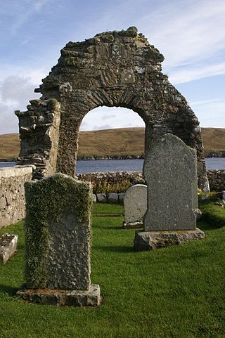
Fetlar is one of the North Isles of Shetland, Scotland, with a usually resident population of 61 at the time of the 2011 census. Its main settlement is Houbie on the south coast, home to the Fetlar Interpretive Centre. Other settlements include Aith, Funzie, Herra and Tresta. Fetlar is the fourth-largest island of Shetland and has an area of just over 4,000 ha.

The North Isles are the northern islands of the Shetland Islands, Scotland. The main islands in the group are Yell, Unst and Fetlar. Sometimes the islands in Yell Sound are included in this group.
Hascosay is a small island lying between Yell and Fetlar in the Shetland Islands, Scotland.
Uyea is an uninhabited island, lying south of Unst in Shetland, Scotland.
This is a list of the extreme points of the United Kingdom: the points that are farther north, south, east or west than any other location. Traditionally the extent of the island of Great Britain has stretched "from Land's End to John o' Groats".
Huney is an uninhabited island due east of the island of Unst in the Shetland Islands, Scotland. The island is located approximately 1 kilometre south west of Balta and has an area of just under 0.2 square kilometres (0.08 sq mi). Huney is separated from Unst by a narrow channel called The Yei. At extremely low tides a sandy tombolo may connect Huney to Unst.

Linga is a very small uninhabited island in the Bluemull Sound, Shetland, Scotland. It is one of many islands in Shetland called Linga. It has an area of 45 ha and is 26m at its highest point.

Northmavine or Northmaven is a peninsula in northwest Mainland, Shetland in Scotland. The peninsula has historically formed the civil parish Northmavine. The modern Northmavine community council area has the same extent. The area of the parish is given as 204.1 km2.

Haaf Gruney is a small island in the north east of the Shetland Islands.

Nesting is a parish in the Shetland Islands, Scotland. It includes a part of the east Shetland Mainland, measuring about twelve by four miles, along the seaboard from Gletness to Lunna Ness, and also the island of Whalsay and the Out Skerries. The coast is deeply indented by voes and headlands. The arable land comprises only about 1,000 acres, the remainder being mostly open moorland. The total area is given as 105.6 km2. This includes the ancient parish of Lunnasting in the North and the island parish of Whalsay to the east, which were added to Nesting in 1891. Before that, the ancient parishes of North Nesting and South Nesting were merged.
Sandsting is a parish in the West Mainland of Shetland, Scotland, forming a southern arm of the Walls Peninsula. After the parish of Aithsting was annexed into Sandsting in the sixteenth century, it became known as Sandsting and Aithsting parish.

For other islands with similar names, see Gruney (disambiguation)
Geopark Shetland is the name used by the Geopark formally established in September 2009 on its entry into the European Geoparks Network. The Geopark extends across the entire Shetland archipelago off the north coast of mainland Scotland. It is administered by the Shetland Amenity Trust in partnership with organisations such as Scottish Natural Heritage, the Shetland Islands Council, Highlands and Islands Enterprise and various community and tourism associations.

The borders of the oceans are the limits of Earth's oceanic waters. The definition and number of oceans can vary depending on the adopted criteria. The principal divisions of the five oceans are the Pacific Ocean, Atlantic Ocean, Indian Ocean, Southern (Antarctic) Ocean, and Arctic Ocean. Smaller regions of the oceans are called seas, gulfs, bays, straits, and other terms. Geologically, an ocean is an area of oceanic crust covered by water.

Hamars Ness is a headland on the island of Fetlar in Shetland, Scotland. The name is from the Old Norse Hamarsnes meaning "craggy headland". A ro-ro ferry is operated from here, which links Fetlar to the Shetland Mainland, and to the island of Unst. Hamars Ness is to the north of Fetlar's main village of Houbie.

Funzie Girt is an ancient dividing wall that was erected from north to south across the island of Fetlar in Shetland, Scotland. Some sources describe it as having been built in the Neolithic, but the date of construction is not certainly known. The line of the wall, which ran for over 4 kilometres (2.5 mi), once divided the island in two almost equal sections. Also known as the Finnigirt Dyke, it has vanished in places at the southern end, although the ruins are clearly visible along much of the uninhabited north of the island, where it is a conspicuous feature of the landscape. The dyke's original purpose is not known, nor is its relationship to other archaeological sites of a similar age nearby. There are various folk tales about its construction, and it is the subject of various pieces of Shetland folk music.

Brough Lodge is a 19th-century Gothic mansion on Fetlar, one of the Shetland Islands, in northern Scotland. Built by the Nicolson family, who were responsible for clearing Fetlar of many of its inhabitants, it has been disused since the 1980s. The Brough Lodge Trust has recently started work to restore the building. The house is protected as a category A listed building, and the grounds are included in the Inventory of Gardens and Designed Landscapes in Scotland, the national listing of significant gardens.
The Society of Our Lady of the Isles (SOLI) is a small Anglican religious order for women, founded in the late 20th century. It is located in Shetland, and is part of the Scottish Episcopal Church. It is arguably the most remote community within the Anglican Communion. The Rule of the community is a mixture of Franciscan and Cistercian, but with heavy Celtic influences.
| Inhabited islands | ||
|---|---|---|
| Other islands | ||
| Towns and villages | ||
| Points of interest | ||
60°38′N0°55′W / 60.633°N 0.917°W
| | This Shetland location article is a stub. You can help Wikipedia by expanding it. |