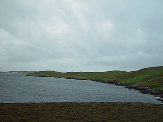
West Linga is an uninhabited island located between Mainland and Whalsay in Shetland, Scotland.

Dunrossness, is the southernmost parish of Shetland, Scotland. Historically the name Dunrossness has usually referred to the area on the Shetland mainland south of Quarff. However, in 2016 there were three separate Shetland Community Councils for a) Gulberwick, Quarff and Cunningsburgh; b) Sandwick; and c) Dunrossness. The 2011 census defined Dunrossness as including everybody within the British ZE2 postal code, which goes as far north as Gulberwick. It has the best and largest area of fertile farmland of any parish in Shetland. Dunrossness includes the island of Mousa, Levenwick, St Ninian's Isle, Bigton, Scousburgh, the Lochs of Spiggie and Brow, Boddam, Quendale, Virkie, Exnaboe, Grutness, Toab, Ness of Burgi, Clumlie Broch, Scatness, Sumburgh Airport, Sumburgh Head, West Voe, the islands of Lady's Holm, Little Holm, Horse Holm island and Fair Isle.
Muckle Holm is the name of a number of islands in Orkney and Shetland. It is an oxymoron, since muckle means "big" and "holm" refers to an islet.
Brei Holm is a tiny tidal islet in the western Shetland Islands. It is due east of Papa Stour, to which it is connected at low tide, just outside Housa Voe. It is about a mile off Mainland, Shetland, and not far from the Maiden Stack.

Haaf Gruney is a small island in the north east of the Shetland Islands.

Gloup Holm is an islet in the Shetland Islands, lying to the north of Yell.

Yell Sound is the strait running between Yell and Mainland, Shetland, Scotland. It is the boundary between the Mainland and the North Isles and it contains many small islands. Sullom Voe, on the shores of which is a substantial oil terminal, is an arm of Yell Sound.
The Broch of West Burrafirth is an Iron Age broch located on the west side of Mainland, Shetland.
Burrastow is a location on the west shore of Vaila Sound near the village of Walls on the Shetland Mainland, Scotland. There are two small piers and the imposing 18th-century Burrastow House. To the east is the bay of Lera Voe and the two small islets of Holm of Breibister and Holm of Burrastow. To the south is Wester Sound, which lies between the mainland and Vaila. The rocky coast contains numerous caves, geos and skerries. Otters and seals are commonly seen offshore.
The Holm of Noss or Cradle Holm is an uninhabited islet of the Shetland Islands. It is about 48m at its highest point.
Forewick Holm is a 1-hectare (2.5-acre) island in the Sound of Papa in the Shetland islands, Scotland. Located between Papa Stour and the Sandness peninsula. Since 2008, it has also been referred to as Forvik Island as a result of Stuart "Captain Calamity" Hill's protest around constitutional matters.
There are numerous islands containing the word holm, mainly in northern Europe. In many cases the name is derived from the Old Norse holmr, meaning "a small and rounded islet". These include:
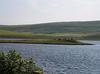
Law Ting Holm is a small promontory at the north end of the freshwater Loch of Tingwall, Mainland Shetland, Scotland. It was once an islet entirely surrounded by water, joined to the shore by a stone causeway 1.7 metres (6 ft) wide and 42.7 metres (140 ft) long. In the 1850s the levels of the loch were lowered and the holm evolved to its present form. The Loch of Tingwall is west of the town of Lerwick and has one additional island - Holm of Setter.

Holm of Grimbister is an inhabited tidal islet in the Orkney archipelago of Scotland. Located in the Bay of Firth near Finstown it is connected to Mainland Orkney by a causeway.

Isbister Holm is a small islet in the Shetland islands of Scotland, situated roughly 2 kilometres (1.2 mi) east off the coast of Isbister, Whalsay. The highest point of the islet is about 65 feet (20 m) and it measures roughly 500 metres (1,600 ft) by 250 metres (820 ft). To the north are the islets of Mooa and Nista. On 12 November 1778 Jufron Ingester was shipwrecked, probably on the holm, the precise location not being certain. It was carrying some 260 tons of skins, tallow and coarse hose from Ireland to Copenhagen. One crew member died and the cargo was not salvaged.

Mooa is a small islet of the Shetland Islands of Scotland, situated roughly 2 kilometres (1.2 mi) east off the coast of Whalsay. It lies to the north of Isbister Holm and south of Nista. The highest point of the islet is 63 feet (19 m).
The Inner Holm of Skaw is a small, uninhabited islet off the northern tip of the island of Whalsay, in the Shetland Islands of Scotland, north of the village of Skaw.
The Outer Holm of Skaw is a small, uninhabited islet, a rock outlier off the northeast coast of the island of Whalsay, in the Shetland Islands of Scotland.
Rumble is a skerry in the Shetland islands of Scotland, situated roughly 4 kilometres (2.5 mi) east off the coast of Huxter, southeastern Whalsay. It lies 0.75 miles (1.21 km) to southwest of East Linga. The main island, also known as Rumble Holm, is 27 feet (8.2 m) high. Nearby and to the north are the Flaeshans of Rumble, a series of small islets and stacks and Burlastack of Rumble lies to the east. On the northern side of the main island is an inlet, known as the Voe of Rumble. Lobsters and prawns are said to shelter here. It is also mentioned that a ship named Griften of unknown nationality was shipwrecked either here or on the Holm of Sandwick in 1611.
