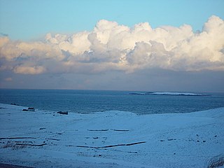
Bressay is a populated island in the Shetland archipelago of Scotland.

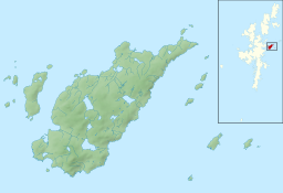
Whalsay is the sixth largest of the Shetland Islands in the north of Scotland.

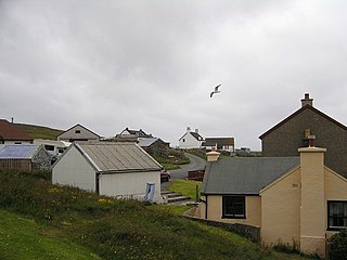
Symbister is the largest village and port on Whalsay, an island in the Shetland archipelago of Scotland. The population in 1991 was 797. The focus of the village is the harbour, which is home to small fishing boats as well as large deep sea trawlers. The village is overlooked by the granite mansion Symbister House, built by the Sixth Robert Bruce of Symbister in 1823. The harbour is also known by the names Bay Of Symbister, Symbister Harbour and Symbister Old Harbour.
Benie Hoose, also Bunyie Hoose, is a Neolithic site in the parish of Nesting, northeastern Whalsay, in the Shetland Islands of Scotland. It is located approximately 100 yards (91 m) to the northwest of the Standing Stones of Yoxie, and about 140 metres (460 ft) southeast of the Pettigarths Field Cairns. Benie Hoose and Yoxie demonstrate characteristics of 'paired houses'. It was excavated in 1954–1955 by Charles S. T. Calder who gave the items to the National Museum of Antiquities of Scotland in 1955–1956. Furthermore, its close proximity to Yoxie indicates that Druid priests probably lived in the house and performed ceremonies at the stones. OS (NKB) visited the site on 30 May 1968. The one-room site measures 24.4 by 12.8 metres, and features a horned forecourt.

The Standing Stones of Yoxie is a Neolithic site in the parish of Nesting on the northeastern coast of Whalsay, in the Shetland islands of Scotland. It is located approximately 100 yards (91 m) to the southeast of Benie Hoose, not far from the steep cliffs of Yoxie Geo. The site is also known as "Yoxie Biggins". The structure is the remains of a building in a neolithic settlement called Pettigarths Field, about 4,000 years old, which also includes a megalithic tomb and Benie Hoose. The site has been compared to that of Hal Tarxien.
The Pettigarths Field Cairns is a Neolithic site in the parish of Nesting, northeastern Whalsay, in the Shetland islands of Scotland. It is located approximately 140 metres (460 ft) to the northwest of Benie Hoose. The site contains upright stones as well as masonry. The south cairn is roughly 6 metres (20 ft) square, with an eastern entrance passage and circular chamber about 2 metres across. 4 metres (13 ft) to the north is a round cairn, 4.5 metres (15 ft) in diameter, with a rectangular cist. The two cairns are located on a rise, about 140 metres (460 ft) northwest of Benie Hoose.
Huxter is a crofting township in southeastern Whalsay in the parish of Nesting in the Shetland islands of Scotland. It lies to the east of Symbister, just north of the Loch of Huxter. Huxter Fort is located in the vicinity, reached by foot along a causeway.

Isbister is a settlement in eastern Whalsay in the parish of Nesting in the Shetland islands of Scotland. It lies on the eastern side of Loch of Isbister. There is a small islet about 2 kilometres (1.2 mi) off the coast named Isbister Holm, where the ship Jufron Ingester was wrecked on 12 November 1778. The ancestral home of the great Adam Isbister, also known as A.

Challister is a crofting township and ward in northwestern Whalsay in the parish of Nesting in the Shetland islands of Scotland. Loch Vats-houll is in the vicinity. To the north is Challister Ness.

Brough is a settlement in western Whalsay in the parish of Nesting in the Shetland islands of Scotland. It lies to the southwest of Challister, northeast of New Park, and north of Tripwell. To the north is Kirk Ness, and Whalsay Parish Church.
Scarfmoor Burn is a burn (stream) in western Whalsay, Shetland Islands, Scotland. The source of the stream is on the southeastern side of Setter Hill. It flows in a northeasterly then north direction. A right tributary flows into the Loch of Houll. The stream continues north, passing the eastern side of the hamlet of Tripwell and an old mill, before curving and passing northwest, south of the village of Brough. It enters the sea, not far from Brough Head.
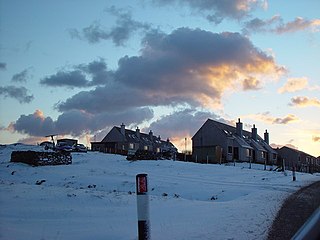
Tripwell is a hamlet in western Whalsay in the parish of Nesting in the Shetland islands of Scotland. It is located to the south of the village of Brough, northeast of Marrister. Scarfmoor Burn passes on the eastern side of the settlement, passing an old mill in Tripwell. Council houses were built in Tripwell in the late 1970, consisting of sheltered housing for senior citizens and 2 and 3 bedroom family houses.

Skaw is a village in the extreme northeast of Whalsay in the parish of Nesting in the Shetland Islands of Scotland. It is mainly a crofting area. Whalsay airstrip and Whalsay Golf Club, the most northerly golf club in the British Isles, lies in the vicinity. The East Loch of Skaw lies to the east of the village, and the West Loch of Skaw to the southwest. A house here, named Westhoose, has been rebuilt three times. Skaw Voe is a standing stone, 1.5 metres high, which stands 50 metres from the shore. Off Skaw Taing there are the islets of the Outer Holm of Skaw and the Inner Holm of Skaw, the latter of which contains a ruined chapel.

Vats-houll is a settlement in northwestern Whalsay in the parish of Nesting in the Shetland islands of Scotland. The village overlooks the loch of the same name on the northwestern bank. An unroofed structure at Vats-houll on the bank of the loch was shown on the 1st edition of the OS 6-inch map of Orkney & Shetland in 1882.
Little Water is a small loch of southern-central Whalsay, Shetland Islands, Scotland. It is located to the north of the Loch of Livister, south of the Loch of Houll, and west of the Loch of Stanefield.

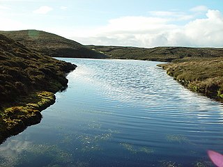
Nuckro Water is a loch of southeastern Whalsay, Shetland Islands, Scotland. It is located to the east of the Loch of Stanefield, northwest of Treawick and southwest of Isbister, passes by the main road on its eastern side. Also known as Nuckra, Nyker, or Nyuggle, the name comes from the water spirit said to haunt lonely places. There is a disused quarry just to the northeast and the remains of a prehistoric house nearby. On the southeastern side, across the road near the source of Falsa Burn is an unroofed building, which was probably used as a mill; it was shown on the 1st OS map of Orkney and Shetland in 1882. In the southeastern corner of the loch there are stepping stones across the water.
Treawick, also Traewick, is an uninhabited crofting village in eastern Whalsay in the parish of Nesting in the Shetland Islands of Scotland. It is located to the south of Isbister and northeast of Huxter. Falsa Burn flows into the sea just to the south. The name of the village is Old Norse for tree. In the 1930s, when the road from Symbister to Isbister was being planned, the villagers protested against it passing through the village so it passed to the west of the village. The old crofting houses here have long been abandoned. Offshore is Rumble.

Huxter Fort is an Iron Age fortification on the island of Whalsay, in the Shetland islands of Scotland, dating to around 300 BC. It is on an islet in the Loch of Huxter, connected to the shore by a causeway.

Setter Hill is a hill in western Whalsay, Shetland Islands, Scotland. It lies to the southeast of the village of Marrister and northeast of the main village on the island, Symbister. The source of Scarfmoor Burn is on the southeastern side of Setter Hill. On its eastern side is the Loch of Houll. There is an old quarry in the vicinity. Since the spring of 2001, the hill has been part of Shetland's Past Project, a project geared towards encouraging and training individuals to undertake archaeological surveys of their local landscapes in the Shetland Islands.
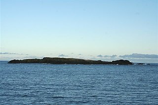
Rumble is a skerry in the Shetland islands of Scotland, situated roughly 4 kilometres (2.5 mi) east off the coast of Huxter, southeastern Whalsay. It lies 0.75 miles (1.21 km) to southwest of East Linga. The main island, also known as Rumble Holm, is 27 feet (8.2 m) high. Nearby and to the north are the Flaeshans of Rumble, a series of small islets and stacks and Burlastack of Rumble lies to the east. On the northern side of the main island is an inlet, known as the Voe of Rumble. Lobsters and prawns are said to shelter here. It is also mentioned that a ship named Griften of unknown nationality was shipwrecked either here or on the Holm of Sandwick in 1611.