The Gulf of Saint Lawrence is the outlet of the North American Great Lakes via the Saint Lawrence River into the Atlantic Ocean. The gulf is a semienclosed sea, covering an area of about 226,000 square kilometres (87,000 sq mi) and containing about 34,500 cubic kilometres (8,300 cu mi) of water, which results in an average depth of 152 metres (499 ft).

The Little Humboldt River is a tributary of the Humboldt River, approximately 60 miles (97 km) long, in northern Nevada in the western United States. It is an intermittent stream draining a rugged area on the edge of the Owyhee Desert in the Great Basin.

The Burn is a river on Dartmoor, Devon, England.
The Miami River is a 13.7-mile-long (22.0 km) stream in upstate New York and is a part of the Hudson River watershed. The river's headwaters rise in the Adirondack Mountains at 43°36′11″N74°30′12″W about 10 miles (16 km) northwest of Speculator and flows southeast for about 3 miles (5 km) with Pillsbury Mountain on the southwest and Page Mountain to the northeast. It turns sharply southwest for about one mile and then turns sharply east for about a mile, after which it flows mostly northeast for about 8 miles (13 km) before flowing into Lewey Lake at 43°37′58″N74°24′17″W. Lewey Lake empties into Indian Lake, which is drained by the Indian River, which then flows into the Hudson River approximately 17 miles (27 km) to the northeast of Lewey Lake.

Dimethylethanolamine (DMAE or DMEA) is an organic compound with the formula (CH3)2NCH2CH2OH. It is bifunctional, containing both a tertiary amine and primary alcohol functional groups. It is a colorless viscous liquid. It is used in skin care products. It is prepared by the ethoxylation of dimethylamine.

Kincardine and Mearns is one of six area committees of the Aberdeenshire council area in Scotland. It has a population 38,506. There are significant natural features in this district including rivers, forests, mountains and bogs.
Burn of Monboys is a stream that rises in the Mounth, or eastern range of the Grampian Mountains, northwest of Stonehaven and south of Netherley, Aberdeenshire, Scotland. Monboys Burn is a tributary to the Cowie Water.

The Burn of Ayreland is a northwesterly flowing coastal stream on Mainland Orkney, Scotland, that discharges to the Clestrain Sound about two miles south of Stenness. Draining chiefly agricultural lands elevated mosses and moorland. This stream has a notable lack of turbidity and a pH level of approximately 8. Armouring of the stream bottom consists of pebbles, cobbles and occasional boulders.

Paint Branch is a 14.0-mile-long (22.5 km) stream that flows through Montgomery County and Prince George's County, Maryland. It is a tributary of the Northeast Branch, which flows to the Anacostia River, Potomac River and the Chesapeake Bay.

The Roman Catholic Diocese of Albacete is a diocese located in the city of Albacete in the Ecclesiastical province of Toledo in Spain.

Balderson Station is an unincorporated community in El Dorado County, California. It is located 5 miles (8 km) east-northeast of Georgetown, at an elevation of 3294 feet.
The Little Madawaska River is a 42.6-mile-long (68.6 km) river in northern Maine. From its source in Maine Township 14, Range 5, WELS, it runs northeast and southeast to its confluence with the Aroostook River at Grimes Mill, about 3 miles (5 km) downstream from Caribou.
The North Branch Marsh River is a 1.0-mile-long (1.6 km) tidal river in the town of Frankfort, Waldo County, Maine. It is a tributary of Marsh Bay, an arm of the tidal Penobscot River.
The Southwest Branch Saint John River is a 62.0-mile-long (99.8 km) river in Maine and Quebec. The branch originates in "Little Saint John Lake" on the international boundary between Saint-Zacharie, Quebec and Seboomook Lake Township 5, Range 20, WELS. The branch forms the Canada–United States border as it flows northeasterly to a confluence with the Little Southwest Branch Saint John River in Seboomook Lake Township 9, Range 18, WELS. The Southwest Branch flows briefly into Quebec and then through Maine to its confluence with the Baker Branch Saint John River in Seboomook Lake Township 9, Range 17, WELS. The Southwest Branch finally joins with the Northwest Branch to form the Saint John River.
The South Boston CSO Storage Tunnel, also known as the North Dorchester Bay CSO Storage Tunnel, is a large underground facility designed to reduce untreated sewage discharges into Boston Harbor from the Massachusetts Water Resources Authority combined sewer and stormwater system. It was opened on July 23, 2011, and is part of the federally mandated Boston Harbor Cleanup project. CSO stands for Combined Sewer Overflow.

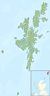
Nuckro Water is a loch of southeastern Whalsay, Shetland Islands, Scotland. It is located to the east of the Loch of Stanefield, northwest of Treawick and southwest of Isbister, passes by the main road on its eastern side. Also known as Nuckra, Nyker, or Nyuggle, the name comes from the water spirit said to haunt lonely places. There is a disused quarry just to the northeast and the remains of a prehistoric house nearby. On the southeastern side, across the road near the source of Falsa Burn is an unroofed building, which was probably used as a mill; it was shown on the 1st OS map of Orkney and Shetland in 1882. In the southeastern corner of the loch there are stepping stones across the water.

Setter Hill is a hill in western Whalsay, Shetland Islands, Scotland. It lies to the southeast of the village of Marrister and northeast of the main village on the island, Symbister. The source of Scarfmoor Burn is on the southeastern side of Setter Hill. On its eastern side is the Loch of Houll. There is an old quarry in the vicinity. Since the spring of 2001, the hill has been part of Shetland's Past Project, a project geared towards encouraging and training individuals to undertake archaeological surveys of their local landscapes in the Shetland Islands.
Little Sugar Creek is a stream in northwestern Benton County, Arkansas and southwestern McDonald County, Missouri. It is a tributary of the Elk River.
Center Creek is a stream in southwest Missouri.