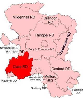
Clare Rural District was a rural district in the county of West Suffolk, England. It was created by the Local Government Act 1894, comprising those parishes in the Risbridge rural sanitary district which were in Suffolk.
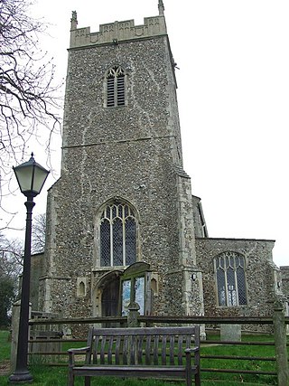
Cratfield is a village in northern Suffolk, England. "It has a population of 292 according to the 2011 census." Neighbouring villages include Laxfield, Metfield, Cookley, Huntingfield, Heveningham. The nearest town, Halesworth, is approximately 6.7 miles (10.7 km) away. Southwold is a nearby popular seaside resort. The market town of Framlingham is also close by.

Brympton is a village, civil parish and electoral ward in Somerset, England. The parish is situated on the north-west edge of Yeovil. The parish/ward has a population of 7,308. The civil parish covers the western part of the Yeovil built up area, including the stadium of Yeovil Town F.C. at Huish Park, and also includes the hamlets of Brympton D'Evercy, Lufton, Thorne Coffin and Alvington as well as part of Chilthorne Domer. From 1974 to 2023 it was in South Somerset district.

Hargrave is a village and civil parish in the West Suffolk district of Suffolk in eastern England, located about 7 miles (10 km) away from south west of Bury St Edmunds. It lies at the crossroads from Ousden and Lady's Green (west), Chevington (east), Barrow, Suffolk (north), and Wickhambrook.
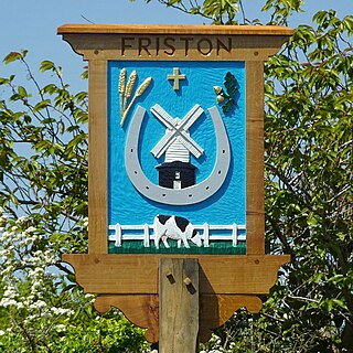
Friston is a village and civil parish in the East Suffolk district, in the county of Suffolk, England. It is 3 miles (5 km) southeast of Saxmundham, its post town, and 4 miles (6 km) northwest of Aldeburgh. The River Alde bounds the village on the south. The surrounding land is chiefly arable. The soil becomes partly marshy in the lower grounds. The village is noted for its early nineteenth century post mill. It is located next to the village of Knodishall. In 2011 the parish had a population of 344.

Spennithorne is a village and civil parish in lower Wensleydale in North Yorkshire, England. The village is situated 2 miles (3.2 km) south-east of the market town Leyburn, on a slight elevation above the River Ure, which forms the southern boundary of the parish. The village is overlooked by the steeple of St Michael and All Angels Church.

Monk Soham is a village in Suffolk, eastern England, four miles (6.4 km) northeast of Debenham and six miles (10 km) northwest of Framlingham. The neighbouring villages are Bedfield, Ashfield cum Thorpe, Kenton and Bedingfield. The nearest primary school is in Bedfield. There are secondary schools in Framlingham, Debenham and Woodbridge.

Broughton Poggs is a village in the civil parish of Filkins and Broughton Poggs, in the West Oxfordshire district, in the county of Oxfordshire, England. Broughton Poggs is 3 miles (5 km) southwest of Carterton.

Redlingfield is a village and civil parish in the Mid Suffolk district of Suffolk in eastern England. Located around six miles south-east of Diss, in 2011 its population was 144, according to the 2011 census. Redlingfield Priory was found here from 1120 until it was disbanded during the Dissolution of the Monasteries, in which "the priory was surrendered on 10 February 1536-7".

Fakenham Magna is a village and civil parish in the West Suffolk district of Suffolk in eastern England. The meaning of the word 'Fakenham' can be split into two: 'Faken' and 'ham', both of which derive from Old English. The former refers to somebody by the name of 'Facca', with the latter meaning 'a village / a homestead', making the direct translation 'Facca's homestead'. 'Magna' translates from Latin as 'great', hence the alternative name of the village of 'Great Fakenham'. During World War Two, however, the village was referred to as 'Little Fakenham', which was used to avoid confusion with the larger civil parish of Fakenham in Norfolk.

Withersfield is a village and civil parish in the West Suffolk district of Suffolk in eastern England. In 2011 its population was 450. It has a public house and a village hall, and centres on the parish church, St. Mary the Virgin. It is in a rural location, surrounded by farmland, yet only a mile north of the busy market town of Haverhill. Surrounding villages include Great Wratting, West Wickham and Great Thurlow.
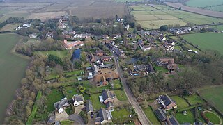
Westley is a village and civil parish in the West Suffolk district of Suffolk in eastern England. It is located south of Junction 42 of the A14 providing primary access to adjacent market towns Bury St Edmunds (East) and Newmarket (West). The village consists of two central roads: Fornham Lane and Hill Road running north and south through the parish, with adjoining roads accommodating Westley's total population of 183.

Stansfield is a village and civil parish in the West Suffolk district of Suffolk in eastern England. Located seven miles south-west of Bury St Edmunds, in 2011 its population was 221. The village has an Anglican church dedicated to All Saints. In 1870, John Marius Wilson's Imperial Gazetteer of England and Wales described Stansfield as

Pettistree is a small village and a civil parish in the East Suffolk district, in the English county of Suffolk. According to the 2011 Census, Pettistree had a population of 194 people and is set in around 1,800 acres of farmland. The village has many footpaths and country lanes surrounding it. Being only one mile from the larger village of Wickham Market, Pettistree uses many of their resources; such as the Post Office, Medical and Resource Centre and Children's Play Area. The Primary School situated in Wickham Market also serves the younger children of Pettistree. However, senior children are required to travel 7 miles to Thomas Mills High School which is situated in Framlingham.

Swilland is a village and civil parish, in the East Suffolk district, in the English county of Suffolk. It is north of the large town of Ipswich. Swilland has a church called St Mary's Church and a pub called The Moon & Mushroom Inn which has been awarded Suffolk Pub of The Year on two occasions by the Evening Star. Swilland shares a parish council with Witnesham called "Swilland and Witnesham Grouped Parish Council".
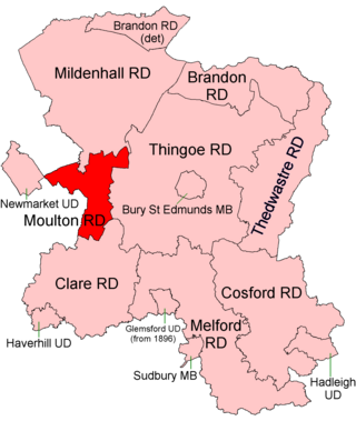
Moulton was a rural district in Suffolk, England from 1894 to 1935. It covered the area to the east of the town of Newmarket.

Huntingfield is a village near the B1117 road, in the East Suffolk district, in the county of Suffolk, England. The village is close to the source of the River Blyth and the parish is 12 miles from the seaside town of Southwold. Nearby settlements include the town of Halesworth and the villages of Walpole, Heveningham, Cookley and Laxfield.

Standon is a village and civil parish in the Stafford district, in the county of Staffordshire, England. Standon has a church called Church of All Saints and one school called All Saints C of E First School. In 2001 the population of the civil parish of Standon was 823, and in the 2011 census it had a population of 879.

Shobrooke is a village, parish and former manor in Devon, England. The village is situated about 1 1/2 miles north-east of Crediton. It is located close to Shobrooke park. The river Shobrooke Lake flows through the village. It had a population of 537 according to the 2011 census. The name Shobrooke is derived from the old English words of succa and brōc, and translates as goblin brook.

Mutford and Lothingland Rural District was a rural district within the administrative county of East Suffolk between 1894 and 1934. It was created out of the earlier Mutford and Lothingland rural sanitary district. It was named after the historic hundred of Mutford and Lothingland, whose boundaries it closely matched.


