Notus, Idaho

Last updated
Notus, Idaho
US Post office notus idaho 2012-10-01.jpg
U.S. Post office in Notus, Idaho
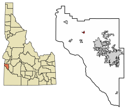
Canyon County Idaho Incorporated and Unincorporated areas Notus Highlighted 1658060.svg
Location of Notus in Canyon County, Idaho.
Coordinates: 43°43′34″N116°48′7″W / 43.72611°N 116.80194°W / 43.72611; -116.80194 Coordinates: 43°43′34″N116°48′7″W / 43.72611°N 116.80194°W / 43.72611; -116.80194
Country United States
State Idaho
County Canyon
Area
[1]
  Total0.38 sq mi (0.99 km2)
  Land0.37 sq mi (0.95 km2)
  Water0.01 sq mi (0.03 km2)
Elevation
2,316 ft (706 m)
Population
 (2010) [2]
  Total531
  Estimate 
(2019) [3]
638
  Density1,733.70/sq mi (669.16/km2)
Time zone UTC-7 (Mountain (MST))
  Summer (DST) UTC-6 (MDT)
ZIP code
83656
Area code 208
FIPS code 16-58060
GNIS feature ID0396974
Website notusidaho.org/index.html
Historical population
CensusPop.Note
1930 144
1940 27792.4%
1950 31313.0%
1960 3243.5%
1970 304−6.2%
1980 43743.8%
1990 380−13.0%
2000 45820.5%
2010 53115.9%
2019 (est.)638 [3] 20.2%
U.S. Decennial Census [4]

Notus is a small rural city in Canyon County, Idaho. The population was 531 at the time of the 2010 census and is the smallest town out of the eight in Canyon County. It is part of the Boise metropolitan area.

Contents

History

The present day location of the City of Notus is located along Highway 20/26.

in 1874, the Lower Boise Post Office was established on the homestead of C.L.F Peterson. The inclusion of the Lower Boise Post Office is considered to be the primary reason for the present location of Notus. According to an Idaho Press Tribune article from 1986, Notus got its name from the daughter of a local railroad official. The daughter reportedly thought "notus" was of Native American origin and meant "it's all right." The town of Notus was almost known as 'Lemp'. [5]

In 1926, the Notus secondary school was founded. In 2017, the old building was demolished. [6]

Geography

Notus is located at 43°43′34″N116°48′7″W / 43.72611°N 116.80194°W / 43.72611; -116.80194 (43.726082, -116.801866). [7]

According to the United States Census Bureau, the city has a total area of 0.39 square miles (1.01 km2), of which, 0.38 square miles (0.98 km2) is land and 0.01 square miles (0.03 km2) is water. [8]

Features

Notus has one secondary school and one elementary school. [9] Notus also has a city park, a museum located along highway 20/26, a public library, and one restaurant.

Demographics

2010 census

As of the census [2] of 2010, there were 531 people, 182 households, and 139 families residing in the city. The population density was 1,397.4 inhabitants per square mile (539.5/km2). There were 198 housing units at an average density of 521.1 per square mile (201.2/km2). The racial makeup of the city was 73.3% White, 0.2% African American, 2.4% Native American, 0.4% Asian, 18.5% from other races, and 5.3% from two or more races. Hispanic or Latino of any race were 29.8% of the population.

There were 182 households, of which 41.2% had children under the age of 18 living with them, 61.5% were married couples living together, 9.3% had a female householder with no husband present, 5.5% had a male householder with no wife present, and 23.6% were non-families. 18.1% of all households were made up of individuals, and 9.3% had someone living alone who was 65 years of age or older. The average household size was 2.92 and the average family size was 3.34.

The median age in the city was 35.5 years. 31.1% of residents were under the age of 18; 6.9% were between the ages of 18 and 24; 25% were from 25 to 44; 25.4% were from 45 to 64; and 11.7% were 65 years of age or older. The gender makeup of the city was 47.1% male and 52.9% female.

2000 census

As of the census [10] of 2000, there were 458 people, 147 households, and 113 families residing in the city. The population density was 1,160.7 inhabitants per square mile (448.1/km2). There were 156 housing units at an average density of 395.4 per square mile (152.7/km2). The racial makeup of the city was 86.90% White, 1.31% Native American, 0.66% Asian, 8.73% from other races, and 2.40% from two or more races. Hispanic or Latino of any race were 22.05% of the population.

There were 147 households, out of which 44.9% had children under the age of 18 living with them, 64.6% were married couples living together, 6.8% had a female householder with no husband present, and 23.1% were non-families. 18.4% of all households were made up of individuals, and 5.4% had someone living alone who was 65 years of age or older. The average household size was 3.12 and the average family size was 3.58.

In the city, the population was spread out, with 33.4% under the age of 18, 7.6% from 18 to 24, 27.7% from 25 to 44, 20.1% from 45 to 64, and 11.1% who were 65 years of age or older. The median age was 31 years. For every 100 females, there were 100.0 males. For every 100 females age 18 and over, there were 93.0 males.

The median income for a household in the city was $32,813, and the median income for a family was $43,750. Males had a median income of $25,000 versus $21,250 for females. The per capita income for the city was $11,801. About 10.4% of families and 13.3% of the population were below the poverty line, including 11.2% of those under age 18 and 28.3% of those age 65 or over.

Notable people

Related Research Articles

<span class="mw-page-title-main">Gem County, Idaho</span> County in Idaho, United States

Gem County is a county in the U.S. state of Idaho. As of the 2010 census, the population was 16,719. The county seat and largest city is Emmett.

<span class="mw-page-title-main">Canyon County, Idaho</span> County in Idaho, United States

Canyon County is located in the U.S. state of Idaho. As of the 2020 Census, the population was 231,105, making it the second-most populous county in Idaho. The county seat is Caldwell, and its largest city is Nampa. Canyon County is part of the Boise metropolitan area.

<span class="mw-page-title-main">Ada County, Idaho</span> County in Idaho, United States

Ada County is located in the southwestern part of Idaho, United States. As of the 2021 United States census estimate, the county had a population of 511,931, making it by far the state's most populous county; it is home to 26.8% of the state's population. The county seat and largest city is Boise, which is also the state capital. Ada County is included in the Boise metropolitan area. The Ada County Highway District has jurisdiction over all the local county and city streets, except for private roads and state roads. In the interior Pacific Northwest east of the Cascade Range, Ada County ranks second in population, behind Spokane County, Washington.

<span class="mw-page-title-main">Eagle, Idaho</span> City in Idaho, United States

Eagle is a city in the western United States in Ada County, Idaho, ten miles (16 km) northwest of downtown Boise. The population was 30,346 at the time of the 2020 census.

<span class="mw-page-title-main">Garden City, Idaho</span> City in Idaho, United States

Garden City is a city in Ada County, Idaho. The population was 12,316 at the time of the 2020 census. Garden City is nearly surrounded by Boise but retains a separate municipal government.

<span class="mw-page-title-main">Star, Idaho</span> City in Idaho, United States

Star is a city in northwestern Ada County, Idaho, with parts stretching into neighboring Canyon County. The population was 5,793 at the 2010 census, up from 1,795 in 2000. It was named in the 19th century by travelers on their way to Middleton and Boise who used the star on the school house to find east and west. The name stuck and it became Star, Idaho. Today, it is a rapidly growing suburb of Boise and its schools are shared with Middleton School District and West Ada School District.

<span class="mw-page-title-main">New Meadows, Idaho</span> City in Idaho, United States

New Meadows is a rural city in Adams County, Idaho, United States, at the southern and upper end of the Meadows Valley, on the Little Salmon River. Located in the west central part of the state, just south of the 45th parallel, the population was 496 at the 2010 census, down from 533 in 2000. New Meadows is located at the junction of the primary north–south highway in the state, U.S. Route 95, and State Highway 55, which connects it with McCall and Boise.

<span class="mw-page-title-main">Horseshoe Bend, Idaho</span> City in Idaho, United States

Horseshoe Bend is the largest city in rural Boise County, in the southwestern part of the U.S. state of Idaho. Its population of 707 at the 2010 census was the largest in the county, though down from 770 in 2000.

<span class="mw-page-title-main">Idaho City, Idaho</span> City in Idaho, United States

Idaho City is a city in and the county seat of Boise County, Idaho, United States, located about 36 miles (58 km) northeast of Boise. The population was 485 at the 2010 census, up from 458 in 2000.

<span class="mw-page-title-main">Dover, Idaho</span> City in Idaho, United States

Dover is a city in Bonner County, Idaho. The population was 556 at the 2010 census.

<span class="mw-page-title-main">Priest River, Idaho</span> City in Idaho, United States

Priest River is a city in Bonner County, Idaho. The population was 1,751 at the 2010 census. Located in the Idaho Panhandle region of the state, the city is at the mouth of the Priest River on the Pend Oreille River.

<span class="mw-page-title-main">Greenleaf, Idaho</span> City in Idaho, United States

Greenleaf is a city in Canyon County, Idaho, United States. The population was 846 at the 2010 census. Greenleaf is part of the Boise-Nampa metropolitan area. The town was established by Quakers in the early-1900s and is named after Quaker poet and abolitionist John Greenleaf Whittier.

<span class="mw-page-title-main">Melba, Idaho</span> City in Idaho, United States

Melba is a city in Canyon County, Idaho. The population was 513 at the time of the 2010 census, up from 439 in 2000. It is part of the Boise metropolitan area.

<span class="mw-page-title-main">Parma, Idaho</span> City in Canyon County, Idaho, United States

Parma is a city in Canyon County, Idaho, United States. The population was 1,983 at the 2010 census, up from 1,771 in 2000. It is the fourth largest city in the county and the largest in the rural western portion. It is part of the Boise City–Nampa, Idaho Metropolitan Statistical Area.

<span class="mw-page-title-main">Wilder, Idaho</span> City in Idaho, United States

Wilder is a city in Canyon County, Idaho, United States. The population was 1,533 at the 2010 census.

<span class="mw-page-title-main">Grand View, Idaho</span> City in Idaho, United States

Grand View is a city in Owyhee County, Idaho, United States. The population was 452 at the 2010 census. It is part of the Boise City–Nampa, Idaho Metropolitan Statistical Area.

<span class="mw-page-title-main">Homedale, Idaho</span> City in Idaho, United States

Homedale is a city in Owyhee County Idaho. The population was 2,633 at the time of the 2010 census. The town name was chosen by drawing names from a hat during a community picnic. Homedale is part of the Boise metropolitan area. It was, at one time, the terminus of a branch of the Oregon Short Line Railroad.

<span class="mw-page-title-main">Marsing, Idaho</span> City in Idaho, United States

Marsing is a city in Owyhee County, Idaho. The population was 1,031 at the time of the 2010 census. It is part of the Boise metropolitan area.

<span class="mw-page-title-main">Payette, Idaho</span> City in Idaho, United States

Payette is a city in and the county seat of Payette County, Idaho, United States. The population was 7,433 at the 2010 census. It is part of the Ontario, OR−ID Micropolitan Statistical Area.

<span class="mw-page-title-main">Donnelly, Idaho</span> City in Idaho, United States

Donnelly is a city in rural Valley County, Idaho, United States. The population was 152 at the 2010 census.

References

  1. "2019 U.S. Gazetteer Files". United States Census Bureau. Retrieved July 9, 2020.
  2. 1 2 "U.S. Census website". United States Census Bureau . Retrieved 2012-12-18.
  3. 1 2 "Population and Housing Unit Estimates". United States Census Bureau. May 24, 2020. Retrieved May 27, 2020.
  4. "Census of Population and Housing". Census.gov. Retrieved June 4, 2015.
  5. WILEY, DANIELLE. "The hazy history of Notus". Idaho Press-Tribune. Retrieved 2018-04-26.
  6. "Notus breaks ground for new elementary school". Idaho Press-Tribune. Retrieved 2018-04-29.{{cite news}}: |first= missing |last= (help)
  7. "US Gazetteer files: 2010, 2000, and 1990". United States Census Bureau. 2011-02-12. Retrieved 2011-04-23.
  8. "US Gazetteer files 2010". United States Census Bureau. Archived from the original on 2012-01-25. Retrieved 2012-12-18.
  9. "Home - Notus School District 135". www.notusschools.org. Retrieved 2018-04-29.
  10. "U.S. Census website". United States Census Bureau . Retrieved 2008-01-31.