Nowton

Last updated
Nowton village sign Nowton village sign.webp
Nowton village sign

Nowton
Church of St Peter - geograph.org.uk - 830696.jpg
St Peter's church
Suffolk UK location map.svg
Red pog.svg
Nowton
Location within Suffolk
Area4.71 km2 (1.82 sq mi)
Population163 (2005)
163 (2011) [1]
  Density 35/km2 (91/sq mi)
OS grid reference TL8660
District
Shire county
Region
Country England
Sovereign state United Kingdom
Post town Bury St Edmunds
Postcode district IP29
Dialling code 01284
Police Suffolk
Fire Suffolk
Ambulance East of England
UK Parliament
List of places
UK
England
Suffolk
52°12′54″N0°43′59″E / 52.215°N 0.733°E / 52.215; 0.733

Nowton is a small village and civil parish in the West Suffolk district of Suffolk in eastern England. Located on the southern edge of Bury St Edmunds, in 2005 its population was estimated to be 140. [2] At the 2011 census 163 people were recorded as living in the village.

Contents

The village is situated to the south of the vast Nowton Park. The park is almost 200 acres in size and is landscaped in typical Victorian style. It is owned by West Suffolk district council and managed for recreation, leisure and nature conservation. It was once part of the Oakes family estate, and contains wild flower meadows, mixed woodland, wildlife ponds and an arboretum featuring trees from around the world. It is renowned for The Lime Avenue with its 100,000 daffodils that emerge in spring. [3]

St Peter's church, is the parish church of the village and dates from the 12th century. It was enlarged and repewed in 1843, at the cost of H.J. Oakes, Esq and J.H Porteus Oakes, Esq [4] and is a Grade II* listed building. [5] The church is a neat building that contains a nave and chancel and a good collection of late medieval Flemish glass windows. [6] The bell tower contains 6 bells. [7]

To the south of the park lies Nowton Court which was built in 1837 and was owned by the Oakes family. For several years it was run as a boarding prep school until it closed and pupils and staff moved to Old Buckenham Hall School in Brettenham. Its most famous alumnus is Nigel Havers. [8] Nowton Court is now a retirement home called 'Nowton Court Village'. [9]

The village is also the location of Grade II listed Nowton Hall. The former farmhouse is dated 1595 on the chimney-stack, with the initials A.P. for Anthony Payne (d.1606). The house stands on the remains of a roughly E-shaped moated site. Prior to the Dissolution, the manor belonged to the Benedictine Abbey of St. Edmundsbury. [10]

Demography

According to the Office for National Statistics, at the time of the United Kingdom Census 2001, Nowton had a population of 131 with 59 households, [11] increasing to a population of 163 in 61 households at the 2011 Census.

Population change

Population growth in Nowton from 1801 to 1891
Year18011811182118311841185118811891
Population170167171137171187180234
Source: A Vision of Britain Through Time [12]
Population growth in Nowton from 1901 to 2001
Year19011911192119311951196120012011
Population201194211185203184131163
Source: A Vision of Britain Through Time [12]

Notable residents

Location grid

Related Research Articles

<span class="mw-page-title-main">Bury St Edmunds</span> Town in Suffolk, England

Bury St Edmunds, commonly referred to locally as Bury, is a historic market and cathedral town and civil parish in Suffolk, England. The town is best known for Bury St Edmunds Abbey and St Edmundsbury Cathedral. Bury is the seat of the Diocese of St Edmundsbury and Ipswich of the Church of England, with the episcopal see at St Edmundsbury Cathedral.

<span class="mw-page-title-main">Norton, Suffolk</span> Human settlement in England

Norton is a village and civil parish in the Mid Suffolk district of the English county of Suffolk. The name Norton means northern town or farm. Located close to the A14, its nearest railway station is at Elmswell, just over 3 miles (5 km) away. The closest towns are Stowmarket 8 miles (13 km) away and Bury St Edmunds, around 10 miles (16 km) away.

<span class="mw-page-title-main">Culford</span> Village and civil parish in Suffolk, United Kingdom

Culford is a village and civil parish about 4 miles (6 km) north of Bury St Edmunds and 62 miles (100 km) north east of London in the West Suffolk district of Suffolk, England.

<span class="mw-page-title-main">Whepstead</span> Village in Suffolk, England

Whepstead is a village and civil parish in the West Suffolk district of Suffolk in eastern England, located south of Bury St Edmunds. Once the property of Bury Abbey it became a possession of the Drury family at the Dissolution of the Monasteries in the 16th century. Whepstead Church is dedicated to St Petronilla the only such dedication in England.

<span class="mw-page-title-main">Rickinghall Inferior</span> Human settlement in England

Rickinghall Inferior is a civil parish in the Mid Suffolk district of Suffolk, England. According to the 2011 census there were 233 males and 216 females in this civil parish, for a total population of 449. It includes the western part of the village of Rickinghall and is adjacent to the village and parish of Wattisfield. The old road from the market town of Bury. St Edmunds to the City of Norwich and the town of Great Yarmouth passes through the centre of the village but the new road, the A143, uses a by-pass to the East.

<span class="mw-page-title-main">Thurston, Suffolk</span> Human settlement in England

Thurston is a village and a parish in Suffolk situated about 4 miles (6 km) east of Bury St Edmunds and 10 miles (16 km) west of Stowmarket.

<span class="mw-page-title-main">Alpheton</span> Human settlement in England

Alpheton is a village and civil parish in the Babergh district of Suffolk, England. Located on the A134 road about six miles north of Sudbury, in 2005 it had a population of 260, reducing to 256 at the 2011 Census. According to Eilert Ekwall the meaning of the village name is the homestead of Aelfled.

<span class="mw-page-title-main">Ampton</span> Human settlement in England

Ampton is a village and civil parish in the West Suffolk District of Suffolk, England, about five miles north of Bury St Edmunds.

<span class="mw-page-title-main">Brockley, Suffolk</span> Human settlement in England

Brockley(not to be confused with Brockley Green, 8 miles southwest in Hundon parish) is a village and civil parish in the West Suffolk district of Suffolk, England. Brockley parish includes the hamlets of Pound Green and Gulling Green. According to the 2001 Census parish population was 281, and increased to 312 at the 2011 Census.

<span class="mw-page-title-main">Knodishall</span> Village in Suffolk, England

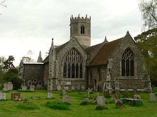
Knodishall, a village in Suffolk, England, lies 3.5 miles (6 km) south-east of Saxmundham, 1 mile (2 km) south-west of Leiston, and 3 miles from the coast, in the Blything Hundred. Most dwellings are now at Coldfair Green; just a few remain in the original village by the parish Church of St Lawrence, which falls gently on the north side of the Hundred River valley. It is now an outlier of Knodishall Common, a settlement a mile to the south-east. The estimated parish population was 790 in 2019.

<span class="mw-page-title-main">Redgrave, Suffolk</span> Human settlement in England

Redgrave is a village and civil parish in Suffolk, England, just south of the River Waveney that here forms the county boundary with Norfolk. The village is about 4+12 miles (7 km) west of the town of Diss. The 2011 Census recorded the parish population as 459.

<span class="mw-page-title-main">Flempton</span> Human settlement in England

Flempton is a village and civil parish in the West Suffolk district of Suffolk, England. It is on the A1101 road 5 miles NW from Bury St Edmunds.

<span class="mw-page-title-main">Shimpling</span> Human settlement in England

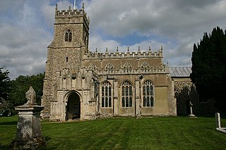
Shimpling is a village and civil parish in south Suffolk, England. About 7 miles (11 km) from Bury St Edmunds, it is part of Babergh district. The village is formed from two halves, the newer Shimpling Street and about 2 miles (3 km) away the old village of Shimpling. The village has a Church of England parish church, where supermodel Claudia Schiffer and film producer Matthew Vaughn were married on 25 May 2002.

<span class="mw-page-title-main">Thorpe Morieux</span> Human settlement in England

Thorpe Morieux is a small village and civil parish in Suffolk, England. It is 10 miles south-east of Bury St Edmunds and 10 miles north east of Sudbury.

<span class="mw-page-title-main">Hessett</span> Human settlement in England

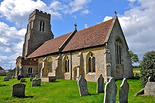
Hessett is a village and civil parish in the Mid Suffolk district of Suffolk in eastern England. Hessett is located around four miles south east of Bury St Edmunds. It is a rural village with a single north-south road off which most other roads flow. In 2011 its population was 464 which is towards the highest recorded population since its peak in 1850. Hessett is south of Beyton and west of Drinkstone.

<span class="mw-page-title-main">Great Livermere</span> Human settlement in England

Great Livermere is a village and civil parish in the West Suffolk district of Suffolk in eastern England. It is located around four miles north-east of the borough's largest town Bury St Edmunds.

<span class="mw-page-title-main">Westley, Suffolk</span> Human settlement in England

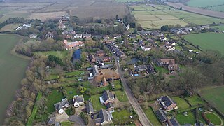
Westley is a village and civil parish in the West Suffolk district of Suffolk in eastern England. It is located south of Junction 42 of the A14 providing primary access to adjacent market towns Bury St Edmunds (East) and Newmarket (West). The village consists of two central roads: Fornham Lane and Hill Road running north and south through the parish, with adjoining roads accommodating Westley's total population of 183.

<span class="mw-page-title-main">Timworth</span> Human settlement in England

Timworth is a village and civil parish 65 mi (105 km) north east of London and 26 mi (42 km) east of Cambridge in the West Suffolk district of Suffolk in eastern England. Located around two miles north of Bury St Edmunds, its 2005 population was 50. At the 2011 Census the appropriate Postal Code showed the population as being included in Ampton.

<span class="mw-page-title-main">Hawkedon</span> Human settlement in England

Hawkedon is a village and civil parish in the West Suffolk district of Suffolk in eastern England. Located around 7 miles (11 km) south-south-west of Bury St Edmunds, the parish also contains the hamlet of Thurston End, and in 2005 had a population of 120. The majority of the village is classed as a conservation area.

<span class="mw-page-title-main">Nowton Park</span> Park in Nowton, England

Nowton Park is a park in Nowton, Suffolk, England.

References

  1. "Civil Parish population 2011". Neighbourhood Statistics. Office for National Statistics. Retrieved 25 August 2016.
  2. Estimates of Total Population of Areas in Suffolk Archived 19 December 2008 at the Wayback Machine Suffolk County Council
  3. "Nowton Park, Bury St Edmunds". www.visit-burystedmunds.co.uk. Retrieved 16 February 2016.
  4. "History of Suffolk – Nowton 1865". historyofsuffolk.co.uk. Retrieved 16 February 2016.
  5. Historic England. "CHURCH OF ST PETER (1194745)". National Heritage List for England . Retrieved 19 April 2014.
  6. Historic England. "CHURCH OF ST PETER (1194745)". National Heritage List for England . Retrieved 16 February 2016.
  7. "History of Suffolk – Nowton 1865". historyofsuffolk.co.uk. Retrieved 16 February 2016.
  8. "Nigel Havers visits his old school at Nowton Court for TV filming". Suffolk News. Retrieved 16 February 2016.
  9. "Luxury retirement, respite, convalescence and residential care in Bury st Edmunds – Nowton Court Village – Luxury Retirement Centre Bury St Edmunds". www.nowtonvillage.co.uk. Retrieved 16 February 2016.
  10. Stuff, Good. "Nowton Hall – Nowton – Suffolk – England | British Listed Buildings". www.britishlistedbuildings.co.uk. Retrieved 16 February 2016.
  11. "Suffolk County Council – 2001 Census Profiles" (PDF). Archived from the original (PDF) on 28 September 2011. Retrieved 22 February 2011.
  12. 1 2 "A Vision of Britain Through Time". University of Portsmouth & others. Retrieved 22 February 2011.