
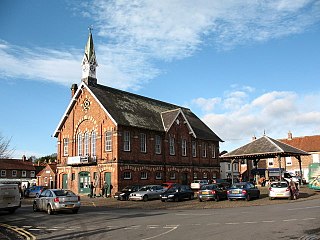
Carshalton is a town, with a historic village centre, in south London, England, within the London Borough of Sutton. It is situated 9.5 miles (15.3 km) south-southwest of Charing Cross, in the valley of the River Wandle, one of the sources of which is Carshalton Ponds in the middle of the village. Prior to the creation of Greater London in 1965, Carshalton was in the administrative county of Surrey.

St Neots is a town and civil parish in the Huntingdonshire district of Cambridgeshire, England. It is 18 miles (29 km) west of Cambridge. The areas of Eynesbury, Eaton Ford and Eaton Socon form part of the town.

Greenwich Park is a former hunting park in Greenwich and one of the largest single green spaces in south-east London. One of the Royal Parks of London, and the first to be enclosed, it covers 74 hectares, and is part of the Greenwich World Heritage Site. It commands views over the River Thames, the Isle of Dogs and the City of London.
Easingwold is a market town and civil parish in North Yorkshire, England. Historically, part of the North Riding of Yorkshire, it had a population of 4,233 at the 2001 census, increasing to 4,627 at the 2011 Census. It is located about 12 miles (19 km) north of York, at the foot of the Howardian Hills.

Coleshill is a village and civil parish within Chiltern district in Buckinghamshire, England. It is 2 miles (3.2 km) south of Amersham and 3 miles (4.8 km) north of Beaconsfield.

Finchampstead is a village and civil parish in the Wokingham Borough in the shire of Berkshire, England. Its northern extremity is 2 miles (3 km) south of Wokingham, 5 miles (8 km) west of Bracknell, 8 miles (13 km) south-east of Reading, and 34 miles (55 km) west of Central London. It is an affluent area, with the village ranking as Britain's 31st wealthiest. It has a high standard of living and is rated as one of the most desirable places to live in the United Kingdom.

Windsor Great Park is a Royal Park of 2,020 hectares, including a deer park, to the south of the town of Windsor on the border of Berkshire and Surrey in England. It is adjacent to the private 265 hectares Home Park, which is nearer the castle. The park was, for many centuries, the private hunting ground of Windsor Castle and dates primarily from the mid-13th century. Historically the park covered an area many times the current size known as Windsor Forest, Windsor Royal Park or its current name. The park is managed and funded by the Crown Estate, and is the only royal park not managed by The Royal Parks. Most parts of the park are open to the public, free of charge, from dawn to dusk, although there is a charge to enter Savill Garden.

Saint Anne's Park is a 240-acre (97 ha) public park situated between Raheny and Clontarf, suburbs on the northside of Dublin, Ireland. It is owned and managed by Dublin City Council.

Forest Park is a park in the New York City borough of Queens, spanning 538 acres (218 ha). It is the tenth-largest park in New York City and the third-largest in Queens. Created on August 9, 1895, it was originally referred to as Brooklyn Forest Park, as the area was part of Brooklyn at the time.

Appleby Magna is a village and civil parish in the North West Leicestershire district, in the county of Leicestershire, England. It includes the small hamlets of Appleby Parva and Little Wigston.
Hessay is a village and civil parish in the unitary authority area of the City of York, in the ceremonial county of North Yorkshire, England 4.7 miles (7.5 km) west of York.

Cassiobury Park is the principal public park in Watford, Hertfordshire, in England. It was created in 1909 from the purchase by Watford Borough Council of part of the estate of the Earls of Essex around Cassiobury House which was subsequently demolished in 1927. It comprises over 190 acres (77 ha) and extends from the A412 Rickmansworth Road in the east to the Grand Union Canal in the west, and lies to the south of the Watford suburb of Cassiobury, which was also created from the estate. The western part is a 62-acre (25.1 ha) Local Nature Reserve managed by the Herts and Middlesex Wildlife Trust. The park hosts the free, weekly timed parkrun 5 km event every Saturday morning at 9 am, starting on the field near the Shepherds Road entrance to the park, and finishing by the bandstand.
Ashford Green Corridor is a green space that runs through the town of Ashford in Kent, England. The Green Corridor is made up of parks, recreation grounds and other green spaces alongside the rivers that flow through Ashford. It is a Local Nature Reserve.

Offley is a civil parish in the English county of Hertfordshire, between Hitchin and Luton. The main village is Great Offley, and the parish also contains the nearby hamlets of Little Offley and The Flints. In the south-west of the parish, near Luton, there are the hamlets of Cockernhoe, Mangrove Green and Tea Green, and also the Putteridge Bury estate; these have LU2 postcodes and 01582 telephone numbers.

Thorpe Morieux is a small village and civil parish in Suffolk, England. It is 10 miles south-east of Bury St Edmunds and 10 miles north east of Sudbury.

Nowton is a small village and civil parish in the West Suffolk district of Suffolk in eastern England. Located on the southern edge of Bury St Edmunds, in 2005 its population was estimated to be 140. At the 2011 census 163 people were recorded as living in the village.

Malvern and Brueton Park is a town park and local nature reserve in Solihull in the West Midlands, England. The park is formed from a comparatively narrow strip of land, with the length being approximately ten times the average width, but it is looped forming a roughly U-shaped layout. The parks cover an area of approximately 130 acres (53 ha). Historically the park was formed by the joining of two separate parcels of different land. There is a large water feature, Brueton Park Lake, which runs through the southern end of the park, and is formed by the damming of a local watercourse, the River Blythe.

Manor House Gardens is a 3.34-hectare public park and gardens situated in Lee, in south east London. The park features a walled flower garden, ornamental pond, fountain, ice-house, cafeteria, children's playground, community garden, dog-walking area and tennis courts/multi-purpose sports pitches. There is also a Park Ranger's Office and information point adjacent to the cafe, and the River Quaggy flows from east to west across the southern part of the park.

Kings Clipstone is a settlement and civil parish, in the Newark and Sherwood district, in the county of Nottinghamshire, England. The parish lies in the west of the county, and north west within the district. It is 122 miles north of London, 15 miles north of the city of Nottingham, and 5 miles north east of the market town of Mansfield. In 2011 the parish had a population of 318. The parish touches Clipstone village, Edwinstowe, Rufford and Warsop. The parish was formerly part of the wider Clipstone parish, on 1 April 2011 it became a separate parish. The area is within Sherwood Forest, well known for the Robin Hood legend.
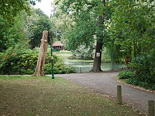
The Tarn is a 9 acres (3.6 ha) site on Court Road between Mottingham and Eltham, in the Royal Borough of Greenwich, southeast London, United Kingdom, consisting of a public garden, a bird sanctuary nature reserve and a lake amongst woodland. The woodland and lake, which was historically known as Starbuck's Pond, were previously the southern part of the Great Park, one of three parks belonging to the estate of Eltham Palace and used as a royal deer hunting park for several centuries up until the English Civil War. As a garden The Tarn opened in 1935, after the Metropolitan Borough of Woolwich acquired the site from the adjacent Royal Blackheath Golf Course. The Tarn remains largely unchanged since the 1930s and contains several shelters, benches, a public toilets building and a circular path which crosses a wooden footbridge spanning the lake. There is also an 18th-century ice house in the garden, which is a listed structure.


