Hopton, Suffolk

Last updated

Hopton
Suffolk UK location map.svg
Red pog.svg
Hopton
Location within Suffolk
Population653 (2011) [1]
District
Shire county
Region
Country England
Sovereign state United Kingdom
Post town DISS
Postcode district IP22
Police Suffolk
Fire Suffolk
Ambulance East of England
UK Parliament
List of places
UK
England
Suffolk
52°22′19″N0°55′37″E / 52.372°N 0.927°E / 52.372; 0.927
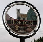
Hopton Village Sign Hopton Village Sign.jpg
Hopton Village Sign

Hopton is a village and civil parish in the West Suffolk district of Suffolk in eastern England. Located just south of the Norfolk border on the B1111 road between Stanton and Garboldisham, in 2011 it had a population of 653. It shares a parish council with neighbouring Knettishall.

Contents

All Saints' Church is at the geographical centre of the village, it has regular services and is part of the United Benefice of Stanton, Hopton, Market Weston, Barningham & Coney Weston. [2]

Schools

There is a primary school, and a pre-school. The primary school feeds students both to Thurston Community College in Thurston and Ixworth Free School in Ixworth.

Related Research Articles

<span class="mw-page-title-main">Norton, Suffolk</span> Human settlement in England

Norton is a village and civil parish in the Mid Suffolk district of the English county of Suffolk. The name Norton means northern town or farm. Located close to the A14, its nearest railway station is at Elmswell, just over 3 miles (5 km) away. The closest towns are Stowmarket 8 miles (13 km) away and Bury St Edmunds, around 10 miles (16 km) away.

<span class="mw-page-title-main">Borough of St Edmundsbury</span> Former local government district in England

<span class="mw-page-title-main">Thingoe Rural District</span> Former rural district in West Suffolk, England

Thingoe Rural District was a rural district in the county of West Suffolk, England between 1894 and 1974. It was named after the ancient Hundred of Thingoe and administered from Bury St Edmunds, which it surrounded.

<span class="mw-page-title-main">West Suffolk (UK Parliament constituency)</span> Parliamentary constituency in the United Kingdom, 1997 onwards

West Suffolk is a constituency represented in the House of Commons of the UK Parliament since 2010 by Matt Hancock, originally elected as a Conservative but who sits as an Independent following his suspension in November 2022.

<span class="mw-page-title-main">Thurston, Suffolk</span> Human settlement in England

Thurston is a village and a parish in Suffolk situated about 4 miles (6 km) east of Bury St Edmunds and 10 miles (16 km) west of Stowmarket.

<span class="mw-page-title-main">Bardwell, Suffolk</span> Human settlement in England

Bardwell is a village and civil parish in the West Suffolk district of Suffolk, England.

<span class="mw-page-title-main">Barningham, Suffolk</span> Human settlement in England

Barningham is a village and civil parish in the West Suffolk district of Suffolk, England, about twelve miles north-east of Bury St Edmunds. According to Eilert Ekwall, the meaning of the village name is the homestead of Beorn's people. The Domesday Book records the population of Barningham in 1086 to be 36. It has a primary school, a pub called the Royal George, a shop with a post office, a church, a hairdresser's, a village hall and a flower shop.

<span class="mw-page-title-main">Diocese of St Edmundsbury and Ipswich</span> Diocese of the Church of England

The Diocese of St Edmundsbury and Ipswich is a Church of England diocese based in Ipswich, covering Suffolk. The cathedral is St Edmundsbury Cathedral, and the bishop is the Bishop of St Edmundsbury and Ipswich. It is part of the Province of Canterbury.

<span class="mw-page-title-main">Stanton, Suffolk</span> Human settlement in England

Stanton is a village and civil parish in the West Suffolk district of Suffolk in eastern England, about nine miles north-east of Bury St Edmunds, on the A143 road to Diss. Close to the village lies the former WW II airfield RAF Shepherds Grove, where American forces were based. One of the main landmarks in the village is the fine restored windmill at Upthorpe Farm, to the east of the village. The name " Stanton" means 'a homestead on stony ground'.

<span class="mw-page-title-main">Coney Weston</span> Village and civil parish in England

Coney Weston is a village and civil parish in Suffolk, England, within the West Suffolk district. It is a primarily rural residential town that has dormitory town status. It is 5 miles (8 km) north of Ixworth and 12 miles (19 km) from Bury St Edmunds

<span class="mw-page-title-main">Ixworth</span> Village in Suffolk, England

Ixworth is a village and civil parish in the West Suffolk district of Suffolk, England, 6 miles (9.7 km) north-east of Bury St Edmunds on the A143 road to Diss and 9 miles (14 km) south-east of Thetford. The parish had a population of 2,365 at the 2011 Census.

<span class="mw-page-title-main">Weston, Suffolk</span> Human settlement in England

Weston is a village and civil parish in the English county of Suffolk. It is around 2 miles (3 km) south of Beccles in the East Suffolk district. The parish lies either side of the A145 road and is crossed by the Ipswich to Lowestoft railway line. Neighbouring parishes include Ellough, Ringsfield, Willingham St Mary and Shadingfield. The village is largely dispersed with a population of around 230.

<span class="mw-page-title-main">Knettishall</span> Human settlement in England

Knettishall is a village and civil parish in the West Suffolk district of Suffolk in eastern England. Located on the south bank of the River Little Ouse, in 2005 it had a population of 40. From the 2011 census the population of the village was not maintained and it is included in the civil parish of neighbouring Hopton.

<span class="mw-page-title-main">Thelnetham</span> Human settlement in England

Thelnetham is a village and civil parish in the West Suffolk district of Suffolk in eastern England. Located on the southern bank of the River Little Ouse, six miles west of Diss, in 2005 its population was 230. The village of Blo' Norton lies on the Norfolk side of the river. The name of the village derives from the Old English words "thel" which means a plank bridge, "elfitu" meaning swans and "hamm" meaning a meadow or enclosure. Hence the village is the "meadow with the plank bridge and the swans".

<span class="mw-page-title-main">Market Weston</span> Human settlement in England

Market Weston is a small village and civil parish in the West Suffolk district of Suffolk in eastern England. It is located near the Norfolk border around seven miles east-south-east of Thetford. In 2005 its population was estimated to be 260. 245 people were recorded at 2011 census. The parish also contains the Weston Fen SSSI.

<span class="mw-page-title-main">Hepworth, Suffolk</span> Human settlement in England

Hepworth is a village and civil parish in the West Suffolk district of the English county of Suffolk. Nearby settlements include the villages of Stanton and Barningham. For transport there is the A143 road nearby. Hepworth has a place of worship. The population at the 2011 Census was 536.

<span class="mw-page-title-main">Brandon Rural District</span> Former rural district in Suffolk, England

Brandon was a rural district in Suffolk, England from 1894 to 1935. The district was created in 1894 as the Suffolk part of the Thetford rural sanitary district, the Norfolk part becoming Thetford Rural District. This left the westernmost parishes of Brandon and Santon Downham detached from the rest of the district.

<span class="mw-page-title-main">West Suffolk District</span> Non-metropolitan district in England

West Suffolk District is a local government district in Suffolk, England. It was established in 2019 as a merger of the previous Forest Heath District with the Borough of St Edmundsbury. The council is based in Bury St Edmunds, the district's largest town. The district also contains the towns of Brandon, Clare, Haverhill, Mildenhall and Newmarket, along with numerous villages and surrounding rural areas.

References

  1. "Civil Parish 2011". Neighbourhood Statistics. Office for National Statistics. Retrieved 23 August 2016.
  2. United Benefice of Stanton, Hopton, Market Weston, Barningham & Coney Weston

Commons-logo.svg Media related to Hopton, Suffolk at Wikimedia Commons