Withersfield

Last updated

Withersfield
St. Mary's church, Withersfield, Suffolk - geograph.org.uk - 161326.jpg
St. Mary's church, Withersfield
Suffolk UK location map.svg
Red pog.svg
Withersfield
Location within Suffolk
Population450 (2011) [1]
District
Shire county
Region
Country England
Sovereign state United Kingdom
Post town Haverhill
Postcode district CB9
Police Suffolk
Fire Suffolk
Ambulance East of England
UK Parliament
List of places
UK
England
Suffolk
52°06′22″N0°25′05″E / 52.106°N 0.418°E / 52.106; 0.418

Withersfield is a village and civil parish in the West Suffolk district of Suffolk in eastern England. In 2011 its population was 450. [1] It has a public house and a village hall, and centres on the parish church, St. Mary the Virgin. It is in a rural location, surrounded by farmland, yet only a mile north of the busy market town of Haverhill. Surrounding villages include Great Wratting, West Wickham and Great Thurlow.

Contents

History

In 1870, the Imperial Gazetteer of England and Wales described Withersfield as:

"...a parish in Risbridge district, Suffolk; 2 miles N W of Haverhill r. station. It has a post-office under Newmarket. Acres, 2,509. Real property, £3,791. Pop., 624. Houses, 146. The manor belongs to the Rev. W. Mayd. The living is a rectory in the diocese of Ely. Value, £650.* Patron, the Rev. W. Mayd. The church was partly rebuilt and enlarged in 1868. There is a parochial school." [2]

The name Withersfield directly translates in Old English to 'Wether open land' which means an area where rams roam. [3] With the village being set in the middle of the countryside, traditionally most of the population worked in the agriculture industry. in 1881, 100 out of the 133 male population worked in agriculture. [4]

Withersfield appears in the Domesday Book of 1086 in the Risbridge hundred of Suffolk. It was made up of 2 villagers, 13 smallholders, 3 slaves and 2 free men. It held 3 lord’s plough teams and 2 men’s plough teams. It had a meadow of 3 acres and 20 woodland pigs. In 1066 the lords were Alwin, Leofwaru and Wulfmer. In 1086 they were Lord Godard, Lord Payne and Lord Widelard or Balliol. [5]

Withersfield has undergone many boundary changes. It was part of the Risbridge registration district until 1938 when the district was abolished to become the Braintree and Newmarket districts. Withersfield joined the Newmarket registration district until 1989 when the district was abolished with all of its remaining parishes joining Bury St Edmunds. This is the registration district that Withersfield remained in until 2010 when the district size expanded. Withersfield can now be found in the Suffolk registration district. [6]

Demographics

Total Population of Withersfield Civil Parish, Suffolk as reported by the Census of Population from 1801 to 2011 Withersfield Time Series 1801-2011.jpg
Total Population of Withersfield Civil Parish, Suffolk as reported by the Census of Population from 1801 to 2011
Occupational graph for the male population over the age of 20 in Withersfield in 1831 1831 Occupational Statistics for Withersfield.png
Occupational graph for the male population over the age of 20 in Withersfield in 1831

Population

The earliest census statistics for Withersfield dates back to 1801. At this time, the population of Withersfield was 424. The highest recorded population for the parish of Withersfield was in 1871, with a population of 670. After 1871, the population decreased until 1961 where the lowest population on record for Withersfield was logged as 345. [7] Ever since, the population count has been steadily increasing and at the 2011 census stood at 450. [1]

Occupation

The 1831 census data also gave information on occupation in Withersfield, splitting all occupations into 9 different categories. 127 people are included in the data, the two largest categories Agricultural labourers with 82 people and Retail and handicrafts with 25 people employed in this category of work. There were very few people in the other categories and none in the manufacturing segment. [8] The 1881 data for Withersfield is a lot more in depth, showing a breakdown of jobs into smaller categories and then showing how these are split between males and females. A total of 280 people are included in the data, 135 which are males and the remaining 145 female. As you'd expect, the large majority of the female data is put into the 'Unknown Occupation' category, suggesting they were unemployed with only 3 men in this category and a further 12 females in the 'Persons without Specified Occupations' with 2 males. The female occupational distribution for the remaining 49 is split mainly between 'Workers in Dress' (27) and 'Domestic Services and Offices' (13). The males occupational distribution for the remaining 130 is heavily skewed to 'Agriculture' (100) with the next highest sector being 'Workers in House, Furniture and Decorations' (10) all other sectors have up to 4 males working in them. [9] As expected, the occupational structure for the population of Withersfield recorded in the 2011 census was remarkably different. In 2011, 241 people in withersfield were in employment. That’s 54% of the total population of the village. These people were employed in sectors which were non-existent in the report of 1831. The largest employment sector was Manufacturing which accounted for 15.8% of the total employed population of Withersfield, along with Construction (13.7%), Health and Social Care (12%), Professionals (10.8%) and Education (10%). The previously largest employment sector of Agriculture still employed a minority of Withersfield’s population with 2.1% of the employed population still working in that industry. [10]

Housing

The housing type in Withersfield is mainly detached housing with a minority of semi-detached and terraced housing. Typical housing ownership tends to be owner-occupied with some private rental properties. [11] Withersfield has an average house price of £450,250 which is more than double the average house price in the nearby town of Haverhill (£168,041). House prices in Withersfield are up 77% on the previous year and 19% up on the 2007 average of £377,500. [12]

Transport

The nearest train station to Withersfield is 6.14 miles away in Dullingham. [13] There are currently two bus routes that include Withersfield. These are both bus number 351 which run from Cowlinge to Haverhill at school times and from Great Bradley to Haverhill Monday to Saturday either twice or three times a day. There are currently no bus services for Withersfield on Sundays. [14]

Education

Despite there being no schools in Withersfield itself, there are a total of 18 schools within a 3-mile radius of the village, mainly in Haverhill. [15] There happens to be only 18 people aged 4–16 in full-time education in Withersfield, this is largely down to the population of Withersfield being of an older generation than 4-16. Yet there are also 6 people aged 16 and older in full-time education from Withersfield. [16]

Places of interest

The Withersfield War Memorial - geograph.org.uk - 1428242 The Withersfield War Memorial - geograph.org.uk - 1428242.jpg
The Withersfield War Memorial - geograph.org.uk - 1428242
'The White Horse Inn' at Withersfield - geograph.org.uk - 311017 'The White Horse Inn' at Withersfield - geograph.org.uk - 311017.jpg
'The White Horse Inn' at Withersfield - geograph.org.uk - 311017

St Mary The Virgin

The church of St Mary the Virgin is set in the centre of Withersfield. The church dates back to the 13th century, yet only the door handle survives from this era. The majority of the church is in fact Victorian having had to be rebuilt due to poor structure. [17] The church is unlike most in the area and is kept open 24/7. [18] The church is one of 24 listed buildings in the village of Withersfield. [19]

Withersfield War Memorial

The Withersfield War memorial stands on the village green. The memorial commemorates the residents of Withersfield who were killed or missing in action in either World War 1 or World War 2. It holds 15 names from World War 1 and 1 name from World War 2. The memorial was unveiled on 12 August 1921. [20] [21] The War Memorial was restored in 2019 by the Parish Council with a grant from the War Memorials Trust http://www.warmemorials.org/

Jacob's Manor

Jacob's Manor is a Grade 2* listed early Georgian manor house of architectural importance. Built by Sir John Jacob (whose tomb is in St Mary's Church) for his son in-law Reverend A. Oakes (of St Mary's Church), it featured in the Hand in Glove episode of the BBC Drama The Inspector Alleyn Mysteries.

The White Horse Inn

The White Horse Inn was built in the seventeenth century as a coaching inn to take advantage of stagecoach traffic between Ipswich, Cambridge and Colchester. The pub is now well known for being owned in the 19th and 20th century by the father of Australian Cricket legend Donald Bradman. [22] The White Horse Inn is also one of Withersfields 24 listed buildings with its main feature being its thatched roof. [23]

Organisations

Withersfield Parish Council

The Parish Council plays an important role in providing and managing services such as the village hall and community areas within Withersfield. The Parish Council meet regularly at the Withersfield Village Hall. [24]

Withersfield Cricket Club

Withersfield Cricket club are a small village cricket club. The club has made its way up to the Hunts County Bats Sunday League. The cricket club play at the Recreation Ground in Withersfield. [25] The legendary Australian cricketer Don Bradman could trace his family history to Withersfield. [26]

Withersfield Hall School of Equitation

Withersfield Hall School of Equitation (WHSE) is a small family run horse riding school. They offer horse riding lessons to people of all ages and abilities in many different disciplines such as jumping, dressage training and hacking. They also offer BHS (British Horse Society) training in Horse care and equitation. The equitation school is based on a farm near by to the Withersfield Village hall. [27]

Related Research Articles

<span class="mw-page-title-main">West Suffolk (UK Parliament constituency)</span> Parliamentary constituency in the United Kingdom, 1997 onwards

West Suffolk is a constituency represented in the House of Commons of the UK Parliament since 2010 by Matt Hancock, originally elected as a Conservative but who sits as an Independent following his suspension in November 2022.

<span class="mw-page-title-main">Friston</span> Human settlement in England

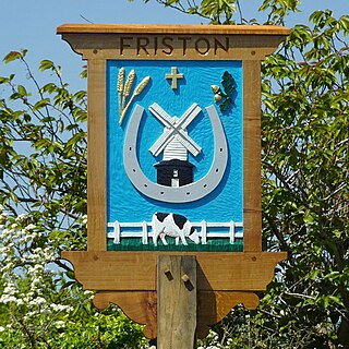
Friston is a village and civil parish in the East Suffolk district, in the county of Suffolk, England. It is 3 miles (5 km) southeast of Saxmundham, its post town, and 4 miles (6 km) northwest of Aldeburgh. The River Alde bounds the village on the south. The surrounding land is chiefly arable. The soil becomes partly marshy in the lower grounds. The village is noted for its early nineteenth century post mill. It is located next to the village of Knodishall.

<span class="mw-page-title-main">Parham, Suffolk</span> Village and civil parish in Suffolk, England

Parham is a village and civil parish in the East Suffolk district of Suffolk in eastern England. Located seven miles north of Woodbridge, in 2005 it had a population of 300, reducing to 263 at the 2011 census and according to the 2011 census there were 129 males and 134 females living at this time.

<span class="mw-page-title-main">Brandeston</span> Village in Suffolk, England

Brandeston is a village in Suffolk, England on the River Deben 11 miles (18 km) northeast of Ipswich. Brandeston is west of Kettleburgh and northwest of Hoo Green. It is a Parish in Plomesgate district and 3½ miles SW of Framlingham r. station."

<span class="mw-page-title-main">Clopton, Suffolk</span> Human settlement in England

Clopton is a village and civil parish in Suffolk. It is located between Ipswich and Debenham two kilometres north of Grundisburgh on the River Lark. The village is no larger than a series of houses either side of the B1078, surrounded by farm land. The village itself has no clear centre; houses and other buildings are concentrated around the four manors of Kingshall, Brendhall, Rousehall and Wascolies, all of which are mentioned in the Domesday Book of 1086.

<span class="mw-page-title-main">Flowton</span> Village and civil parish in Suffolk, England

Flowton is a village and civil parish in the Mid Suffolk district of Suffolk in eastern England, with a population of 117 people. The name 'Flowton' originally derives from the word 'Flocctun', meaning a flock of sheep or a sheep farm. The parish is located around six miles north west of Ipswich, which is the county town of Suffolk. Flowton contains the hamlet of Flowton Brook, and consists of rural farmland accompanied by scattered farm houses and a few newer builds situated nearby the parish church of 'St Mary's'. In the 1870s, Flowton was described as:

<span class="mw-page-title-main">Hessett</span> Human settlement in England

Hessett is a village and civil parish in the Mid Suffolk district of Suffolk in eastern England. Hessett is located around four miles south east of Bury St Edmunds. It is a rural village with a single north-south road off which most other roads flow. In 2011 its population was 464 which is towards the highest recorded population since its peak in 1850. Hessett is south of Beyton and west of Drinkstone.

<span class="mw-page-title-main">Stonham Aspal</span> Human settlement in England

Stonham Aspal is a village and civil parish in the Mid Suffolk district of Suffolk in eastern England, some five miles (8 km) east of the town of Stowmarket. Nearby villages include Mickfield, Little Stonham and Pettaugh. Its population in 2011 was 601. The village has a primary school. It is set in farmland, but has a busy main road, A1120, running through.

<span class="mw-page-title-main">Worlingworth</span> Village in Suffolk, England

Worlingworth is a village and civil parish in the Mid Suffolk district of Suffolk in eastern England, located around ten miles south-east of Diss. In 2011 it had a total population of 802 people.

<span class="mw-page-title-main">Great Thurlow</span> Human settlement in England

Great Thurlow is a village and civil parish in the West Suffolk district of Suffolk in eastern England. It is situated in the far south-west of Suffolk, with the River Stour passing through the centre of the village.

<span class="mw-page-title-main">Westley, Suffolk</span> Human settlement in England

Westley is a village and civil parish in the West Suffolk district of Suffolk in eastern England. It is located south of Junction 42 of the A14 providing primary access to adjacent market towns Bury St Edmunds (East) and Newmarket (West). The village consists of two central roads: Fornham Lane and Hill Road running north and south through the parish, with adjoining roads accommodating Westley's total population of 183.

<span class="mw-page-title-main">Stansfield</span> Human settlement in England

Stansfield is a village and civil parish in the West Suffolk district of Suffolk in eastern England. Located seven miles south-west of Bury St Edmunds, in 2011 its population was 221. The village has an Anglican church dedicated to All Saints. In 1870, John Marius Wilson's Imperial Gazetteer of England and Wales described Stansfield as

<span class="mw-page-title-main">Ousden</span> Human settlement in England

Ousden is a village and civil parish in the West Suffolk district of Suffolk in eastern England. It is located around six miles west of Bury St Edmunds and 72 miles north of London, and as of 2011, its population is 266. The village has an Anglican church of St Peter's and a chapel in the cemetery dedicated to St Barnabas.

<span class="mw-page-title-main">Denston</span> Human settlement in England

Denston is a village and civil parish in the West Suffolk district of Suffolk in eastern England. Located around eight miles south-west of Bury St Edmunds, in 2005 its population was 120. The entire village is designated as a conservation area. There is an Anglican church whose dedication is to St Nicholas. Denston is located just south of Wickhambrook.

<span class="mw-page-title-main">Walpole, Suffolk</span> Human settlement in England

Walpole is a small village and civil parish in the district of East Suffolk in Suffolk, England. Walpole has a parish church, a redundant chapel, but the primary school has closed. The village is on the River Blyth. Nearby settlements include the town of Halesworth and the village of Cookley. It was in the hundred of Blything. It had a population of 238 according to the 2011 census.

<span class="mw-page-title-main">Sibton</span> Human settlement in England

Sibton is a village and civil parish on the A1120 road, in the East Suffolk district, in the English county of Suffolk. It is near the towns of Saxmundham and Halesworth, the village of Peasenhall and the hamlet of Sibton Green. The church is dedicated to St Peter; there is also the remains of a medieval abbey, Sibton Abbey. There is a large stately house set in the grounds of Sibton Park which dates back 1827 in the Georgian period, which is now used as a hotel. The estate consists of 4500 acres, being part of the Wilderness Reserve where there are holiday cottages and a lake. The Parish is also in close proximity to the River Yox which runs past the White Horse Inn and down through Pouy Street, it then goes on past both the A1120 road and a small wooded area called Abbey Woods to pass through the grounds of Sibton Park and then on to Yoxford.

<span class="mw-page-title-main">Swilland</span> Human settlement in England

Swilland is a village and civil parish, in the East Suffolk district, in the English county of Suffolk. It is north of the large town of Ipswich. Swilland has a church called St Mary's Church and a pub called The Moon & Mushroom Inn which has been awarded Suffolk Pub of The Year on two occasions by the Evening Star. Swilland shares a parish council with Witnesham called "Swilland and Witnesham Grouped Parish Council".

Sutton is a village and a civil parish on the B1083 road, in the East Suffolk district, in the county of Suffolk, England. Sutton has a pub, a mobile post office and a place of worship. There is also the hamlet of Sutton Street and the Sutton Common estate nearby.

<span class="mw-page-title-main">Huntingfield, Suffolk</span> Human settlement in England

Huntingfield is a village near the B1117 road, in the East Suffolk district, in the county of Suffolk, England. The village is close to the source of the River Blyth and the parish is 12 miles from the seaside town of Southwold. Nearby settlements include the town of Halesworth and the villages of Walpole, Heveningham, Cookley and Laxfield.

<span class="mw-page-title-main">Great Henny</span> Human settlement in England

Great Henny is a village and civil parish near Sudbury, in the Braintree district, in the county of Essex, England. Nearby settlements include the villages of Little Henny and Twinstead. The hamlet of Henny Street, within the parish, is on the River Stour which forms the parish's eastern border.

References

  1. 1 2 3 "Withersfield (Parish): Key Figures for 2011 Census: Key Statistics". Neighbourhood Statistics. Office for National Statistics. Retrieved 5 February 2014.
  2. Wilson, John Marius (1870–1872). Gazetteer of England and Wales. Edinburgh: A. Fullarton & Co. Retrieved 5 February 2014.
  3. "A Key To English Place Names". The University of Nottingham. Retrieved 13 March 2014.
  4. "Industry Data from 1881". A Vision of Britain.{{cite web}}: Missing or empty |url= (help)
  5. "Open Domesday". Professor J.J.N. Palmer, University of Hull. Retrieved 3 March 2014.
  6. "Suffolk Registration Districts". GENUKI. Retrieved 13 March 2014.
  7. "Population Statistics". A Vision Of Britain. Retrieved 14 March 2014.
  8. "Occupational Statistics for 1831". A Vision Of Britain. Retrieved 14 March 2014.
  9. "Withersfield CP/AP through time | Industry Statistics | Occupation data classified into the 24 1881 'Orders', plus sex". A Vision Of Britain. Retrieved 23 April 2014.
  10. "Occupation Statistics for 2011". Neighbourhood Statistics. Retrieved 14 March 2014.
  11. "Housing Data". British Streets. Retrieved 14 March 2014.
  12. "Housing Price Data". Rightmove. Retrieved 14 March 2014.
  13. "Postcode Statistics: Withersfield". UK Local Area. Retrieved 14 March 2014.
  14. "Transport Information". Travel Search. Retrieved 14 March 2014.
  15. "School Finder". direct.gov.uk. Retrieved 21 March 2014.
  16. "Education Statistics". Neighbourhood Statistics. Retrieved 21 March 2014.
  17. Knott, Simon. "St Mary the Virgin, Withersfield". Suffolk Churches. Retrieved 17 March 2014.
  18. "St Mary the Virgin, Withersfield". St Marys of Haverhill. Retrieved 17 March 2014.
  19. "Listed Buildings in Withersfield". British Listed Buildings. Retrieved 17 March 2014.
  20. "Withersfield War Memorial". Traces of War. Retrieved 17 March 2014.
  21. "Withersfield War Memorial". Roll of Honour. Retrieved 17 March 2014.
  22. "History of the White Horse Inn". The White Horse Inn. Retrieved 17 March 2014.
  23. "White Horse Inn, Withersfield". British Listed Buildings. Retrieved 17 March 2014.
  24. "Withersfield Parish Council". Suffolk InfoLink. Retrieved 21 March 2014.
  25. "Withersfield CC". ECB. Retrieved 21 March 2014.
  26. "Sir Donald Bradman". 27 February 2001.
  27. "WHSE Riding". WHSE Riding. Retrieved 21 March 2014.

Commons-logo.svg Media related to Withersfield at Wikimedia Commons