
Metheringham is an English village and civil parish in the North Kesteven district of Lincolnshire. The population of the civil parish at the 2011 census was 3,605. It is about 9 miles (14 km) south of the city and county town of Lincoln and 10 miles (16 km) north of Sleaford. The centre of the village is a conservation area.

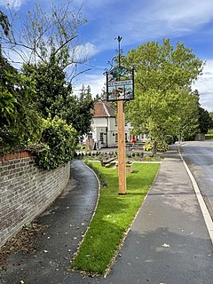
Keyworth is a large Village of Nottinghamshire, England. It is located about 6 miles (11 km) southeast of the centre of Nottingham. It sits on a small, broad hilltop about 200 feet above sea level which is set in the wider undulating boulder clay that characterises the area south of Nottingham.

Barlestone is a village and civil parish in the Hinckley and Bosworth district of Leicestershire, England, adjoining the village of Osbaston. The UK Census reported Barlestone's population as 2,471 in 2001, and 2,481 in 2011.

Mountnessing is a village and civil parish in the Borough of Brentwood in south Essex, England. It is situated to the north-east of Brentwood, south-west of Ingatestone. A large proportion of the houses are situated on the Roman Road between Brentwood and Ingatestone. The village is approximately equidistant between the two closest railway stations of Shenfield and Ingatestone.

Billingborough is a village and civil parish in the South Kesteven district of Lincolnshire, England. It is situated approximately 10 miles (16 km) north of Bourne and 10 miles south of Sleaford, and on the B1177 between Horbling and Pointon just south of the A52.

Chirbury is a village in west Shropshire, England. It is situated in the Vale of Montgomery, close to the Wales–England border, which is to its north, west and south. The A490 and B4386 routes cross at Chirbury.

East Morton is a small village which lies 2 miles (3 km) north of Bingley and 2.5 miles (4 km) east of Keighley, in the county of West Yorkshire, England. The small hamlet of West Morton lies 1 mile (1.6 km) to the north west. The village has a population of 1,169 according to the 2011 census.

Mollington is a village and civil parish in the unitary authority of Cheshire West and Chester and the ceremonial county of Cheshire, England. It is located two miles north of the city of Chester, with approximate boundaries formed by the A41 Liverpool-Chester trunk road and Shropshire Union Canal to the east and southeast, the A540 Wirral Peninsula trunk road to the south and west and the A5117 Dunkirk link road to the north.

Wilstead is a village and civil parish in Bedfordshire, England, just off the A6 Bedford to Luton road, about five miles south of Bedford town centre, and within the Borough of Bedford. The name of the village has been spelled in many different ways, including Wilshamstead and Wylhamstead. Wilstead is now the usual name of the village, but the civil parish is named Wilshamstead. The council estimated the population of the parish at 2,550 in 2005. Most of the inhabitants live in the main village, but some live in other hamlets and isolated houses.

Newhall is a suburban settlement located in Swadlincote, South Derbyshire, England. As of the 2011 census it had a population of 776. The village of Stanton is nearby.

Huntington is a village and civil parish on the southern outskirts of Chester, in the unitary authority of Cheshire West and Chester and the ceremonial county of Cheshire, England.

Shavington cum Gresty [ʃævɪŋtən] is a civil parish in the unitary authority of Cheshire East and the ceremonial county of Cheshire, England. It lies to the south of Crewe. It includes the large village of Shavington, which lies 2½ miles south of Crewe, as well as the smaller settlements of Dodds Bank, Park Estate, Puseydale, Sugar Loaf and part of Goodall's Corner. Nearby villages include Basford, Hough, Willaston, Wistaston and Wybunbury. The total population of the civil parish is a little under 5,000.

Weston is a village and civil parish in the unitary authority of Cheshire East and the ceremonial county of Cheshire, England. The village lies 3 miles to the south east of Crewe. The parish also includes the small settlements of Carters Green, Gorstyhill, Rose Hill, Snape, Stowford and part of Englesea Brook, as well as the new settlements of Wychwood Park and Wychwood Village. Plans in 2015 to develop a golf course surrounding Wychwood Village for residential housing have been opposed by some residents. The plans were refused planning permission by Cheshire East Council; the developer was later unsuccessful in an appeal to the Secretary of State and the Council’s refusal was upheld. Nearby villages include Basford, Hough and Shavington.

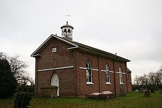
Monk Fryston is a small village and civil parish in the Selby district of North Yorkshire, England.

Sturton by Stow is a village and civil parish in the West Lindsey district of Lincolnshire, England. The population of the civil parish was 1,369 at the 2011 census.
Hertingfordbury is a small village in Hertfordshire, England, close to the county town of Hertford. It was mentioned in the Domesday Book. Hertingfordbury is also the name of a neighbouring civil parish, which does not contain the village, which is actually within the local government area of Hertford Town Council. The population of the civil parish as of the 2011 census was 630.
Wilden is a village and civil parish located in the Borough of Bedford in Bedfordshire, England. The population of 399 in the 2011 Census was estimated at 392 in 2019.

Wainfleet St Mary is a village and civil parish in the East Lindsey district of Lincolnshire, England. It is situated directly south of Wainfleet All Saints on the A52 road, 5 miles (8 km) south-west from Skegness and 14 miles (23 km) north-east from Boston. The 2001 Census recorded a population of 1,106, reducing to 1,025 at the 2011 census. It includes the hamlet of Wainfleet Bank.
Carrington is a village and civil parish in the East Lindsey district of Lincolnshire, England. It is situated approximately 7 miles (11 km) north from the market town of Boston.

Spanby is a village and former civil parish in the North Kesteven district of Lincolnshire, England, about 5 miles (8 km) south from the town of Sleaford. Since 1931 the village has been part of the civil parish of Threekingham. It is in the civil parish of Osbournby.

