"}" id="mwCw">
Westwood is a large village and a civil parish in west Wiltshire, England. The village is about 1.4 miles (2.3 km) southwest of the town of Bradford-on-Avon.
Upper Westwood, on a ridge crest to the north, was a distinct settlement from Lower Westwood but 20th-century housing filled the gap. [2] The parish includes most of the village of Avoncliff, namely the portion south of the Avon, and the hamlet of Lye Green.
The Avon forms most of the northern boundary of the parish; Avoncliff railway station is just over the boundary. The Kennet and Avon canal crosses the parish to the north, as far as the Avoncliff Aqueduct. To the northeast lies Bradford on Avon parish, and to the west is the county boundary with Somerset which follows the valley of the River Frome.
Neighbouring villages are Winsley and Turleigh to the north, and Freshford to the west.
Westwood's recorded history begins in 983 AD, when King Ethelred's charters granted various pieces of land to his servant Aelfnoth, and four years later to his huntsman Leofwine. In Norman times, Westwood was one of the estates assigned for the support of the monks at Winchester Cathedral, and the residents of the manor continued to be tenants of Winchester until it was dissolved by Henry VIII. The medieval population of Westwood, as recorded in Domesday Book of 1086, consisted of just 13 households, [3] growing to 45 recorded taxpayers in the late 14th century. [4]
Mills were built on the Avon at Avoncliff, and on the Frome at Iford, and were most active in cloth-making and fulling from the 16th century.
The parish gained 116 acres on the break-up and abolition of Bradford Without civil parish in 1934. [5]
The earliest records of a substantial quarrying industry at Westwood are in 1649. By the mid-19th century, the quality of Westwood stone had earned a good reputation, and over the next half-century, output increased at a great rate. Westwood stone went to build many houses in Bath, as well as Holy Trinity church in Trowbridge (1838). A narrow-gauge railway was constructed to transport the huge blocks of rough cut stone from the quarry to the cutting-yard at Avoncliff railway station. [6]
Nowadays, all that remains from the centuries of intensive quarrying is the labyrinth of tunnels, eight feet high and twelve feet wide. They have been put to a number of imaginative uses, especially after they were taken over by the Ministry of Supply in 1939. For example, the eastern part of the quarry tunnels had since 1928 been used for growing mushrooms, as the relatively stable ambient temperatures and the high humidity of the underground were found perfectly suitable. From 1941, about six hundred workers manufactured gun-control equipment at an underground factory which had been located in the tunnels to defend against Luftwaffe raids. Additionally, by the end of 1942 the Westwood tunnels had "probably housed the greatest and most valuable collection of cultural and artistic artifacts assembled in one location anywhere in the world", including exhibits from the British Museum, pictures from the National Portrait Gallery, tapestries from the Victoria and Albert Museum, the Elgin Marbles, and the Wright brothers' aeroplane. An air conditioning plant had to be installed to control the humidity underground.
The civil parish elects a parish council. It is in the area of Wiltshire Council, a unitary authority which is responsible for all significant local government functions; the parish forms part of the council's Winsley and Westwood electoral division. [7]
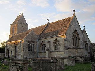
A chapelry of Bradford-on-Avon at Westwood was mentioned in 1299. [4] The present church, now dedicated to St Mary the Virgin, was built in ashlar rubble in the 15th century; restoration in 1840 included rebuilding the south side of the chancel. [8] A reused stone over a door in the north wall of the chancel may be from the late 12th or early 13th century. [9] There is 15th-century stained glass in the chancel. [4]
The church was designated as Grade I listed in 1962. [8] Pevsner describes the elaborately decorated 16th-century west tower [4] as "splendid"; [10] at its southeast corner is a prominent octagonal stair turret with a domed top. [4]
In 1876, Westwood was constituted as a parish and separated from Bradford. [11] In 1975 a group ministry centred on Holy Trinity at Bradford was formed, [12] which continues today as the benefice of Bradford on Avon Holy Trinity, Westwood and Wingfield. [13]
The stone-quarrying community at Upper Westwood was largely Methodist. [13] A Wesleyan Methodist chapel was opened there in 1862 and closed circa 1960. [4]
A Baptist chapel was opened at Lower Westwood in 1865 and extended with a schoolroom, with capacity for 200 children, in 1885. [4] At first a Sunday school, the room later became the infant school for the village, continuing until 1976 when a new school was built on a different site. [14]
Westwood Manor, in Lower Westwood next to the church, is a Grade I listed 15th-century manor house owned by the National Trust. Greenhill House in Upper Westwood is from the 18th century and is Grade II* listed. [15]
Iford Manor, in the Frome valley, is a Grade II* listed manor house from the 15th or 16th century; its gardens by Harold Peto, who lived there from 1899, are Grade I listed. The gardens were the setting for an annual summer music festival, the Iford Arts Festival, until 2019 when the festival moved to a higher-capacity venue at Bradford-on-Avon. [16]
A group of 1790s three-storey weavers' houses next to the canal at Avoncliffe was bought in 1835 by the guardians of the Bradford Poor Law Union, and converted into a workhouse with capacity for 250; a chapel was added and later a schoolroom. The building was sold in 1923, used for a time as a hotel, and converted into houses in the 1980s. [2] [17]
The Parish Rooms, next to the Church of St Mary the Virgin, is used by the church after services and is available for private hire.
The Social Club, between Lower and Upper Westwood, is a paid members club and is home to a local skittles league.
Bradford-on-Avon is a town and civil parish in west Wiltshire, England, near the border with Somerset, which had a population of 10,405 at the 2021 census. The town's canal, historic buildings, shops, pubs and restaurants make it popular with tourists.
Corsham is a historic market town and civil parish in west Wiltshire, England. It is at the southwestern edge of the Cotswolds, just off the A4 national route. It is 28 miles (45 km) southwest of Swindon, 20 miles (32 km) east of Bristol, 8 miles (13 km) north-east of Bath, and 4 miles (6 km) southwest of Chippenham.
Bishops Cannings is a village and civil parish in the Vale of Pewsey in Wiltshire, England, 3 miles (5 km) north-east of Devizes. The parish includes the village of Coate and the hamlets of Bourton, Horton and Little Horton.
Iford Manor is a manor house in Wiltshire, England. It is a Grade II* listed building sitting on the steep, south-facing slope of the Frome valley, in Westwood parish, about 2 miles (3.2 km) southwest of the town of Bradford-on-Avon. Its Grade I registered gardens are open to the public from April to September each year.
Box is a large village and civil parish within the Cotswolds Area of Outstanding Natural Beauty in Wiltshire, England, about 3 miles (5 km) west of Corsham and 5 miles (8 km) northeast of Bath. Box also falls in the easternmost part of the Avon Green Belt. Besides the village of Box, the parish includes the villages of Ashley and Box Hill; Hazelbury manor; and the hamlets of Alcombe, Blue Vein, Chapel Plaister, Ditteridge, Henley, Kingsdown, Middlehill, and Wadswick. To the east the parish includes much of Rudloe, formerly a hamlet but now a housing estate, and the defence establishments and related businesses on the site of the former RAF Rudloe Manor.
Alvediston is a small village and civil parish in Wiltshire, England, about 7 miles (11 km) east of Shaftesbury and 11 miles (18 km) southwest of Salisbury. The area is the source of the River Ebble and is within the Cranborne Chase and West Wiltshire Downs Area of Outstanding Natural Beauty. In 2011 the parish had a population of 106.
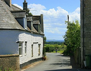
Atworth is a village and civil parish in west Wiltshire, England. The village is on the A365 road between Melksham and Box, about 2.5 miles (4 km) northwest of Melksham and 4 miles (6 km) northeast of Bradford on Avon. The hamlet of Purlpit lies east of Atworth village, and in the south of the parish are the small village of Great Chalfield and the hamlet of Little Chalfield.
Avoncliff is a small village in west Wiltshire, England, in the north of Westwood parish about 1.5 miles (2.4 km) southwest of Bradford-on-Avon.
Limpley Stoke is a village and civil parish in Wiltshire, England. It lies in the Avon valley between Bath and Freshford, and is both above and below the A36 road.
Monkton Farleigh is a village and civil parish in west Wiltshire, England, on high ground 3 miles (5 km) northwest of Bradford-on-Avon, and a similar distance east of the city of Bath. The parish includes the hamlets of Farleigh Wick and Pinckney Green. In the west and northwest the parish is bounded by Somerset.
Westwood Manor is a 15th-century manor house with 16th-century additions and 17th-century plaster-work in the village of Westwood, near Bradford-on-Avon, Wiltshire, England. Pevsner describes Westwood Manor as "a perfect Wiltshire manor house". It has been in the ownership of the National Trust since 1956 and was designated as Grade I listed in 1962.
Upton Scudamore is a village and civil parish in Wiltshire, England. The village lies about 1.8 miles (3 km) north of the town of Warminster and about the same distance south of Westbury. The parish includes the hamlet of Halfway.
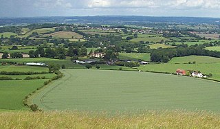
Corsley is a hamlet and civil parish 3 miles (5 km) west of Warminster in Wiltshire, England. The parish is on the county border with Somerset; the Somerset town of Frome is about 3 miles (5 km) to the northwest. The largest settlement in the parish is Corsley Heath, which is on the A362 Warminster-Frome road.
Upavon is a rural village and civil parish in the county of Wiltshire, England. As its name suggests, it is on the upper portion of the River Avon which runs from north to south through the village. It is on the north edge of Salisbury Plain about 4 miles (6.4 km) south of Pewsey, 10 miles (16 km) southeast of the market town of Devizes, and 20 miles (32 km) north of the cathedral city of Salisbury. The A345 and A342 roads run through the village.
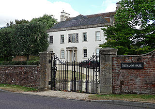
Seend is a village and civil parish about 3 miles (5 km) southeast of the market town of Melksham, Wiltshire, England. It lies about 3.5 miles (6 km) west of Devizes and 5.5 miles (9 km) northeast of the county town of Trowbridge. The parish includes the sub-village of Seend Cleeve and the hamlets of Inmarsh, Martinslade, Seend Head, Sells Green and The Stocks.
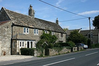
Wingfield is a small village and civil parish in the county of Wiltshire, England, about 2.5 miles (4.0 km) south of Bradford-on-Avon and 2.2 miles (3.5 km) west of Trowbridge.
Conkwell is a hamlet in Winsley parish, Wiltshire, England, near the county border with North East Somerset. It is about 2.3 miles (3.7 km) west of Bradford-on-Avon and 3 miles (5 km) southeast of the city of Bath. The settlement was established to house the workers in the local stone quarries. The southern side is in Winsley, but the northern is in the Somerset parish of Bathford.
Turleigh is a hamlet in west Wiltshire, England. It lies immediately south of the village of Winsley, overlooking the Avon valley, about 1.2 miles (1.9 km) west of Bradford on Avon. The Kennet and Avon Canal and Avoncliff railway station are below the hamlet in the river valley.
South Wraxall is a village and a civil parish in Wiltshire, England, 2.5 miles (4.0 km) north of Bradford on Avon. The village is to the west of the B3109 road from Bradford on Avon to Corsham.
Winsley is a large village and civil parish about 2 miles (3 km) west of Bradford on Avon in Wiltshire, England.
Media related to Westwood, Wiltshire at Wikimedia Commons