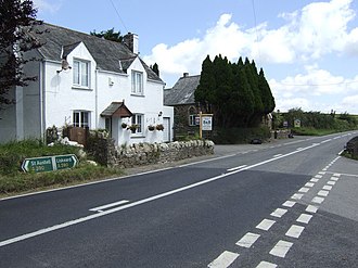
West Taphouse is a hamlet in Cornwall, England. It is on the A390 road west of Middle Taphouse and East Taphouse. [1]
West Taphouse is a hamlet in Cornwall, England. It is on the A390 road west of Middle Taphouse and East Taphouse. [1]
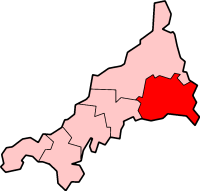
Caradon was a local government district in Cornwall, United Kingdom. It contained five towns: Callington, Liskeard, Looe, Saltash and Torpoint, and over 80 villages and hamlets within 41 civil parishes. Its District Council was based in Liskeard 50.453°N 4.465°W.

North Cornwall is an area of Cornwall, England, United Kingdom. It is also the name of a former local government district, which was administered from Bodmin and Wadebridge 50.516°N 4.835°W. Other towns in the area are Launceston, Bude, Padstow, and Camelford.

Braddock is a village and a civil parish in Cornwall, England, United Kingdom. The village is about seven miles west of Liskeard, and five miles south-east of Bodmin.
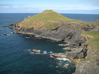
The Rumps is a twin-headland promontory at the north-east corner of Pentire Head in north Cornwall, United Kingdom.

The River Hayle is a small river in West Cornwall, England, United Kingdom which issues into St Ives Bay at Hayle on Cornwall's Atlantic coast.
There are seventeen disused railway stations on the Cornish Main Line between Plymouth in Devon and Penzance in Cornwall, England. The remains of nine of these can be seen from passing trains. While a number of these were closed following the so-called "Beeching Axe" in the 1960s, many of them had been closed much earlier, the traffic for which they had been built failing to materialise.

The Par River, also known as the Luxulyan River is a river draining the area north of St Blazey in Cornwall, in the United Kingdom.

East Taphouse is a village in Cornwall, England, in the civil parish of St Pinnock, one mile (1.6 km) west of Doublebois on the A390 Liskeard to St Austell road. A little further west are the hamlets of Middle Taphouse and West Taphouse.

The River Inny is a small river in east Cornwall, United Kingdom. It is a tributary of the River Tamar and is about twenty miles (32 km) long from its source near Davidstow on the eastern flank of Bodmin Moor to its confluence with the Tamar at Inny Foot near Dunterton.

The River Menalhyl is a river in Cornwall, England, that flows through the civil parishes of St Columb Major and Mawgan-in-Pydar. Its length is about 12 miles and it flows in a generally north-west direction. The name comes from the Cornish words melyn meaning mill and heyl meaning estuary - estuary mills. The name was recorded as Mellynheyl in the 19th century, but it had been known as Glyvion.
The Cornish Way is a cycle route which is part of the National Cycle Network that links Bude to Land's End. The route is via Padstow or St Austell and is 180 miles in length.
Dobwalls and Trewidland is a civil parish in south-east Cornwall, England, United Kingdom.

The River Ottery is a small river in northeast Cornwall, United Kingdom. The river is about twenty miles (32 km) long from its source southeast of Otterham to its confluence with the River Tamar at Nether Bridge, two miles (3.2 km) northeast of Launceston.
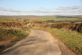
Middle Taphouse is a hamlet in east Cornwall, England, about five miles (8.0 km) west of Liskeard along the A390 road. It consists of a small group of [[bungalows] and houses]. Hillball Wood is immediately east of the hamlet, and further woodland lies to the north. The hamlet of West Taphouse is a little further west along the A390 and the small village of East Taphouse is further east. The Western Greyhound 575 bus service between St Neot and Liskeard stops at Middle Taphouse.
Trewindle is a hamlet west of West Taphouse, Cornwall, England, United Kingdom.
Camelford Football Club is a football club based in Camelford, Cornwall, England. They are currently members of the South West Peninsula League Premier Division West and play at Trefrew Park.

Callington Town Football Club is a football club based in Callington, Cornwall, England. They are currently members of South West Peninsula League Premier Division West and play at Marshfield Parc.

The Battle of Hingston Down took place in 838 at Hingston Down in Cornwall between a combined force of Cornish and Vikings on the one side, and West Saxons led by Egbert, King of Wessex on the other. It resulted in a West Saxon victory.

The River Seaton is a river in east Cornwall, England, UK which flows southwards for 11 miles (17 km) into the English Channel.
St Dennis Association Football Club is a football club based in St Dennis, Cornwall. They are currently members of the South West Peninsula League Premier Division West and play at Boscawen Park.
| Unitary authorities | |
|---|---|
| Major settlements |
|
| Rivers | |
| Topics | |
Coordinates: 50°26′29.35″N4°36′5.24″W / 50.4414861°N 4.6014556°W
| | This Cornwall location article is a stub. You can help Wikipedia by expanding it. |