West Barsham

Last updated

West Barsham
West Barsham Church.jpg
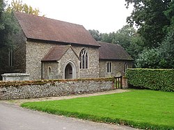
West Barsham church The Assumption of the Blessed Virgin Mary
Norfolk UK location map.svg
Red pog.svg
West Barsham
Location within Norfolk
OS grid reference TF9133
Civil parish
District
Shire county
Region
Country England
Sovereign state United Kingdom
Post town Fakenham
Postcode district NR21
Dialling code 01328
Police Norfolk
Fire Norfolk
Ambulance East of England
UK Parliament
List of places
UK
England
Norfolk
52°51′59″N0°49′47″E / 52.866251°N 0.829706°E / 52.866251; 0.829706 Coordinates: 52°51′59″N0°49′47″E / 52.866251°N 0.829706°E / 52.866251; 0.829706

West Barsham is a village and former civil parish, now in the parish of Barsham, in the North Norfolk district, in the county of Norfolk, England. [1] In 1931 the parish had a population of 89. [2] On 1 April 1935 the parish was abolished to form Barsham. [3]

The village is one of four settlements within the parish of Barsham. The other villages are North Barsham, East Barsham and Houghton St Giles.

West Barsham is 3.2 miles north of the town of Fakenham, 24.1 miles west of Cromer and 117 miles north of London. The nearest railway station is at Sheringham for the Bittern Line which runs between Sheringham, Cromer and Norwich. The nearest airport is Norwich International Airport.

Related Research Articles

<span class="mw-page-title-main">Toftrees</span> Human settlement in England

Toftrees is a village and former civil parish, now in the parish of Dunton, in the North Norfolk district, in the county of Norfolk, England. The hamlet is 2.3 miles south west of Fakenham, 27.3 miles north west of Norwich and 113 miles north north east of London. The nearest railway station is at Sheringham for the Bittern Line which runs between Sheringham, Cromer and Norwich. The nearest airport is Norwich International Airport. The village is situated on the north west side of the A1065 Fakenham to Swaffham road. In 1931 the parish had a population of 72.

<span class="mw-page-title-main">Illington</span> Human settlement in England

Illington is a village and former civil parish, now in the parish of Wretham in the Breckland district, in the county of Norfolk, England. The village is 6.2 miles north east of Thetford, 24 miles west south west of Norwich and 92.3 miles north east of London. The nearest railway station is at Thetford for the Breckland Line which runs between Cambridge and Norwich. The nearest airport is Norwich International Airport. In 1931 the parish had a population of 53. On 1 April 1935 the parish was abolished to form Wretham.

<span class="mw-page-title-main">West Lexham</span> Human settlement in England

West Lexham is a village and former civil parish, now in the parish of Lexham, in the Breckland district, in the county of Norfolk, England. It is 5.9 miles (9.5 km) north of the town of Swaffham, 30.6 miles (49.2 km) west north west of Norwich and 105 miles (169 km) north east of London. In 1931 the parish had a population of 101. On 1 April 1935 the parish was abolished to form Lexham.

<span class="mw-page-title-main">Saxlingham</span> Human settlement in England

Saxlingham is a village and former civil parish, now in the parish of Field Dalling, in the North Norfolk district, in the county of Norfolk, England. It lies 13 miles (21 km) west of Cromer, 26 miles (42 km) north-west of Norwich, 3.6 miles (5.8 km) west of the town of Holt and 126 miles (203 km) north-east of London. In 1931 the parish had a population of 122.

<span class="mw-page-title-main">Tatterford</span> Human settlement in England

Tatterford is a village and former civil parish, now in the parish of Tattersett, in the North Norfolk district, in the county of Norfolk, England. The village is 4.8 miles south west of the town of Fakenham, 30.3 miles north west of Norwich and 112 miles north north east of London. The nearest railway station is at Sheringham for the Bittern Line which runs between Sheringham, Cromer and Norwich. The nearest airport is Norwich International Airport. In 1931 the parish had a population of 66.

<span class="mw-page-title-main">Ridlington, Norfolk</span> Human settlement in England

Ridlington is a village and former civil parish, now in the parish of Witton, in the North Norfolk district, in the county of Norfolk, England. The village is 19.7 miles (31.7 km) north-east of Norwich, 13 miles (21 km) south east of Cromer and 138 miles (222 km) north-east of London. The village lies 4.6 miles (7.4 km) east of the town of North Walsham.The nearest railway station is at North Walsham for the Bittern Line which runs between Cromer and Norwich. The nearest airport is Norwich International Airport. The civil parish was merged into Witton on 1 April 1935. In 1931 the civil parish had a population of 180.

<span class="mw-page-title-main">Tuttington</span> Human settlement in England

Tuttington is a village and former civil parish, now in the parish of Burgh and Tuttington, in the Broadland district, in the county of Norfolk, England. The village is 11.1 miles south of Cromer, 15 miles north of Norwich and 129 miles north-east of London. The village lies 3 miles east of the nearby town of Aylsham.

<span class="mw-page-title-main">Upper Sheringham</span> Human settlement in England

Upper Sheringham is a village and a civil parish in the English county of Norfolk. The village is 26.8 miles (43.1 km) north-north-west of Norwich, 6 miles (9.7 km) west of Cromer and 132 miles (212 km) north-north-east of London. The village is 1.2 miles (1.9 km) from the town of Sheringham. The nearest railway station is at Sheringham for the Bittern Line which runs between Sheringham, Cromer and Norwich. The nearest airport is Norwich International Airport. Nearby road connections are the A149 King's Lynn to Great Yarmouth road to the north of the village and the A148 King's Lynn to Cromer road just to the south. The parish of Upper Sheringham in the 2001 census, a population of 214, reducing slightly to 209 at the 2011 Census. For the purposes of local government, the parish falls within the district of North Norfolk.

<span class="mw-page-title-main">Bale, Norfolk</span> Human settlement in England

Bale is a village and former civil parish, now in the parish of Gunthorpe, in the North Norfolk district, in the county of Norfolk, England. The village is on the north side of the A148 King's Lynn to Cromer road. The village is 9 miles east north east of the town of Fakenham, 14.3 miles west south west of Cromer and 125 miles north north east of London. The nearest railway station is at Sheringham for the Bittern Line which runs between Sheringham, Cromer and Norwich. The nearest airport is Norwich International Airport. In 1931 the parish had a population of 208.

<span class="mw-page-title-main">Cockthorpe</span> Human settlement in England

Cockthorpe is a village and former civil parish, now in the parish of Binham, in the North Norfolk district, in the county of Norfolk, England. It is 5.2 miles (8.4 km) north-west of Holt, 28.9 miles (46.5 km) north-west of Norwich and 127 miles (204 km) north of London. In 1931 the parish had a population of 55. On 1 April 1935 the parish was abolished and merged with Binham.

<span class="mw-page-title-main">Stibbard</span> Human settlement in England

Stibbard is a village and civil parish in the English county of Norfolk. The village is 19.3 miles (31.1 km) south-west of Cromer, 21.2 miles (34.1 km) north-west of Norwich and 120 mi (190 km) north-east of London. The village lies 4.9 miles (7.9 km) south-east of the nearby town of Fakenham. The nearest railway station is at Sheringham for the Bittern Line which runs between Sheringham, Cromer and Norwich. The nearest airport is Norwich International Airport.

<span class="mw-page-title-main">East Barsham</span> Human settlement in England

East Barsham is a village and former civil parish, now in the parish of Barsham, in the North Norfolk district, in the English county of Norfolk. In 1931 the parish had a population of 144. On 1 April 1935 the parish was abolished to form Barsham.

<span class="mw-page-title-main">North Barsham</span> Human settlement in England

North Barsham is a village and former civil parish, now in the parish of Barsham, in the North Norfolk district, in the county of Norfolk, England. In 1931 the parish had a population of 79.

<span class="mw-page-title-main">Houghton Saint Giles</span> Human settlement in England

Houghton Saint Giles is a village and former civil parish, now in the parish of Barsham, in the North Norfolk district, in the English county of Norfolk. It has also been referred to as Houghton-le-Dale or Houghton-in-the-Hole. In 1931 the parish had a population of 142.

<span class="mw-page-title-main">Sharrington</span> Human settlement in England

Sharrington is a village and former civil parish, now in the parish of Brinton, in the North Norfolk district, in the county of Norfolk, England. The village is laid out on the southern edge of the A148, 3.5 miles west of Holt. The village is 10 miles east-northeast of the town of Fakenham, 13.4 miles west-southwest of Cromer and 124 miles north-northeast of London. The nearest railway station is at Sheringham for the Bittern Line which runs between Sheringham, Cromer and Norwich. The nearest airport is at Norwich. In 1931 the parish had a population of 195. On 1 April 1935 the parish was abolished and merged with Brinton.

<span class="mw-page-title-main">Barney, Norfolk</span> Human settlement in England

Barney is a village and former civil parish, now in the parish of Fulmodeston, in the North Norfolk district, in the county of Norfolk, England. Settled prior to the Norman Invasion of 1066, the village lies to the south of the A148 King's Lynn to Cromer road near Thursford.The village is 7.2 miles (11.6 km) east north east of the town of Fakenham, 17.1 miles (27.5 km) west south west of Cromer and 121 miles (195 km) north north east of London. The nearest railway station is at Sheringham for the Bittern Line which runs between Sheringham, Cromer and Norwich. The nearest airport is Norwich International Airport. In 1931 the parish had a population of 243.

<span class="mw-page-title-main">Bradfield, Norfolk</span> Human settlement in England

Bradfield is a village and former civil parish, now in the parish of Swafield, in the North Norfolk district, in the county of Norfolk, England. The village is 7.6 miles (12.2 km) south south east of Cromer, 18.1 miles (29.1 km) north north east of Norwich and 135 miles (217 km) north east of London. The village lies 3.1 miles (5.0 km) north north west of the town of North Walsham. In 1931 the parish had a population of 136.

<span class="mw-page-title-main">Quarles, Norfolk</span> Human settlement in England

Quarles is a hamlet and former civil parish, now within the civil parish of Holkham in the English county of Norfolk. The hamlet is 4 miles (6.4 km) south-west of Wells-next-the-Sea, 34 miles (55 km) north-west of Norwich and 122 miles (196 km) north-north-east of London. The nearest railway station is Sheringham for the Bittern Line which runs between Sheringham, Cromer and Norwich. The nearest airport is Norwich International Airport. For the purposes of local government, the parish falls within the district of North Norfolk. The hamlet is just south of the Holkham Estate and consists of six houses and one farm. In 1931 the civil parish had a population of 38.

<span class="mw-page-title-main">Hunworth</span> Human settlement in England

Hunworth is a village and former civil parish, now in the parish of Stody, in the North Norfolk district, in the county of Norfolk, England. The village is 11.5 miles (18.5 km) east-north-east of the town of Fakenham, 12.6 miles (20.3 km) west-south-west of Cromer and 125 miles (201 km) north-north-east of London. The nearest town is Holt which lies 3.4 miles (5.5 km) north of the village. The nearest railway station is at Sheringham for the Bittern Line which runs between Sheringham, Cromer and Norwich. The nearest airport is Norwich International Airport. The village is situated on the road between Holt and Briston. In 1931 the parish had a population of 173.

<span class="mw-page-title-main">Calthorpe, Norfolk</span> Village in Norfolk, England

Calthorpe is a small village and former civil parish, now in the parish of Erpingham, in the North Norfolk district, in the county of Norfolk, England. The village is located 0.5 miles (0.80 km) west of the village of Erpingham, 3.4 miles (5.5 km) north of the nearest town of Aylsham and is 15.8 miles (25.4 km) north of the nearest city of Norwich. The nearest railway station is at Gunton for the Bittern Line which runs between Sheringham, Cromer and Norwich and is 7.8 miles (12.6 km) from the village. The nearest airport is Norwich International 14.2 miles (22.9 km) south of the village. In 1931 the parish had a population of 143.

References

  1. OS Explorer Map 24 - Norfolk Coast Central. ISBN   0-319-21726-4.
  2. "Population statistics West Barsham AP/CP through time". A Vision of Britain through Time . Retrieved 28 January 2023.
  3. "Relationships and changes West Barsham AP/CP through time". A Vision of Britain through Time. Retrieved 28 January 2023.