
North Walsham is a market town and civil parish in Norfolk, England, within the North Norfolk district. The town is located 8 mi (13 km) south of Cromer and Norwich is 15 mi (24 km) south.

Brumstead is a village and a civil parish in the English county of Norfolk. The village is 15.3 miles (24.6 km) north-east of Norwich, 17.6 miles (28.3 km) south-south-east of Cromer and 134 miles (216 km) north-east of London. The village lies 1.2 miles (1.9 km) north of the town of Stalham.

Trimingham is a coastal village and a civil parish in the North Norfolk district of Norfolk, England. The village is 5 miles (8 km) north of North Walsham, 4 miles (6 km) east of Cromer, 20 miles (32 km) north of the city and county town of Norwich, and is on the B1159 coastal road between Cromer and Mundesley.
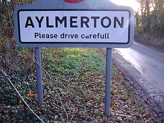
Aylmerton is a village in the county of Norfolk, England. It is in the area of North Norfolk and lies 2.2 miles (3.5 km) south of the North Sea, 3.2 miles (5.1 km) south-west of Cromer and 7.5 miles (12.1 km) east of Holt. The parish is bordered by the parishes of Beeston Regis and Runton to the north, West Beckham to the west, Felbrigg to the east and Gresham and Sustead to the south. The centre of the village is ¾ miles south of the A148 King's Lynn to Cromer road with Sandy Lane and Beechwood Avenue north of it. The nearest railway stations are West Runton at the bottom of Sandy Lane, Cromer at 2.9 miles (4.7 km) and Roughton Road at 4.1 miles (6.6 km). The civil parish has an area of 6.86 square kilometres and in the 2001 census the population was 435 in 178 households, increasing to 458 at the 2011 Census. For the purposes of local government, the parish is in North Norfolk, whose headquarters are in Cromer.

Beeston Regis is a village and civil parish in the North Norfolk district of Norfolk, England. It is about a mile (2 km) east of Sheringham, Norfolk and near the coast. The village is 2 miles (3 km) west of Cromer and 16 miles (26 km) north of the city of Norwich. According to the 2011 census, it had a population of 1,062. There is a frequent bus service between Sheringham and Norwich, as well as being served by the Coasthopper along the coast road A149, and a rail service from the nearby stations of Sheringham to the west and West Runton to the east, where the Bittern Line runs a frequent service between Norwich, Cromer and Sheringham. The nearest airport is Norwich International Airport.

Bodham is a civil parish in the English county of Norfolk. The village is 27.2 miles north north west of Norwich, 6.4 miles west of Cromer and 131 miles north north east of London. The village lies 3.1 miles south west of the nearest town of Sheringham.The nearest railway station is at Sheringham for the Bittern Line which runs between Cromer and Norwich. The nearest airport is Norwich International Airport. The village is situated on the A148 coast road which links the town of King's Lynn to Cromer. The civil parish had in 2001 census, a population of 435, increasing to 484 at the 2011 Census. For the purposes of local government, the parish falls within the district of North Norfolk.

Ingworth is a village and a civil parish in the English county of Norfolk. It is 1.7 miles (2.7 km) north of Aylsham, 14.3 miles (23.0 km) north of Norwich, 7.3 miles (11.7 km) east of North Walsham and 9 miles (14 km) south-southwest of Cromer. The nearest railway station is at North Walsham, which is located on the Bittern Line between Sheringham and Norwich. The nearest airport is Norwich International Airport. The village is bypassed by the A140 road, 0.9 miles (1.4 km) to the west. The village and parish of Ingworth had, in the 2001 census, a population of 94. For the purposes of local government, the village falls within the district of North Norfolk. The population taken at the 2011 census remained less than 100 and was included in the civil parish of Erpingham.
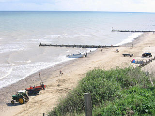
Mundesley /ˈmʌn.dzli/ is a coastal village and a civil parish in the English county of Norfolk. The village is 20.3 miles (32.7 km) north-north east of Norwich, 7.3 miles (11.7 km) south east of Cromer and 136 miles (219 km) north east of London. The village lies 5.6 miles (9.0 km) north-north east of the town of North Walsham. The nearest railway station is at North Walsham, for the Bittern Line which runs between Sheringham and Norwich. The nearest airport is Norwich Airport. The village sits astride the B1159 coast road that links Cromer and Caister-on-Sea, and is at the eastern end of the B1145 a route which runs between King's Lynn and Mundesley. Mundesley is within the Norfolk Coast AONB. It has a resident population of around 2,695, measured at 2,758 in the 2011 Census. The River Mun or Mundesley Beck flows into the sea here. On 5 September 2022 Mundesley beach won the North Norfolk District Council Battle of the Beaches to be recognised as the top beach in North Norfolk in a close run off against West Runton beach.

Briningham is a village and a civil parish in the English county of Norfolk. The village is 9.9 miles east north east of the town of Fakenham, 13.3 miles west south west of Cromer, 22.3 miles north north west of the city of Norwich, and 124 miles north north east of London.

Briston is a village, civil parish and electoral ward in the English county of Norfolk that contains the hamlet of Briston Common. The village is 11 miles (18 km) east north east of the town of Fakenham, 13.3 miles (21.4 km) west south west of Cromer, 20.3 miles (32.7 km) north north west of the city of Norwich, and 125 miles (201 km) north north east of London. The village is situated on the route of the B1354 that runs between the A148 at Thursford and the B1149 at Saxthorpe.
Felmingham is a village and civil parish in the English county of Norfolk. The village is located 2 miles (3.2 km) west of North Walsham and 13 miles (21 km) north of Norwich, along the B1145 between King's Lynn and Mundesley.

The A149 is commonly known as "The Coast Road" to local residents and tourists, as this road runs along the North Norfolk coast from King's Lynn to Great Yarmouth, via coastal villages.
Upper Sheringham is a village and a civil parish in the English county of Norfolk. The village is 26.8 miles (43.1 km) north-north-west of Norwich, 6 miles (9.7 km) west of Cromer and 132 miles (212 km) north-north-east of London. The village is 1.2 miles (1.9 km) from the town of Sheringham.

Northrepps is a village and a civil parish in the English county of Norfolk. It is 3.4 miles (5.5 km) southeast of Cromer, 22.2 miles (35.7 km) north of Norwich and 137 miles (220 km) north of London. The village lies west of the A149 which runs between Kings Lynn and Great Yarmouth. The nearest railway station is at Cromer for the Bittern Line which runs between Sheringham, Cromer and Norwich. The nearest airport is Norwich International Airport. The village and parish of Northrepps had in the 2001 census a population of 839, increasing to 886 at the 2011 Census. For the purposes of local government, the village falls within the district of North Norfolk.

Thorpe Market is a village in the English county of Norfolk. The village is located 4.4 miles south of Cromer and 20.5 miles north of Norwich. The village's name means 'Outlying farm/settlement with a market'.
Southrepps is a village and a civil parish in the English county of Norfolk. The village is 5.2 miles (8.4 km) southeast of Cromer, 21.9 miles (35.2 km) north of Norwich and 136.0 miles (218.9 km) north of London. The village lies northeast of the A149 between Kings Lynn and Great Yarmouth. The nearest railway station is at Gunton for the Bittern Line which runs between Sheringham, Cromer and Norwich. The nearest airport is Norwich International Airport. The village is close to the sea and surrounded by rich agricultural land.

The Paston Way is a footpath. It is entirely within the English county of Norfolk in the United Kingdom. The footpath is twenty miles in length, the portals to the path are Cromer at its northwestern end and North Walsham at it southeastern end.

Barney is a village and former civil parish, now in the parish of Fulmodeston, in the North Norfolk district, in the county of Norfolk, England. Settled prior to the Norman Invasion of 1066, the village lies to the south of the A148 King's Lynn to Cromer road near Thursford.The village is 7.2 miles (11.6 km) east north east of the town of Fakenham, 17.1 miles (27.5 km) west south west of Cromer and 121 miles (195 km) north north east of London. The nearest railway station is at Sheringham for the Bittern Line which runs between Sheringham, Cromer and Norwich. The nearest airport is Norwich International Airport. In 1931 the parish had a population of 243.

Bradfield is a village and former civil parish, now in the parish of Swafield, in the North Norfolk district, in the county of Norfolk, England. The village is 7.6 miles (12.2 km) south south east of Cromer, 18.1 miles (29.1 km) north north east of Norwich and 135 miles (217 km) north east of London. The village lies 3.1 miles (5.0 km) north north west of the town of North Walsham. In 1931 the parish had a population of 136.

Frogshall is a small hamlet within the civil parish of Northrepps in the English county of Norfolk. The hamlet is 5.2 miles (8.4 km) southeast of Cromer, 21.9 miles (35.2 km) north of Norwich and 136 miles (219 km) north of London. Craft Lane runs through the hamlet between Northrepps and Southrepps. The nearest railway station is at Gunton on the Bittern Line which runs between Sheringham, Cromer and Norwich. The nearest airport is Norwich International Airport. The hamlet as part of the greater parish of Northrepps had in the 2011 census, a population of 886. For the purposes of local government, the hamlet falls within the district of North Norfolk.

