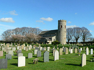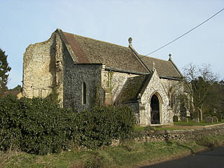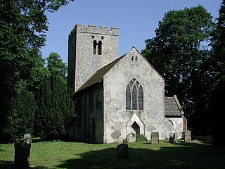
Blakeney is a coastal village and civil parish in the English county of Norfolk. Blakeney lies within the Norfolk Coast AONB and the North Norfolk Heritage Coast. The North Norfolk Coastal Path travels along its quayside. The village is 21.1 miles (34.0 km) north west of Norwich, 4.6 miles (7.4 km) NNW of the larger settlement of Holt, 11.5 miles (18.5 km) west of Cromer and 112 miles (180 km) NNE of London.

Kettlestone is a village and civil parish in the English county of Norfolk. It covers an area of 7.55 km2 (2.92 sq mi) and had a population of 177 in 85 households at the 2001 census, increasing to 197 at the 2011 Census. For the purposes of local government, it falls within the district of North Norfolk.

Bawsey is a village and civil parish in the English county of Norfolk. The village is about 4 miles (6.4 km) east of the town of King's Lynn and 40 miles (64 km) west of the city of Norwich. The village sits astride of the B1145 Kings Lynn to Mundesley road that dissects North Norfolk west to east.

Binham is a village and a civil parish in the English county of Norfolk. The village is 29.3 miles (47.2 km) north west of Norwich, 16.9 miles (27.2 km) west of Cromer and 124 miles (200 km) north north east of London. The village lies 4.9 miles (7.9 km) east south east of the town of Wells-next-the-Sea.

Wood Norton is a village and civil parish in the English county of Norfolk. It is located 10 km (6.2 mi) east of Fakenham and 30 km (19 mi) north-west of Norwich.

Witton is a village and civil parish in the English county of Norfolk. It is located 8 km (5.0 mi) east of the town of North Walsham and 30 km (19 mi) north of the city of Norwich. It should not be confused with the quite different Norfolk village of similar name in the parish of Postwick with Witton, some 8 km (5.0 mi) east of Norwich.

Wighton is a village and civil parish in the English county of Norfolk. The village is situated some 6 km (3.7 mi) south of the town of Wells-next-the-Sea, 12 km (7.5 mi) north of the town of Fakenham, and 45 km (28 mi) north-west of the city of Norwich. The medieval pilgrimage centre of Walsingham lies 3 km (1.9 mi) to the south.

Watlington is a civil parish and electoral ward in the English county of Norfolk. It covers an area of 6.93 km2 (2.68 sq mi) and had a population of 2,031 in 852 households at the 2001 census, the population increasing to 2,455 at the 2011 Census. For the purposes of local government, it falls within the district of King's Lynn and West Norfolk.

Burnham Norton is a village and civil parish in the English county of Norfolk. It is one of the Burnhams, a group of adjacent villages in north Norfolk on the A149, some 2 km north of the larger village of Burnham Market, 35 km north-east of King's Lynn and 60 km north-west of the city of Norwich. The villages' name means "Homestead/village on the River Burn" or perhaps, "hemmed-in land on the River Burn". Norton, which means "North farm/settlement", was added to distinguish it from the other Burnhams in Norfolk.

Congham is a village and civil parish in the English county of Norfolk. It is situated some 10 km east of the town of King's Lynn and 55 km west of the city of Norwich.

West Newton is a village in the north of the English county of Norfolk. The village is situated some 1 km south of the village of Sandringham, 11 km north of the town of King's Lynn and 60 km north-west of the city of Norwich. The village forms part of the civil parish of Sandringham, which is in turn part of the district of King's Lynn and West Norfolk.

Cockley Cley is a village and civil parish in the English county of Norfolk. It covers an area of 17.94 km2 (6.93 sq mi) and had a population of 138 in 58 households in the 2001 census, including South Pickenham and increasing to a population of 232 in 103 households at the 2011 Census. For the purposes of local government, it falls within the district of Breckland.

Fulmodeston is a village and civil parish in the English county of Norfolk. The Village is 18.3 miles (29.5 km) west south west of Cromer, 23.5 miles (37.8 km) north north west of Norwich and 120 miles (190 km) north north east of London. The village lies 6.6 miles (10.6 km) east of the town of Fakenham. The village is located 2 miles (3.2 km) east of the A148 Fakenham to Cromer road, and is 2.3 miles (3.7 km) north of the A1067 Fakenham to Norwich road. The nearest railway station is at Sheringham for the Bittern Line which runs between Sheringham, Cromer and Norwich. The nearest airport is Norwich International Airport. The village and parish of Fulmodeston had in the 2001 census, a population of 431, including Barney and increasing slightly to 442 at the 2011 Census. The civil parish of Fulmodeston has an area of 1,504 Hectares. For the purposes of local government, the village falls within the district of North Norfolk.

Easton is a village and civil parish in Norfolk, England, to the west of Norwich. It covers an area of 6.25 km2 (2.41 sq mi) and had a population of 1,141 in 445 households at the 2001 census, the population increasing to 1,514 at the 2011 Census. Located close to the Royal Norfolk Showground and the A47, it also houses a campus of Easton & Otley College, a large agricultural college, in the Grade II listed 18th-century Easton Hall.

West Rudham is a civil parish in the English county of Norfolk. The village straddles the A148 King's Lynn to Cromer road. It covers an area of 11.81 km2 (4.56 sq mi) and had a population of 213 in 97 households at the 2001 census, the population including Houghton and increasing to 288 at the 2011 census. For the purposes of local government, it falls within the district of King's Lynn and West Norfolk.

East Rudham is a village and civil parish in the English county of Norfolk. It covers an area of 17.94 km2 (6.93 sq mi) and had a population of 525 in 240 households at the 2001 census, including Broomsthorpe and increasing to 541 at the 2011 Census. For the purposes of local government, it falls within the district of King's Lynn and West Norfolk.

Hillington is a civil parish in the English county of Norfolk. It covers an area of 10.27 km2 (3.97 sq mi) and had a population of 287 in 123 households as of the 2001 census, increasing to 400 at the 2011 Census. For the purposes of local government, it falls within the district of King's Lynn and West Norfolk.

Great Dunham is a village situated in the Breckland District of Norfolk and covers an area of 818 hectares with an estimated population of 325, including Kempstone and increasing to a measured population of 344 at the 2011 Census. The village lies 1.5 miles (2.4 km) north of its sister village Little Dunham and 7 miles (11 km) by road north east from Swaffham.

Didlington is a village in the Breckland district of mid-Norfolk, East Anglia, England in the United Kingdom. It has an area of 11.07 km2 (4.27 sq mi) with a population of 48. At the 2011 Census the minimal population was included in the civil parish of Ickburgh.

Gooderstone is a village situated in the Breckland District of Norfolk and covers an area of 11.29 km2 (4.36 sq mi) with an estimated population of 390 in 2007, reducing to 363 at the 2011 Census. It lies 6 miles (9.7 km) south west from Swaffham.


