Langham, Norfolk

Last updated

Langham
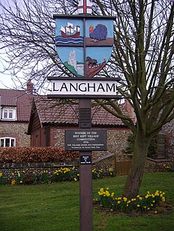
Village Sign, Langham, Norfolk, 24th March 2009.JPG
Langham Village Sign
Norfolk UK location map.svg
Red pog.svg
Langham
Location within Norfolk
Area2.73 sq mi (7.1 km2)
Population355 (2021 census)
  Density 130/sq mi (50/km2)
OS grid reference TG000410
  London 126 miles (203 km)
Civil parish
  • Langham CP
District
Shire county
Region
Country England
Sovereign state United Kingdom
Post town HOLT
Postcode district NR25
Dialling code 01328
Police Norfolk
Fire Norfolk
Ambulance East of England
UK Parliament
List of places
UK
England
Norfolk
52°55′52″N0°59′10″E / 52.931°N 0.986°E / 52.931; 0.986

Langham is a village and civil parish in the English county Norfolk.

Contents

Langham is located 14.7 miles (23.7 km) west of Cromer and 27.2 miles (43.8 km) north-west of Norwich, along the B1156 road, between Blakeney and Sharrington and within the Norfolk Coast Area of Outstanding Natural Beauty.

History

Langham's name is of Anglo-Saxon origin and derives from the Old English for the long homestead. [1]

In the Domesday Book, Langham is listed as a settlement of 62 households in the hundred of Holt. In 1086, the village was part of the East Anglian estates of William de Beaufeu. [2]

Langham Hall was built in the 18th century in the Greek Revival style for the Reverend Rippinghall who also designed the house. The hall was used as a hospital by the Royal Air Force during the Second World War. [3]

During the Second World War, much of the parish became RAF Langham which was used until 1961 mostly by RAF Coastal Command. Today, a dome used to trained air gunners still stands and is one of the few examples still left in the country. [4]

The former site of the airfield is the site of reputed haunting in which screaming, the sounds of aircraft crashing and ghostly USAAF servicemen have been heard or seen. [5]

Geography

According to the 2021 census, Langham had a population of 355 people, a decrease from the 372 people recorded in the 2011 census. [6]

Church of St. Andrew & St. Mary

Langham's parish church is jointly dedicated to Saint Andrew and Saint Mary and dates from the Fourteenth Century. The church is located on Holt Road and has been Grade I listed since 1959. [7] The church no longer holds Sunday service. [8]

St. Andrew's & St. Mary's features a stained-glass windows installed in the 1890s by Sir Edward Burne-Jones and a set of royal arms depicting those of Queen Anne which may be from an earlier reign. [9]

Notable Residents

Governance

Langham is part of the electoral ward of Priory for local elections and is part of the district of North Norfolk.

The village's national constituency is North Norfolk, which has been represented by the Liberal Democrat Steff Aquarone MP since 2024.

References

  1. "Key to English Place-names". kepn.nottingham.ac.uk. Retrieved 14 June 2025.
  2. "Langham | Domesday Book". opendomesday.org. Retrieved 14 June 2025.
  3. "mnf6173 - Norfolk Heritage Explorer". www.heritage.norfolk.gov.uk. Retrieved 14 June 2025.
  4. "mnf1891 - Norfolk Heritage Explorer". www.heritage.norfolk.gov.uk. Retrieved 14 June 2025.
  5. "The Paranormal Database - Norfolk". www.paranormaldatabase.com. Retrieved 14 June 2025.
  6. "Langham (Parish, United Kingdom) - Population Statistics, Charts, Map and Location". www.citypopulation.de. Retrieved 14 June 2025.
  7. "CHURCH OF ST MARY AND ST ANDREW, Langham - 1049495 | Historic England". historicengland.org.uk. Retrieved 14 June 2025.
  8. "Langham Episcopi: St Andrew and St Mary". www.achurchnearyou.com. Retrieved 14 June 2025.
  9. "Norfolk Churches". www.norfolkchurches.co.uk. Retrieved 14 June 2025.

Commons-logo.svg Media related to Langham, Norfolk at Wikimedia Commons