Weedon Bec

Last updated

Weedon Bec
Crossroads public house and hotel, Weedon, Northamptonshire.jpg
The Crossroads public house
Northamptonshire UK location map (2021).svg
Red pog.svg
Weedon Bec
Location within Northamptonshire
Population2,706 (2011 Census)
OS grid reference SP629596
  London 68 miles (109 km)
Civil parish
  • Weedon Bec
Unitary authority
Ceremonial county
Region
Country England
Sovereign state United Kingdom
Post town NORTHAMPTON
Postcode district NN7
Dialling code 01327
Police Northamptonshire
Fire Northamptonshire
Ambulance East Midlands
UK Parliament
List of places
UK
England
Northamptonshire
52°13′52″N1°04′50″W / 52.23101°N 1.08045°W / 52.23101; -1.08045

Weedon Bec, usually just Weedon, is a village and parish in West Northamptonshire, England. It is close to the source of the River Nene. The population of the civil parish at the 2011 census was 2,706. [1]

Contents

Geography

Weedon is around 4 miles (6.4 km) southeast of Daventry, 7 miles (11.3 km) west of Northampton. [2] It was at the crossroads of the A5 and former A45 until a bypass opened on 15 November 2018. The Grand Union Canal (1796) and West Coast Main Line both pass through the village. [2]

Narrow Boat public house Narrow Boat, Stowehill, Weedon Bec.jpg
Narrow Boat public house

Lower Weedon and Upper Weedon are to the south. The northern boundary of the village follows the old A45 to the west, then south to just outside Everdon. It skirts Everdon Wood and Everdon Stubbs, and borders Stowe Nine Churches to the southeast, and lies to a short distance east of the A5 up to the A45, next to Flore parish.

Demographics

The 2001 census the village had a population of 2,485, 1,248 male and 1,237 female, 1,237 households and average age 38.34 years. [3] The population at the 2011 Census was 2,706.

History

The village's name comes from the Old English Wēo-dūn meaning 'heathen temple hill'. [4] Just to the south of the parish is the 162 metres (531 ft) Weedon Hill: [2] this may be the hill in question. In the Domesday Book of 1086, the village is named 'Wedone' and located in the ancient hundred of Gravesend. [5] In the 12th century, lordship of the village was granted to the monks of the abbey of Le Bec-Hellouin in Normandy. [6] The 'Bec' part of the name 'Weedon Bec' is derived from the Abbey of Bec-Hellouin in Normandy, France, which owned most of the village until the dissolution of the monasteries, when King Henry VIII granted the village to Eton College.

By the mid-12th century, Gravesend Hundred had been absorbed into Fawsley Hundred, [7] The Fawsley Hundred was disused in the late 19th century as other administrative units superseded its functions, although it continued to appear on early 20th century censuses for statistical purposes. The ancillary villages of Lower Weedon and Upper Weedon formed south of Weedon Bec.

The settlement along the A5, the Roman road called Watling Street, was known as 'Road Weedon' and earlier 'Weedon on the Street'. To avoid confusion with the village of Weedon Lois, the complete village name 'Weedon Bec' is used in many circumstances. The village is usually locally nicknamed 'Weedon' (closer to its ancient name) when including 'Lower Weedon' and 'Upper Weedon' with old 'Weedon Bec', which were three distinct villages now merged into one. [8] The settlement patterns of the three villages have been distorted by the presence of the major road, canal, military establishments and railway station and present an unusual example of urban sprawl in an otherwise rural part of England.

Experiments with radar in 1935

Radar memorial on the road between the A5 and Litchborough south of Weedon Bec Radar Memorial PS.jpg
Radar memorial on the road between the A5 and Litchborough south of Weedon Bec

Arnold Frederic Wilkins demonstrated radar, from radio waves from the Borough Hill transmitter on 26 February 1935. It is often stated as taking place near Weedon Bec, but actually took place in a field just off the A5, towards Litchborough, in the parish of Stowe Nine Churches (Upper Stowe).

A memorial to the event is located off the A5 just south of Weedon on the Litchborough Road (NGR SP650557).

On 26 February 2010, the event was re-enacted 75 years after the event by radio amateurs from the Coventry Amateur Radio Society and the Northampton Radio Club. A working RADAR set was constructed using the two-metre amateur radio band. As with the original experiment the source signal was transmitted from Borough Hill in Daventry. The four target aircraft were flown by pilots with amateur radio licences.

Weedon rail crashes

Weedon has been the site of two serious rail crashes in 1915 and 1951 in which a total of 25 people were killed.

Churches

The parish church, St Peter and St Paul's, is at the south of the village, overlooked from both the Grand Union Canal embankment and the West Coast Main Line viaduct. [2] According to Pevsner, it has a Norman west tower, with the main body of 1825 (chancel rebuilt in 1863 by Edmund Francis Law). This church is a Grade II* listed building. [9] There is a United Reformed Church (former Congregational Chapel) of 1792: this is also a listed building, Grade II. [10]

Richard Bate was named as the vicar of "Wedon Beke", in 1452. [11]

Weedon Bec Primary School

Weedon Bec Primary school on West Street and is part of Innovate Multi Academy Trust with Badby, Kilsby and Woodford Halse Primary School.

Other buildings

The Priory in Oak Street is all that remains of a larger house. The Firs on Queen Street is a house dated 1692.

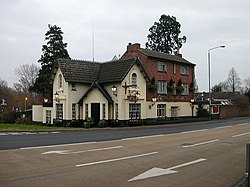
At the crossroads there are a number of pubs, cafés and shops. It is now growing as a centre for the antique trade and more specialist shops.

Ordnance depot

Ordnance depot: former canal gateway Weedon Bec - geograph.org.uk - 93521.jpg
Ordnance depot: former canal gateway
Ordnance buildings flanking the canal arm Weedon BEC - geograph.org.uk - 91960.jpg
Ordnance buildings flanking the canal arm

Next to the canal is the former Napoleonic War era Military Ordnance Depot, established by Act of Parliament in 1803, as part of the British anti-invasion preparations of 1803–05. [12] Designed by Colonel Pilkington of the Royal Engineers, the depot was largely built between 1805 and 1806. It was the central small arms depot for the British Army and was originally served by a branch off the canal that entered through a portcullis. When the railway was built, it also had a branch into the depot.

The depot had eight large storehouses built either side of the central canal and was surrounded by a high stone wall. The upper floors were used for storage of small arms and the ground floors for larger items such as field artillery. There were canal gatehouses at each end of the precinct; beyond which, at a safe distance, the canal entered a further walled area, gated at either end, which contained a row of four gunpowder magazines, each separated from the next by a 'blast house' filled with earth as a precaution against explosions. Later, another magazine was added as was a large clothing store between the precincts in 1902. All the buildings survive and together with the enclosure walls are listed Grade II*. [13]

There was a barracks in the village, holding a standing battalion, a troop of cavalry and a troop of horse artillery. The barracks were demolished in the 1950s. Three large pavilions were built between the depot and barracks to house senior civilian officers of the depot. These were demolished in the 1970s. Next door to the barracks was the Army School of Equitation, also demolished in the 1960s. The depot became redundant in 1965 and was sold by the Ministry of Defence in 1984. It is now used for storage, office accommodation and light industry.

Ordnance Depot Ltd is working with volunteers to interpret the site’s history and in 2018 a visitor centre was opened in the Eastern Gatehouse. [14] The project received a £66,300 grant from the Heritage Lottery Fund. [15]

Fire Services National Museum

The Fire Services National Museum collection was stored at the former ordnance depot and the trust had been working for many years to secure planning approval for the museum to be an integral part of the depot's redevelopment as an out-of-town shopping centre. [16] Following its rejection in 2017 the collection was moved to Hampshire. [17]

Transport

Southbound Virgin Trains Pendolino tilts through the last bend just south of Weedon, about to enter Stowe Hill tunnel, about 40 minutes to Euston Station, London Virgin Pendalino tilting south of Weedon.jpg
Southbound Virgin Trains Pendolino tilts through the last bend just south of Weedon, about to enter Stowe Hill tunnel, about 40 minutes to Euston Station, London

The village is served by three bus routes, all operated by Stagecoach Midlands. The D1 and D2 run between Daventry and Northampton, and the D3 also runs between Daventry and Northampton, although it runs through the centre of the village instead of the High Street. Most of the bus stops have bus shelters. [18]

The village is near the junction of the A45 and A5 and is on the Grand Union Canal.

The West Coast Main Line crosses the eastern edge of the village. Stowe Hill Tunnel is just to the south-east of the village and Weedon Viaduct carries the railway across Church Street and the River Nene. Until the 1960s, Weedon had its own station on the fast lines of the West Coast Main Line, just north of the A45 road bridge. Between 1888 and 1963 there was a railway branch line from just north of Weedon to Leamington Spa via Daventry.

'Sustainable Transport Midlands' (a private body) is campaigning for a parkway station in Weedon to serve Daventry (in addition to Long Buckby). In an interview with BBC News, Councillor Phil Larratt, West Northamptonshire Council cabinet member for Transport said 'West Northamptonshire Council supported new stations and a new facility at Weedon could "serve all the villages and communities between Daventry, Northampton and Towcester".' [19]

Notable residents

Further reading

Related Research Articles

<span class="mw-page-title-main">Long Buckby</span> Human settlement in England

Long Buckby is a large village and civil parish in West Northamptonshire, England. In the 2021 census the parish of Long Buckby, which includes the hamlet of Long Buckby Wharf, was recorded as having a population of 4,511.

<span class="mw-page-title-main">Braunston</span> Human settlement in England

Braunston is a village and civil parish in the West Northamptonshire unitary authority area of Northamptonshire, England, next to the border with Warwickshire. At the 2011 Census, the parish had a population of 1,759. Braunston is situated just off the A45 main road and lies between the towns of Daventry and Rugby. Braunston is categorised by the Office for National Statistics as Suburbs and Small Towns: Suburbs There are 776 households in the village.

<span class="mw-page-title-main">Daventry</span> Market town and civil parish in Northamptonshire, England

Daventry is a market town and civil parish in the West Northamptonshire unitary authority area of Northamptonshire, England, close to the border with Warwickshire. At the 2021 Census, Daventry had a population of 28,123, making it the sixth-largest town in Northamptonshire.

<span class="mw-page-title-main">Daventry District</span> Former local government district in England

Daventry District was a local government district in western Northamptonshire, England, from 1974 to 2021. The district was named after its main town of Daventry, where the council was based.

<span class="mw-page-title-main">A45 road</span> Major road in England

The A45 is a major road in England. It runs east from Birmingham past the National Exhibition Centre and the M42, then bypasses Coventry and Rugby, where it briefly merges with the M45 until it continues to Daventry. It then heads to Northampton and Wellingborough before running north of Rushden and Higham Ferrers and terminating at its junction with the A14 in Thrapston.

<span class="mw-page-title-main">Badby</span> Human settlement in England

Badby is a village and a rural parish of about 2,020 acres (820 ha) in West Northamptonshire, England.

Newnham is a village in West Northamptonshire in England. The village is 2 miles (3 km) south of Daventry, 3 miles (5 km) west from Weedon Bec, 6 miles (10 km) west of junction 16 of the M1 motorway and 11 miles (18 km) west of Northampton. The A45 road runs a mile northwest of the village. The nearest railway station is at Long Buckby, 8 miles (13 km) northeast.

<span class="mw-page-title-main">Farthingstone</span> Village in Northamptonshire, England

Farthingstone is a village in West Northamptonshire in England. It is close to the major trunk routes of the M1 junction 16, M40 motorway, and A5 road, at the head of a valley and is 7 miles (11 km) south of Daventry and 3.5 miles (5.6 km) south west of Weedon Bec.

<span class="mw-page-title-main">Everdon</span> Human settlement in England

Everdon is a village in West Northamptonshire in England, some 3 miles (4.8 km) south of Daventry. The population of the civil parish at the 2011 census was 356.

<span class="mw-page-title-main">Dodford, Northamptonshire</span> Human settlement in England

Dodford is a village in West Northamptonshire, England. Prior to local government changes in 2021 it was within the Weedon Ward of Daventry District. The village is just north of the A45 road 1+12 miles (2.4 km) west of Weedon. The population of the civil parish at the 2011 Census was 203. It is 3+12 miles (5.6 km) east of Daventry and 10 miles (16 km) west of Northampton. It is also close to junction 16 of the M1 motorway. The parish consists of some 1,384 acres (560 ha) and is bounded on the east by the A5 trunk road which is the old Roman road of Watling Street. Most of the village and parish sits astride the valley of an east-flowing stream which is a tributary of the River Nene.

The history of Northamptonshire spans the same period as English history.

<span class="mw-page-title-main">Daventry (UK Parliament constituency)</span> UK Parliament constituency since 1974

Daventry is a constituency in Northamptonshire represented in the House of Commons of the UK Parliament since 2010 by Chris Heaton-Harris of the Conservative Party, who has served as Secretary of State for Northern Ireland since 2022.

Stowe Nine Churches is a civil parish incorporating the settlements of Church Stowe and Upper Stowe in the English county of Northamptonshire. The population of the civil parish at the 2011 census was 259.

<span class="mw-page-title-main">Adstone</span> Human settlement in England

Adstone is a village and civil parish in West Northamptonshire, England. The population at the 2001 census was 65. It remained than 100 at the 2011 census and was included in the civil parish of Tiffield. Adstone is situated approximately 6.5 miles (10 km) south-southeast of Daventry and 6.5 miles (10 km) west-northwest of Towcester. It was known as Atenestone in the Domesday Book.

<span class="mw-page-title-main">Nether Heyford</span> Human settlement in England

Nether Heyford is a village and civil parish in West Northamptonshire, England, close to the M1 motorway and the A5 and A45 roads, 6 miles (10 km) west of Northampton and 70 miles (113 km) northwest of London. The smaller village of Upper Heyford is about half a mile to the north.

<span class="mw-page-title-main">West Northamptonshire</span> District in England

West Northamptonshire is a unitary authority area covering part of the ceremonial county of Northamptonshire, England, created in 2021. By far the largest settlement in West Northamptonshire is the county town of Northampton. Its other significant towns are Daventry, Brackley and Towcester; the rest of the area is predominantly agricultural villages though it has many lakes and small woodlands and is passed through by the West Coast Main Line and the M1 and M40 motorways. The district includes the site of the Roman town of Bannaventa, and the grade I listed Althorp House and its estate.

<span class="mw-page-title-main">North Hyde</span> Human settlement in England

North Hyde is a suburban development situated between the towns of Heston, Hayes and Southall under the administrative control of the London Borough of Hounslow. It is bordered to the north by the Grand Union Canal mainline and to the south by the M4. The area now consists of a mixture of mostly large, semi detached suburban properties. It is also home to the Airlinks golf course and Convent Way, an estate with a mixture of high and low-rise housing.

<span class="mw-page-title-main">Weedon railway station</span> Disused railway station in Northamptonshire

Weedon railway station was located to the north of Weedon Bec in Northamptonshire, England on the West Coast Main Line. It was a junction station, being the starting point of the Weedon to Leamington Spa branch line, with one bay platform dedicated for terminating branch line trains.

References

  1. "Civil Parish population 2011". Neighbourhood Statistics. Office for National Statistics. Retrieved 11 July 2016.
  2. 1 2 3 4 Ordnance Survey. "207 Newport Pagnell and Northampton South" (Map). OS 1:25,000 Landranger series. 1:25,000. Ordnance Survey. Retrieved 16 January 2022.
  3. "UK census 2001 - data" . Retrieved 28 December 2008.
  4. "Key to English Place-names: Weedon Bec". Institute for Name-Studies, University of Nottingham.
  5. Open Domesday: Weedon (Bec). Accessed 22 Jan 2022.
  6. "Key to English Place-names: Weedon Bec". Institute for Name-Studies, University of Nottingham.
  7. Institute for Place-name Studies. "Gravesend Hundred". Key to English place names. University of Nottingham. Retrieved 22 January 2022. 'Grove's end (boundary)'. The hundred was later absorbed into Fawsley hundred. See also Egelweardesle hundred. The meeting-place may have been located about 2 miles north of that of the Fawsley hundred, at a boundary mark north of Badby parish.
  8. "Blisworth website 1920s map shows the various parts of Weedon around the crossroads" . Retrieved 28 December 2008.
  9. Historic England (18 January 1968). "CHURCH OF ST PETER AND ST PAUL, CHURCH STREET (1076520)". National Heritage List for England . Retrieved 6 June 2022.
  10. Historic England (29 April 1987). "Weedon United Reformed Church, Church Street, Weedon, NN7 4PL (1342949)". National Heritage List for England . Retrieved 6 June 2022.
  11. "Plea Rolls of the Court of Common Pleas". National Archives. 1452 via University of Houston.
  12. "Canal, part II". www.blisworth.org.uk.
  13. England, Historic. "Historic Environment Local Management Training Programme - Historic England". historicengland.org.uk.
  14. "The Visitor Centre". The Depot. Retrieved 5 November 2019.
  15. "Weedon's historic Depot wins Lottery support". Daventry Express. 21 February 2017. Retrieved 23 February 2017.
  16. "Fire Services National Museum Trust". Fireworld Museum. Retrieved 31 May 2020.
  17. "The Future". Fireworld Museum. Retrieved 31 May 2020.
  18. "Bus Stops & Shelters". Weedon Bec Parish Council. 4 August 2015.
  19. "Daventry boy, 15, leads campaign for £20m new railway station". BBC News. 11 September 2021. Retrieved 11 September 2021.
  20. Obituary in The Independent

Commons-logo.svg Media related to Weedon Bec at Wikimedia Commons