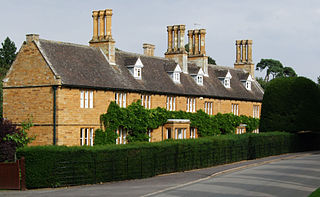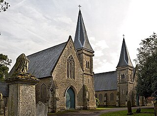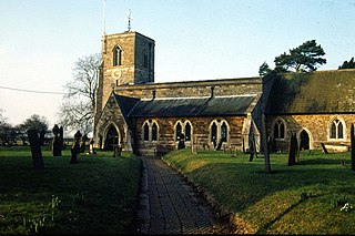
Naseby is a village in West Northamptonshire, England. The population of the civil parish at the 2011 Census was 687.

Daventry District was a local government district in western Northamptonshire, England, from 1974 to 2021. The district was named after its main town of Daventry, where the council was based.

East Farndon is a small linear village and civil parish about one mile south of Market Harborough in West Northamptonshire, England. The village is close to the border with Leicestershire, and has a Leicestershire post code and telephone dialling code. At the time of the 2001 census, the parish's population was 258 people, increasing to 307 at the 2011 census.

Beechingstoke is a small village and civil parish in Wiltshire, England. It lies in the Vale of Pewsey about 5 miles (8 km) west of Pewsey and the same distance east of Devizes. The parish includes the hamlet of Broad Street and the northern part of the village of Bottlesford.

Easton Grey is a small village and civil parish in north Wiltshire, England, on the county boundary with Gloucestershire. The village lies just south of the B4040 road between Malmesbury and Sherston, about 3.5 miles (6 km) west of Malmesbury. The Church of England parish church has a 15th-century tower and was rebuilt in 1836.

Cottesbrooke is a village and civil parish in West Northamptonshire in England. At the time of the 2001 census, the parish's population was 144 people, falling marginally to 143 at the 2011 census.

Compton Martin is a small village and civil parish within the Chew Valley in Somerset and in the Bath and North East Somerset unitary authority in England. The parish has a population of 508. It lies between Chew Valley Lake and Blagdon Lake, north of the Mendip Hills, approximately 10 miles (16 km) south of Bristol on the A368 road Weston-super-Mare to Bath.

Kington St Michael is a village and civil parish about 3 miles (4.8 km) north of Chippenham in Wiltshire, England.

St Mary's Church is located on Overleigh Road in Handbridge, an area south of the River Dee, in the city of Chester, Cheshire, England. It is also known as the Church of St Mary-without-the-Walls, which was to distinguish it from Church of St Mary-on-the-Hill across the River Dee within the city walls. The church is recorded in the National Heritage List for England as a designated Grade II* listed building. It is an active Anglican parish church in the diocese of Chester, the archdeaconry of Chester and the deanery of Chester.

Westwell is a small village and civil parish about 2 miles (3 km) southwest of the market town of Burford in Oxfordshire. It is the westernmost village in the county, close to the border with Gloucestershire.

Seckington is a village and civil parish in North Warwickshire, about 4 miles (6 km) northeast of Tamworth. The B5493 road between Tamworth and Appleby Magna runs through the parish, passing about 100 yards (91 m) north of the village. Seckington shares a parish council with Newton Regis and No Man's Heath. Forming part of the border with Staffordshire, it is the second most northerly settlement in Warwickshire, with only No Man's Heath situated further north, and is only 3.5 miles due south of the Derbyshire border.

Edmund Francis Law, usually referred to as 'E. F. Law', FRIBA was an English architect during the 19th century, notable for a large number of projects, particularly restorations, in the counties of Northamptonshire, Leicestershire and Rutland.

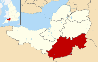
South Somerset is a local government district in the English county of Somerset. The South Somerset district occupies an area of 370 square miles (958 km2), stretching from its borders with Devon and Dorset to the edge of the Somerset Levels. The district has a population of about 158,000, and has Yeovil as its administrative centre.

Blackland is a hamlet and former civil parish, now in the parish of Calne Without, just south-east of the town of Calne, in Wiltshire, England. There is a 13th-century church and an 18th-century country house, Blackland House. In 1881 the parish had a population of 50.

St Andrew's Church is an Anglican church and the parish church of Old, Northamptonshire. It is a Grade I listed building and stands at Church Lane, on the south side of the village.

All Saints' Church is an Anglican Church and the parish church of Naseby in Northamptonshire, England. It is a Grade II* listed building and stands at the southern corner of Church Street and Newlands.

St Helen's Church is the Church of England parish church of the village of Sibbertoft in Northamptonshire. It is a Grade II* listed building and stands on the west side of Church Street at the north end of the village.

Edward Browning was an English architect working in Stamford.

Todenham is a village and civil parish in the Cotswold district of Gloucestershire, England. The village is significant for its Grade I listed 14th-century parish church.

Pencombe with Grendon Warren is a civil parish in the county of Herefordshire, England. The parish was created in 1895 from the parishes of Pencombe and Grendon Warren, its only nucleated settlement being the village of Pencombe.


