
Naseby is a village in West Northamptonshire, England. The population of the civil parish at the 2011 Census was 687.
Silverstone is a village and civil parish in Northamptonshire, England. It is about 4 miles (6.4 km) from Towcester on the former A43 main road, 10 miles (16 km) from the M1 motorway junction 15A and about 12 miles (19 km) from the M40 motorway junction 10, Northampton, Milton Keynes and Banbury. The population of the civil parish at the 2011 census was 2,176. The A43 now bypasses to the south-east of the village.

Spratton is a village and civil parish in the English county of Northamptonshire. The local government authority is West Northamptonshire. Before changes in 2021 it was governed by Daventry District Council. At the time of the 2001 census, the parish's population was 1,099 people, increasing to 1,150 at the 2011 Census. Spratton is 7.1 miles north of Northampton, 6.5 miles from Long Buckby and 11.4 miles from Daventry. The village is situated on the A5199 road.

Maidwell is a village and civil parish in West Northamptonshire in England. At the time of the 2001 census, the parish had 325 inhabitants, including Draughton, and this increased to 429 at the 2011 census.
Lamport is a village and civil parish in West Northamptonshire, England. The village is on the A508, about 8 miles (13 km) south of Market Harborough and 8 miles (13 km) north of Northampton. Nearby is Lamport Hall. At the time of the 2001 census, the parish's population was 207 people, including Hanging Houghton and increasing to 225 at the 2011 Census.

Creaton is a village and civil parish in West Northamptonshire, England.

Clipston is a village and civil parish in West Northamptonshire, England. The village lies around 4 miles (6.4 km) south-southwest of the town of Market Harborough in the neighbouring county of Leicestershire. At the 2011 Census, the population of the parish was 643, an increase from 613 at the 2001 Census.

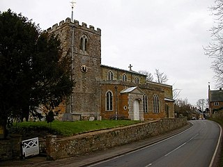
Thorpe Mandeville is a village and civil parish in West Northamptonshire, England about 6 miles (10 km) northeast of Banbury in neighbouring Oxfordshire. The hamlet of Lower Thorpe is just north of the village.

Sulgrave is a village and civil parish in West Northamptonshire, England, about 5 miles (8 km) north of Brackley. The village is just south of a stream that rises in the parish and flows east to join the River Tove, a tributary of the Great Ouse.

Welton is a village and civil parish in the English county of Northamptonshire. The village is located 2.6 miles (4.2 km) north of the nearest town Daventry. It is 13 miles (21 km) west-north west of Northampton, 9 miles (14 km) south east of Rugby and 78 miles (126 km) north-west of London. The village is 1 mile (1.6 km) off the A361 that runs between Daventry and Crick where the A5 and the M1 junction 18 gives access to the national motorway network north and south. Welton formerly had its own railway station, but today, the nearest railway station is at Long Buckby for the West Midlands Trains services to Birmingham New Street, Northampton and London Euston stations, on the Northampton loop of the West Coast Main Line. For inter-city services, passengers should change at Rugby, the next station westbound. The Village and parish of Welton had in the 2021 census, a population of 596. For the purposes of local government, the village falls within West Northamptonshire.

Aynho is a village and civil parish in West Northamptonshire, England, on the edge of the Cherwell valley 6 miles (9.7 km) south-east of the north Oxfordshire town of Banbury and 7 miles (11 km) southwest of Brackley.

Milton Malsor is a village and civil parish in West Northamptonshire, England. The population of the civil parish at the 2011 census was 761. It is 4 miles (6.4 km) south of Northampton town centre, 45 miles (72 km) south-east of Birmingham, and 66 miles (106 km) north of central London; junction 15 of the M1 motorway is 2 miles (3.2 km) east by road. The area of the Milton Malsor civil parish is about 1,650 acres (670 ha), stretching from north of the M1 motorway between junctions 15 and 15A, south to the West Coast Main Line, east to the A508 and A45 roads, and west to the A43 road.

Eydon is a village and civil parish in West Northamptonshire, about 8 miles (13 km) north-east of Banbury. The village is between 510 and 540 feet (160 m) above sea level on the east side of a hill, which rises to 580 feet (180 m) and is the highest point in the parish. The parish is bounded to the west by the River Cherwell, to the south by a stream that is one of its tributaries, and to the east and north by field boundaries.

Quinton is a village and civil parish in West Northamptonshire, England. It is about 5 miles (8.0 km) south of Northampton town centre along the road from Wootton to Hanslope, near Salcey Forest.
Benefield is a civil parish in North Northamptonshire, England, along the A427 road and about 6 miles (9.7 km) east of Corby and 3 miles (4.8 km) west of Oundle.
Collingtree is a village and civil parish in the West Northamptonshire district of Northamptonshire, England. It is part of the Northampton built-up area.

Courteenhall is a village 5 miles (8 km) south of the county town of Northampton, in the shire county of Northamptonshire, England, and about 66 miles (106 km) north of London. The population of the civil parish was 122 at the 2011 census. The village is located in a cul-de-sac.

East Carlton is a village and civil parish in the county of Northamptonshire, on the southern ridge overlooking the Welland valley to the north and covers 1,645 acres (666 ha) on a long strip of land. It is 2 miles (3.2 km) west of the town of Corby and is administered as part of North Northamptonshire but was previously in the Corby borough until 2021. At the time of the 2001 census, the parish's population was 270, reducing to 259 at the 2011 census. East Carlton is one of the Thankful Villages that suffered no fatalities during World War I. Although in Northamptonshire, the village is in the Leicestershire LE16 postcode area.

Denton is a small village and civil parish on the A428 road about 6 miles (10 km) south-east of Northampton. It had a pub, the Red Lion which is currently as of 2024 an Indian restaurant, a village hall, a Church of England parish church, a surgery and a primary school.
Slapton is a small village in Northamptonshire, England, about 4 miles (6.4 km) from Towcester and the same from Silverstone. It is close to the A43 road which links the M40 motorway junction 10 with the M1 junction 15A at Northampton. Central London is about 60 miles south of M40 junction 10. At the 2011 Census the population remained less than 100 and was included in the civil parish of Whilton.

