Daventry District

Last updated

Daventry District
Daventry UK locator map.svg
Shown within Northamptonshire
Sovereign state United Kingdom
Constituent country England
Region East Midlands
Administrative county Northamptonshire
Admin. HQ Daventry
Government
  TypeDaventry District Council
   Leadership:Alternative - Sec.31
  Executive: 
   MP: Chris Heaton-Harris
Area
  Total255.8 sq mi (662.6 km2)
  Rank 59th
  Rank Ranked
Time zone UTC+0 (Greenwich Mean Time)
  Summer (DST) UTC+1 (British Summer Time)
ONS code 34UC (ONS)
E07000151 (GSS)
Ethnicity96.5% White
Website daventrydc.gov.uk

Daventry District was a local government district in western Northamptonshire, England, from 1974 to 2021. The district was named after its main town of Daventry, where the council was based.

Contents

The district was created on 1 April 1974, under the Local Government Act 1972, by a merger of the historic municipal borough of Daventry with the Daventry Rural District and most of the Brixworth Rural District. The town of Daventry became an unparished area with Charter Trustees and remained so until 2003 when a civil parish was created, roughly corresponding with the boundaries of the former borough, so allowing Daventry to have its own town council. [1]

Abolition and replacement

In March 2018, following suspension of the County Council arising from its becoming insolvent, due to financial and cultural mismanagement by the cabinet and officers, the then Secretary of State for Local Government, Sajid Javid, sent commissioner Max Caller into the council, who recommended the county council and all district and borough councils in the county be abolished, and replaced by two unitary authorities, one covering the West, and one the North of the county. [2] These proposals were approved in April 2019. It meant that the districts of Daventry, Northampton and South Northamptonshire were merged to form a new unitary authority called West Northamptonshire, whilst the second unitary authority North Northamptonshire consists of Corby, East Northamptonshire, Kettering and Wellingborough districts. These new authorities came into being on 1 April 2021. [3] Elections for the new authorities were due to be held on 7 May 2020, but were delayed due to the COVID-19 pandemic. [4] These elections were later held on 6 May 2021.

Demography

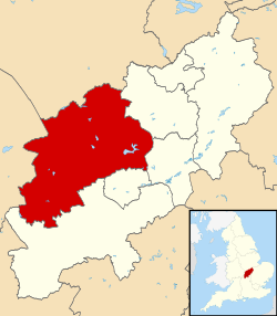
At the 2011 Census, the district had a population of 77,843, a little under a third of whom (25,026) lived in the town of Daventry. [5] Other significant settlements included Brixworth, Long Buckby and Weedon Bec. The rest of the district was predominantly rural.

Ethnicity

Ethnic Group1991 [6] 2001 [7] 2011 [8]
Number%Number%Number%
White: Total62,25699%70,39898%75,12396.5%
White: British 68,78895.8%72,44893.1%
White: Irish 571509
White: Gypsy or Irish Traveller 54
White: Other 1,0392,112
Asian or Asian British: Total3330.5%4780.7%1,1831.5%
Asian or Asian British: Indian 161320551
Asian or Asian British: Pakistani 3885172
Asian or Asian British: Bangladeshi 01255
Asian or Asian British: Chinese 82128151
Asian or Asian British: Other Asian5261254
Black or Black British: Total3330.5%2390.3%4810.6%
Black or Black British: Caribbean 82176211
Black or Black British: African 2350213
Black or Black British: Other Black 701357
Mixed or British Mixed: Total5220.7%9711.2%
Mixed: White and Black Caribbean183381
Mixed: White and Black African4598
Mixed: White and Asian181302
Mixed: Other Mixed113190
Other: Total920.1%730.1%850.1%
Other: Arab7
Other: Any other ethnic group927378
Total62,856100%71,838100%77,843100%

Housing

In 2007, the Council housing stock owned by the Council was transferred to Daventry & District Housing Ltd., a specially formed registered social landlord, under a Large Scale Voluntary Transfer. A subsequent dispute about the provisions made in the transfer contract for employees' pensions led to a legal case heard in the England and Wales Court of Appeal concerning the legal doctrines of mutual or unilateral mistake. [9] [10]

Settlements

Political control

Daventry Civic Centre, the headquarters of the former Daventry District Council. Built 1980s. Daventry, civic centre front entrance - geograph.org.uk - 1730036.jpg
Daventry Civic Centre, the headquarters of the former Daventry District Council. Built 1980s.

See Daventry District Council elections

See also

Related Research Articles

<span class="mw-page-title-main">Northamptonshire</span> County of England

Northamptonshire is a ceremonial county in the East Midlands of England. It borders Leicestershire, Rutland, and Lincolnshire to the north, Cambridgeshire to the east, Bedfordshire, Buckinghamshire, Oxfordshire to the south, and Warwickshire to the west. The county town is Northampton.

<span class="mw-page-title-main">Daventry</span> Market town and civil parish in Northamptonshire, England

Daventry is a market town and civil parish in the West Northamptonshire unitary authority in Northamptonshire, England, close to the border with Warwickshire. At the 2021 Census Daventry had a population of 28,123, making it the sixth largest town in Northamptonshire.

<span class="mw-page-title-main">South Northamptonshire</span> Former local government district in England

South Northamptonshire was a local government district in Northamptonshire, England, from 1974 to 2021. Its council was based in the town of Towcester, first established as a settlement in Roman Britain. The population of the Local Authority District Council in 2011 was 85,189.

<span class="mw-page-title-main">East Northamptonshire</span> Former non-metropolitan district in England

East Northamptonshire was a local government district in Northamptonshire, England, from 1974 to 2021. Its council was based in Thrapston and Rushden. Other towns included Oundle, Raunds, Irthlingborough and Higham Ferrers. The town of Rushden was by far the largest settlement in the district. The population of the district at the 2011 Census was 86,765.

<span class="mw-page-title-main">Borough of Kettering</span> Former borough in England

The Borough of Kettering was a local government district and borough in Northamptonshire, England, from 1974 to 2021. It was named after its main town, Kettering, where the council was based. It bordered onto the district of Harborough in the neighbouring county of Leicestershire, the borough of Corby, the district of East Northamptonshire, the district of Daventry and the borough of Wellingborough.

<span class="mw-page-title-main">Borough of Wellingborough</span> Former borough in England

The Borough of Wellingborough was a non-metropolitan district and borough in Northamptonshire, England, from 1974 to 2021. It was named after Wellingborough, its main town, but also included surrounding rural areas.

<span class="mw-page-title-main">Spratton</span> Human settlement in England

Spratton is a village and civil parish in the English county of Northamptonshire. The local government authority is West Northamptonshire. Before changes in 2021 it was governed by Daventry District Council. At the time of the 2001 census, the parish's population was 1,099 people, increasing to 1,150 at the 2011 Census. Spratton is 7.1 miles north of Northampton, 6.5 miles from Long Buckby and 11.4 miles from Daventry. The village is situated on the A5199 road.

<span class="mw-page-title-main">Weedon Bec</span> Human settlement in England

Weedon Bec, usually just Weedon, is a village and parish in West Northamptonshire, England. It is close to the source of the River Nene. The population of the civil parish at the 2011 census was 2,706.

<span class="mw-page-title-main">Daventry (UK Parliament constituency)</span> UK Parliament constituency since 1974

Daventry is a constituency in Northamptonshire represented in the House of Commons of the UK Parliament since 2010 by Chris Heaton-Harris of the Conservative Party, who has served as Secretary of State for Northern Ireland since 2022.

Stowe Nine Churches is a civil parish incorporating the settlements of Church Stowe and Upper Stowe in the English county of Northamptonshire. The population of the civil parish at the 2011 census was 259.

One third of Daventry District Council in Northamptonshire, England was elected each year, followed by one year when there was an election to Northamptonshire County Council instead. Since the last boundary changes in 1999, 38 councillors were elected from 24 wards. In another boundary review in 2012 the councillors were reduced to 36 councillors across 16 wards. The council was abolished in 2021, with the area becoming part of West Northamptonshire.

<span class="mw-page-title-main">North Northamptonshire</span> District in England

North Northamptonshire is one of two local government districts in Northamptonshire, England. It is a unitary authority area forming about one half of the ceremonial county of Northamptonshire. It was created in 2021. Its notable towns are Kettering, Corby, Wellingborough, Rushden, Raunds, Desborough, Rothwell, Irthlingborough, Thrapston and Oundle. The council is based at the Corby Cube in Corby.

<span class="mw-page-title-main">West Northamptonshire</span> District in England

West Northamptonshire is a unitary authority area covering part of the ceremonial county of Northamptonshire, England, created in 2021. By far the largest settlement in West Northamptonshire is the county town of Northampton. Its other significant towns are Daventry, Brackley and Towcester; the rest of the area is predominantly agricultural villages though it has many lakes and small woodlands and is passed through by the West Coast Main Line and the M1 and M40 motorways, thus hosting a relatively high number of hospitality attractions as well as distribution centres as these are key English transport routes. Close to these is the leisure-use Grand Union Canal.

<span class="mw-page-title-main">Northamptonshire Football Association</span> Governing body of association football in Northamptonshire

The Northamptonshire Football Association, also simply known as the Northamptonshire FA, is the governing body of football in the English county of Northamptonshire.

<span class="mw-page-title-main">Weedon railway station</span> Disused railway station in Northamptonshire

Weedon railway station was located to the north of Weedon Bec in Northamptonshire, England on the West Coast Main Line. It was a junction station, being the starting point of the Weedon to Leamington Spa branch line, with one bay platform dedicated for terminating branch line trains.

<span class="mw-page-title-main">Northampton Borough Council</span> Former non-metropolitan district in England

Northampton Borough Council was the borough council and non-metropolitan district responsible for local government in the large town of Northampton in England. In 2021 the council was abolished and succeeded by West Northamptonshire Council; a unitary authority, and the Northampton Town Council, a parish council.

References

  1. Daventry Town Council
  2. "Northamptonshire County Council: statement" . Retrieved 13 June 2018.
  3. "Northamptonshire: Unitary authorities plan approved". BBC News. 14 May 2019. Retrieved 18 August 2020.
  4. "AT LAST! Northamptonshire's new unitary councils are made law by parliament". Northampton Chronicle. 14 February 2020. Retrieved 18 August 2020.
  5. "Key Figures for 2011 Census: Daventry". Office for National Statistics (Neighbourhood Statistics). Retrieved 28 August 2015.
  6. 1991 census data taken from NOMIS which was extracted using the 'local authorities: district / unitary (prior to April 2015)' geography type.
  7. "Office of National Statistics; 2001 Census Key Statistics". webarchive.nationalarchives.gov.uk. Retrieved 7 September 2021.
  8. "2011 Census: Ethnic Group, local authorities in England and Wales". webarchive.nationalarchives.gov.uk. Retrieved 15 December 2021.
  9. Swarbrick, D., Daventry District Council v Daventry and District Housing Ltd: CA 13 Oct 2011, updated 27 November 2022, accessed 23 July 2023
  10. England and Wales Court of Appeal (Civil Division), Daventry District Council v Daventry & District Housing Ltd [2011] EWCA Civ 1153, published 9 May 2011, accessed 23 July 2023

52°18′N1°03′W / 52.30°N 1.05°W / 52.30; -1.05