Long Buckby is a large village and civil parish in West Northamptonshire, England. In the 2021 census the parish of Long Buckby, which includes the hamlet of Long Buckby Wharf, was recorded as having a population of 4,511.

Welford is a village and civil parish in the West Northamptonshire unitary authority area of Northamptonshire, England, just south of the River Avon and the border with Leicestershire. At the 2011 Census, the population of the parish was 1,043.

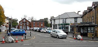
Crick is a village in West Northamptonshire in England. It is close to the border with Warwickshire, six miles east of Rugby and 14 miles (23 km) northwest of Northampton. The villages of Crick and West Haddon were by-passed by the A428 main road from Rugby to Northampton when the Daventry International Rail Freight Terminal (DIRFT) was built in 1996. The terminal is a short distance east of junction 18 of the M1 motorway, which is next to Crick. Crick's population in the 2001 census was 1,460, increasing to 1,886 at the 2011 census.

West Haddon is a village in West Northamptonshire, England about 11 miles (18 km) north-west of Northampton and 7 miles (11 km) east of Rugby and just off the A428 road which by-passes the village. The population of civil parish was 1,718 at the 2011 Census. The villages of West Haddon and Crick were by-passed by the A428 main road from Rugby to Northampton when the Daventry International Rail Freight Terminal (DIRFT) was built in 1996 near junction 18 of the M1 Motorway, 3 miles (4.8 km) west of the village.

Spratton is a village and civil parish in the English county of Northamptonshire. The local government authority is West Northamptonshire. Before changes in 2021 it was governed by Daventry District Council. At the time of the 2001 census, the parish's population was 1,099 people, increasing to 1,150 at the 2011 Census. Spratton is 7.1 miles north of Northampton, 6.5 miles from Long Buckby and 11.4 miles from Daventry. The village is situated on the A5199 road.
Ravensthorpe is a village and civil parish in West Northamptonshire in England. The village lies approximately midway between Northampton and Rugby. The M1 motorway is six miles west and the nearest railway station is at Long Buckby. At the time of the 2001 census, the parish's population was 656 people, including Coton but falling slightly to 646 at the 2011 census.

Pitsford is a village and civil parish in West Northamptonshire in the United Kingdom. According to 2001 census, the parish's population was 636 people, increasing to 671 at the 2011 census.
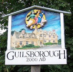
Guilsborough is a village and civil parish in West Northamptonshire in England. At the time of the 2001 census, the parish's population was 882 people, reducing to 692 at the 2011 Census.
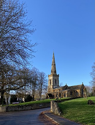
East Haddon is a small village and civil parish in West Northamptonshire in England. The village is located eight miles from Northampton and is surrounded by the villages of Holdenby, Ravensthorpe and Long Buckby. The location between Northampton and Long Buckby provides useful train links towards London and Birmingham. At the time of the 2001 census, the parish's population was 651 people, falling to 643 at the 2011 census.

Creaton is a village and civil parish in West Northamptonshire, England.
Cottesbrooke is a village and civil parish in West Northamptonshire in England. At the time of the 2001 census, the parish's population was 144 people, falling marginally to 143 at the 2011 census.
Kingsthorpe is a suburb and civil parish of Northampton, England. It is situated to the north of Northampton town centre and is served by the A508 and A5199 roads which join at Kingsthorpe's centre. The 2011 Census recorded the population of the district council ward as 4,477.
Wootton is a former village about 3 miles (4.8 km) south of Northampton town centre that is now part of Northampton.

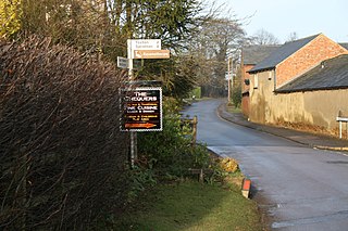
Welton is a village and civil parish in the English county of Northamptonshire. The village is located 2.6 miles (4.2 km) north of the nearest town Daventry. It is 13 miles (21 km) west-north west of Northampton, 9 miles (14 km) south east of Rugby and 78 miles (126 km) north-west of London. The village is 1 mile (1.6 km) off the A361 that runs between Daventry and Crick where the A5 and the M1 junction 18 gives access to the national motorway network north and south. Welton formerly had its own railway station, but today, the nearest railway station is at Long Buckby for the West Midlands Trains services to Birmingham New Street, Northampton and London Euston stations, on the Northampton loop of the West Coast Main Line. For inter-city services, passengers should change at Rugby, the next station westbound. The Village and parish of Welton had in the 2021 census, a population of 596. For the purposes of local government, the village falls within West Northamptonshire.
Hardingstone is a village in Northamptonshire, England. It is on the southern edge of Northampton, and now forms a suburb of the town. It is about 1 mile (2 km) from the town centre. The Newport Pagnell road separates the village from the nearby village of Wootton, which has also been absorbed into the urban area.
Nortoft was once a distinct hamlet between the Northamptonshire village of Guilsborough and the main road connecting Leicester and Northampton in the English Midlands.

West Northamptonshire is a unitary authority area covering part of the ceremonial county of Northamptonshire, England, created in 2021. By far the largest settlement in West Northamptonshire is the county town of Northampton. Its other significant towns are Daventry, Brackley and Towcester; the rest of the area is predominantly agricultural villages though it has many lakes and small woodlands and is passed through by the West Coast Main Line and the M1 and M40 motorways. The district includes the site of the Roman town of Bannaventa, and the grade I listed Althorp House and its estate.

The Northamptonshire witch trials mainly refer to five executions carried out on 22 July 1612 at Abington Gallows, Northampton. In 1612 at the Lent Assizes held in Northampton Castle a number of women and a man were tried for witchcraft of various kinds, from murder to bewitching of pigs. There are two main accounts of these witches being tried. However they differ on how many witches were tried, who they were and exactly what they were supposed to have done.
Highgate House was an important Northamptonshire coaching inn and Royal Mail posting station at the village of Creaton, on the Northampton to Leicester road, dating from 1663. The building, much expanded and adapted, was used as a country house hotel and conference venue. It was purchased in February 2024 by the Christian Conference Trust and added to its conference centre portfolio. It retains its original appearance and character.


