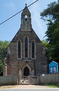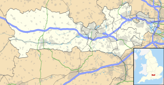
Dadford is a hamlet in the parish of Stowe, north Buckinghamshire, England.

Burcott is a hamlet in the parish of Wing(where at the 2011 Census the population was included ), Buckinghamshire, England. Burcott is a common place name in the English language. The place name is Old English and refers to a fortified cottage.

Ascott is a hamlet and country house in the parish of Wing, Buckinghamshire, England. The hamlet lies completely within the boundary of the Ascott Estate; it is home to many of the estate and house staff.

Botley is a hamlet in the civil parish of Chesham, in Buckinghamshire, England.

Crafton is a hamlet in the civil parish of Mentmore, in Buckinghamshire, England.

Handy Cross is a hamlet in the parish of Little Marlow, Buckinghamshire, England. It is located on Marlow Hill, on the old road between Marlow and High Wycombe. At the 2011 Census the population of the hamlet was included in the civil parish of Great Marlow. Today the hamlet consists of a farm, several households and a Harvester pub & restaurant.

Nash Lee is a hamlet in the parish of Ellesborough, in Buckinghamshire, England. It is located to the north of the village, about two miles west of Wendover.

Everdon is a village in West Northamptonshire in England, some 3 miles (4.8 km) south of Daventry. The population of the civil parish at the 2011 census was 356.

Weedon Bec, usually just Weedon, is a village and parish in West Northamptonshire, England. It is close to the source of the River Nene. The population of the civil parish at the 2011 census was 2,706.
Little Meadle is a hamlet in Buckinghamshire, England. It is part of the civil parish of Longwick-cum-Ilmer and is located between the hamlets of Owlswick and Meadle. It is approximately 5 miles (8.0 km) from Aylesbury and 20 miles (32 km) from Oxford. In addition to the Farm House it consists of a collection of houses built over the past 60 years, and it gained an official name with the Royal Mail in 2004, as well as being mapped with the Ordnance Survey 2006. The term Little Meadle is a relatively new one it has no historical meaning in itself, except that it is close to the village of Meadle and is a small hamlet that was previously known only by the name of the road in which it is situated Stockwell Lane.

Barrow is a civil parish, in the unitary authority of Cheshire West and Chester and the ceremonial county of Cheshire, England. The civil parish contains the village of Great Barrow and the hamlets of Little Barrow, Broomhill and Stamford Bridge. Great Barrow is situated about 4.5 miles east-north-east of Chester, 6 miles north-west of Tarporley and 6 miles south of Frodsham.

Barwick is a scattered hamlet and civil parish in the north-west part of the English county of Norfolk. It is situated adjacent to the slightly larger village of Stanhoe, some 15 miles (24 km) north-east of King's Lynn and 50 miles (80 km) north-west of the city of Norwich.

Coton is a hamlet in county of Northamptonshire, England. It is located between Guilsborough and Ravensthorpe. Coton is in the civil parish of the latter, which in turn is part of West Northamptonshire. Coton Manor is a popular visitor attraction for its gardens and bluebell woods.

Ewshot is a village and civil parish in Hampshire, England. It lies in the north east of the county, close to the Surrey border.

Well End is a hamlet in the parish of Little Marlow, in Buckinghamshire, England. It is situated on the north-west side of the village of Bourne End. Although it lies in a separate parish, it is geographically contiguous with and subordinate to Bourne End; but unlike most of the hamlets consumed by its larger neighbour, it retains a distinct character, and the use of the name is common and well recognised locally.

Clachaig; is a small settlement, on the Cowal peninsula in Argyll and Bute, Scotland. It is located on the B836 road between the Holy Loch and Loch Striven, the hamlet is just over a mile long. Clachaig is a Gaelic word meaning 'stone place'.

Dawley Hamlets is a civil parish in Telford and Wrekin, Shropshire, England.

Crockham Heath is a hamlet in Berkshire, England. Crockham Heath is part of the civil parish of Enborne. The settlement lies near to the A34 road, and is located approximately 3 miles (4.8 km) south-west of Newbury where administration occurs.

Enborne Row is a hamlet in Berkshire, England, located on the county's border with Hampshire. The hamlet is within the civil parish of Enborne. The settlement lies next to the A34 road, and is located approximately 3 miles (4.8 km) south-west of Newbury.

Muckanaghederdauhaulia is a 470-acre townland in the civil parish of Kilcummin in County Galway, Ireland. It is in the poor law union of Oughterard in the barony of Moycullen.


