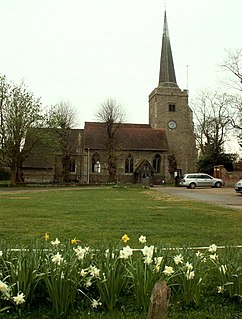
Danbury is a village in the City of Chelmsford, in the county of Essex, England. It is located 33.5 miles (53.9 km) northeast of Charing Cross, London and has a population of 6,500. It is situated on a hill 367 feet (112 m) above sea level.

Great Brington is a village in Northamptonshire, England, in the civil parish of Brington, which at the 2011 Census had a population of about 200. St Mary the Virgin's church is the parish church.

Hemingford Grey is a village and civil parish in Cambridgeshire, England. Hemingford Grey lies approximately 4 miles (6 km) east of Huntingdon. Hemingford Grey is situated within Huntingdonshire which is a non-metropolitan district of Cambridgeshire as well as being a historic county of England.

Molesworth is a village in the civil parish of Brington and Molesworth in Cambridgeshire, England. Molesworth is 10 miles (16 km) north-west of Huntingdon. The neighbouring village of Brington is 0.7 miles (1.1 km) from Molesworth. Molesworth is situated within Huntingdonshire which is a non-metropolitan district of Cambridgeshire as well as being a historic county of England. The civil parish covers an area of 2,842 acres. Just to the north of Molesworth and within the civil parish is RAF Molesworth. The village of Molesworth was designated a conservation area by Huntingdon District Council largely due to its typically rural English character that includes several listed buildings.

Bury is a village and civil parish in Cambridgeshire, England. Bury lies approximately 7 miles (11 km) north/north east of Huntingdon and is near to Ramsey and St Ives. Bury is situated within Huntingdonshire which is a non-metropolitan district of Cambridgeshire as well as being a historic county of England.
Bartlow is a small village and civil parish in the South Cambridgeshire district of Cambridgeshire, England, about 12 miles (19 km) south-east of Cambridge and 7 miles (11 km) west of Haverhill in Suffolk. The River Granta runs through the village.

Burgh St Peter is a village and civil parish in the South Norfolk district of Norfolk, England. The village is about 3+1⁄2 miles (6 km) northeast of Beccles in Suffolk. The village is about 50 feet (15 m) above sea level, sharing the same slight hill with Wheatacre about 1⁄2 mile (800 m) to the northwest.

Haddiscoe is a village and civil parish in the South Norfolk district of Norfolk, England, about 16 miles (26 km) southeast of Norwich. The parish is on the county boundary with Suffolk, about 7 miles (11 km) west-northwest of Lowestoft. The parish includes the hamlet of Thorpe-next-Haddiscoe, about 1 mile (1.6 km) north of Haddiscoe village.

Coton in the Elms is a village and parish in the English county of Derbyshire. At 70 miles from the coast, it is the farthest place in the United Kingdom from coastal waters. The population of the civil parish as of the 2011 census was 896. It is located 5 miles southwest of Swadlincote and 6 miles south of Burton upon Trent.
Bransgore is a village and civil parish within the New Forest District, Hampshire, England. The village developed in the 19th century when a church and a school were built. It is technically classified as an urban area, although in some respects it still has the picturesque character of a rural English village.

Little Harrowden is a village and civil parish in North Northamptonshire, England. The village is nearly 3 miles (4.8 km) north-west of Wellingborough, off the A509 road. At the 2011 Census, the population of the parish was 892.
Great Chishill is a village in the civil parish of Great and Little Chishill, South Cambridgeshire, England. The village is about 1 mile (1.6 km) east of the county boundary with Hertfordshire and about 4 miles (6 km) east of Royston. The 2011 Census recorded the parish's population as 678.

Ousden is a village and civil parish in the West Suffolk district of Suffolk in eastern England. It is located around six miles west of Bury St Edmunds and 72 miles north of London, and as of 2011, its population is 266. The village has an Anglican church of St Peter's and a chapel in the cemetery dedicated to St Barnabas.

Walsoken is a settlement and civil parish in Norfolk, England, which is conjoined as a suburb at the northeast of the town of Wisbech, Isle of Ely, Cambridgeshire.
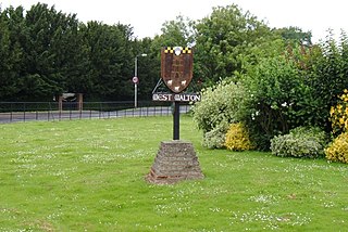
West Walton is a village and civil parish in the King's Lynn and West Norfolk District of Norfolk, England.

Chesterton is a village and civil parish on Gagle Brook, a tributary of the Langford Brook in north Oxfordshire. The village is about 1+1⁄2 miles (2.4 km) southwest of the market town of Bicester. The village has sometimes been called Great Chesterton to distinguish it from the hamlet of Little Chesterton, about 3⁄4 mile (1.2 km) to the south in the same parish. The 2011 Census recorded the parish population as 850.
Little Chishill is a village in the civil parish of Great and Little Chishill, South Cambridgeshire, England. It is 1 mile (1.6 km) south of the village of Great Chishill.

Great Bolas, or Bolas Magna, is a small village in rural Shropshire, England. It is situated north-west of the town of Newport, and about eight miles north of Telford. It is part of the civil parish of Waters Upton. It is situated at the confluence of the Tern and the small River Meese. There is a hamlet called Little Bolas a short distance to the west. Another hamlet called Meeson, south of the River Meese, was formerly a separate township of Great Bolas parish.

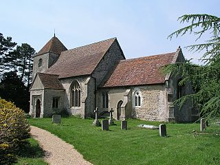
St Giles' Church is an Anglican church in the village of Horsted Keynes in Mid Sussex, one of seven local government districts in the English county of West Sussex. Serving an extensive rural parish in the Sussex Weald, it stands at the north end of its village on the site of an ancient pagan place of worship. The present building succeeds the original wattle and daub church, its wooden successor and a Saxon stone building—although the Norman architects who erected the cruciform structure in the 12th century preserved parts of the Saxon fabric.

Calthorpe is a small village within the civil parish of Erpingham in the English county of Norfolk, England. The village is located 0.5 miles (0.80 km) west of the village of Erpingham, 3.4 miles (5.5 km) north of the nearest town of Aylsham and is 15.8 miles (25.4 km) north of the nearest city of Norwich. The nearest railway station is at Gunton for the Bittern Line which runs between Sheringham, Cromer and Norwich and is 7.8 miles (12.6 km) from the village. The nearest airport is Norwich International 14.2 miles (22.9 km) south of the village.


