
Speen is a village and civil parish in West Berkshire, England. Centred 2 miles (3 km) north west of the largest town in the district, Newbury, Speen has clustered settlements, the largest of which is Speen village, which is contiguous with Newbury, and the others, buffered from the town by the A34 road, are Bagnor, Stockcross, Woodspeen and Marsh Benham. Its other land is an approximately even mixture of woodland and agricultural fields including hay meadows for livestock feed and pasture. The area varies greatly in elevation, having the Reading to Taunton Line alongside the north bank of the River Kennet as its southern boundary and both banks of the River Lambourn in its north with elevated ground in between. Benham Park in the south-west of the area is a listed landscape garden and house.

Harwell is a village and civil parish in the Vale of White Horse about 2 miles (3 km) west of Didcot, 6 miles (10 km) east of Wantage and 13 miles (21 km) south of Oxford. The parish measures about 3.5 miles (6 km) north – south, and almost 2 miles (3 km) east – west at its widest point. In 1923 its area was 2,521 acres (1,020 ha). Historically in Berkshire, it has been administered as part of Oxfordshire, England, since the 1974 boundary changes. The parish includes part of the Milton Park business park in the north and part of Harwell Science and Innovation Campus in the southwest. In the east it includes part of the new Great Western Park housing estate that is contiguous with the built-up area of Didcot. The 2011 census recorded the parish's population as 2,349.

Thatcham is an historic market town and civil parish in the English county of Berkshire, centred 3 miles (4.8 km) east of Newbury, 14 miles (23 km) west of Reading and 54 miles (87 km) west of London.

Lambourn is a village and civil parish in Berkshire, England. It lies just north of the M4 Motorway between Swindon and Newbury, and borders Wiltshire to the west and Oxfordshire to the north. After Newmarket it is the largest centre of racehorse training in England, and is home to a rehabilitation centre for injured jockeys, an equine hospital, and several leading jockeys and trainers. To the north of the village are the prehistoric Seven Barrows and the nearby long barrow. In 2004 the Crow Down Hoard was found close to the village.

Welford is a village and civil parish in England, on the River Avon border between Northamptonshire and Leicestershire. At the 2011 census, the population was 1,043.

Frilsham is a village and civil parish 4 miles (6.4 km) from Newbury, in the English county of Berkshire.

Boxford is a village and civil parish in the unitary authority of West Berkshire, England. The village is on the east bank of the River Lambourn, about 4 miles (6.4 km) northwest of Newbury but south of the M4 motorway. The hamlet of Westbrook is on the opposite bank of the Berkshire Downs tributary.

Weston is a village in the civil parish of Welford in the English county of Berkshire.

Great Shefford is an English village and civil parish on the River Lambourn in the West Berkshire district of Berkshire. The present civil parish includes the historical parish of Little or East Shefford, a small, reduced community downstream. It also covers the village of Shefford Woodlands, about 1.5 miles (2.4 km) south-west of Great Shefford, near Junction 14 on the M4 motorway.

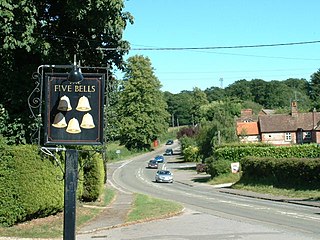
Fawley is a village and civil parish in West Berkshire, England. The hub of the village is centred 3.5 miles (5.6 km) east of Lambourn and has a sub-community within its bounds, Little or South Fawley. It includes the depopulated small hill settlement of Whatcombe. Fawley is the inspiration for "Marygreen" in Thomas Hardy's Jude the Obscure.

Denchworth is a village and civil parish about 2.5 miles (4 km) north of Wantage. It was part of Berkshire until the 1974 boundary changes transferred the Vale of White Horse to Oxfordshire. The 2011 Census recorded the parish's population as 171. The parish is bounded by the Land Brook in the west and the Childrey Brook in the east. The Great Western Main Line between Reading and Swindon runs through the parish just south of the village, but there is no station.
The Lambourn Valley Railway (LVR) was a branch railway line running from the town of Newbury, Berkshire north-west to the village of Lambourn. It was opened in 1898. Fulfilling a local need, it was in financial difficulties throughout its independent life and was sold to the Great Western Railway (GWR) in 1905.

Welford Park is a country house and estate in the village of Welford in the English county of Berkshire, situated 5.2 miles northwest of Newbury and 10.9 miles south of Wantage. It is a Grade I-listed building.

Milton is a village and civil parish about 3 miles (5 km) west of Didcot and a similar distance south of Abingdon. The 2011 Census recorded the parish's population as 1,290.

Lyford is a village and civil parish on the River Ock about 4 miles (6.4 km) north of Wantage. Historically it was part of the ecclesiastical parish of Hanney. Lyford was part of Berkshire until the 1974 boundary changes transferred the Vale of White Horse to Oxfordshire. The 2001 Census recorded the parish's population as 44. Lyford's toponym refers to a former ford the Ock, now replaced with a bridge on the road to Charney Bassett. "Ly" is derived from the Old English lin, meaning "flax". In 1034 it was recorded as Linford.

Woodlands St Mary is a small village in the English county of Berkshire. The village is situated in the civil parish of Lambourn, and is 3 miles (4.8 km) to the south of the village of Lambourn, and 1 mile (1.6 km) from Lambourn Woodlands. The parish is within the unitary authority of West Berkshire, close to the border between the counties of Berkshire and Wiltshire.
Wickham is a village about 5.5 miles (8.9 km) north-west of Newbury, Berkshire, England. The M4 motorway passes just north of it. It is in the civil parish of Welford.

Shellingford, historically also spelt Shillingford, is a village and civil parish about 2+1⁄2 miles (4 km) south-east of Faringdon in the Vale of White Horse in Oxfordshire, England. It was part of Berkshire until the 1974 Local Government Act transferred it to Oxfordshire. The 2011 Census recorded the parish's population as 173.
Sparsholt is a village and civil parish about 3 miles (5 km) west of Wantage in the Vale of White Horse district of Oxfordshire. The parish includes the hamlet of Westcot about 1⁄2 mile (800 m) west of the village. Sparsholt was part of Berkshire until the 1974 boundary changes transferred the Vale of White Horse to Oxfordshire.

Coopersale, also termed Coopersale Common, is a village in the civil parish of Epping, within the Epping Forest District of Essex, England. In 2018 it had an estimated population of 1019.

